Foreign Bodies
Mapping Immigrant Women in Canada and Chile
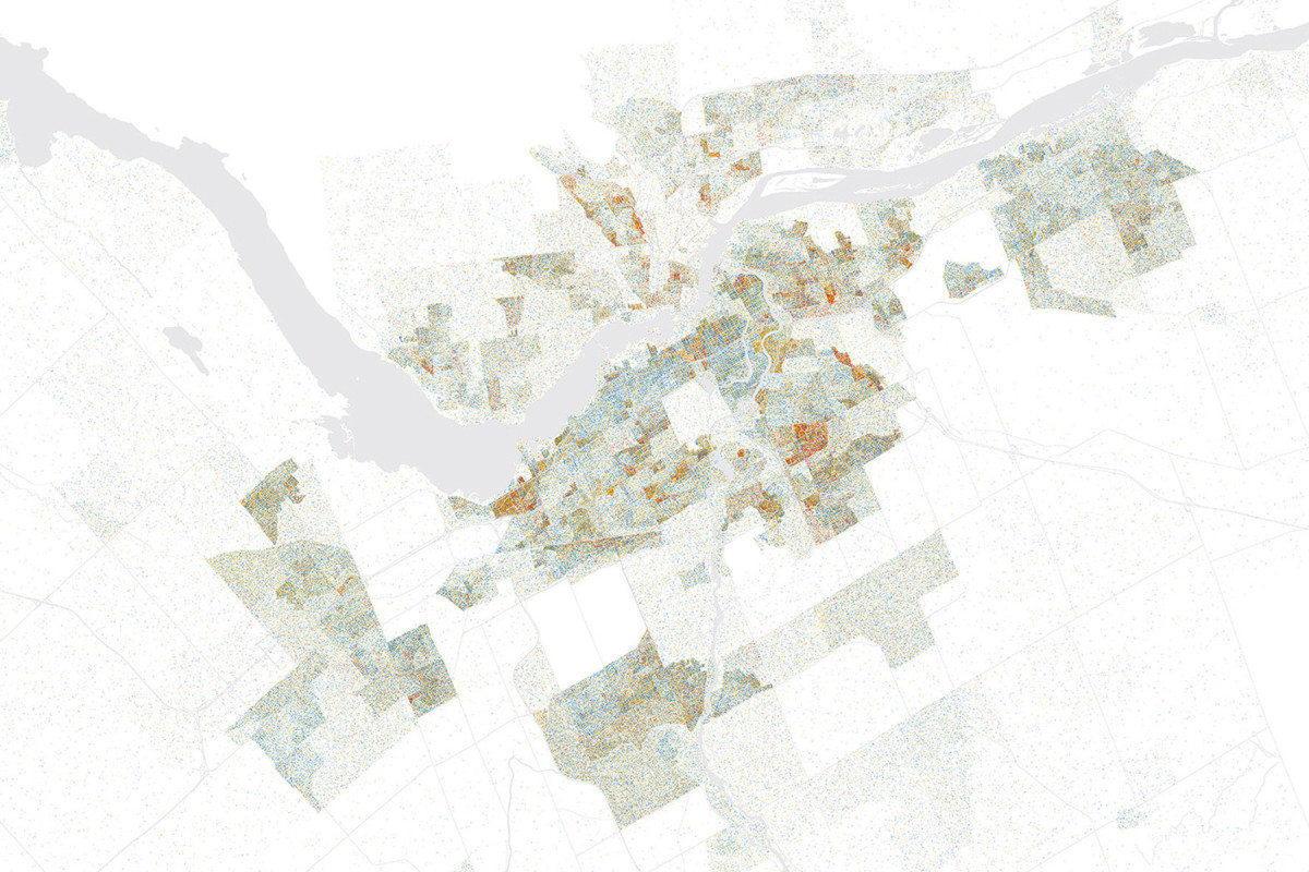
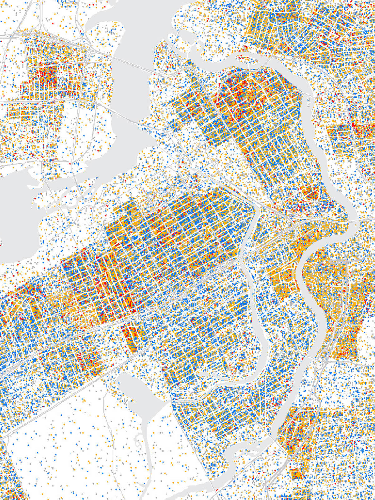
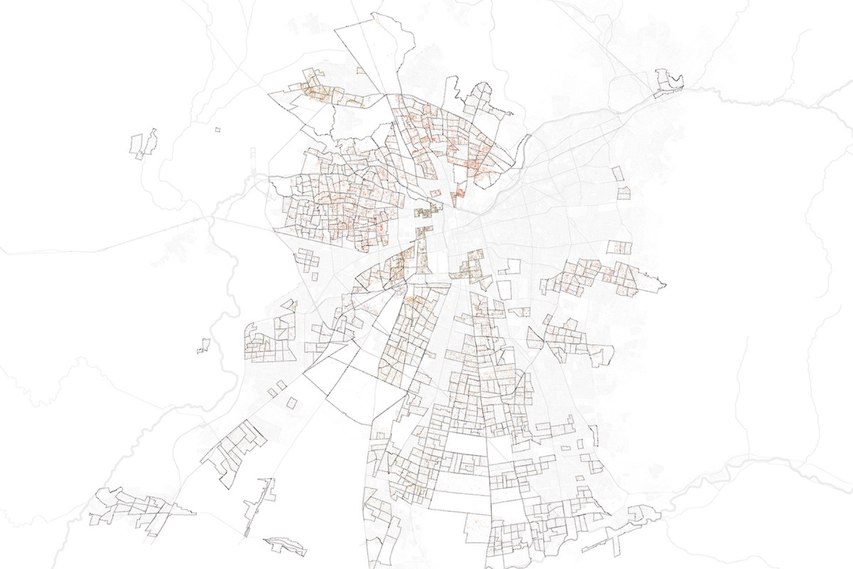
Ottawa, Canada
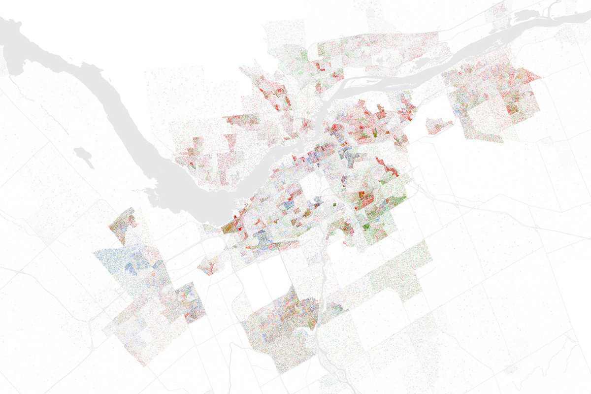
Ottawa, Canada
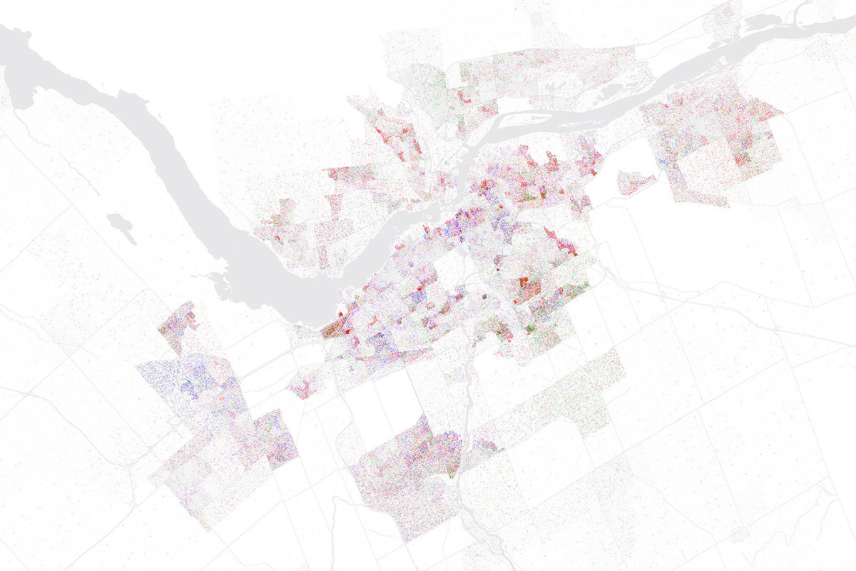
Ottawa, Canada
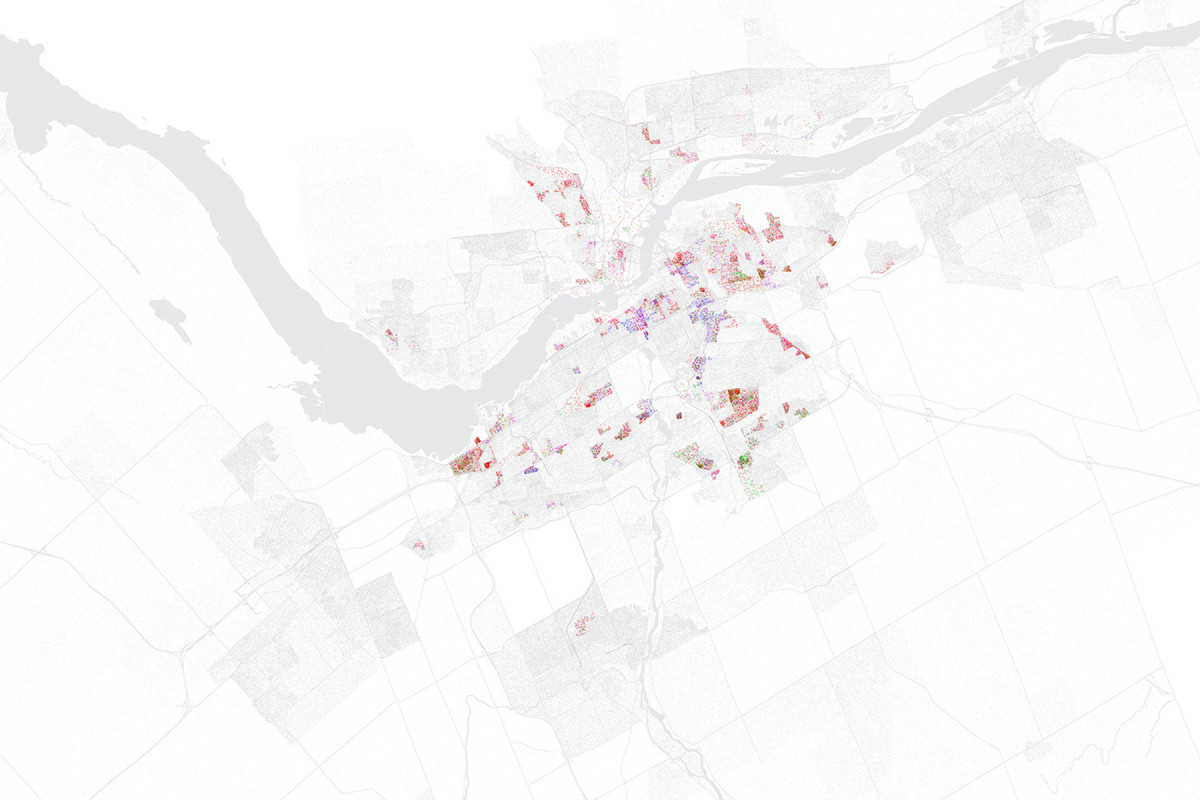
Ottawa, Canada

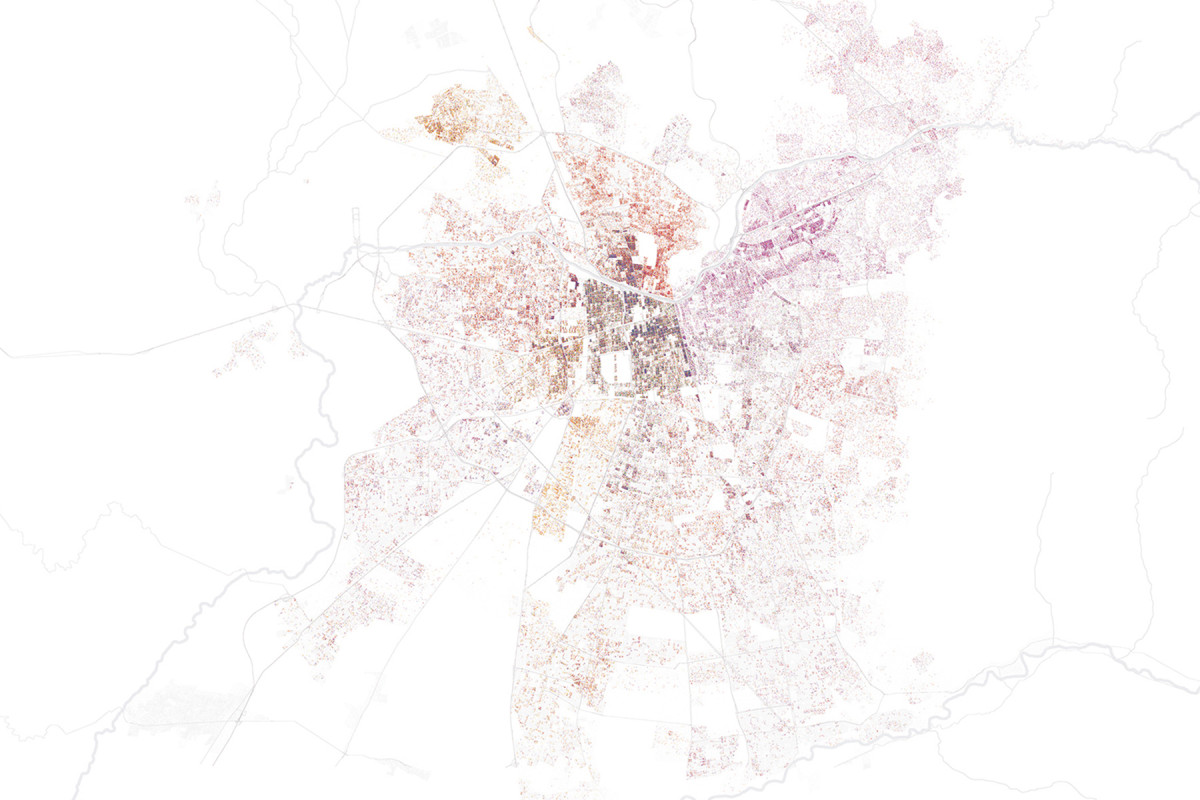
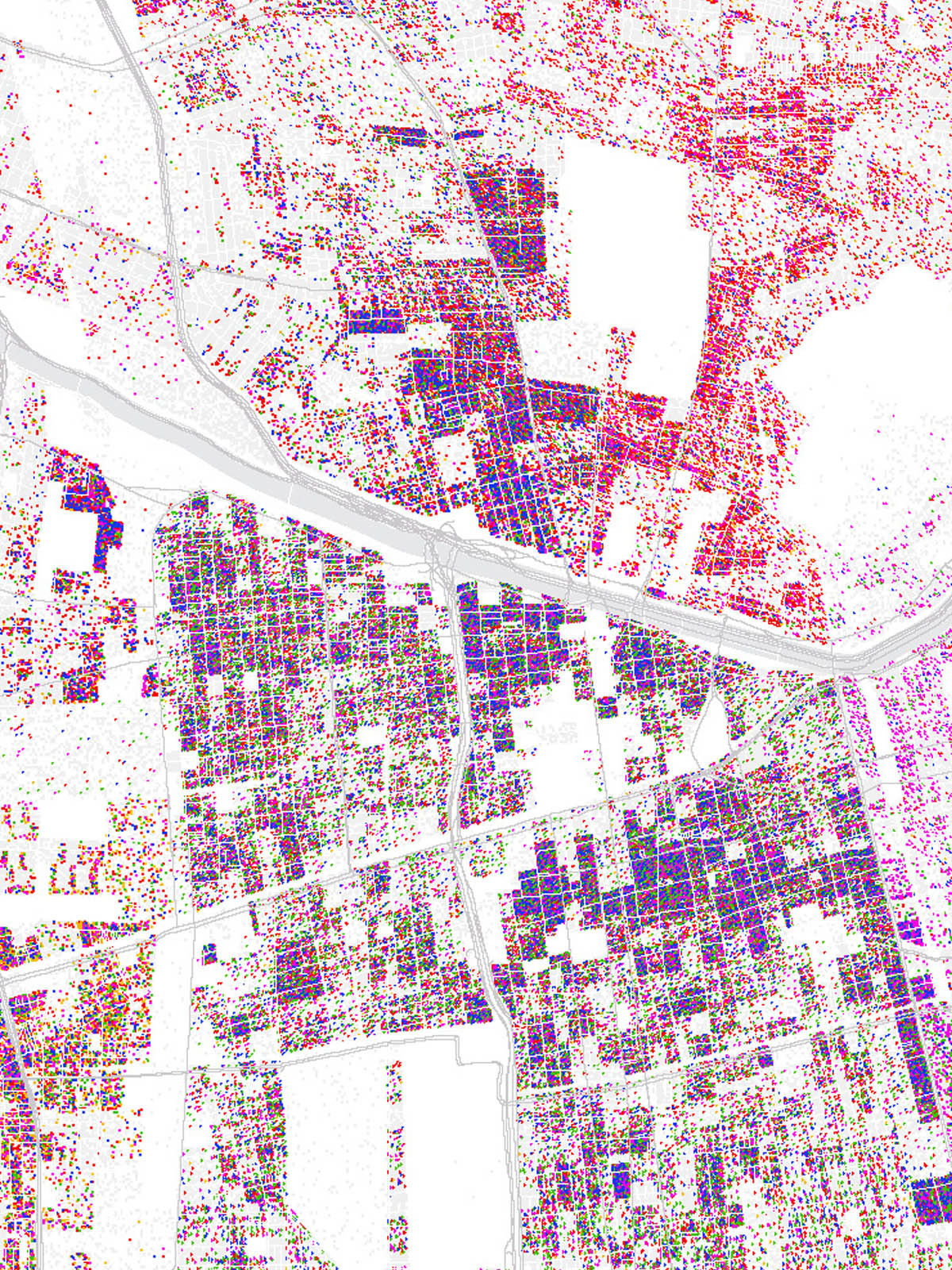
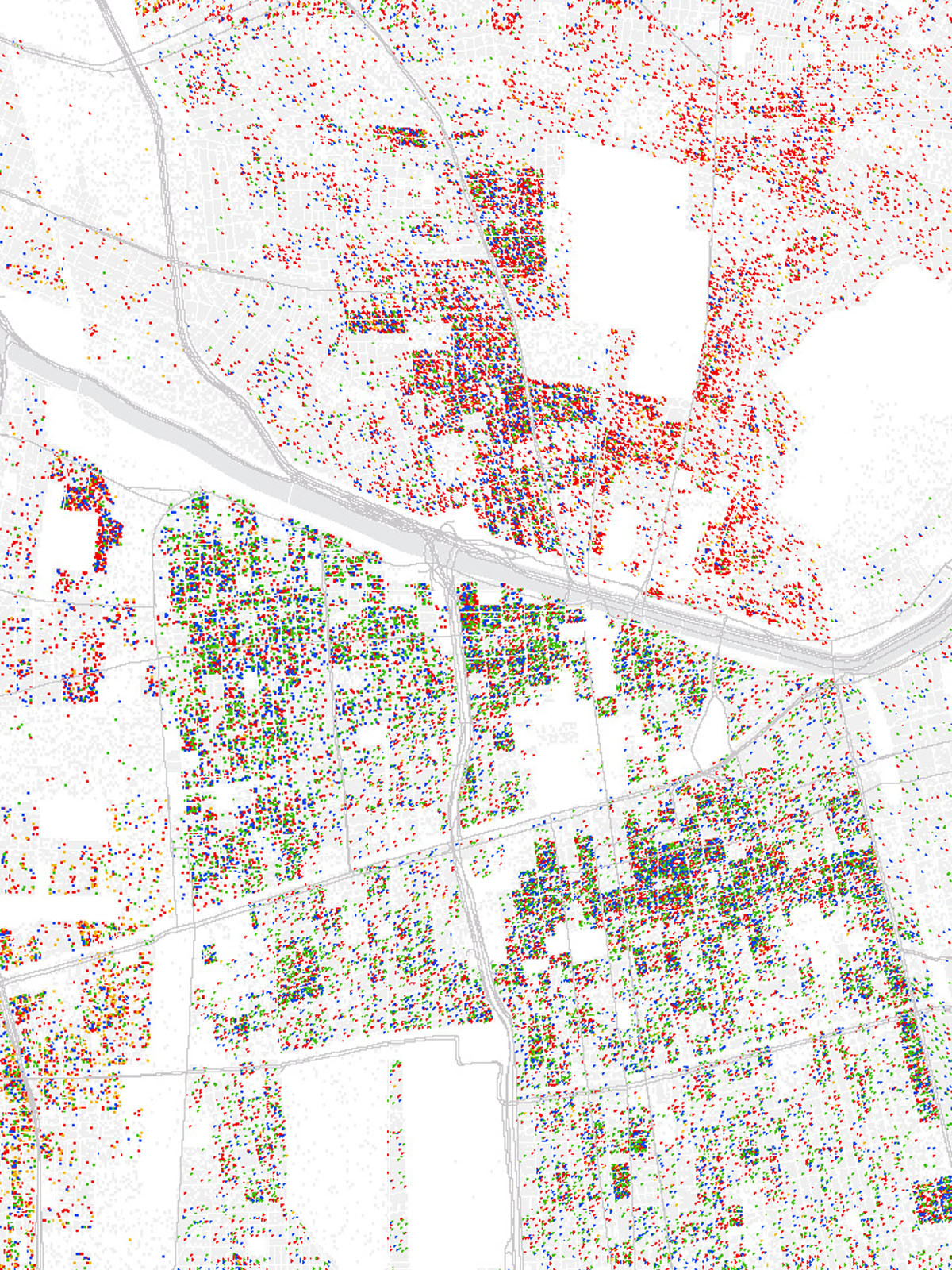
Santiago de Chile, Chile
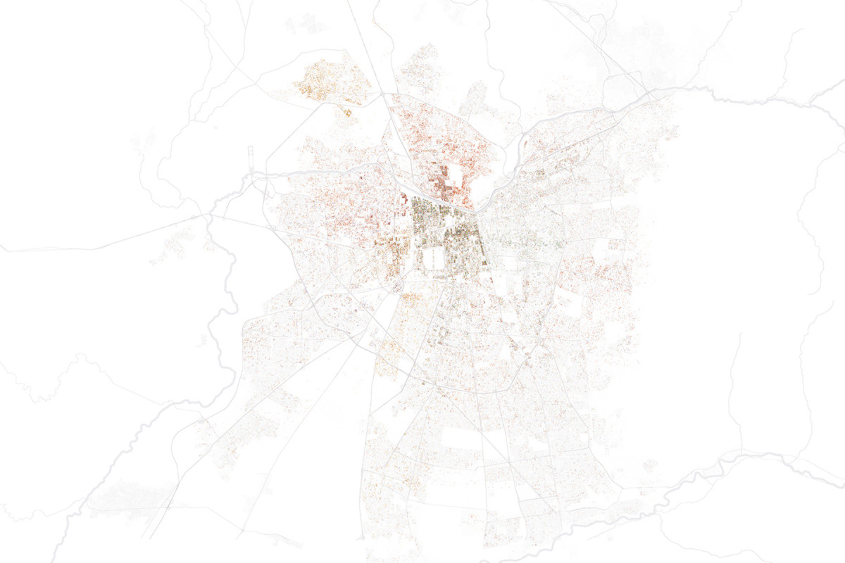
Santiago de Chile, Chile
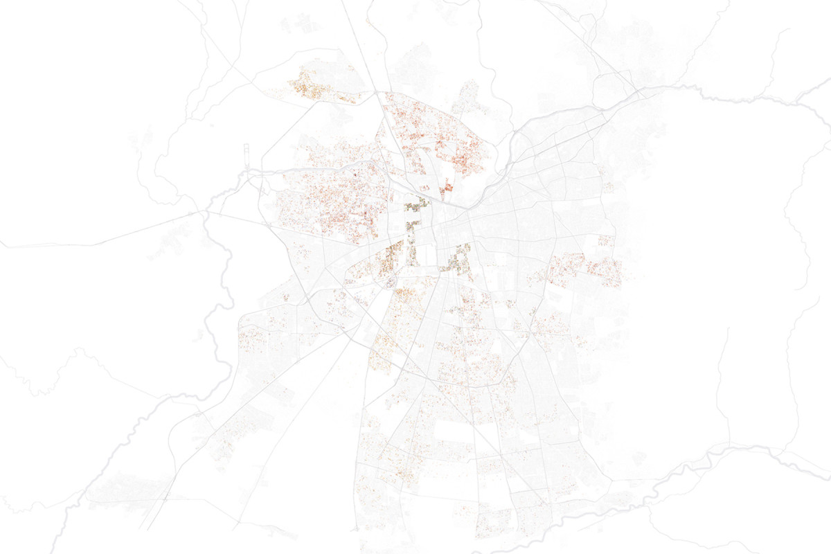
Santiago de Chile, Chile
Santiago de Chile, Chile
This work is part of a research project exploring how the urban experiences of diasporic communities can contribute to imagining more just and equitable urban futures. Faced with the growing diversity of contemporary cities—and at the same time the persistent structural urban exclusion of certain social groups—the study highlights historically marginalized populations as a fundamental step toward more inclusive urban planning.
Our contribution to the project consisted of developing a series of maps and cartography based on the use of Geographic Information Systems (GIS) that visualize census data from Ottawa-Gatineau, Canada, and Santiago, Chile. These cartographies were developed to identify urban areas with a higher proportion of people at risk of exclusion, with a special focus on immigrant, refugee, and racialized women in economically vulnerable situations.
Through the georeferencing and visual representation of these data, maps act as an analytical and narrative tool that sheds light on territories and trajectories that often remain invisible in conventional approaches to urban planning. At the same time, they offer an empirical basis to guide subsequent qualitative studies and inform debates around urban equity in contexts marked by migration, racialization, and structural inequality.