
Urban Design Manual for Asunción Historic Downtown
Date
2025
Service
Urban design
Status
Project
Team
Región AustralAsesor: Arq. Carlos Colombo
Client
Ministerio de Obras Públicas y Comunicaciones del Paraguay (MOPC)
Location
Asunción, Paraguay
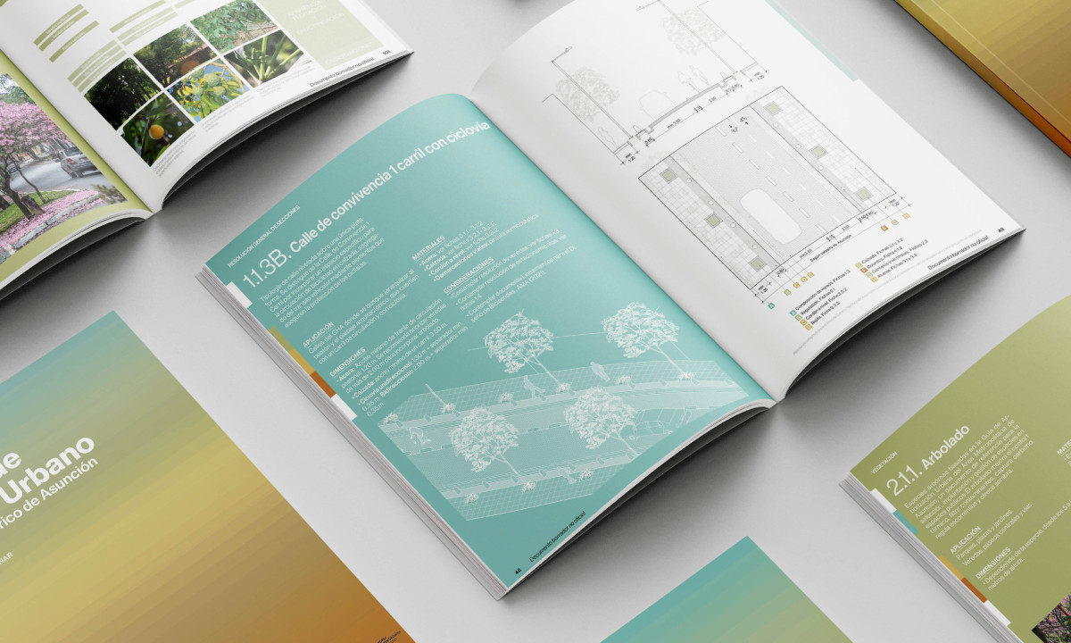
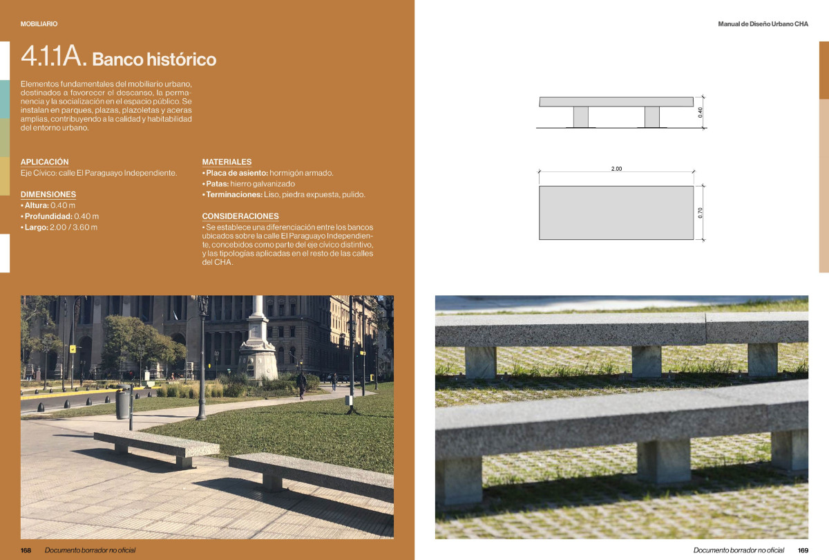
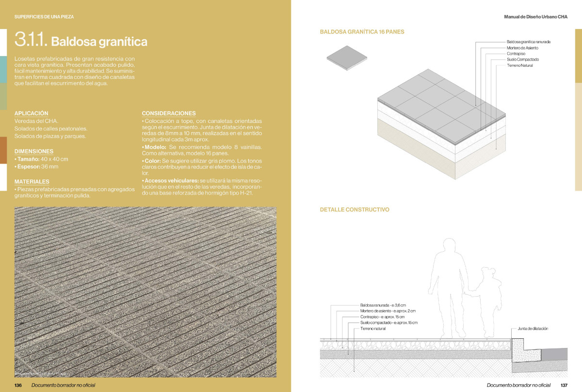
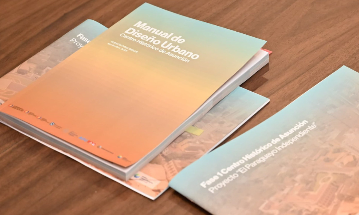
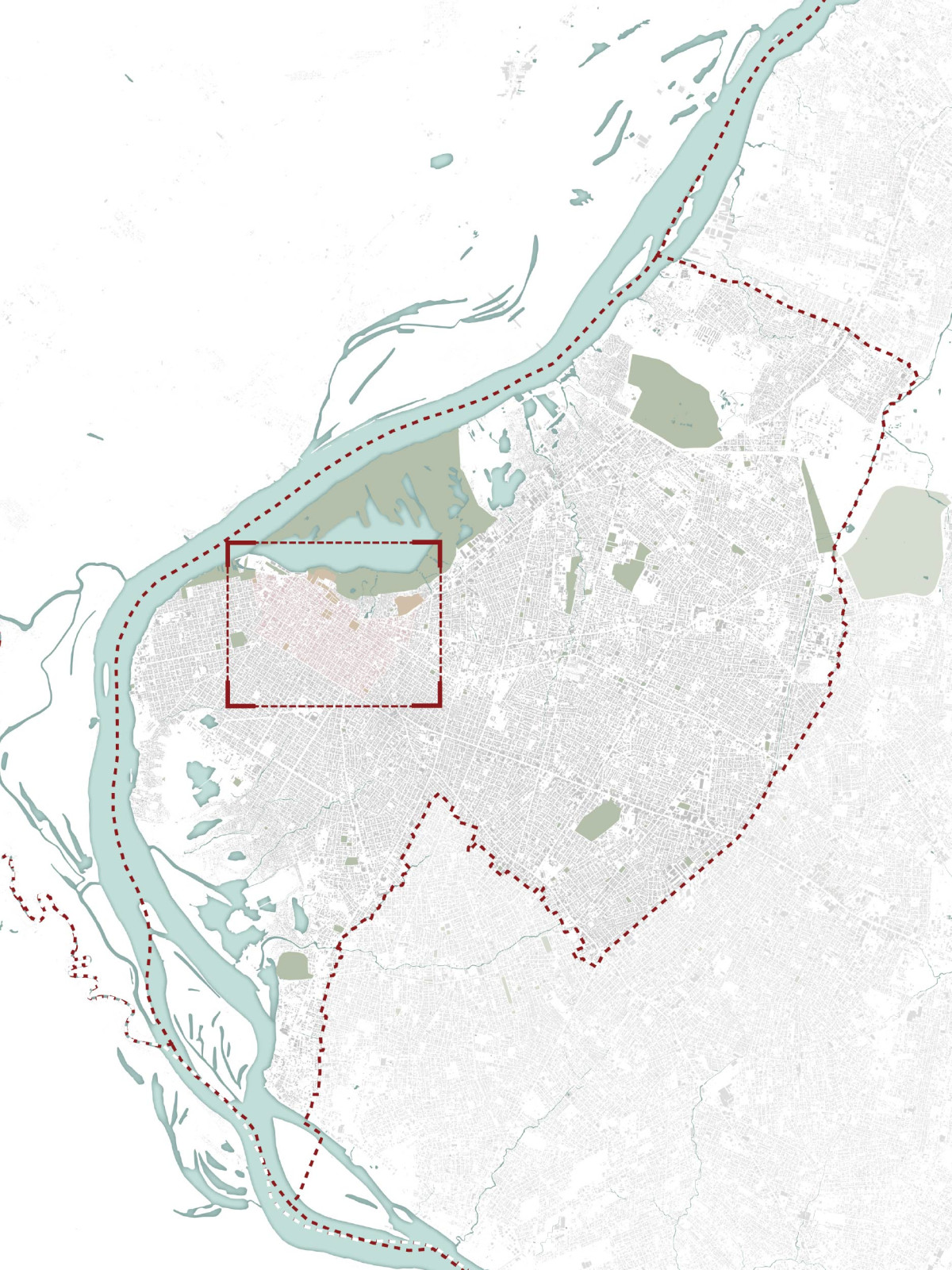
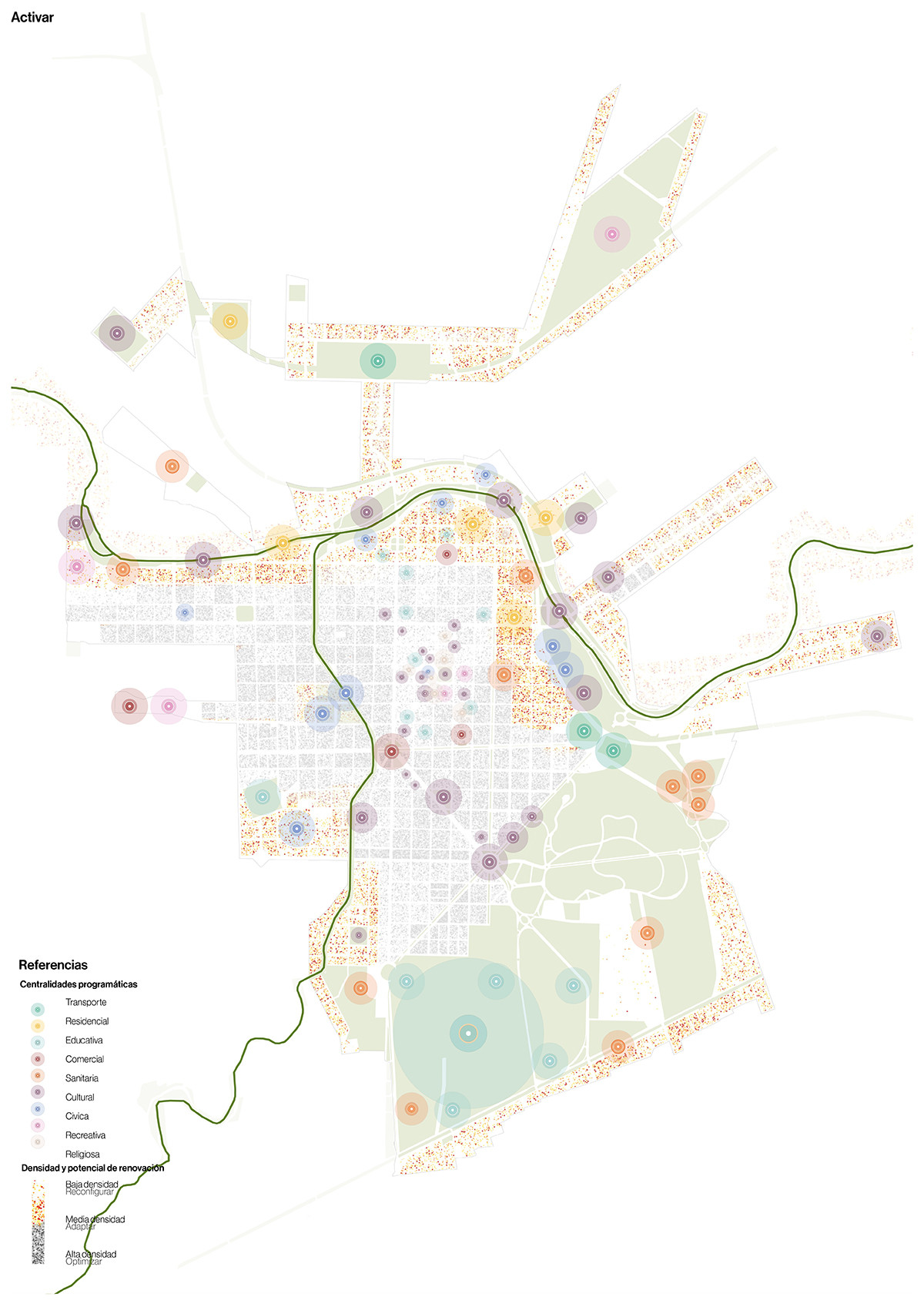
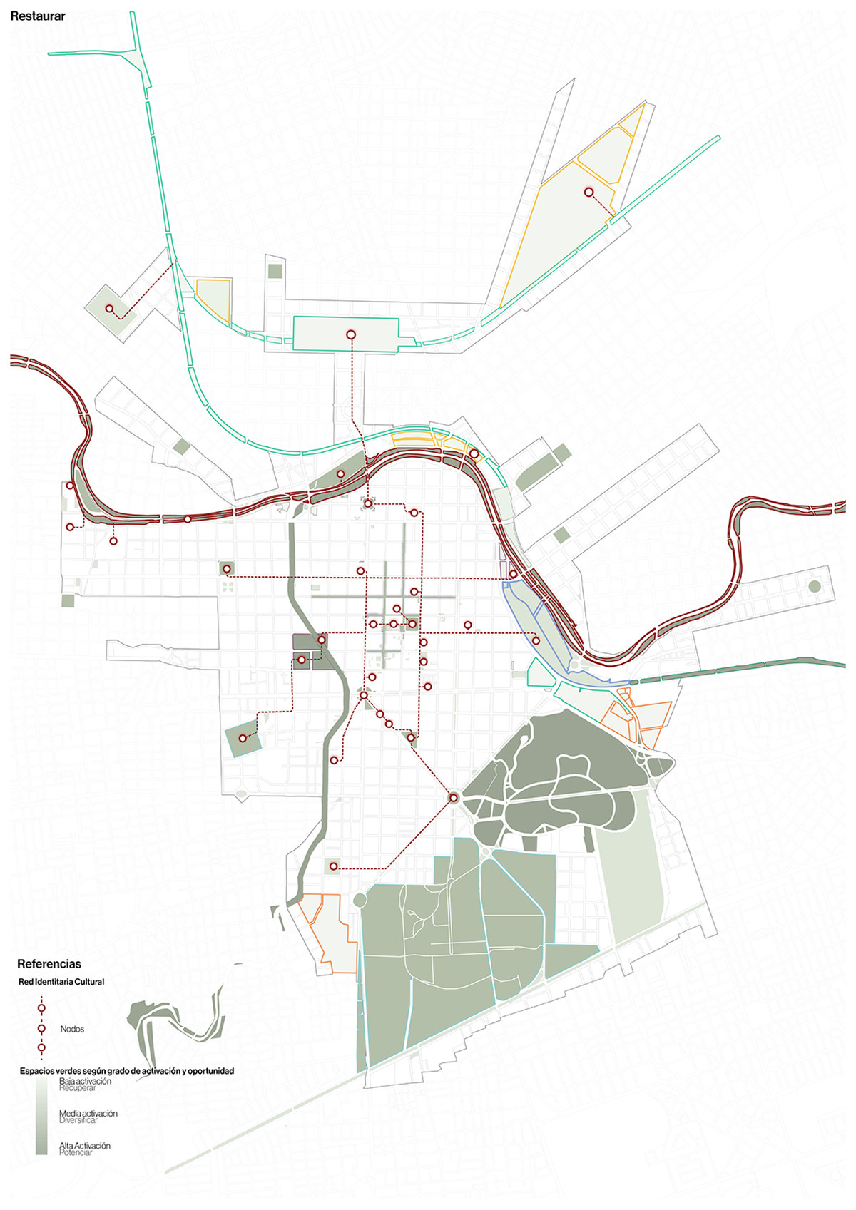
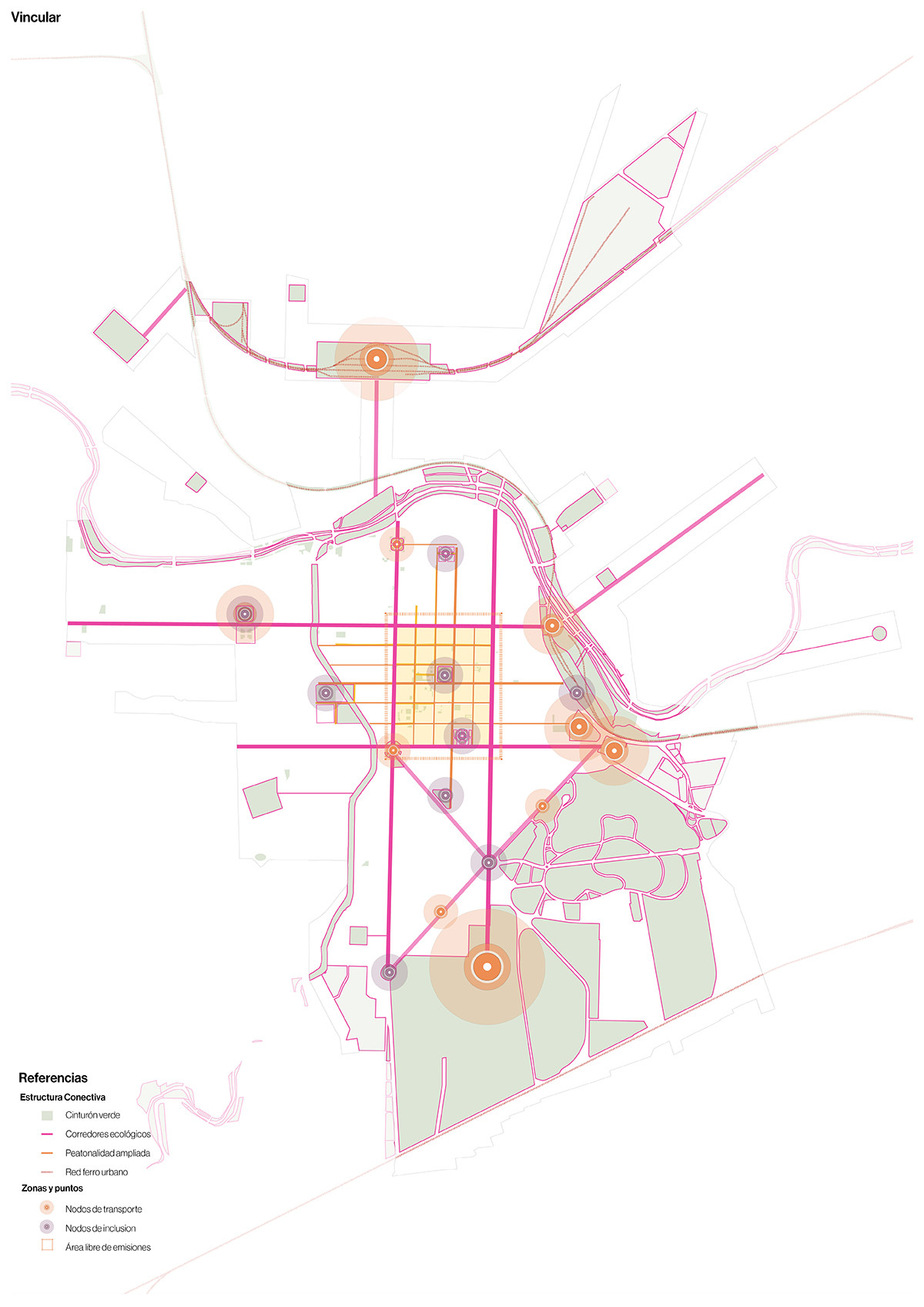
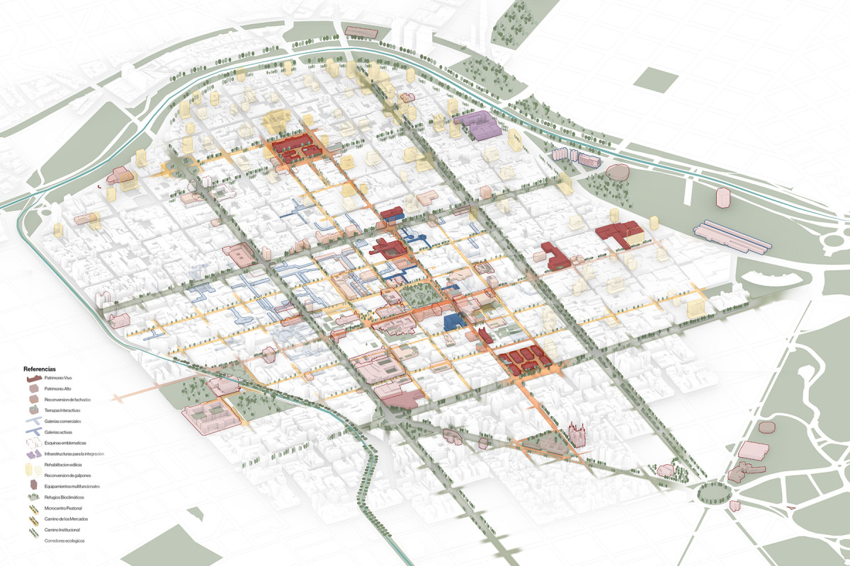
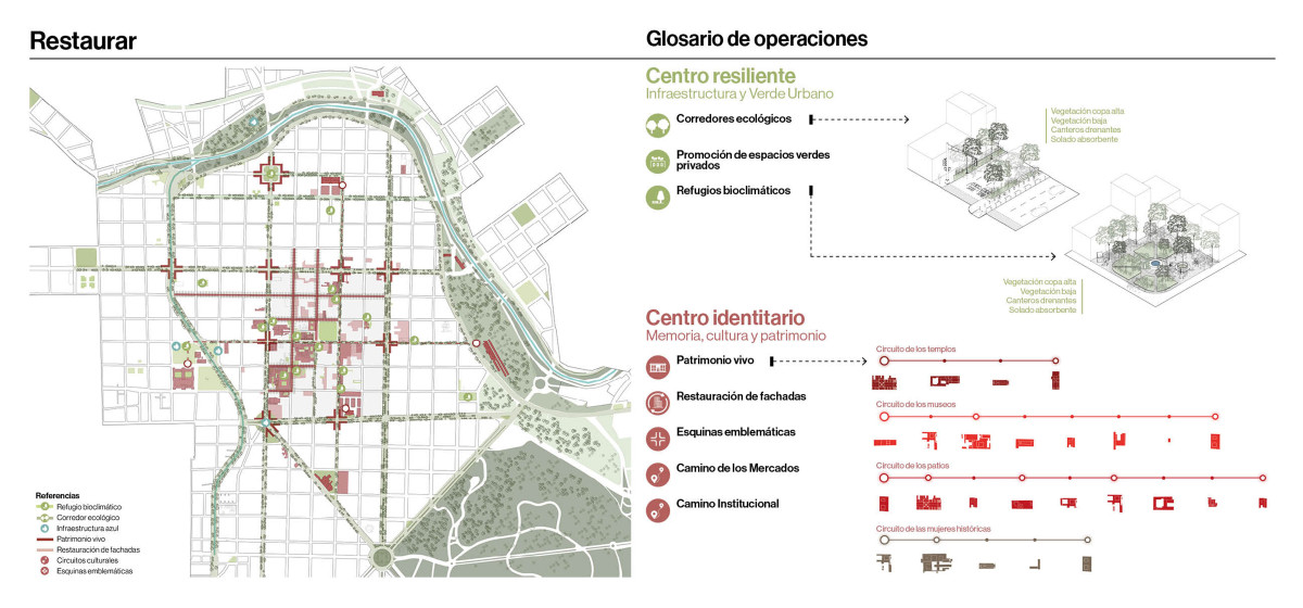
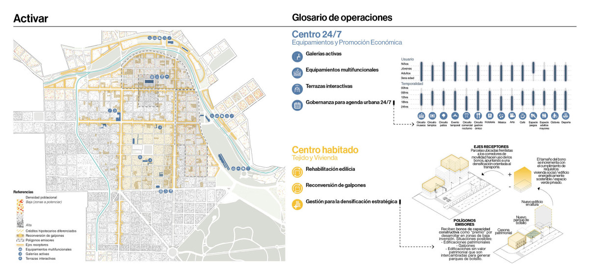
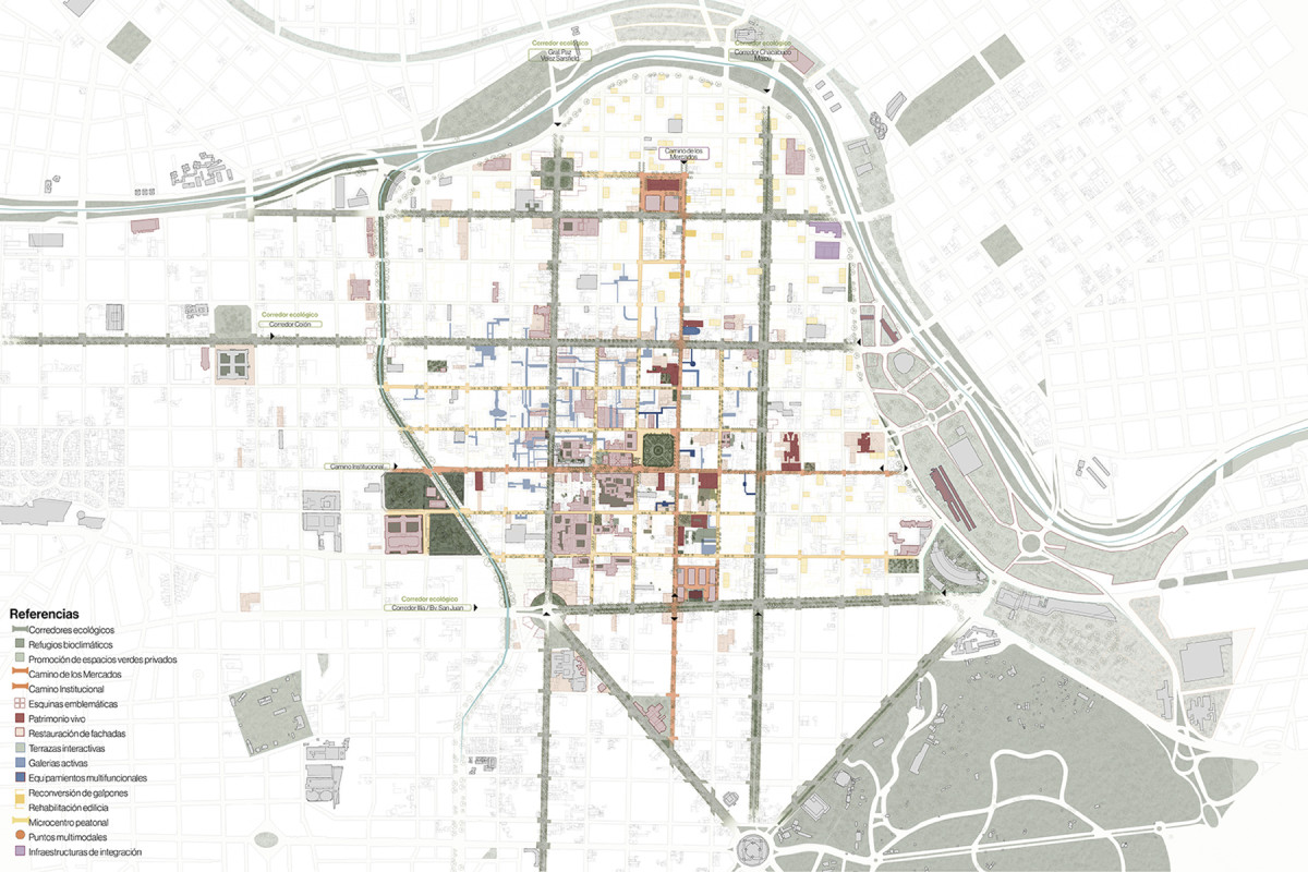
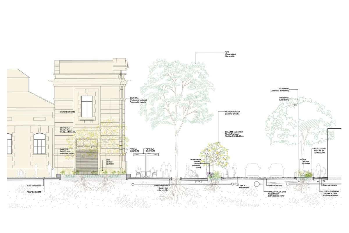
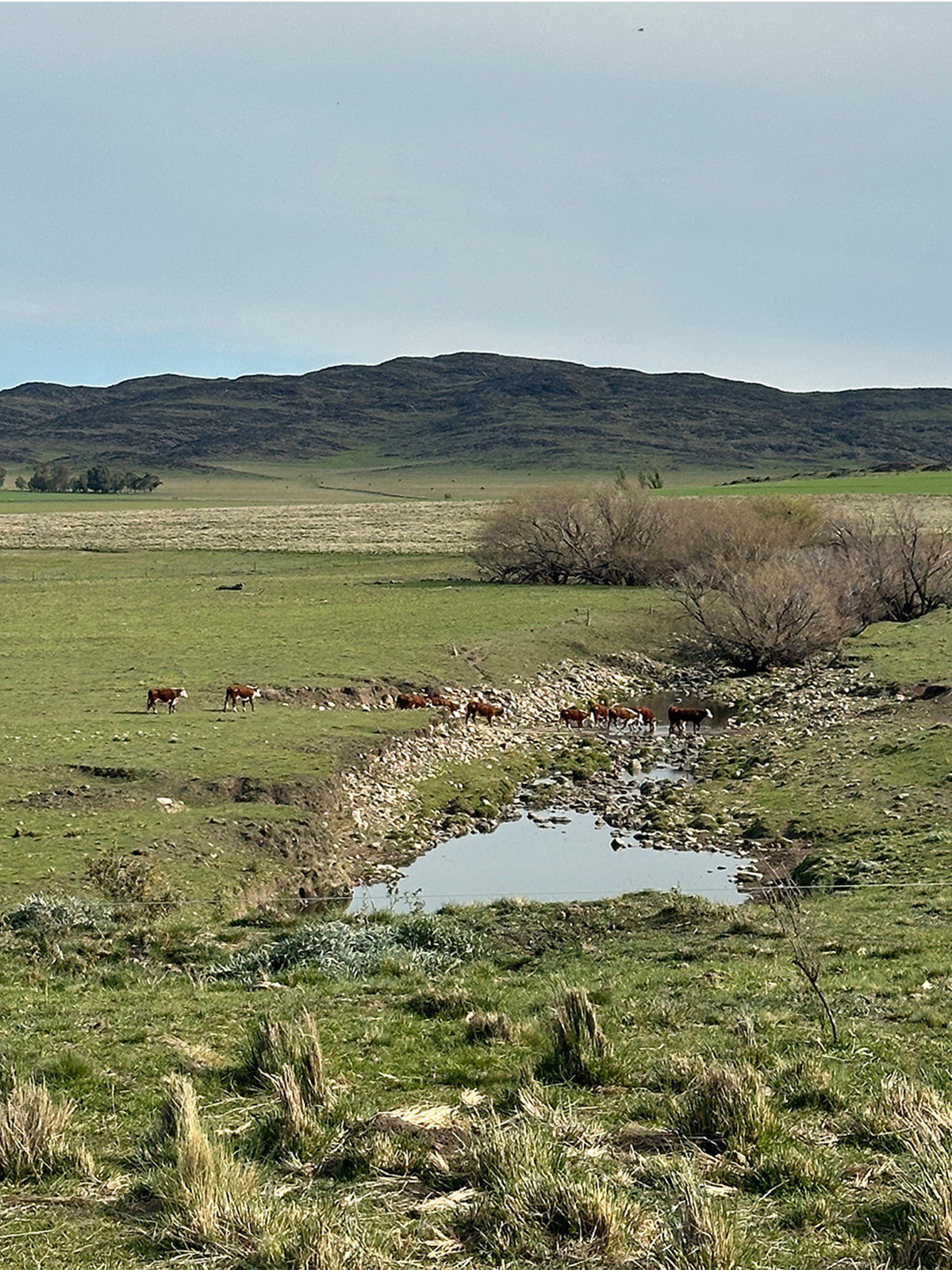
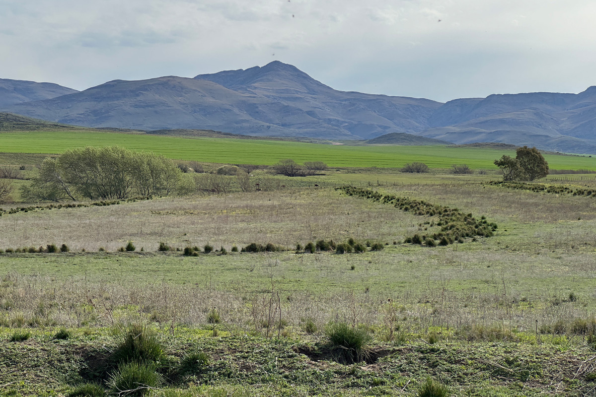
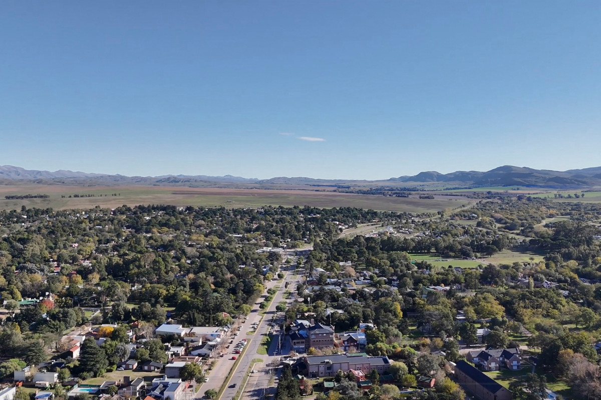
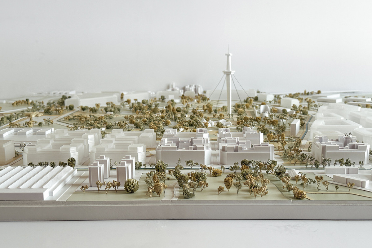
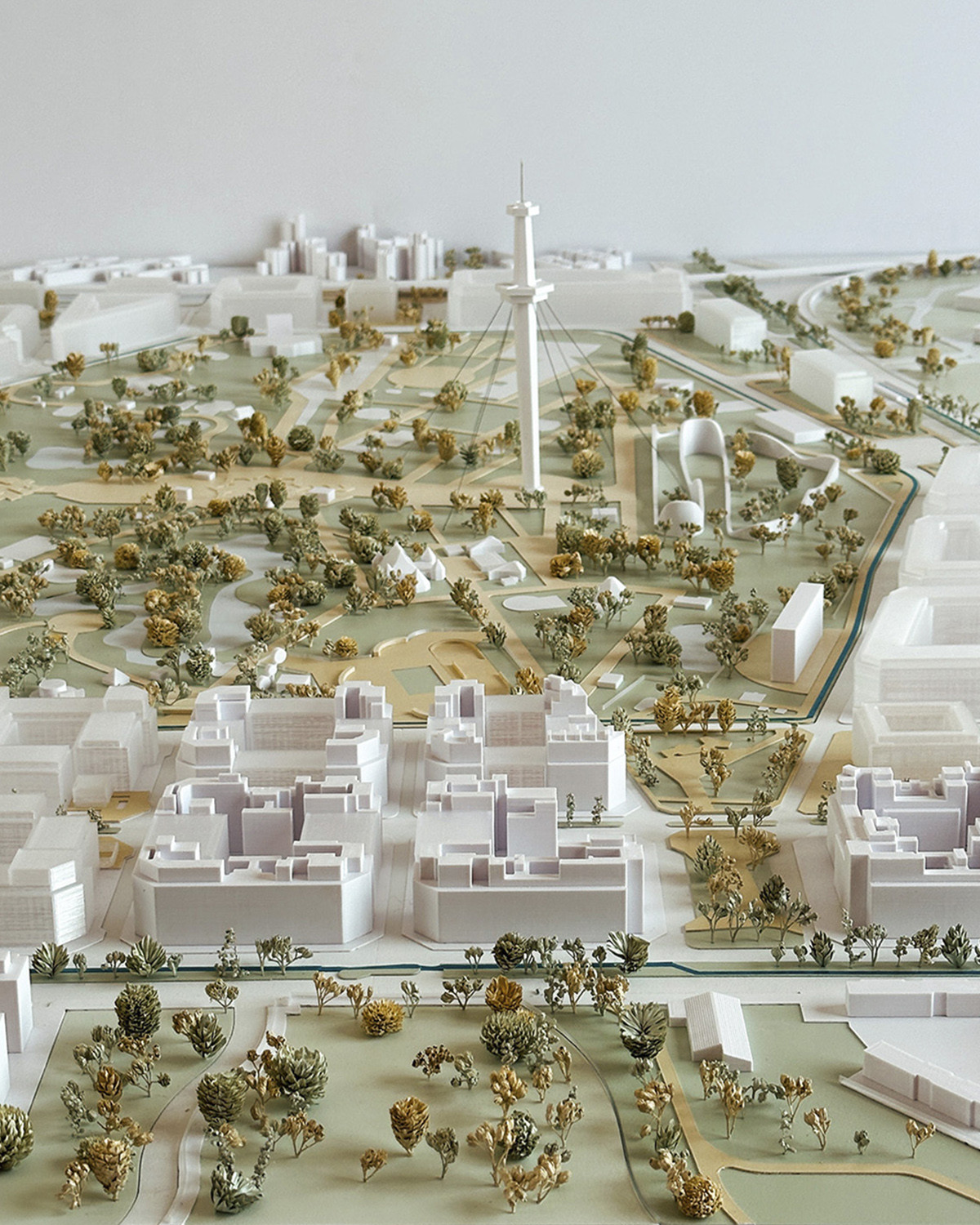
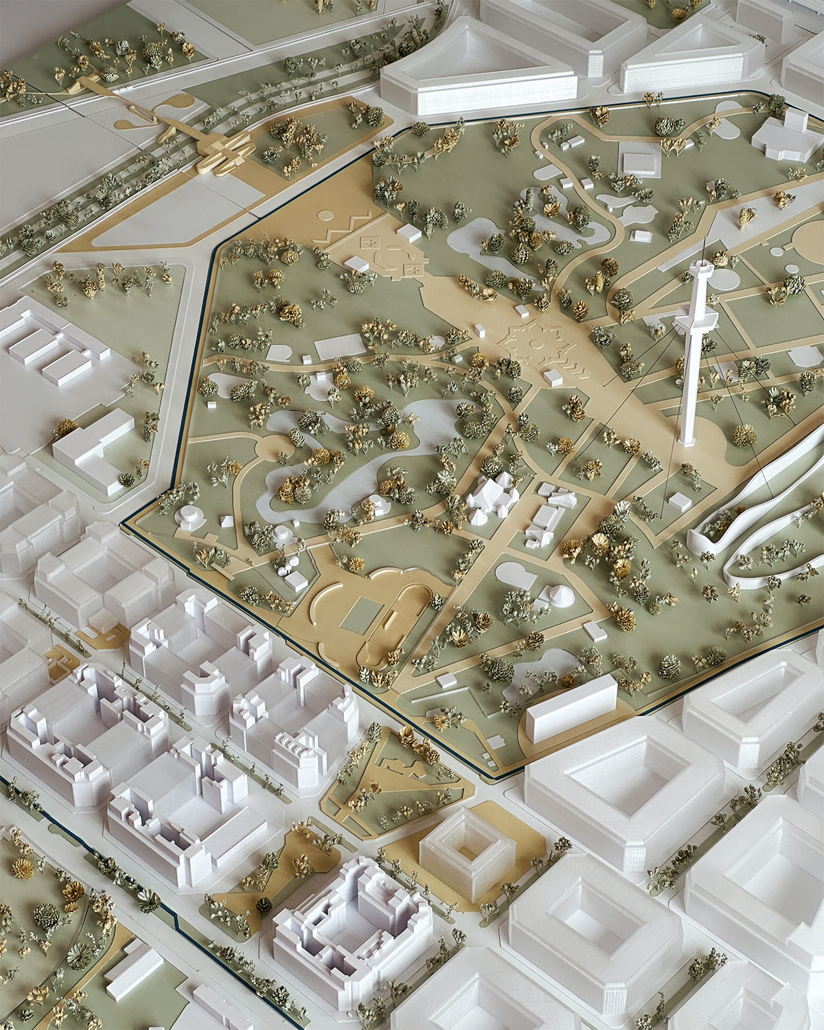
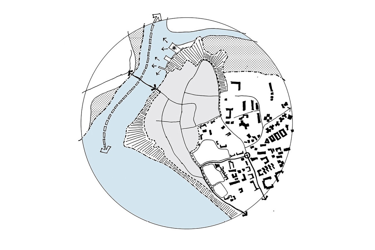
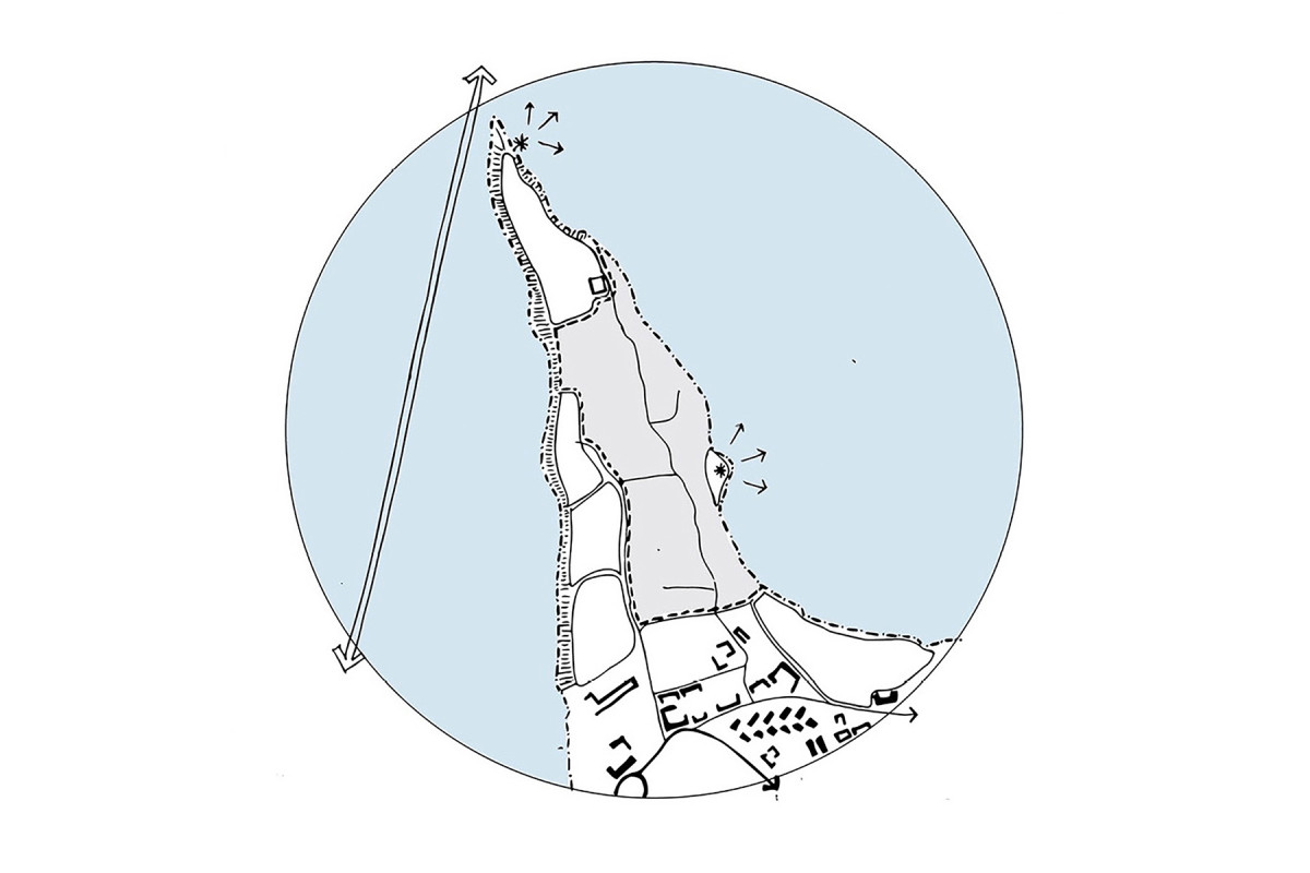
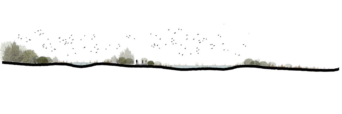
The Urban Design Manual for the Historic Center of Asunción (CHA) is a technical and strategic instrument that guides and unifies criteria for the design of public space in the city’s central area, promoting its patrimonial, environmental, and social revitalization. It was developed within the framework of the Urban Resilience Project for the Asunción Waterfront, led by the Government of Paraguay with financing from the World Bank.
The document is conceived as a methodological guide that organizes design criteria and technical sheets applicable to public spaces—streets, plazas, and parks—incorporating principles of universal accessibility, sustainability, climate comfort, identity, and urban maintenance.
Its scope is limited to the Historic Center and its buffer area, and it is binding for all public and private works developed within this territory.
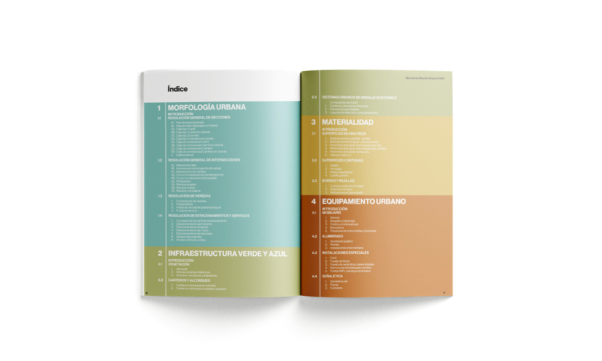
The Manual is structured into four chapters:
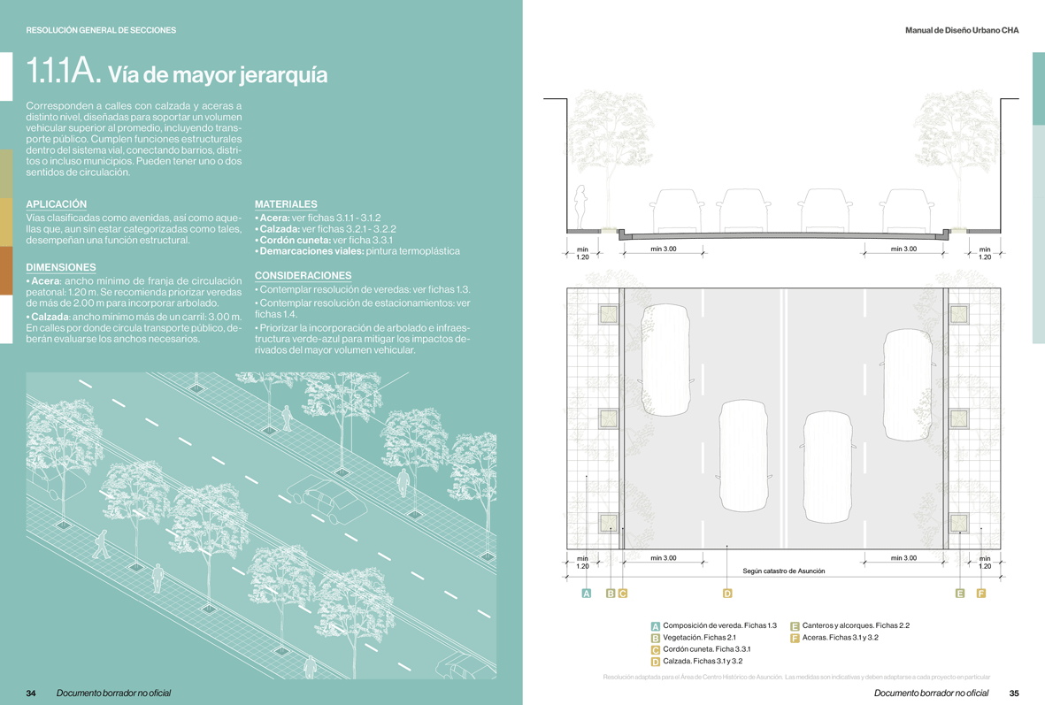
• Urban Morphology: defines typologies of streets, sidewalks, and intersections.
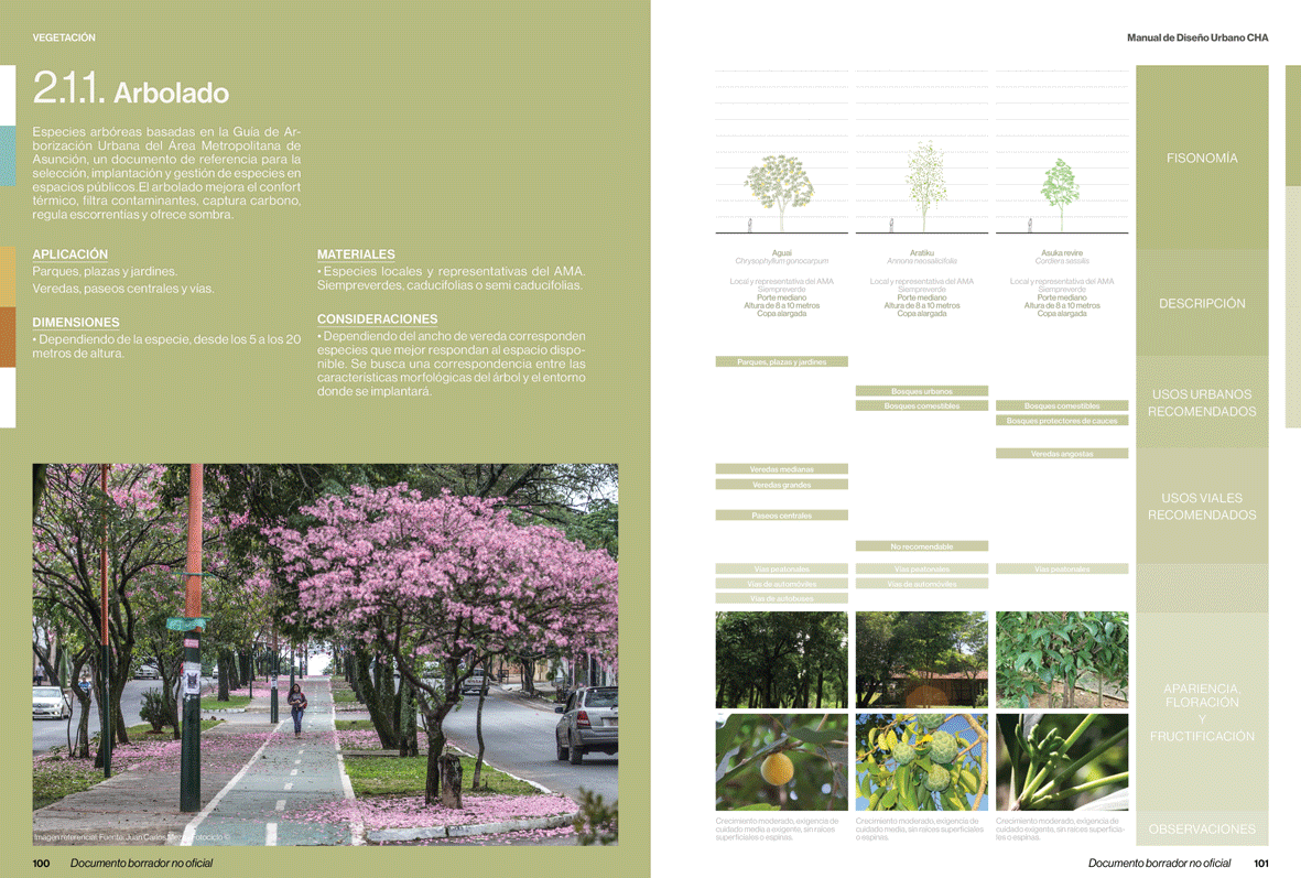
• Green and Blue Infrastructure: integrates nature-based solutions and sustainable drainage strategies.
• Materiality: proposes materials for pavements, edges, and surfaces.
• Urban Furniture: specifies street furniture, lighting, signage, and complementary elements.
Its purpose is to ensure coherence in urban interventions, enhance environmental quality, and strengthen the environmental and social resilience of the Historic Center as a symbolic and functional core of Asunción. In this sense, the Manual proposes a vision of the Historic Center as a living and evolving territory, where urban design articulates memory, identity, and future.
Related projects
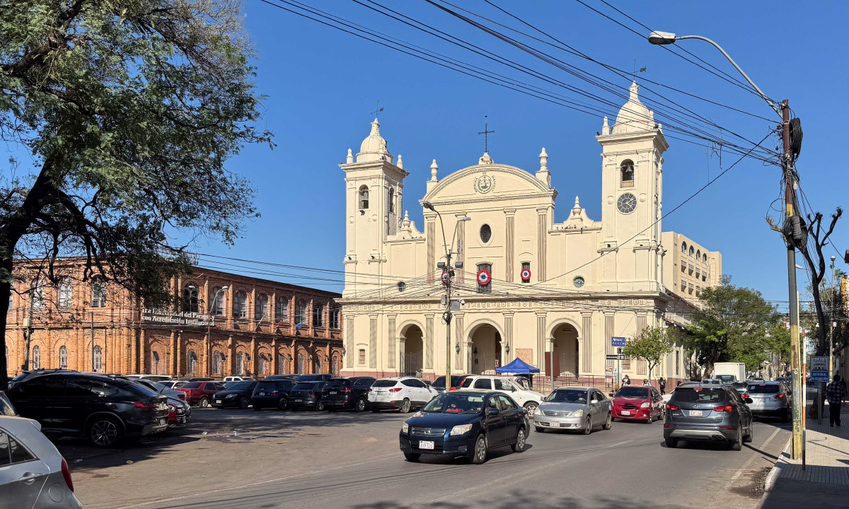
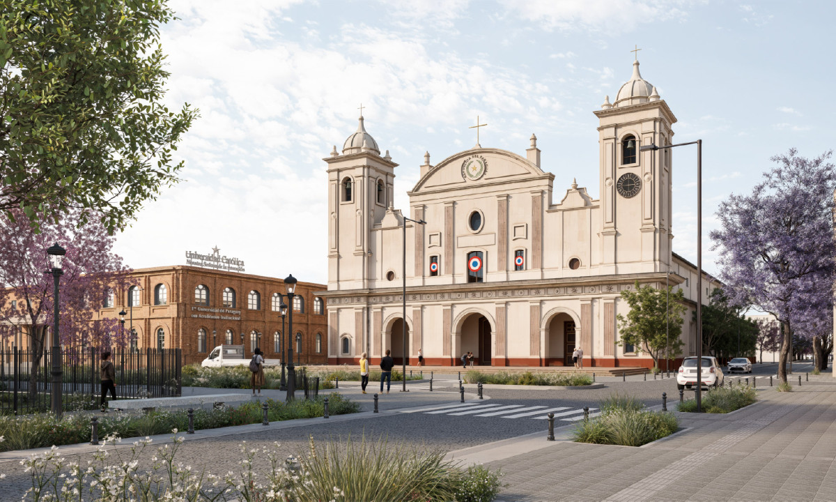
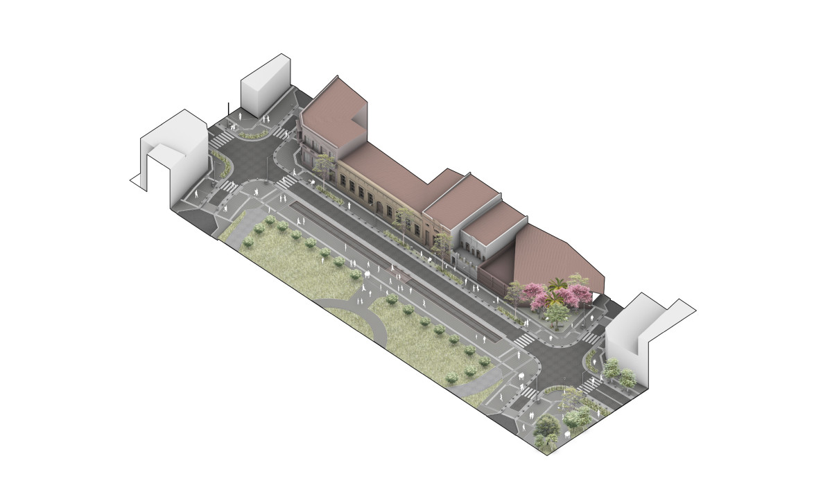
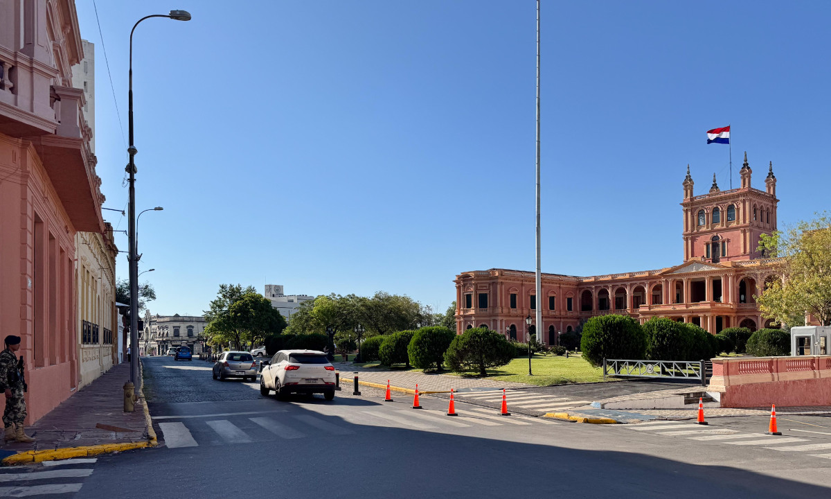
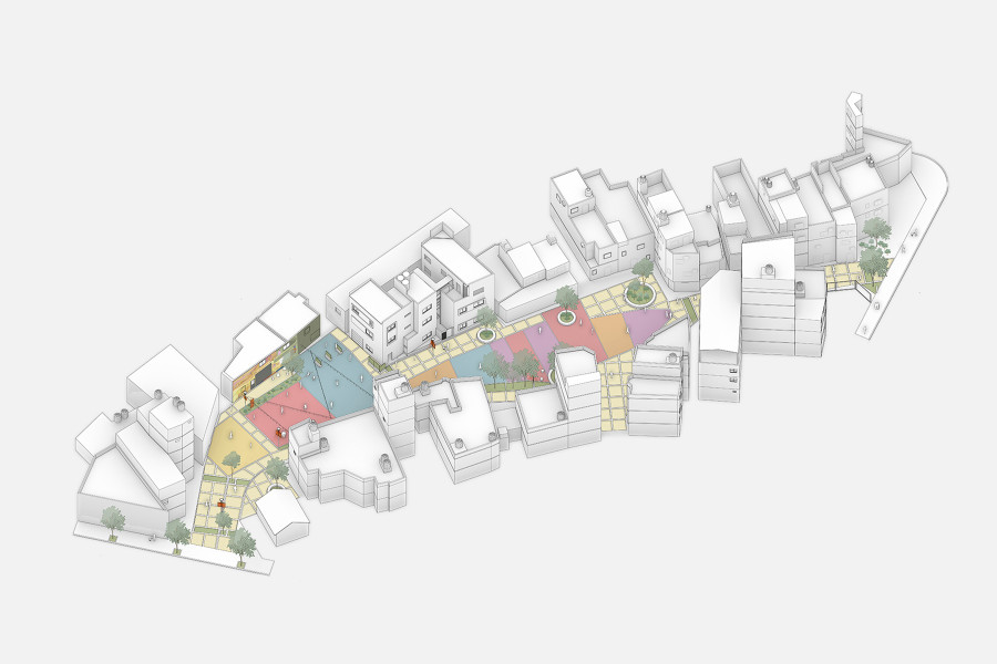
Paraguayo Independiente: Asunción’s Civic Corridor
Before
After
Before
After
Date
2025
Service
Urban design
Status
Project
Team
Región AustralAsesor: Arq. Carlos Colombo
Client
Ministerio de Obras Públicas y Comunicaciones del Paraguay (MOPC)
Location
Asunción, Paraguay
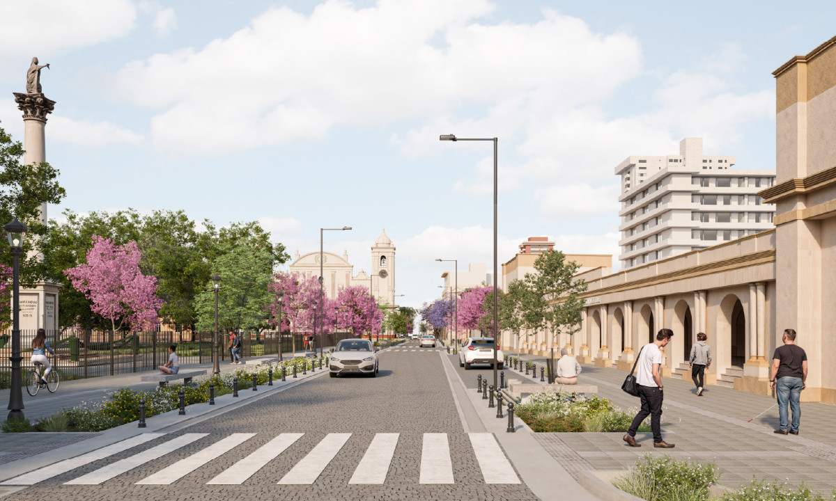
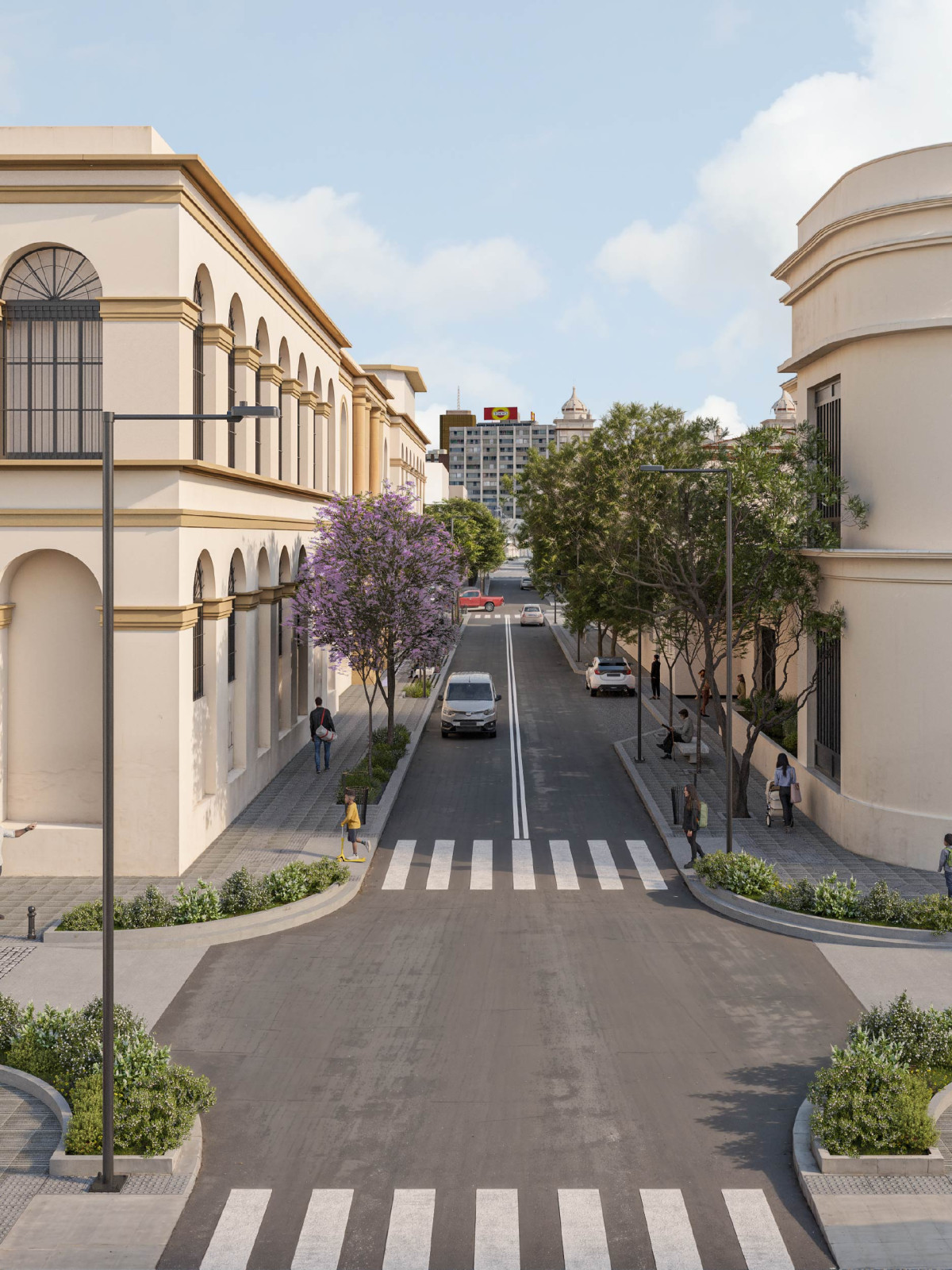
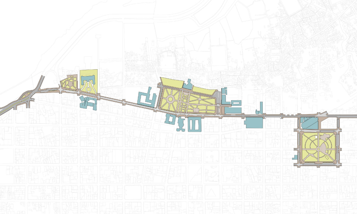
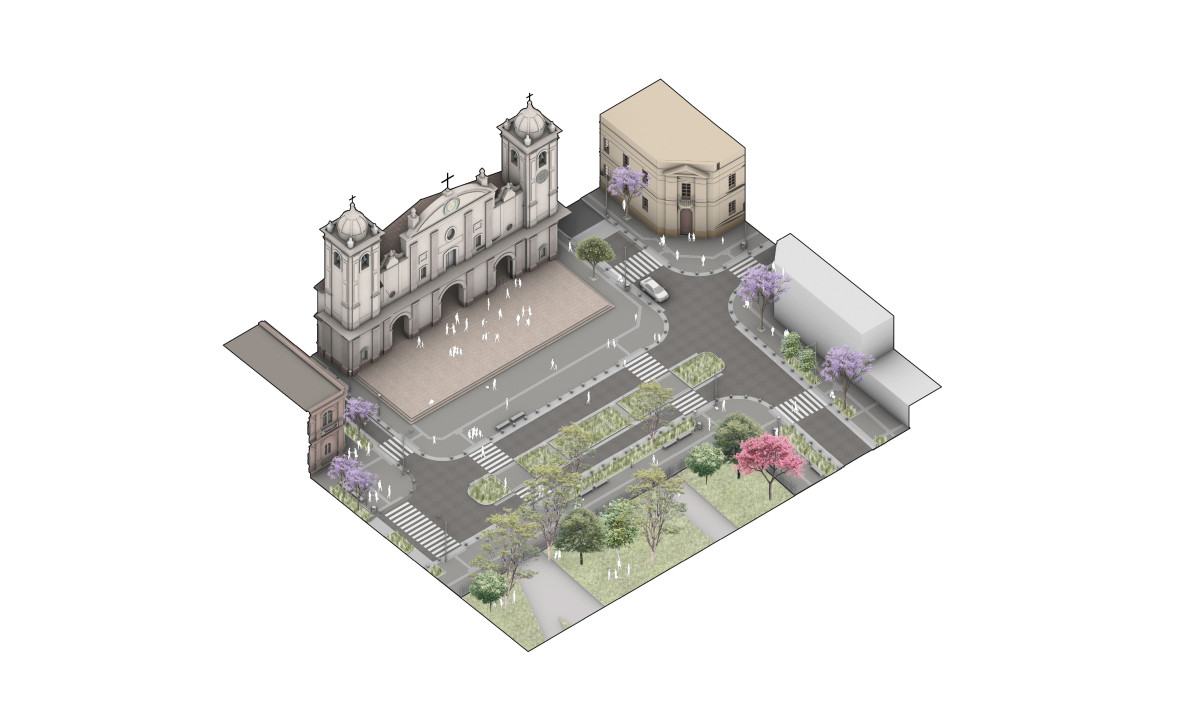
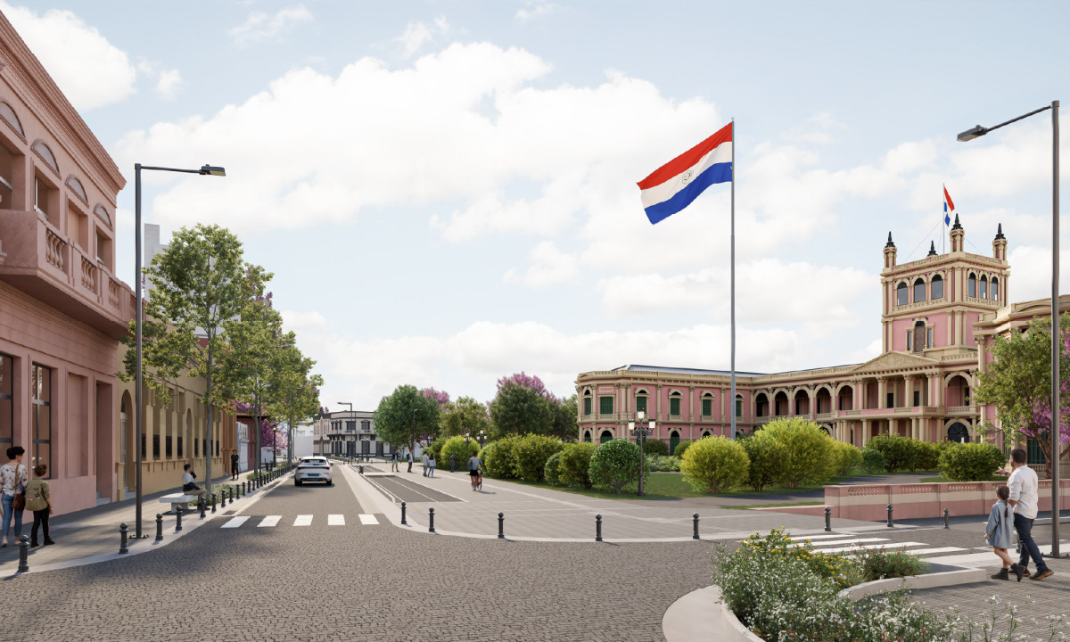
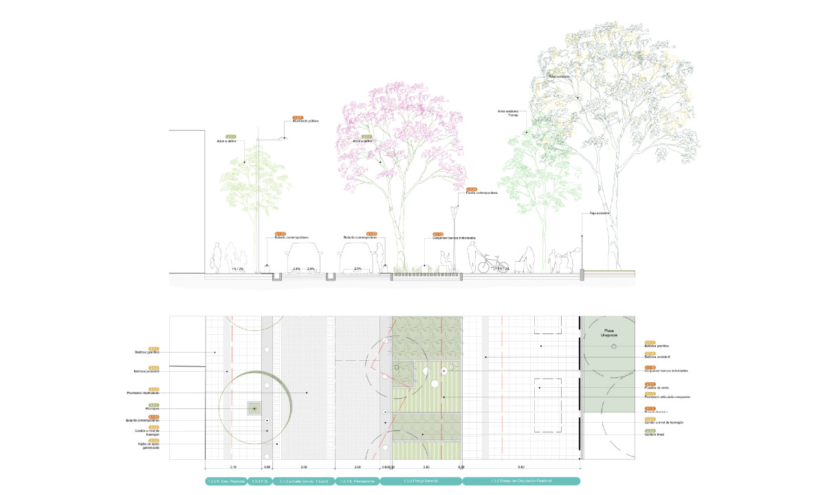
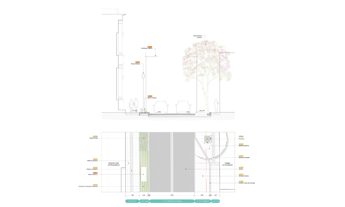
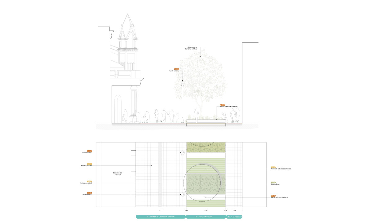
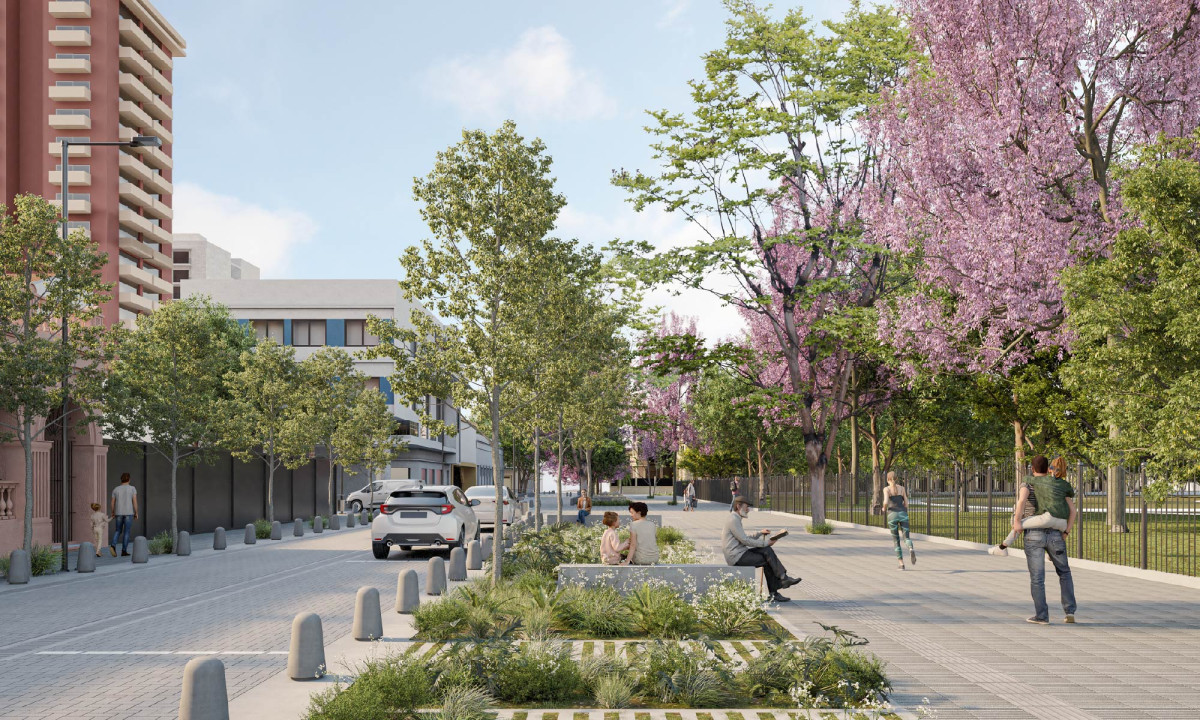
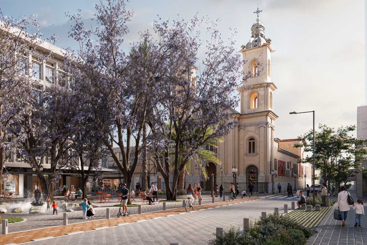
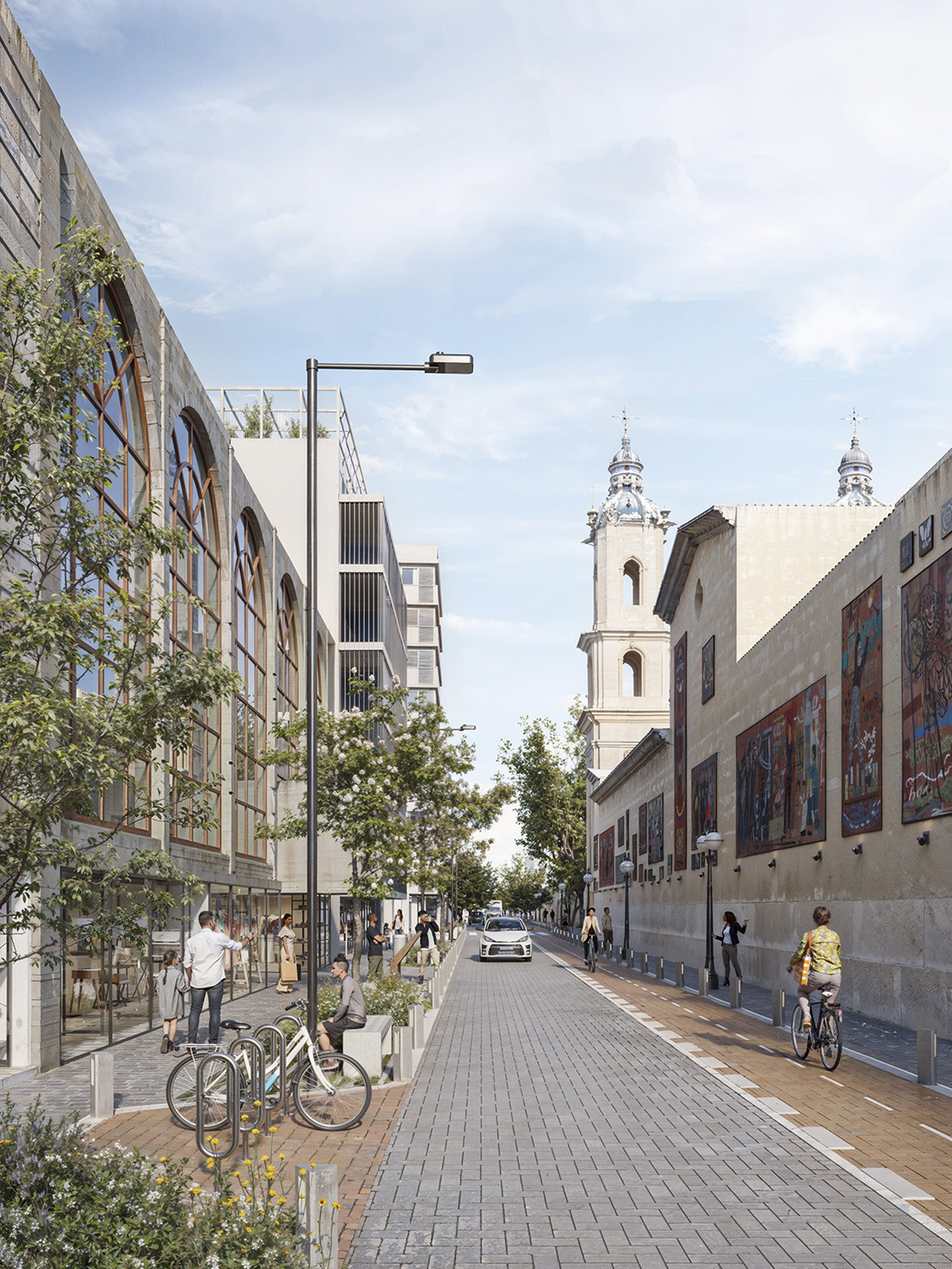
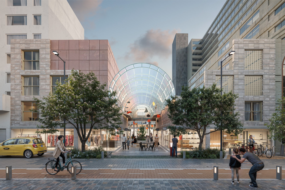
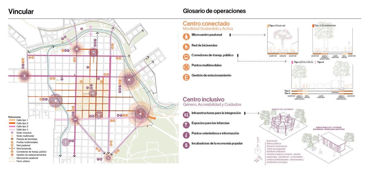
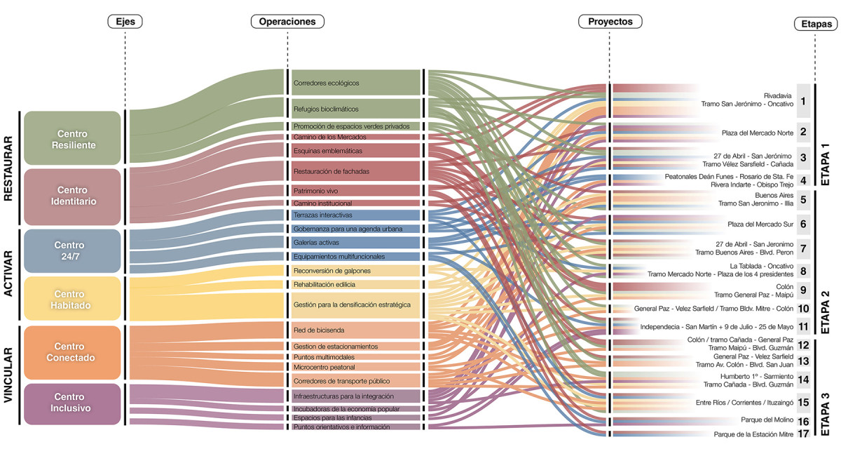
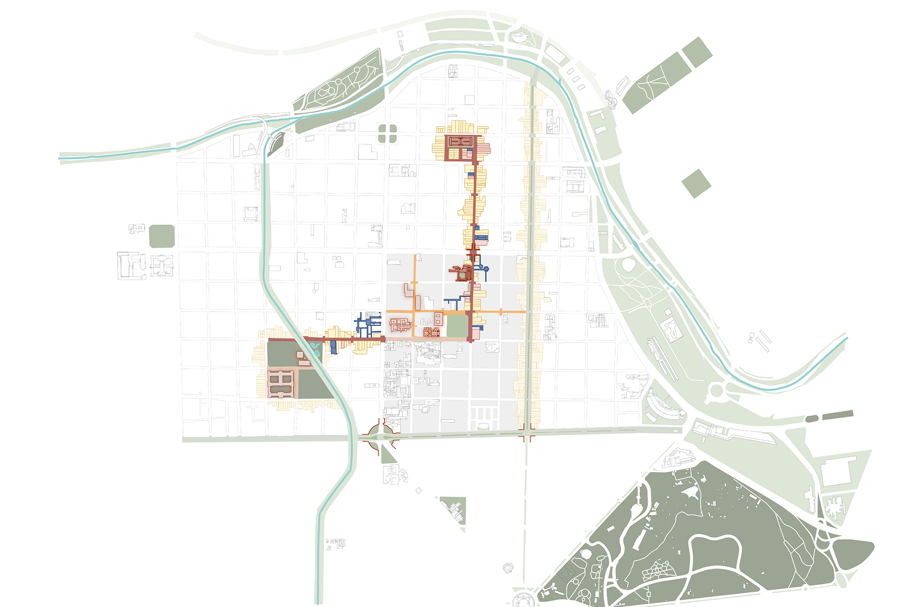
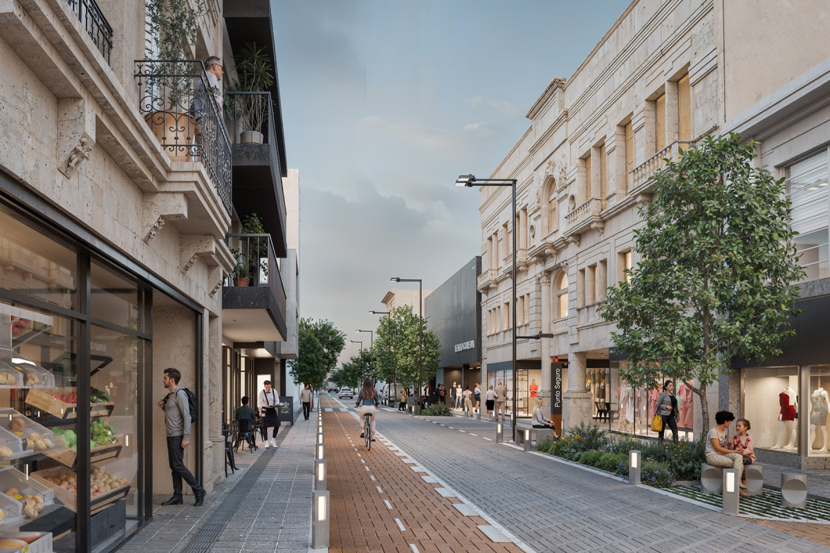
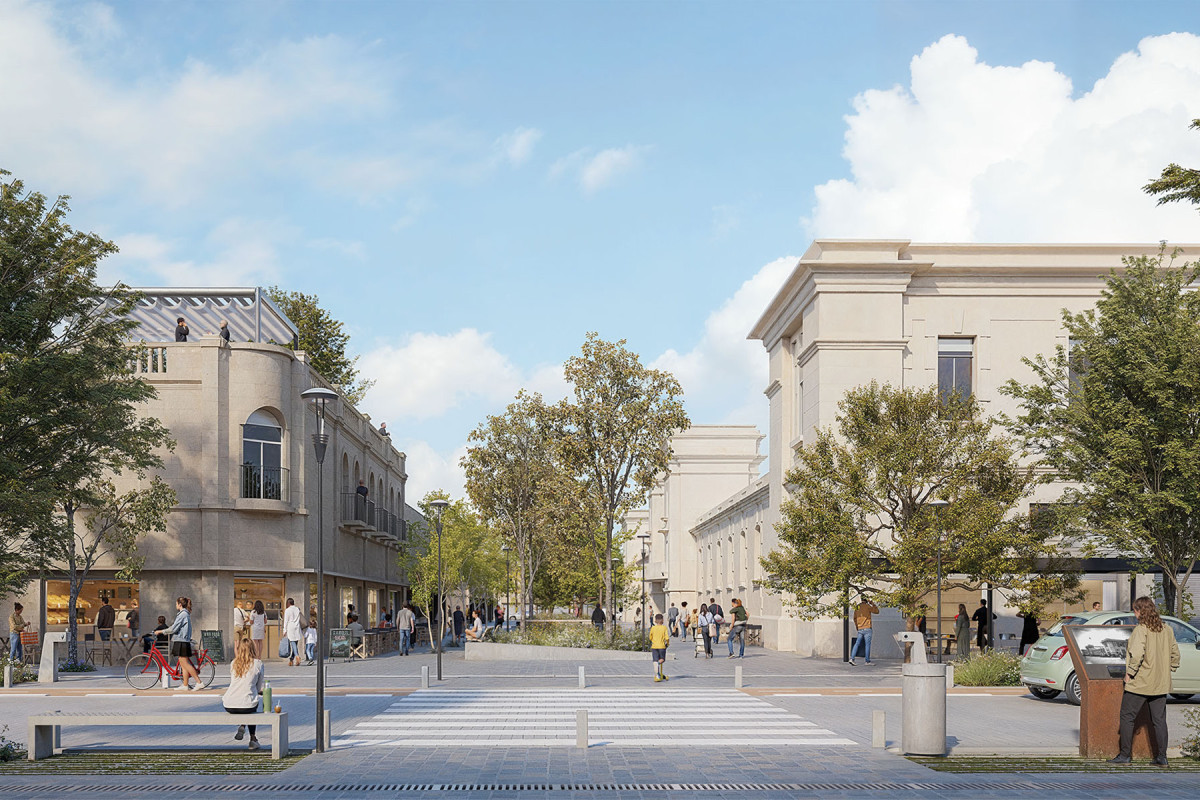
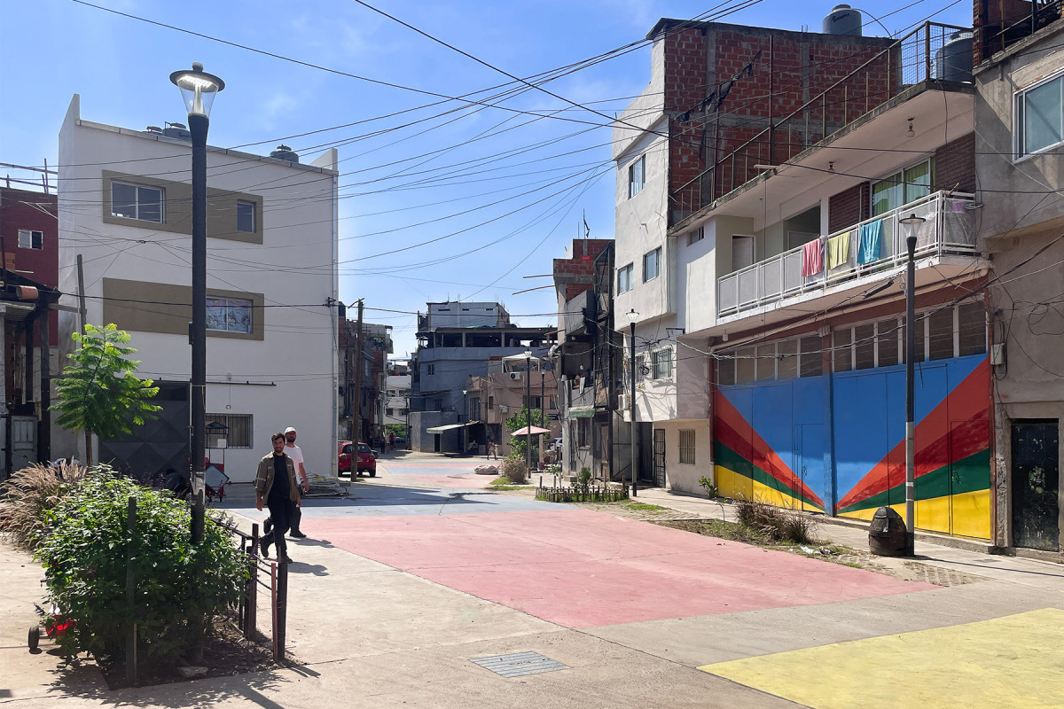
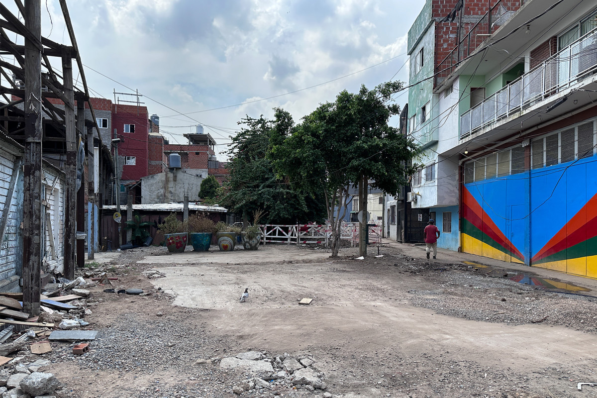
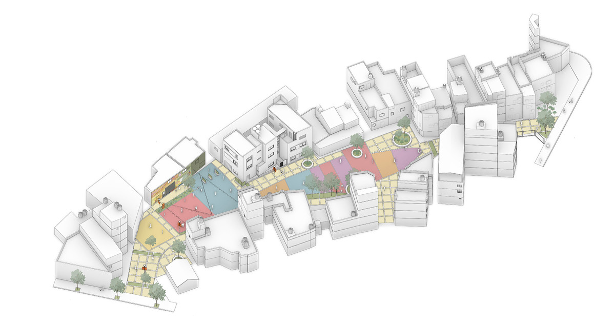
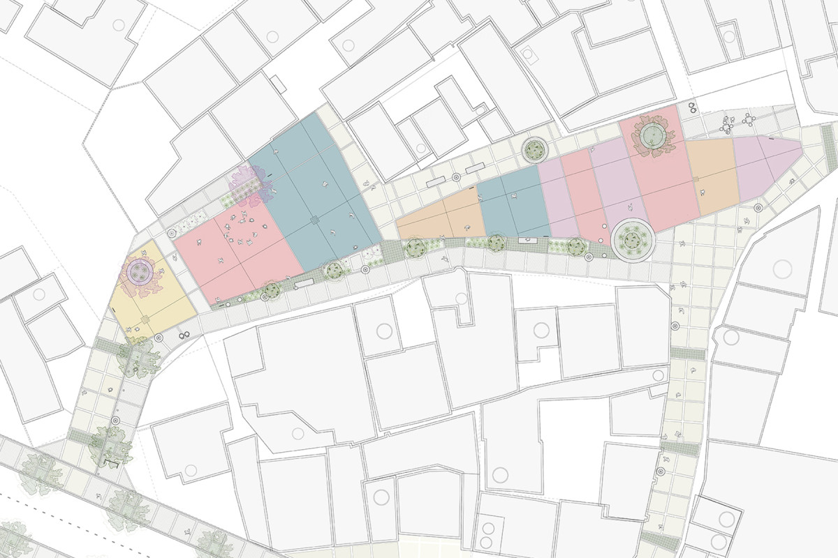
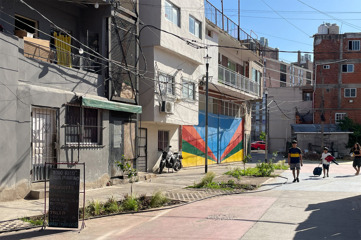
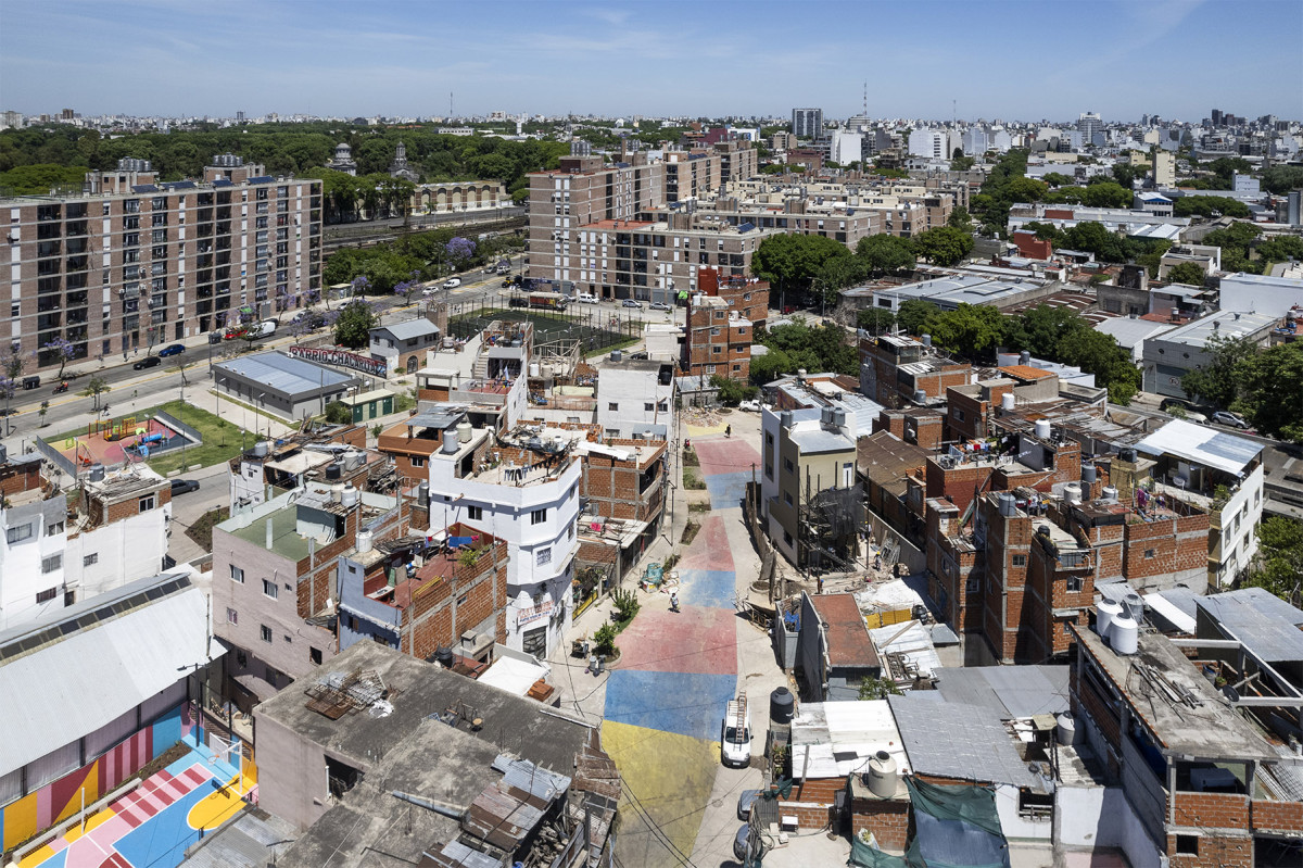
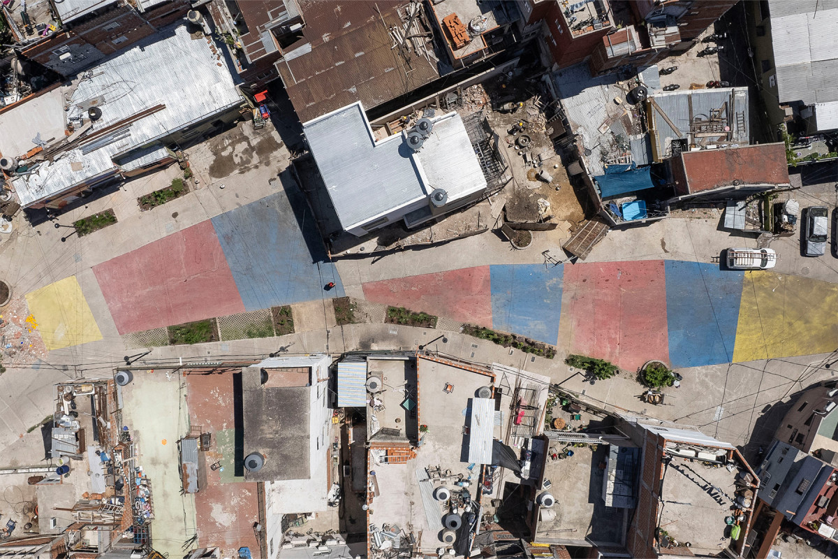
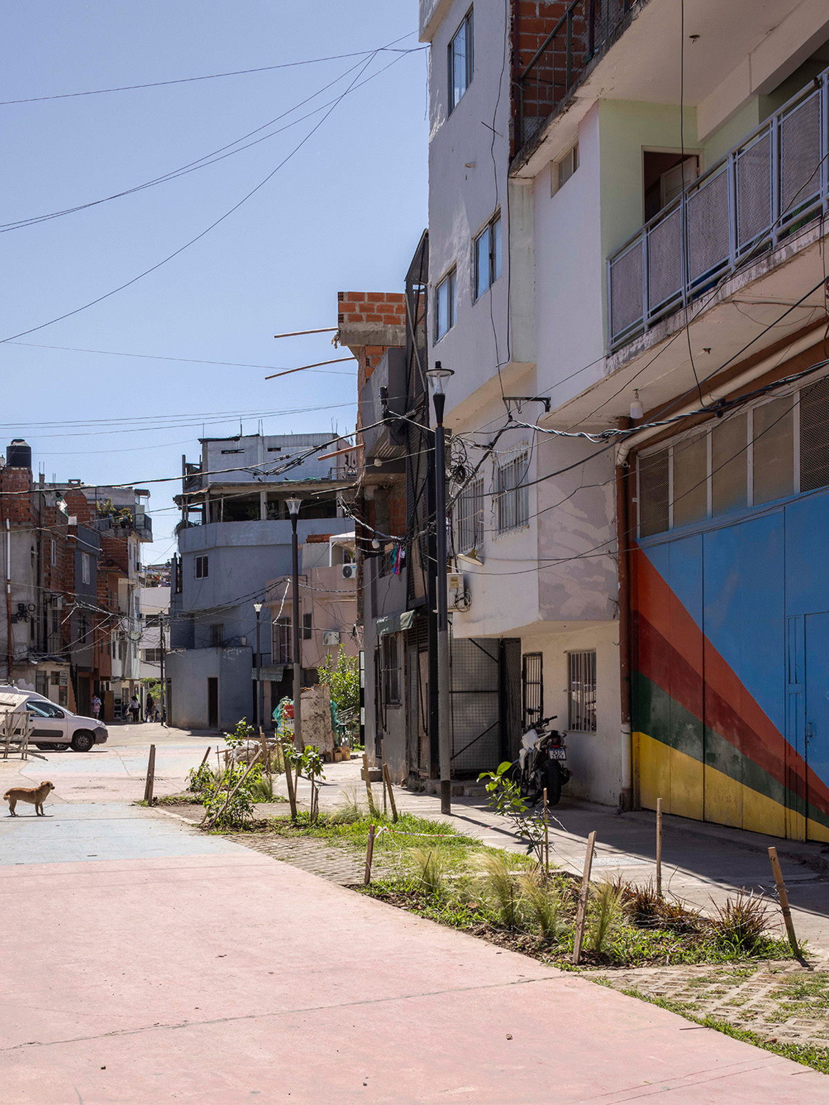
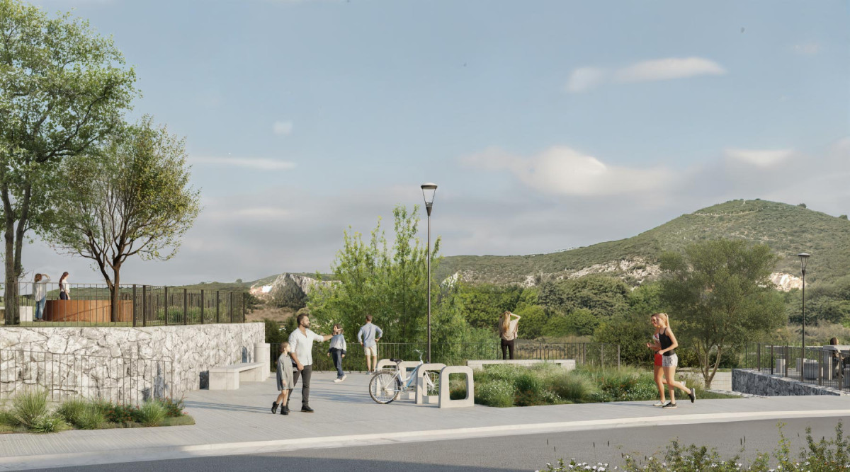
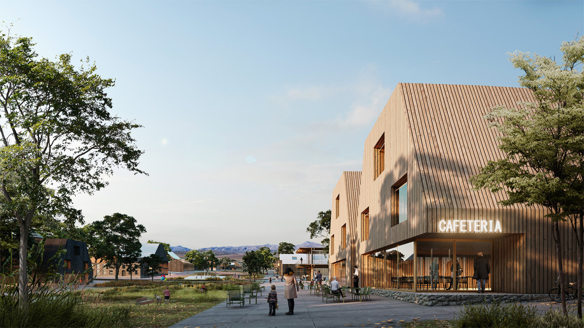
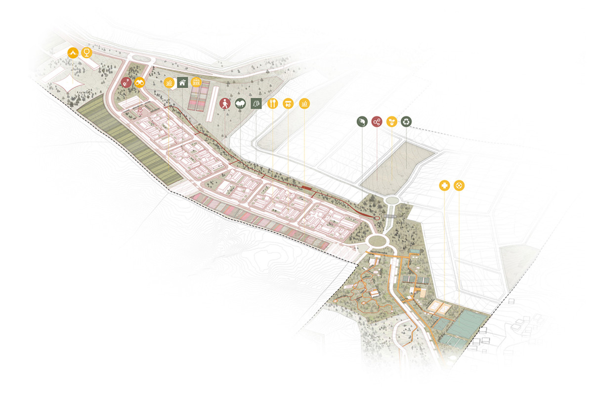
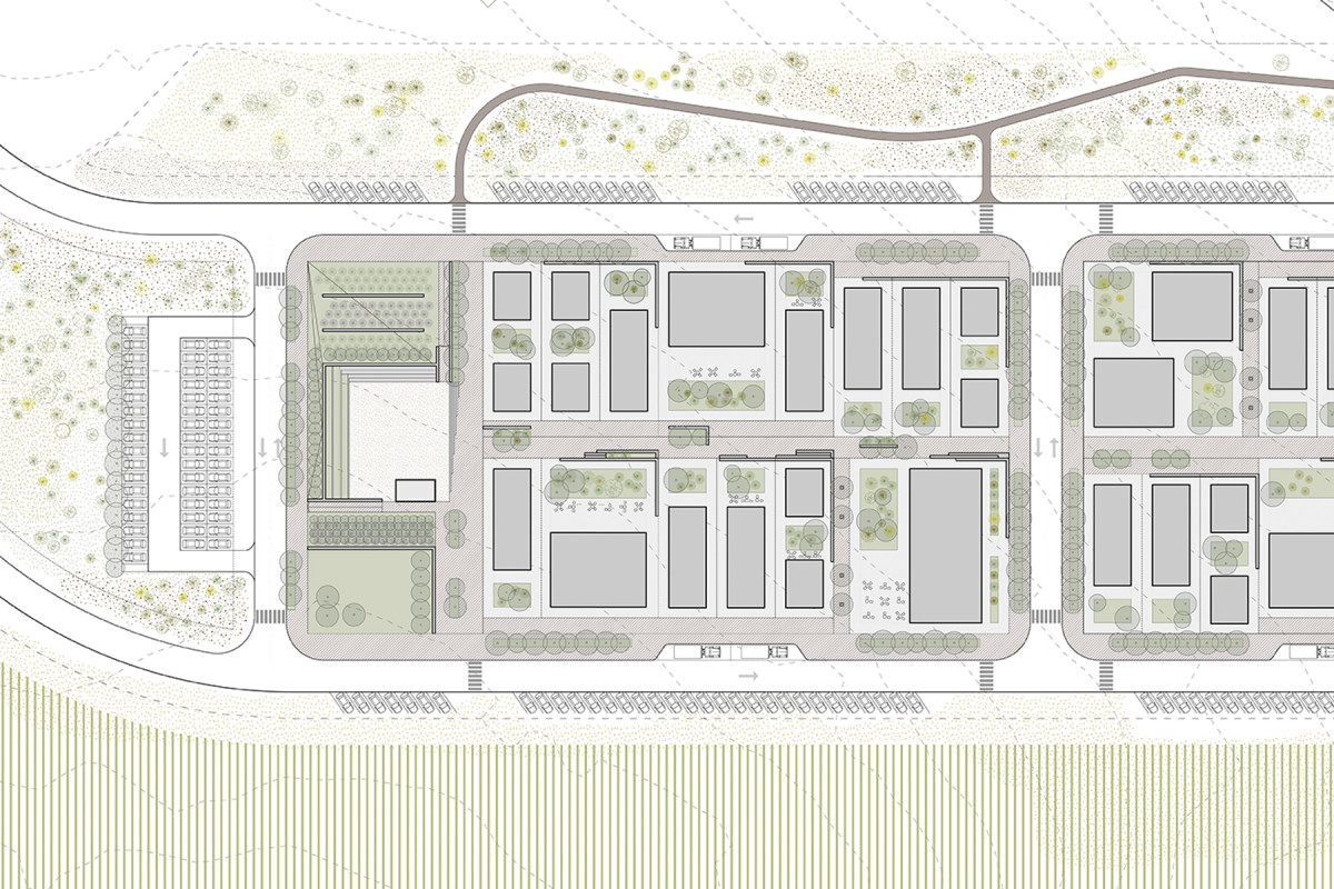
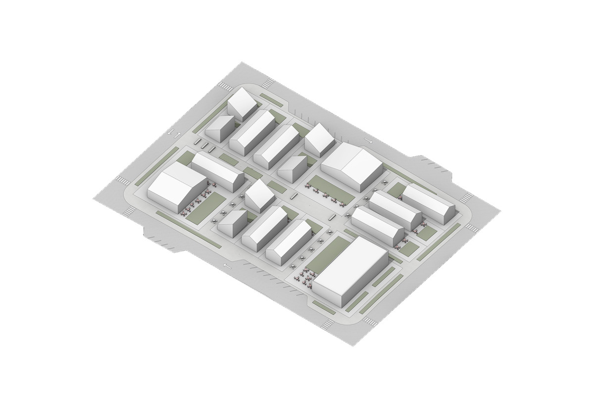
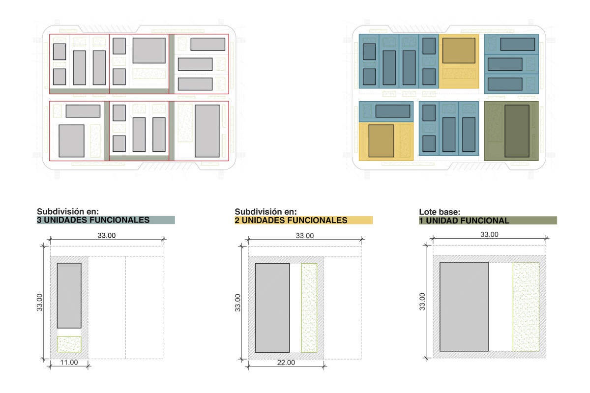
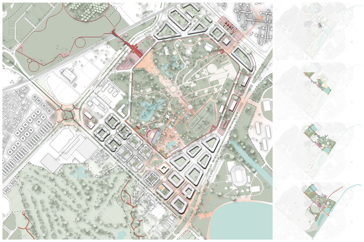
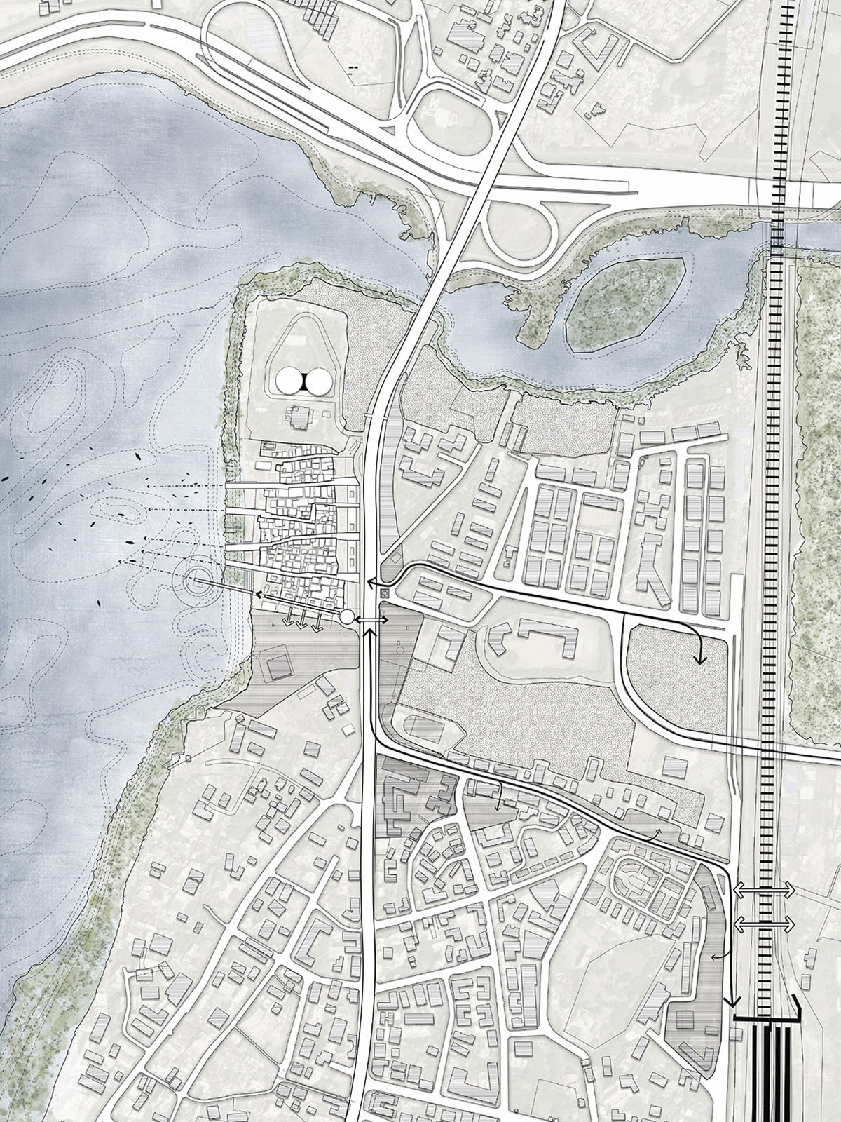
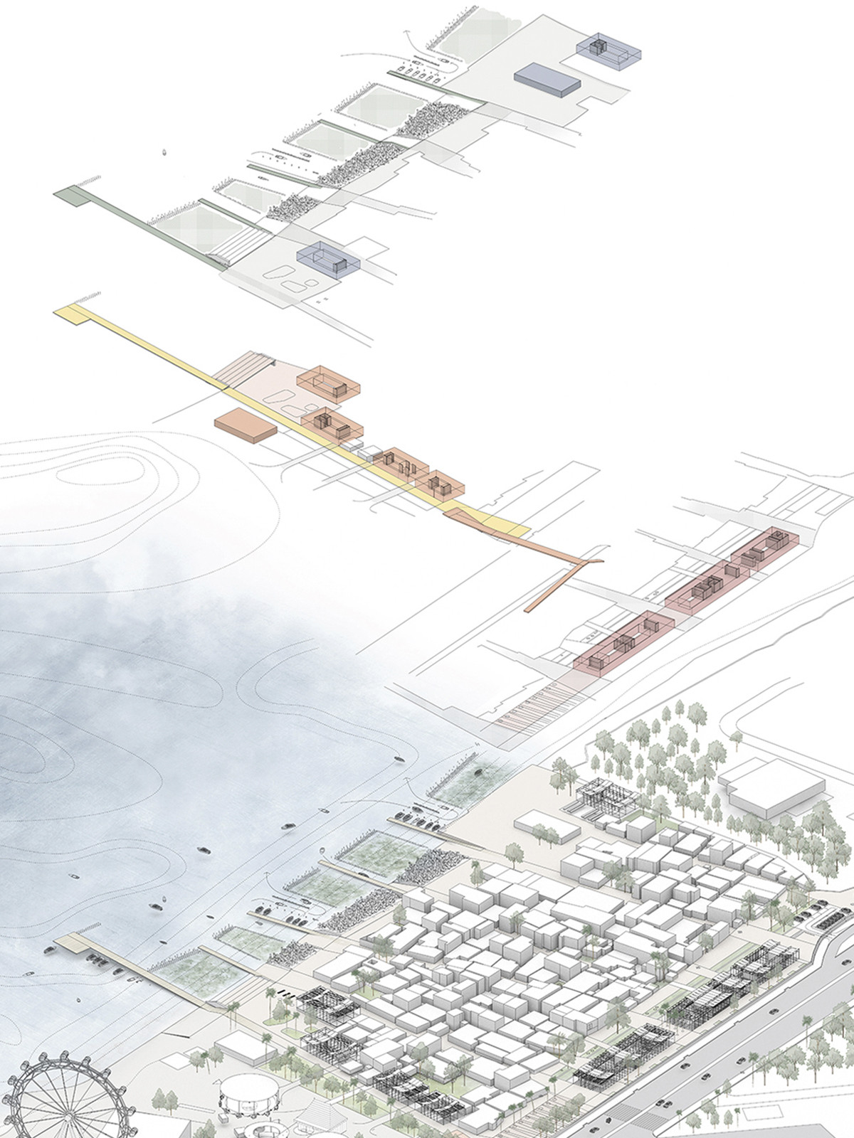
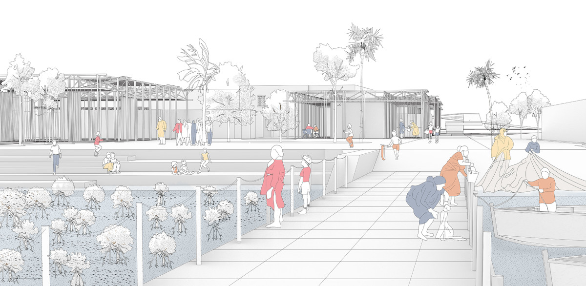
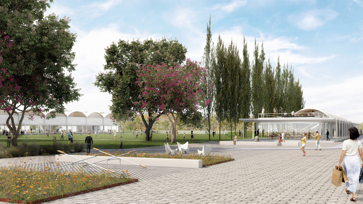
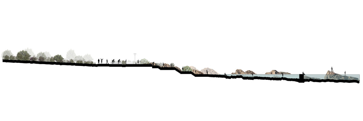
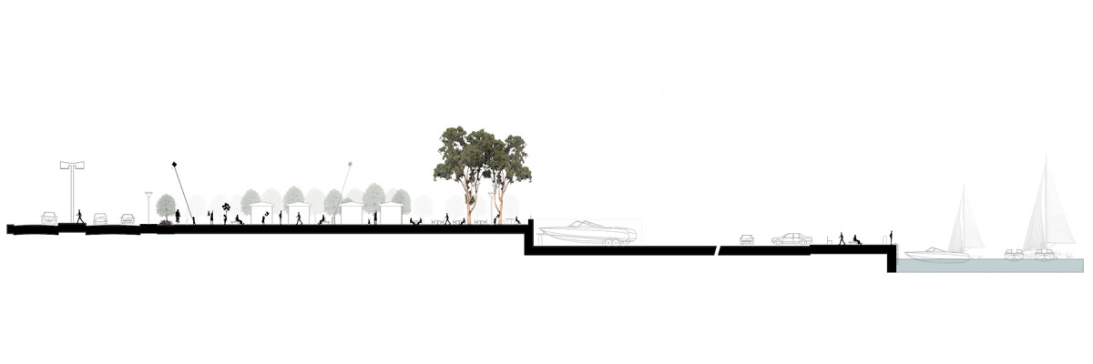
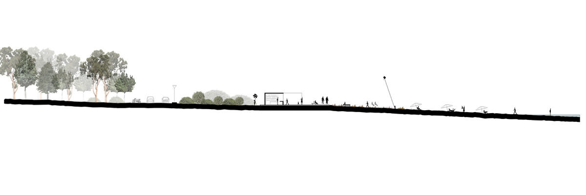
The Paraguayo Independiente Civic Corridor constitutes the first application of the Urban Design Manual for the Historic Center of Asunción along one of the city’s most significant institutional and symbolic axes. Along this corridor stand major public and heritage buildings such as the Palacio de López, the Cathedral, and the Railway Station, configuring a setting where public space, memory, and institutional life converge. The project translates the Manual’s guidelines into a comprehensive public space intervention.
The proposal identifies six strategic sectors as significant urban pieces within the corridor. In each, context-responsive solutions are developed while maintaining a coherent design logic along the entire axis.
The project is structured around three main strategies:
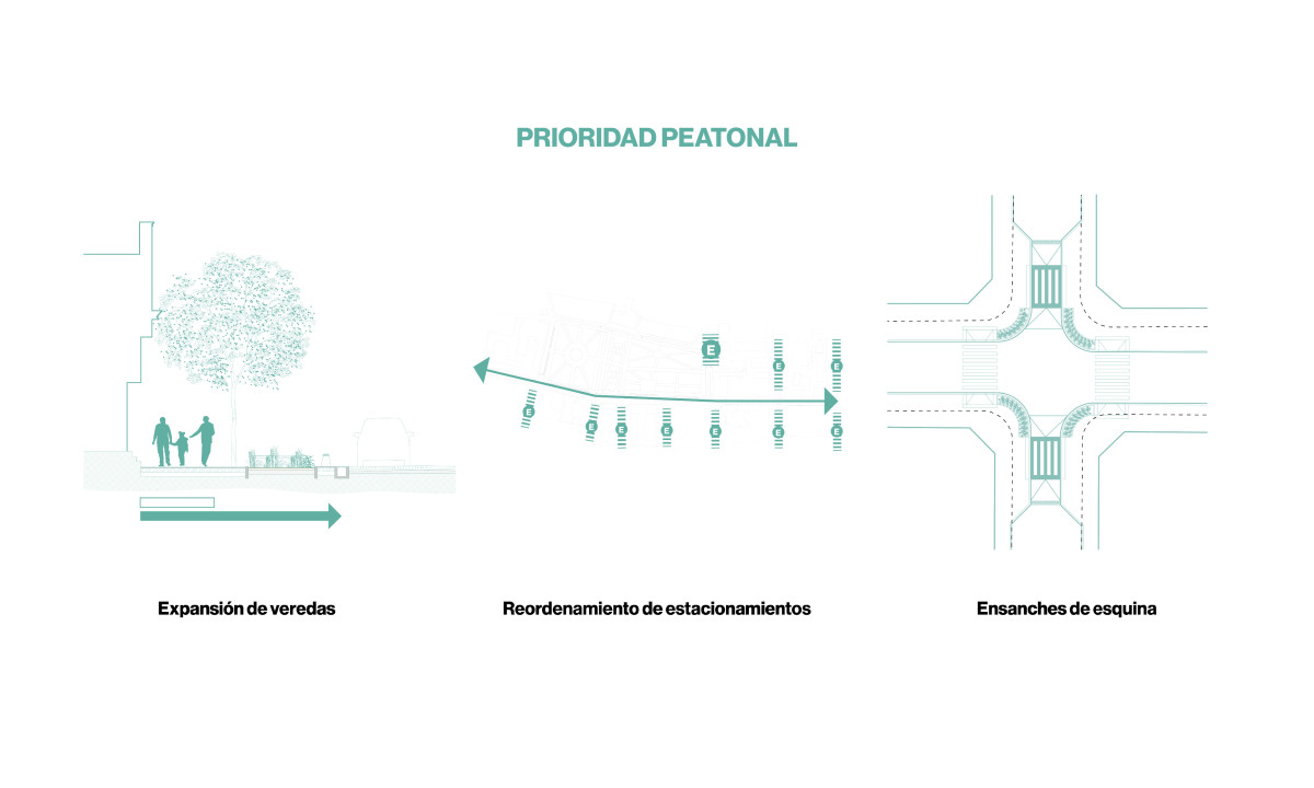
Pedestrian Priority, through the redistribution of street space, the reduction of vehicular lanes, and the widening of sidewalks, strengthening universal accessibility, safety, and pedestrian continuity by prioritizing crossings and reorganizing parking.
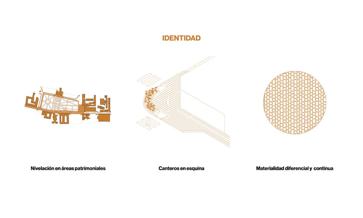
Identity, through material and landscape strategies that consolidate a unified image for the civic axis, including surface leveling in historic areas, the incorporation of planted curb extensions, and the use of differentiated materiality that reinforces its institutional and heritage character.
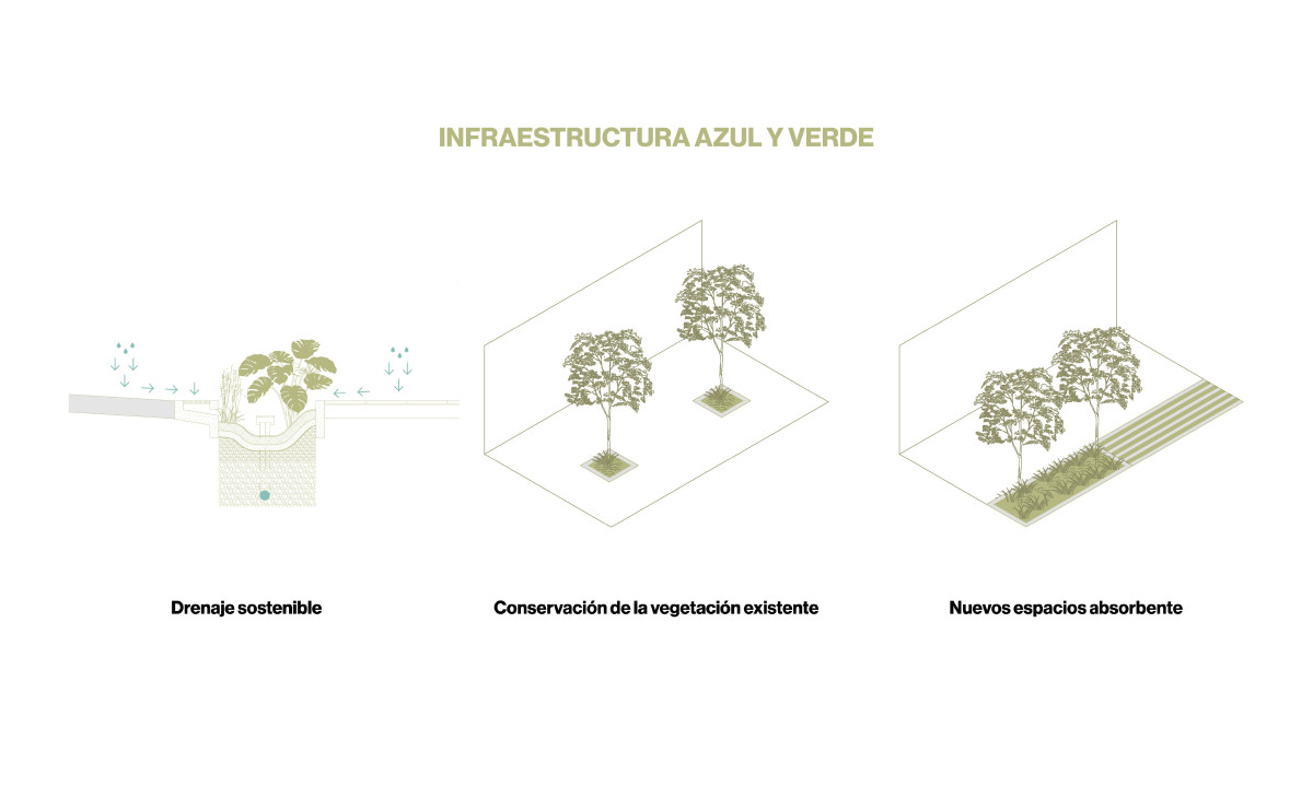
Blue and Green Infrastructure, incorporating sustainable drainage systems, preservation of existing trees, and new permeable surfaces that improve water management, increase thermal comfort, and enhance the corridor’s landscape quality.
The project constitutes the first materialization of the Manual in the public realm and establishes a replicable intervention standard for other sectors of the Historic Center, consolidating the corridor as an axis where heritage, mobility, and landscape are integrated into a coherent and contemporary urban experience.
Related projects
Urban Vision for Córdoba Downtown


Date
2025
Service
PlanningUrban designCompetition
Status
Project – 2nd Prize
Team
Región Austral
Client
Municipality of Córdoba
Location
Cordoba, Argentina
This project aims to shape a new metropolitan centrality for Cordoba’s Central Area—placing people at the heart of urban development. With a comprehensive approach, it seeks to revitalize the city center as a hub for cultural life, heritage appreciation, and Córdoba’s identity. At the same time, it boosts economic and tourism potential, turning the area into an attractive neighborhood to live in. Through strategic actions, the project transforms the center into a resilient, dynamic, and safe space—vibrant both day and night, with connected, inclusive mobility and a strong focus on sustainability and community well-being.
Historic centers in Latin America and beyond face similar challenges: population decline, urban decay, loss of heritage, and mono-functional land use. But these issues also open up a powerful opportunity: to rethink their role in contemporary cities by blending historical value with today’s needs. This project proposes a network of public spaces and architecture that foster social interaction, economic exchange, and cultural expression.
To consolidate this transformation, the project is structured around three main strategies, six key thematic pillars, and 24 specific interventions. Its methodological approach not only focuses on revitalizing public spaces but also on coordinating interventions in private spaces that interact with them—understanding that change requires strategic partnerships between the public and private sectors.
Implementation will follow a three-stage Action Plan, forming a cohesive, adaptable network. This holistic approach creates a solid foundation for replicable and sustainable transformation, offering strategic planning tools to guide action and shape public policy toward better urban living conditions.
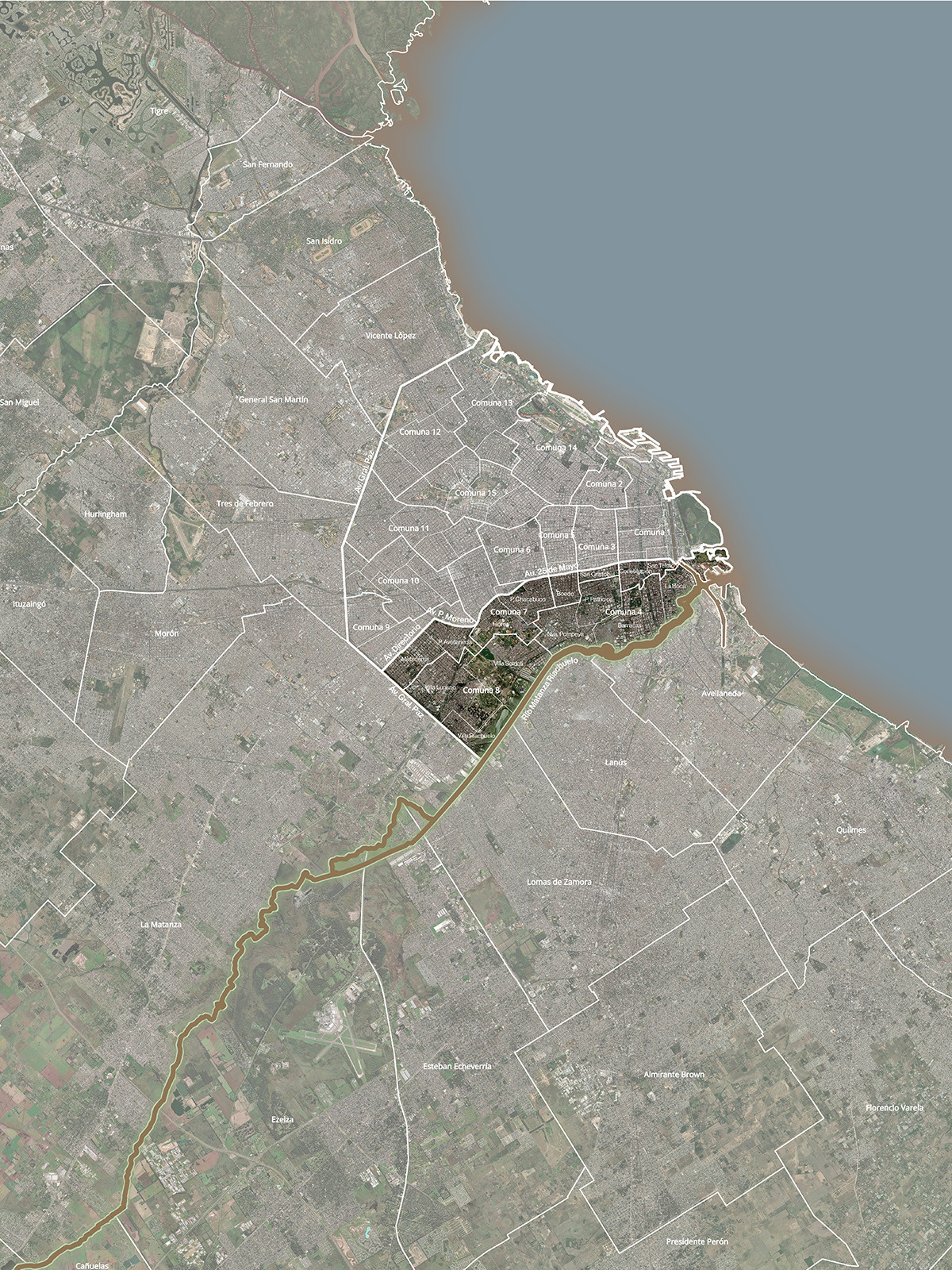
A New Vision for the South of the City of Buenos Aires
Date
2024 - 2025
Service
PlanningUrban design
Status
Project
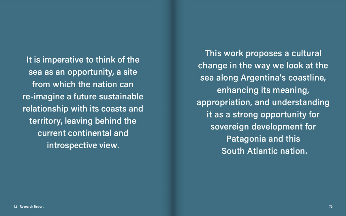
Team
Región Austral Centro de Estudios Económicos Urbanos (UNSAM)
Client
Corporación Buenos Aires Sur- Gobierno de la Ciudad de Buenos Aires
Location
Buenos Aires, Argentina
Historically, urban planning in Buenos Aires has been shaped by a strong dichotomy between the north and the south. While the north has concentrated most public and private investment—becoming the engine of modern expansion and integration into the global market—the south has been relegated to the status of an urban periphery, with limited infrastructure, services, and opportunities. This inequality has manifested not only in material terms but also symbolically, reinforcing an imaginary that sees the south as a territory available for strategic interventions, while simultaneously keeping it fragmented and segregated.
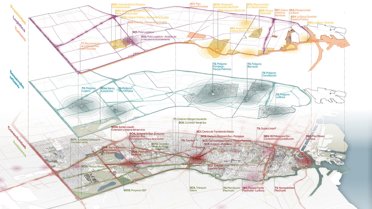
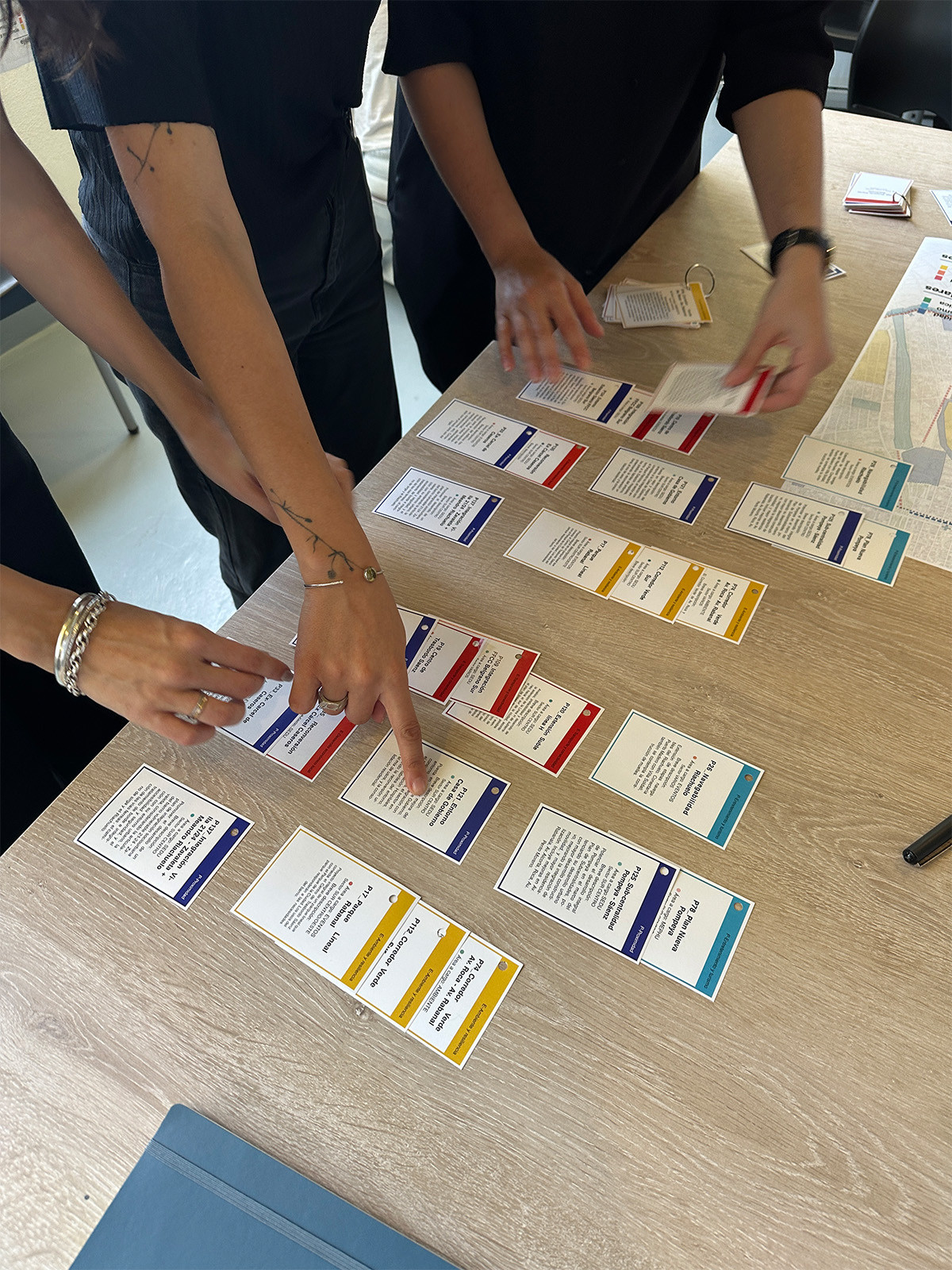
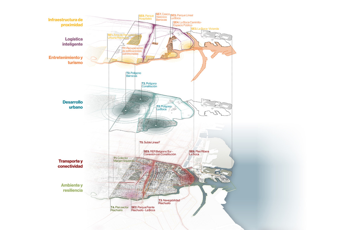
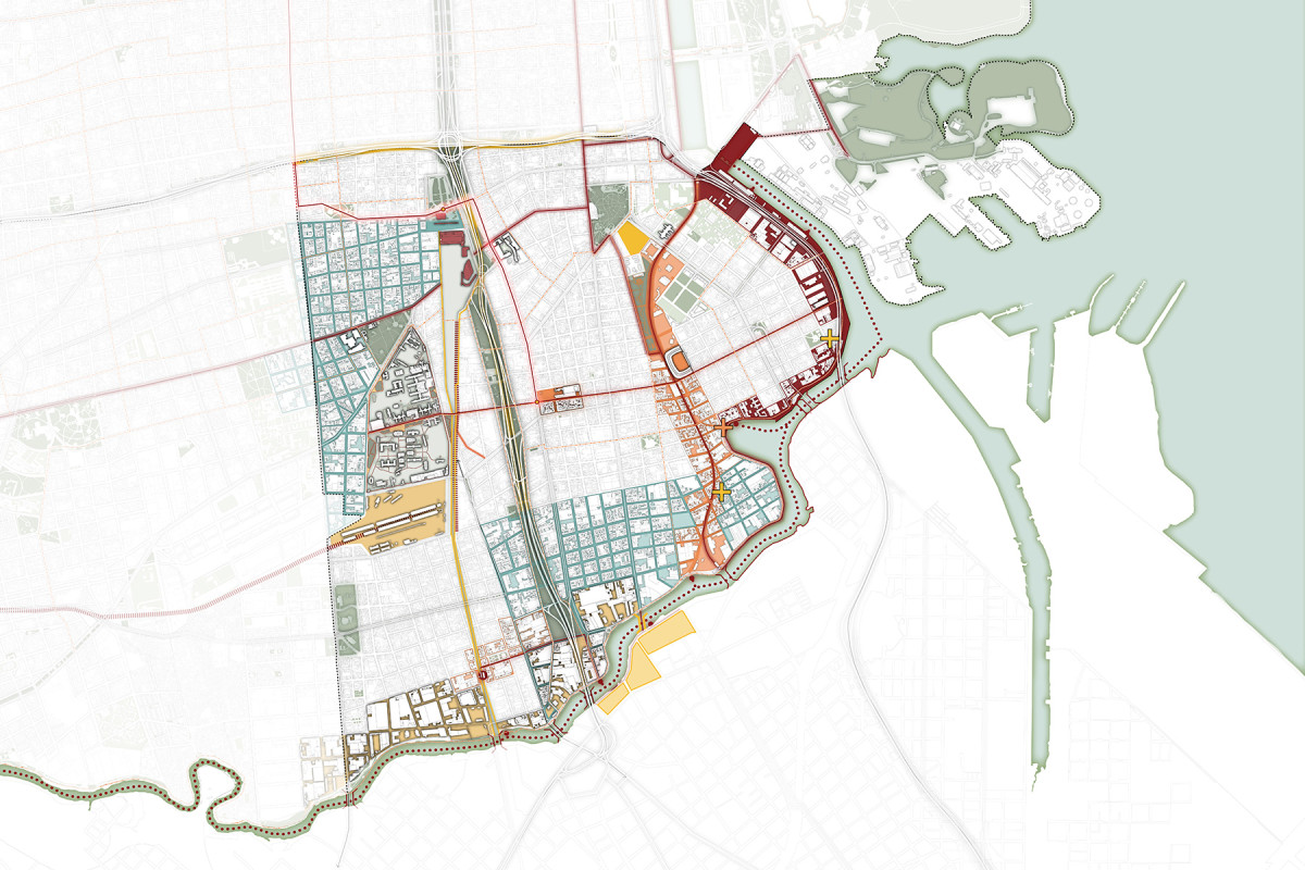
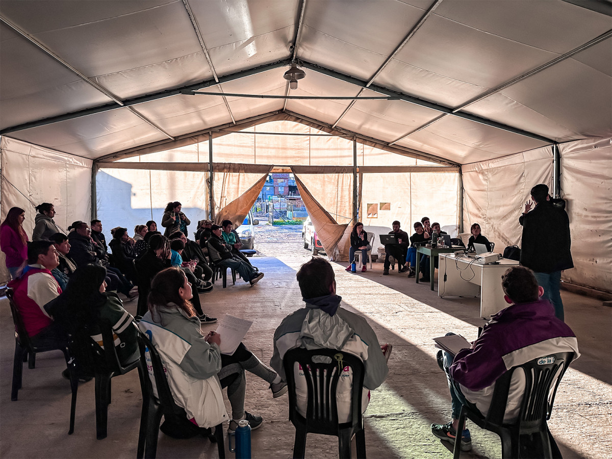
In this context, A New Vision for the South of the City emerges as a strategic initiative to reverse this historical logic and strengthen territorial planning through an integrated, participatory, and evidence-based approach. The project brought together various departments of the Buenos Aires City Government, aiming to align efforts and guide interventions toward a more equitable and balanced urban development.
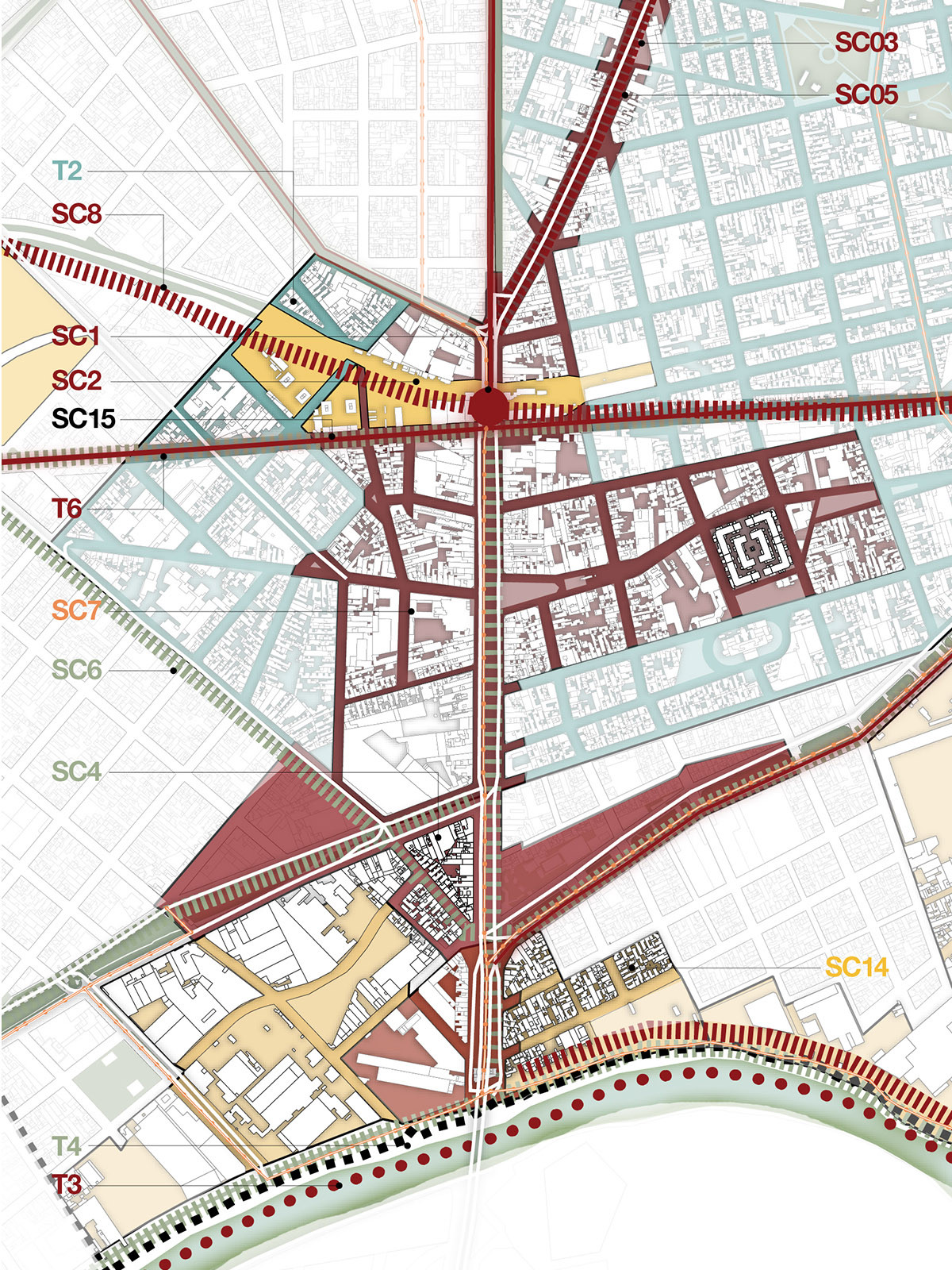
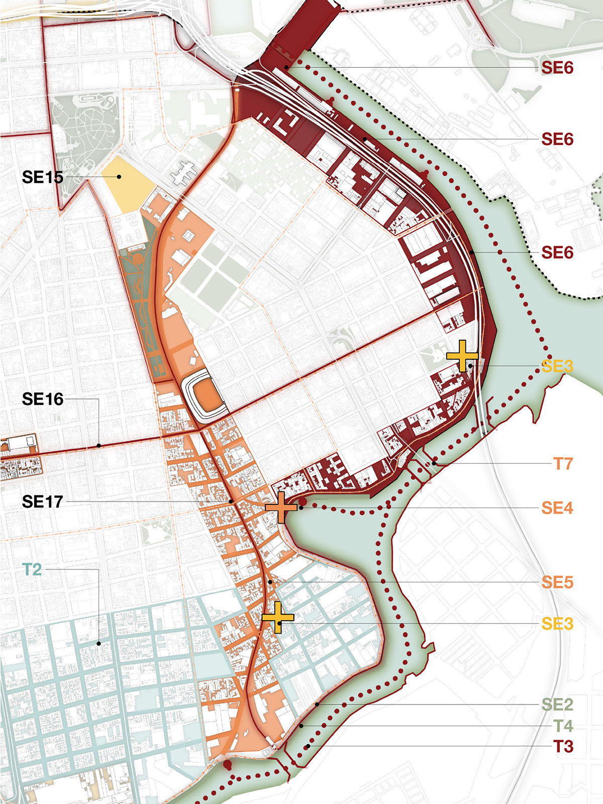
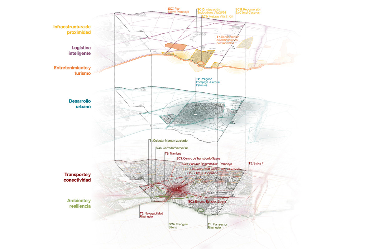
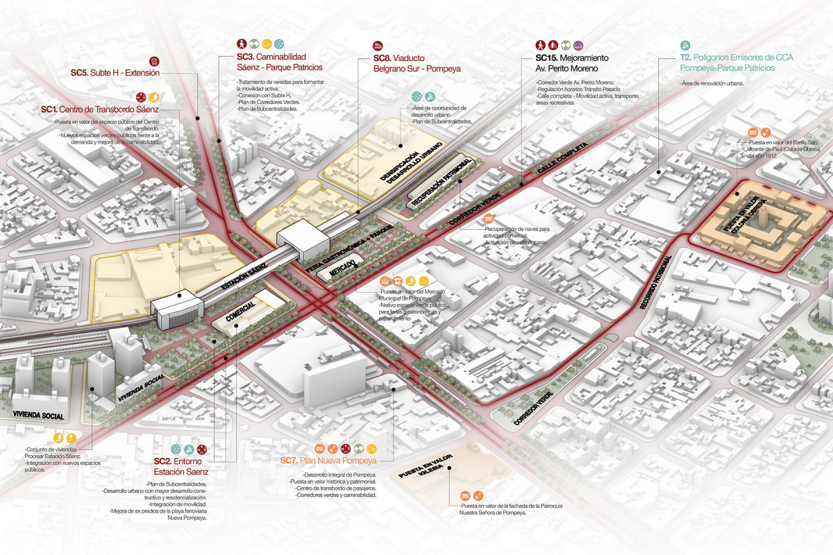
The initiative was structured in three main phases. The first focused on data collection and territorial surveys, including a collaborative diagnosis with technical teams from the government. The second phase centered on the development of a project taxonomy and a prioritization workshop, with the goal of identifying strategic interventions, avoiding overlaps, and optimizing resource use. Finally, the third phase consolidated a long-term shared vision, synthesized in the development of three Integrated Urban Plans (PUIs) for the zones identified within the Southern Development Area: Southwest (SO), South Central (SC), and Southeast (SE).
This approach stands as a replicable model for other cities, highlighting the importance of strategic planning, intersectoral collaboration, and informed decision-making. A New Vision not only provides a concrete roadmap to guide future interventions in the south of Buenos Aires, but also redefines how we understand urban planning: as a tool to build more equitable, connected, and sustainable territories.
Related projects


Playón Network
Public spaces and community infrastructure for integration

Date
2023-2024
Status
1st phase: built. 2nd phase: project
Team
Región Austral
Client
Playón de Chacarita community. Funded by re:arc Institute (Denmark). Support: IVC Buenos Aires
Location
Playón de Chacarita, Buenos Aires, Argentina
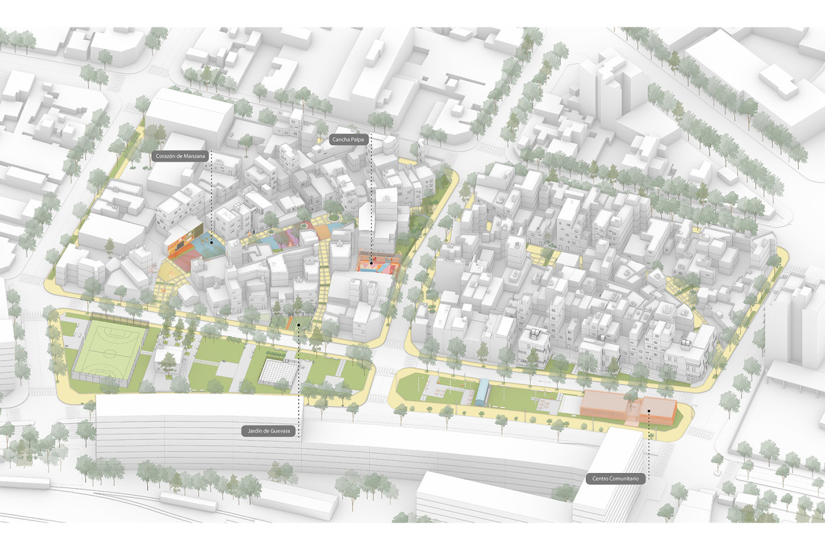
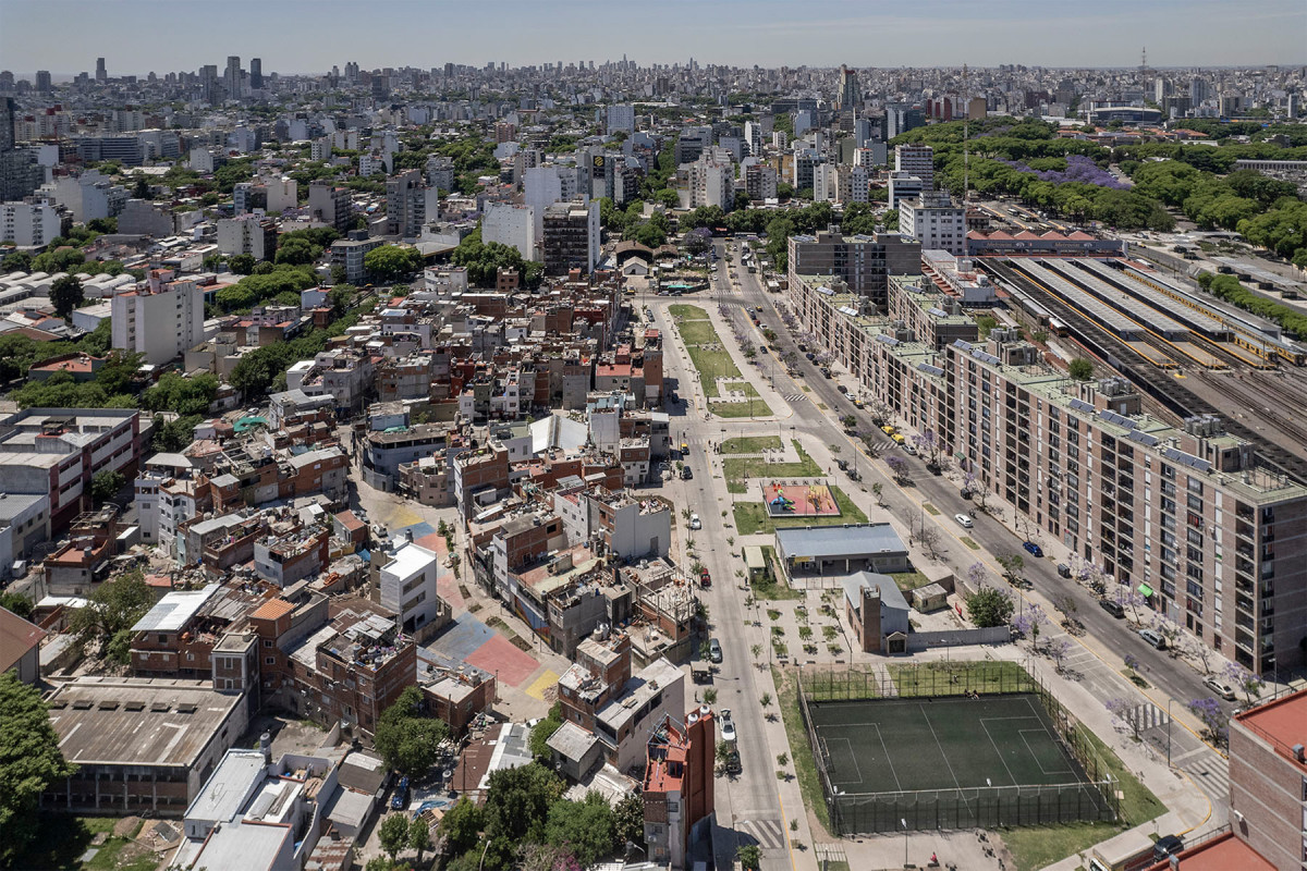
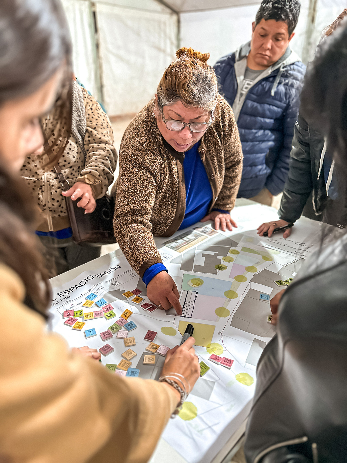
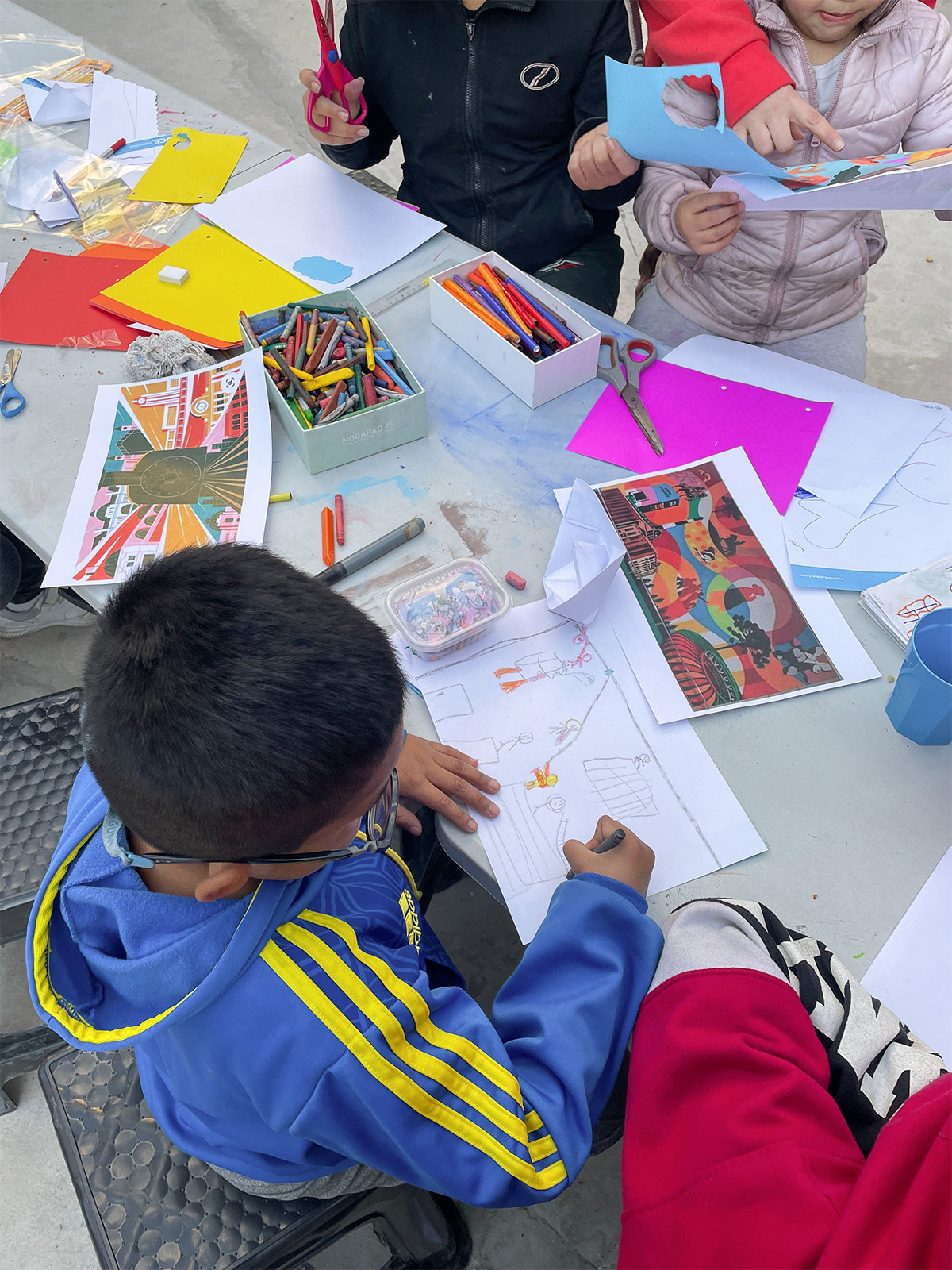
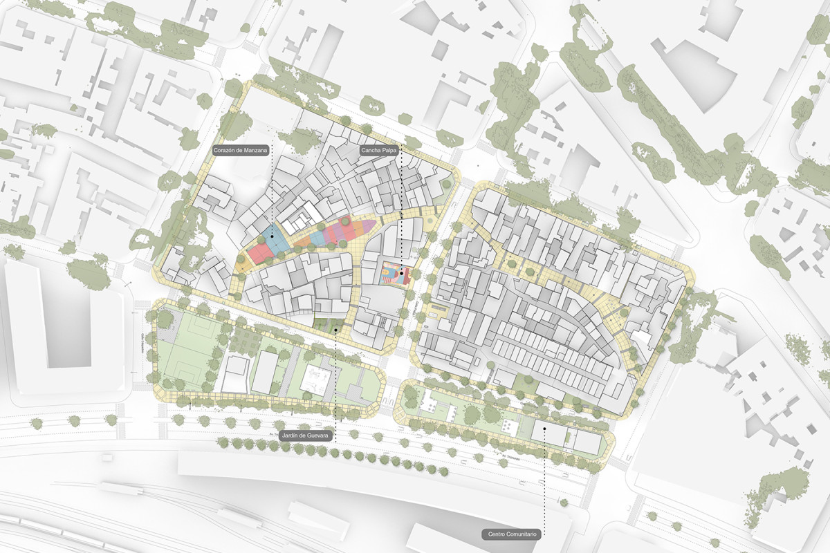
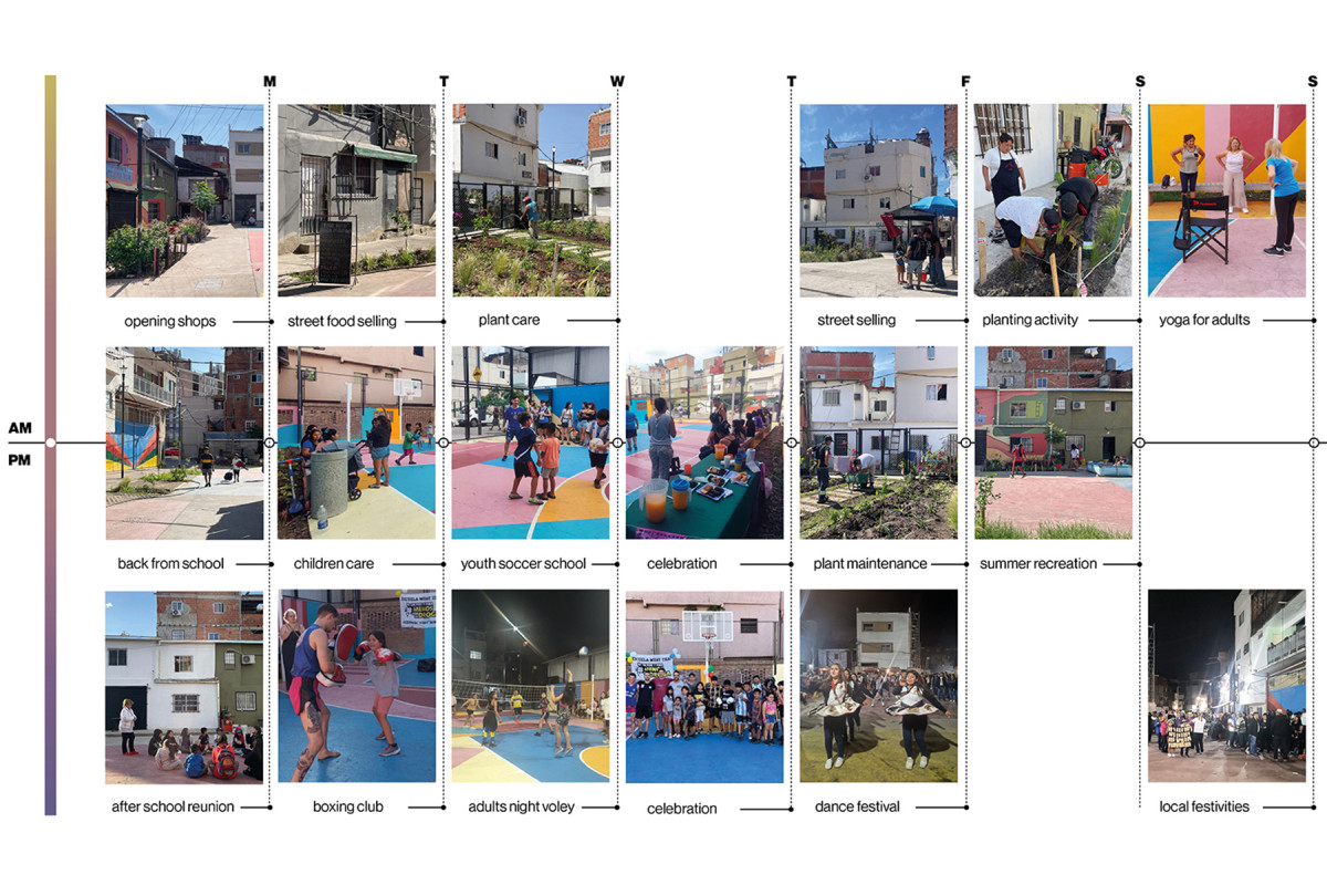
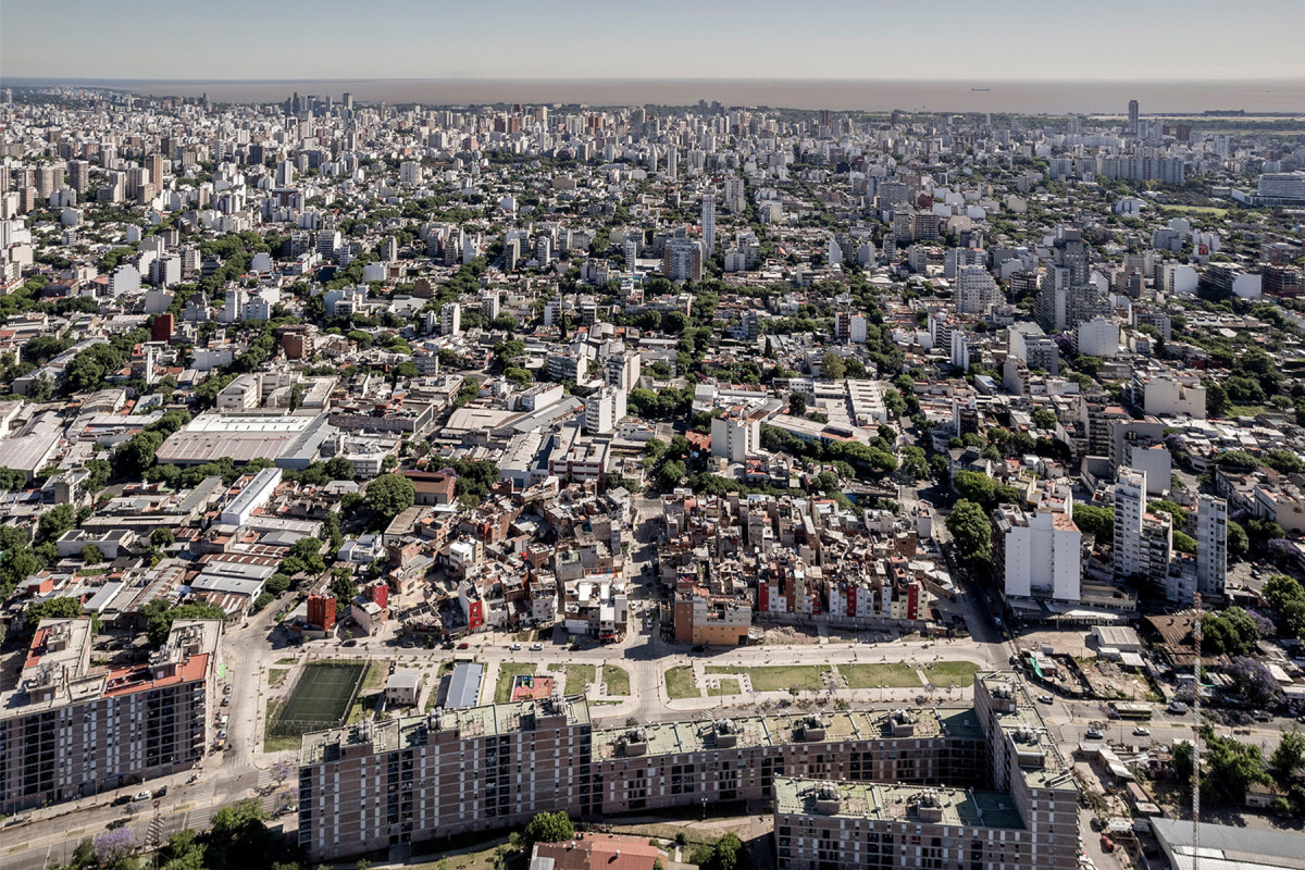
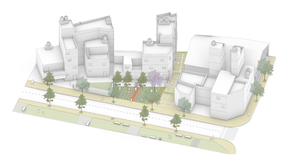
Playón de Chacarita is a self-built settlement in Buenos Aires, established in 2000 on former railway grounds. The Playón Red project aims to create a network of safe, healthy, and sustainable public spaces through participatory dialogue with local residents. The initiative seeks to foster socio-ecological interactions to build a more inclusive and resilient community. To achieve these goals, a collaborative management model was implemented, integrating local organizations and cooperatives with financial support from re:arc Institute and backing from the Buenos Aires Housing Institute.
Through participatory workshops, residents actively contributed to the design of three key projects aimed at transforming the neighborhood in the first phase: (i) The Inner Courtyard, a restored inner courtyard that preserves local memory and identity while improving environmental quality, (ii) The Guevara Garden, a pocket park that also functions as a rain garden to mitigate flooding, (iii) The Palpa Court, a sports space designed to provide safe recreational opportunities for young people. In a second phase, the project envisions the construction of a Community Center dedicated to cultural, educational, and economic activities.
These initiatives form a network of green infrastructure and communal spaces that are essential to improving safety, health, and social well-being in the neighborhood. Playón Red is part of a broader framework of projects and research aimed at reorienting urban sustainability toward climate adaptation in self-built settlements.
Local organizations and cooperatives, deeply rooted in the neighborhood, lead the implementation and construction process. This community-driven approach fosters a sense of belonging and ensures the sustainability of the interventions. By mobilizing a diverse range of stakeholders—including government agencies, local NGOs, and international donors—the initiative promotes both climate and social resilience. Ultimately, it enhances the quality of life for Playón residents and contributes to a more inclusive urban environment, crucial for vulnerable settlements across Latin America.
Related projects

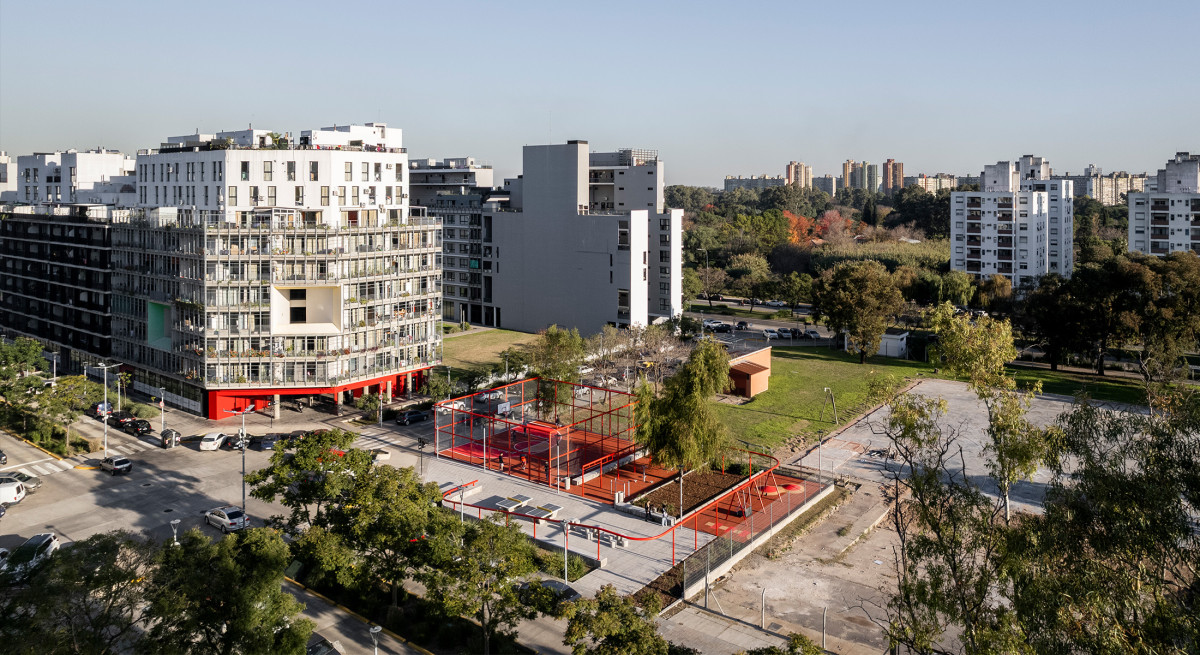
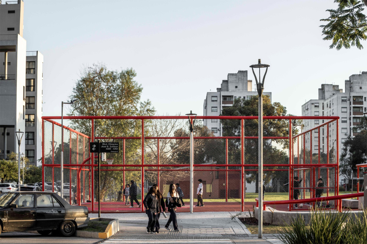
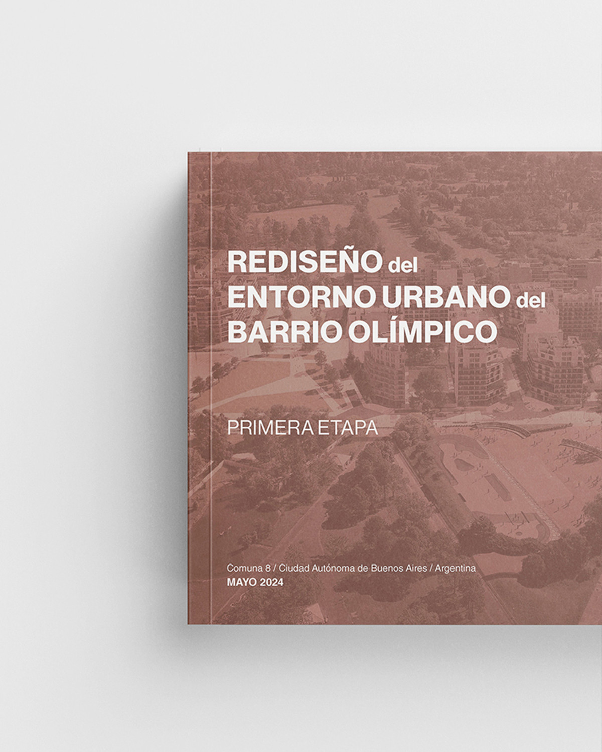
Olympic Neighborhood Plaza

Date
2024 - 2025
Status
Built
Team
Región AustralCentro de Estudios Económicos Urbanos (UNSAM)
Client
Centro de Estudios Económicos Urbanos (UNSAM) y Corporación Buenos Aires Sur , Gobierno de la Ciudad de Buenos Aires
Location
Barrio Olimpico, Buenos Aires, Argentina
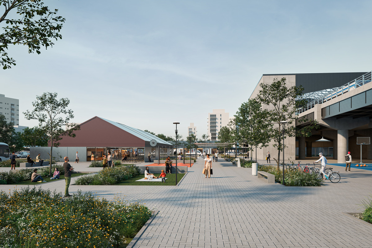
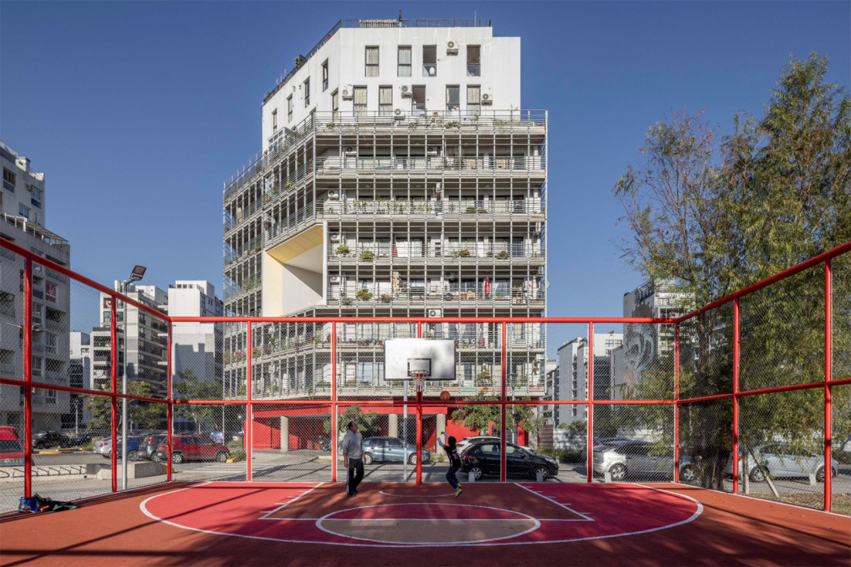
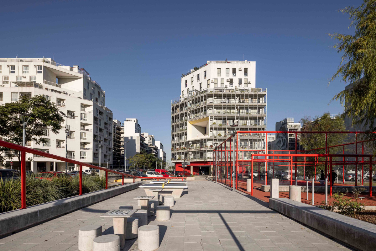
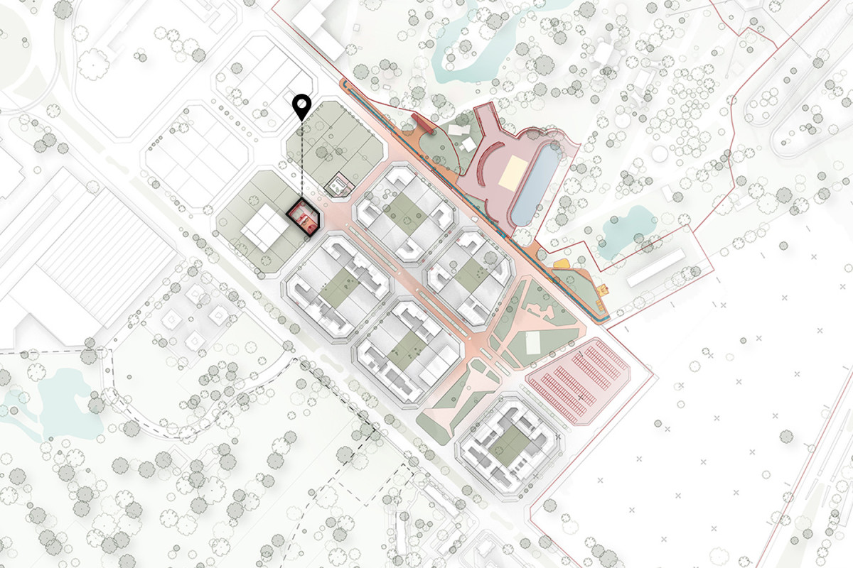
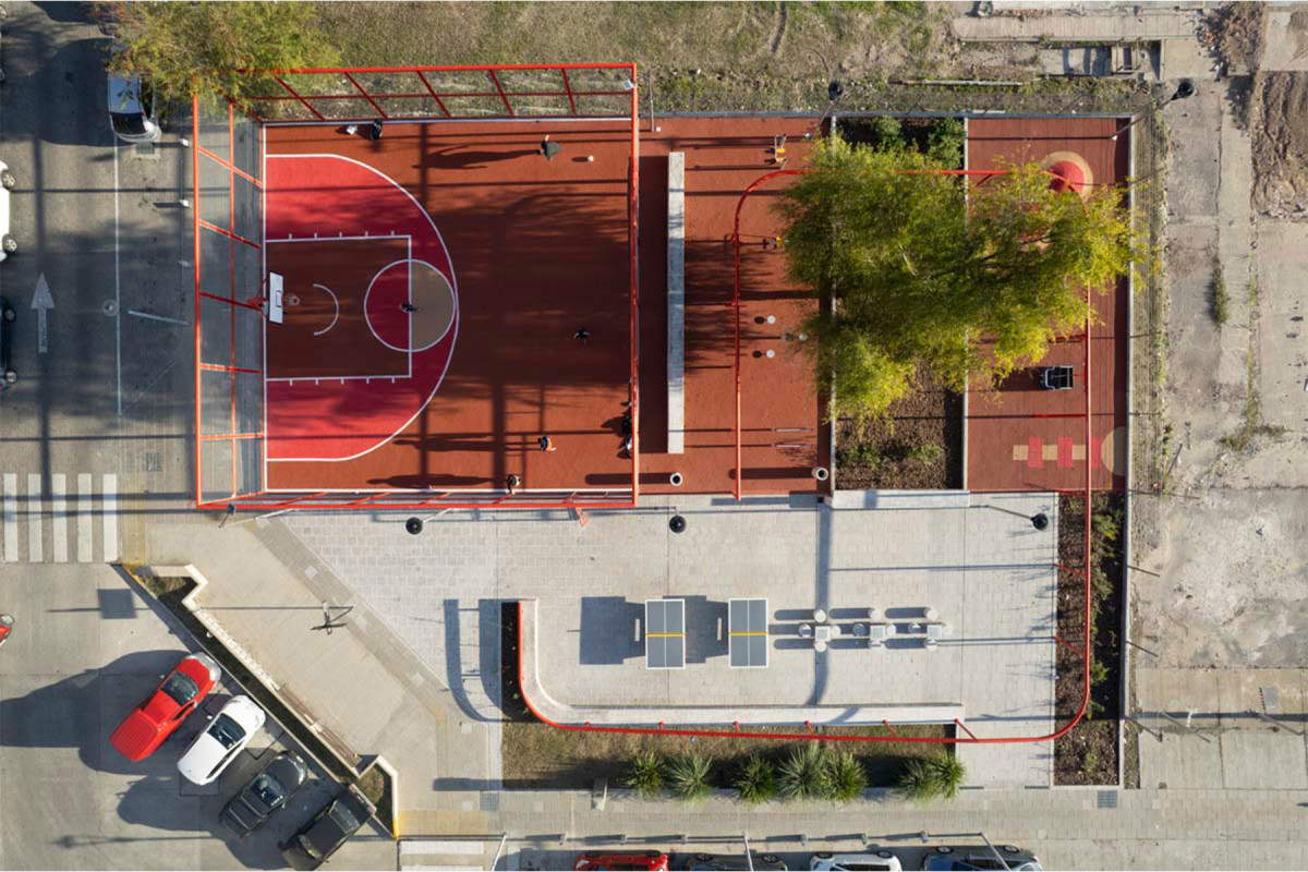
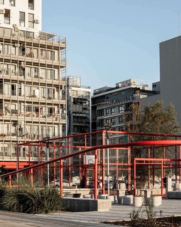
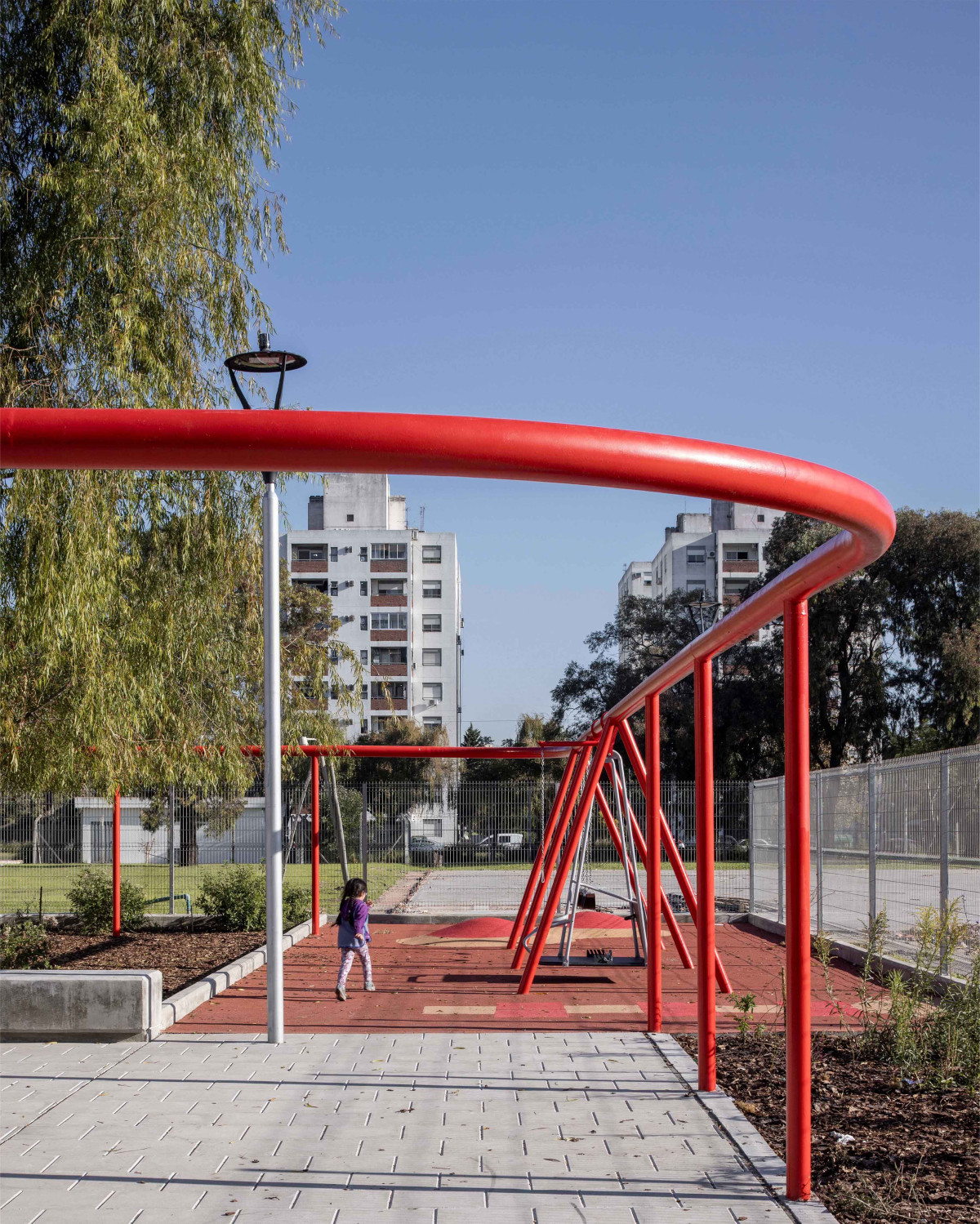
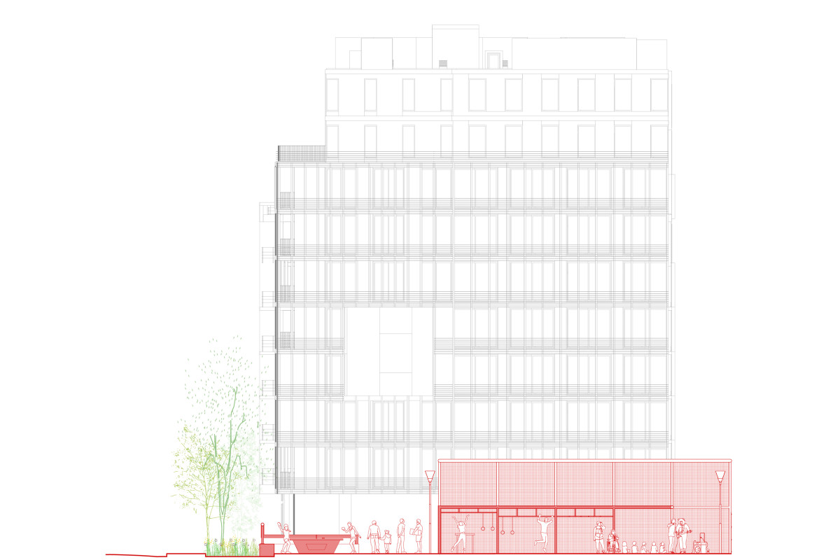
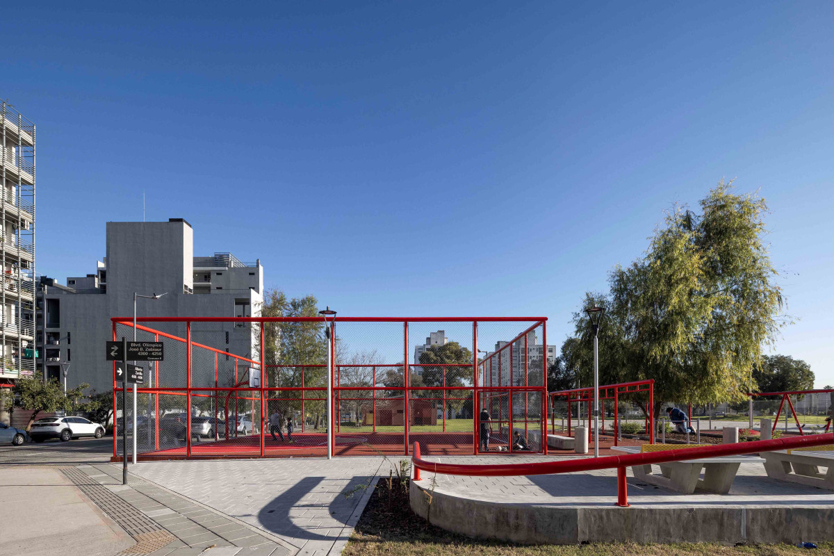
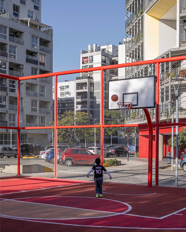
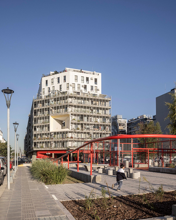
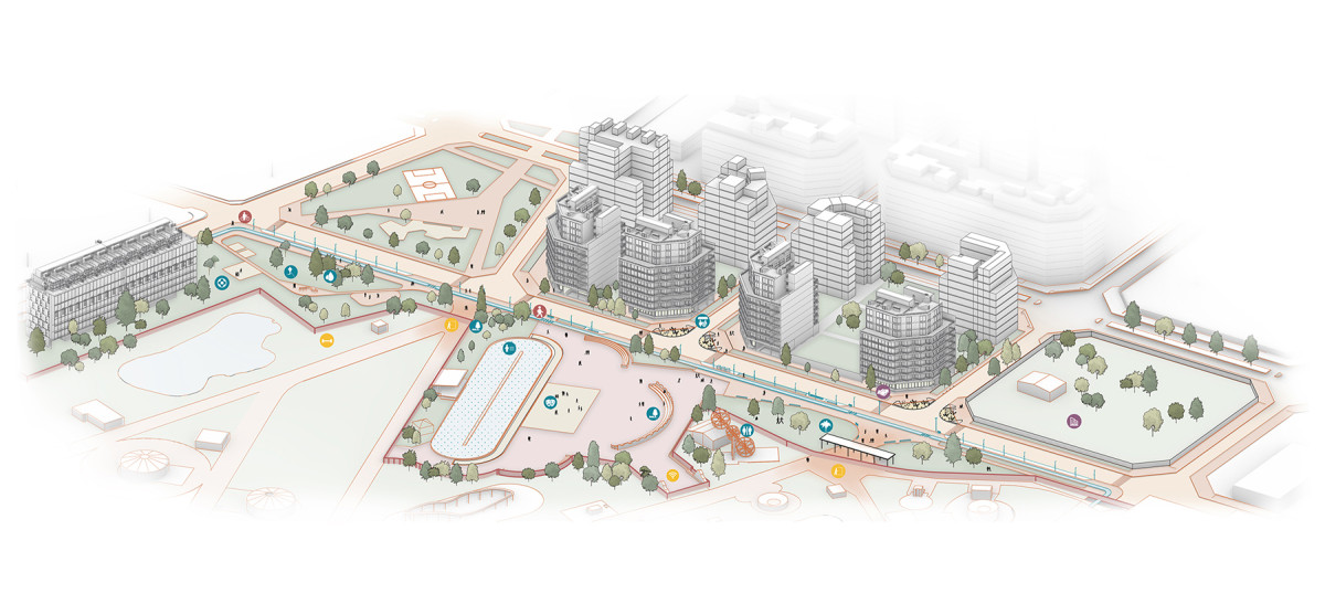
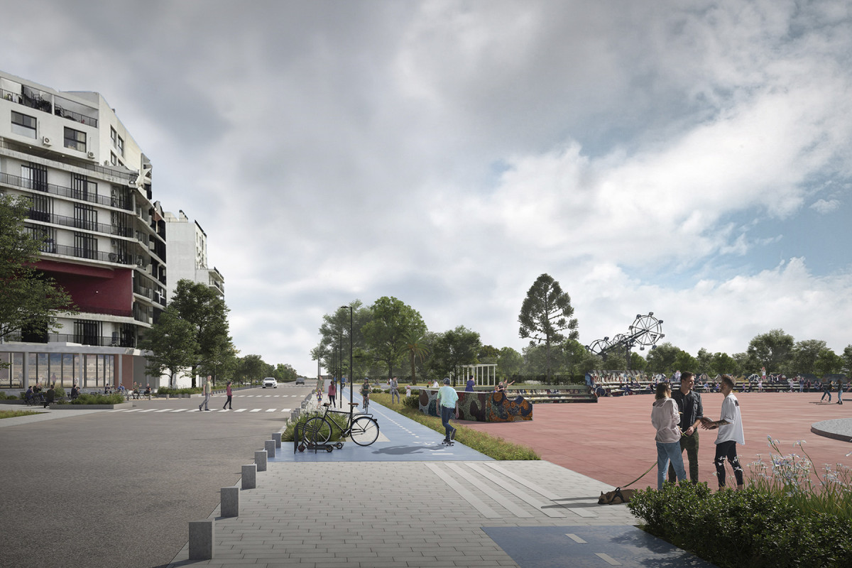
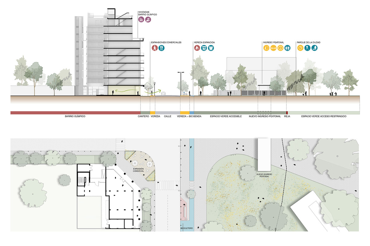
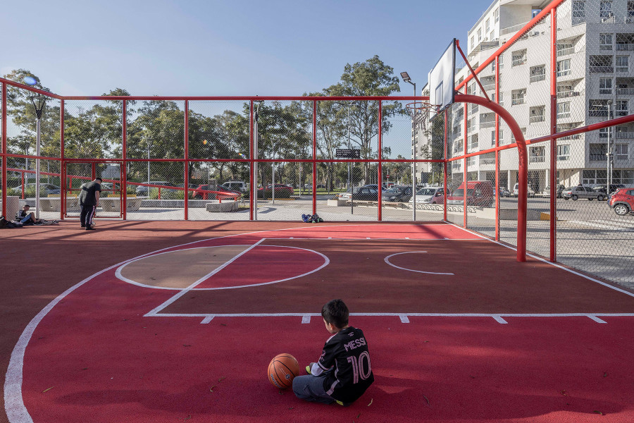
In Comuna 8 of Buenos Aires, the Olympic Village—a legacy of the 2018 Youth Olympic Games—presented an urban paradox: modern residential infrastructure that lacked vibrant public spaces. Faced with the residents' expressed need for gathering places, the design of this community plaza emerges as a direct response, transforming a vacant lot into a catalyst for social activity.
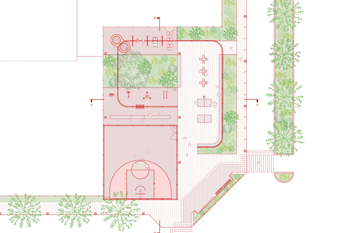
The project is part of a broader urban strategy aimed at providing the area with local amenities. In a context of marked territorial inequality, the plaza stands as a reparative action, offering a tangible alternative for the enjoyment of public space in a historically neglected area. Designed through participatory processes with a special focus on children and adolescents, the intervention transforms an empty plot into an open space that prioritizes the right to play, gather, and recreate.
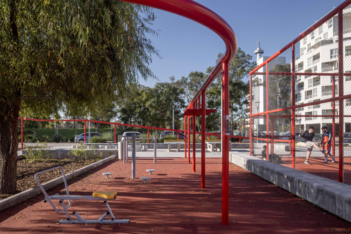
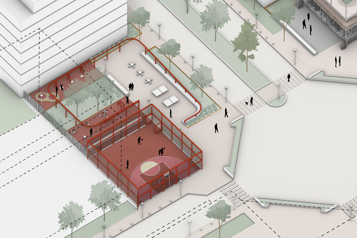
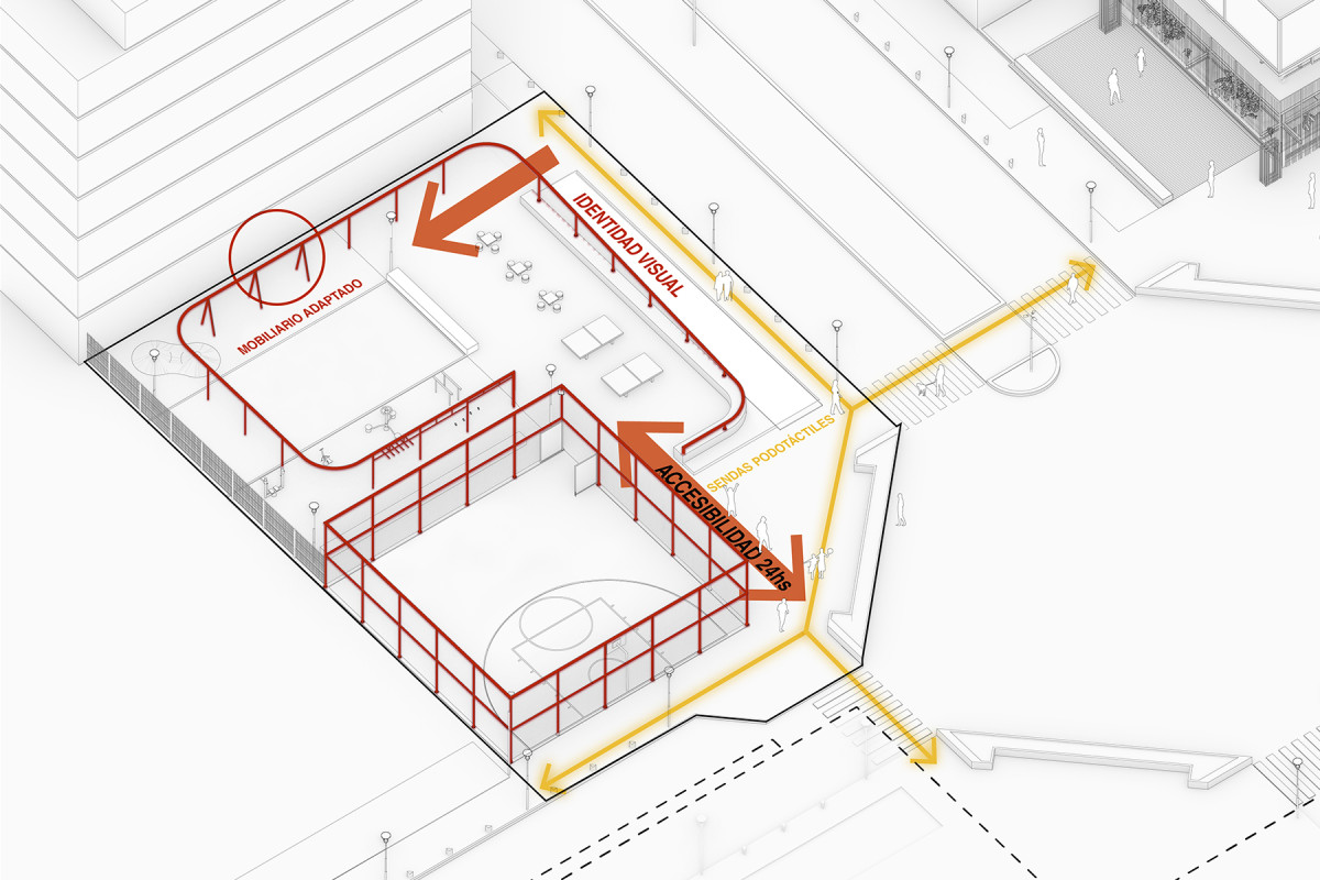
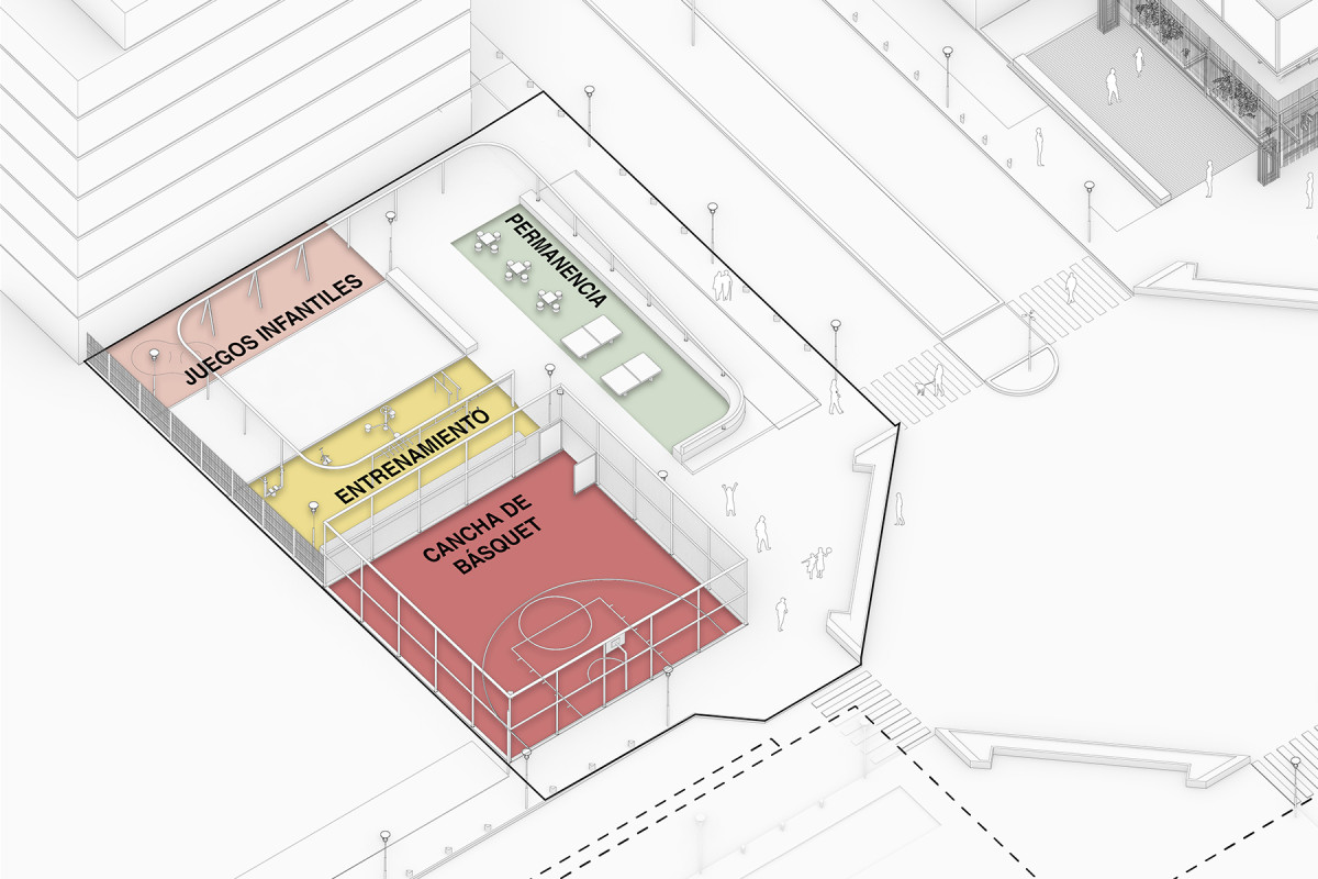
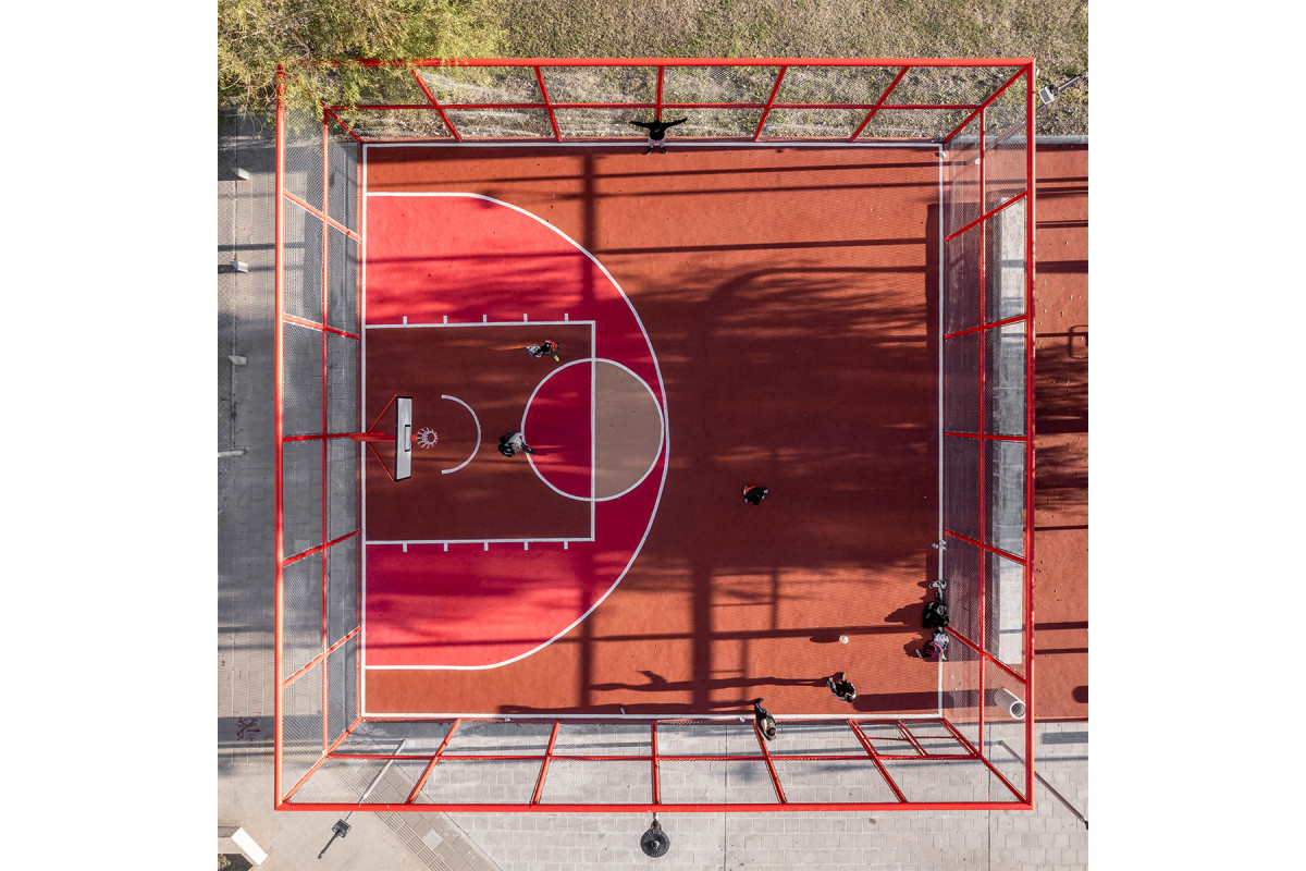
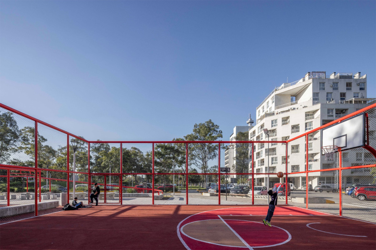
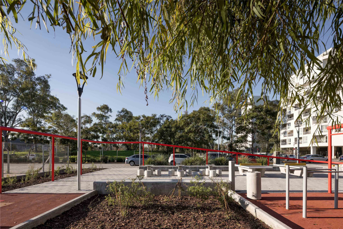
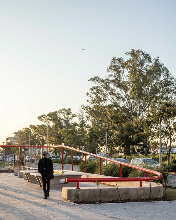
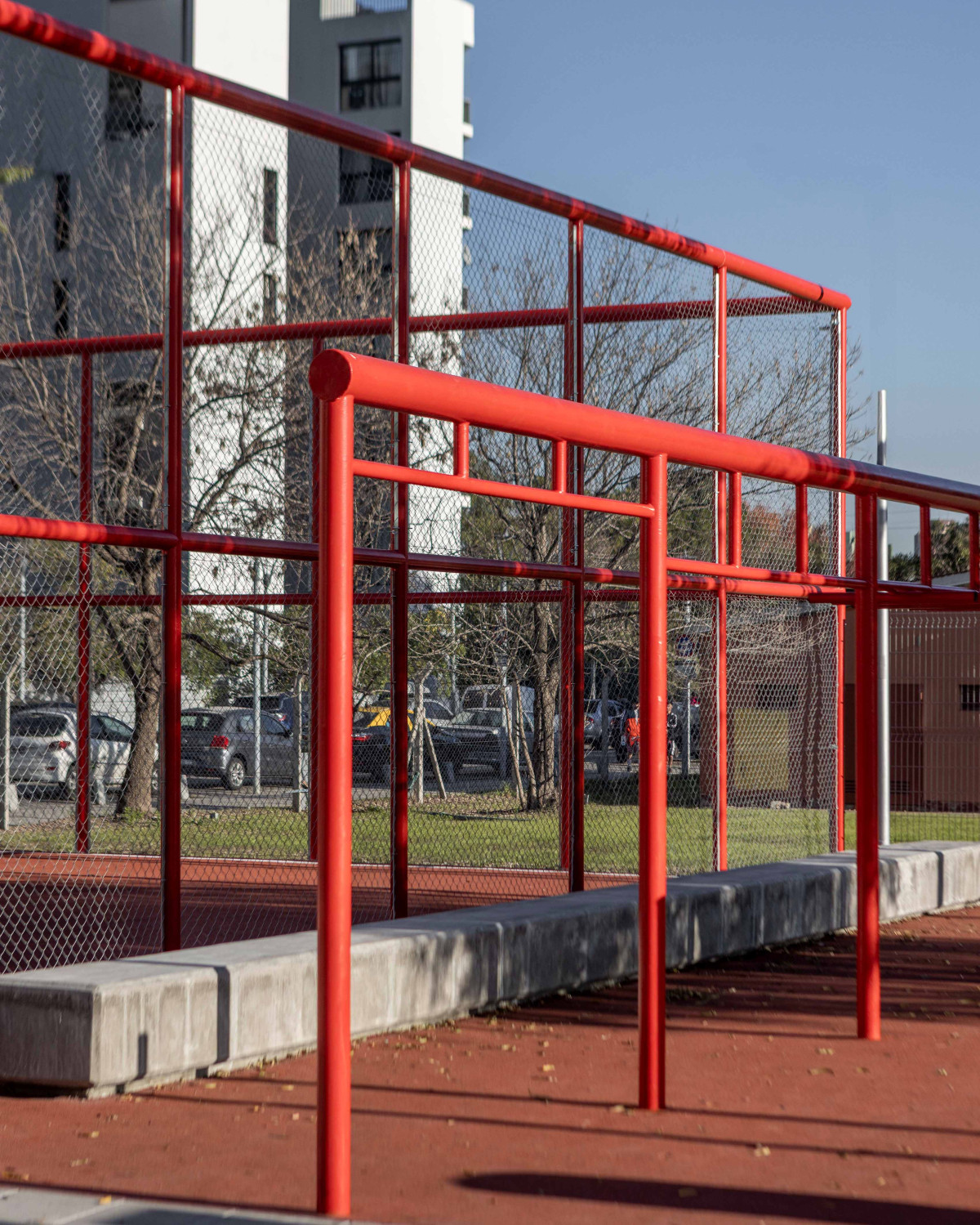
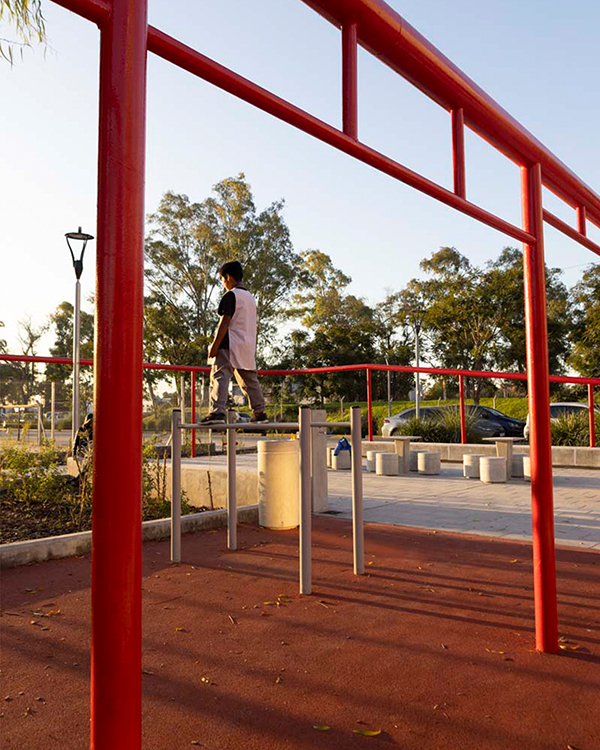
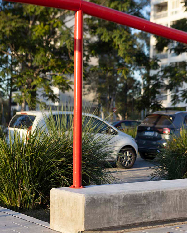
The design was based on universal accessibility criteria to create an inclusive and safe environment with distinct zones for playing, resting, and exercising. The organizing element is a distinctive red metal tube structure that provides a strong visual identity and simultaneously serves as support for play equipment, urban furniture, and signage. Its layout defines the pathways and organizes the program, which includes a basketball court, an exercise area, and a children's playground.
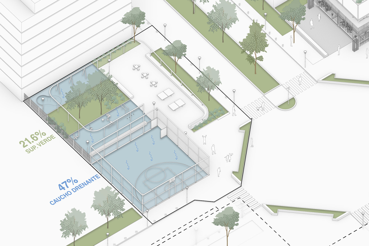
The choice of materials was intended to enhance openness and durability. Permeable surfaces, such as continuous draining rubber that absorbs impact and prevents soil sealing, were incorporated. Additionally, cast-in-place concrete benches are used to define areas and encourage rest without the need for fences or railings, thereby reinforcing the public's appropriation of the space.
From a technical and environmental perspective, durable, low-maintenance, and highly resistant materials suitable for intensive use were selected. The inclusion of native vegetation and shaded areas helps improve environmental comfort and reduce the project's ecological impact.
In response to the retreat of public space in favor of privatized leisure, the plaza was conceived as an everyday, barrier-free place. Its execution is part of a virtuous cycle of urban economics: the new public space drives future developments, which in turn help finance further improvements in the neighborhood. Since its inauguration, the plaza has been heavily used, solidifying its role as a new and vital hub for community life.
Related projects

Inner Courtyard
After
Before
Process
Date
2023-2024
Status
Built
Team
Región Austral
Client
Playón de Chacarita community. Funded by re:arc Institute (Denmark). Support: IVC Buenos Aires
Location
Playon de Chacarita, Buenos Aires, Argentina
As part of the Playón Network project, the inner courtyard of a block in the Playón de Chacarita neighborhood was redesigned, transforming it into a vibrant and public passage of the block. Previously, as an internal and deteriorated area, the space was primarily used as a circulation path, with some residents expanding their economic activities into it.
The transformation aimed to turn the passage into a community gathering point, leveraging the opportunities for appropriation that a high-quality public space can offer. To achieve this, planters with vegetation were added to improve the transition between private home entrances and the public space, providing more permeable surfaces and shade to enhance environmental quality and encourage its use.
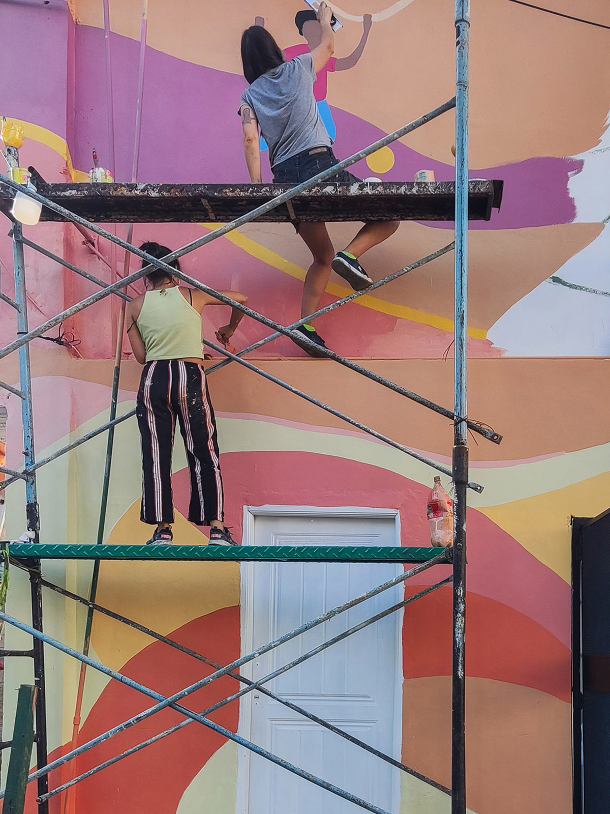
Additionally, lighting improvements were made, and a mural was designed on one of the facades. This mural was created in collaboration with a group of young people from a social organization active in the neighborhood, strengthening the sense of belonging and community participation.
Related projects

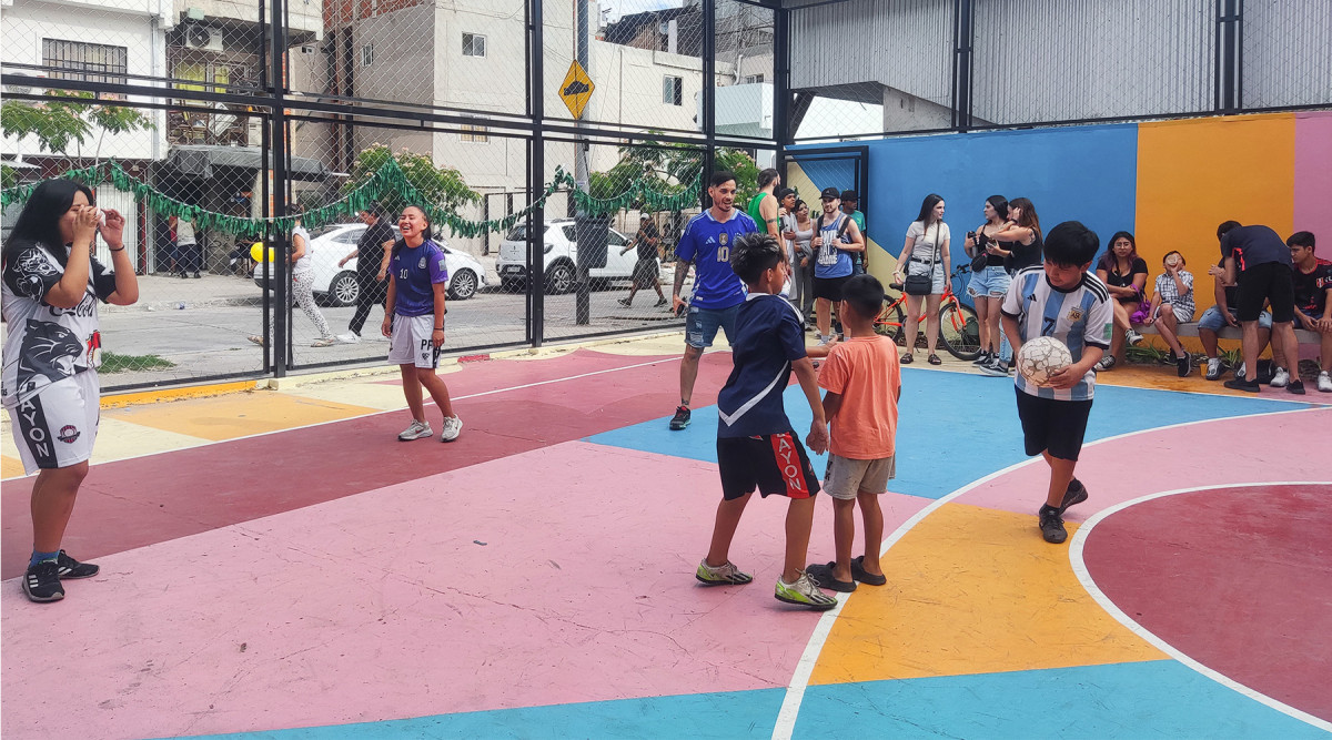
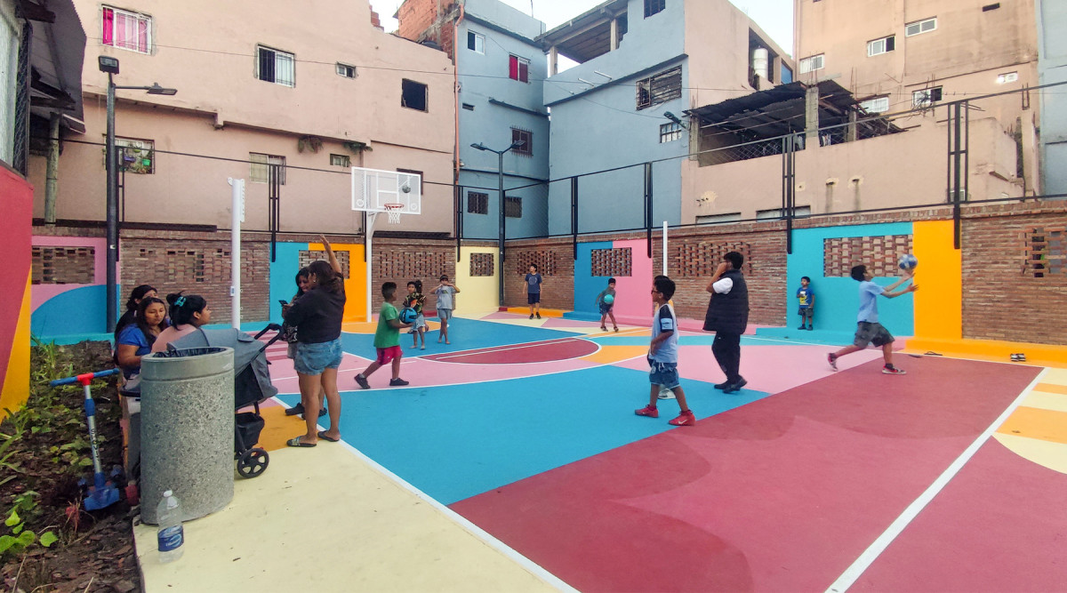
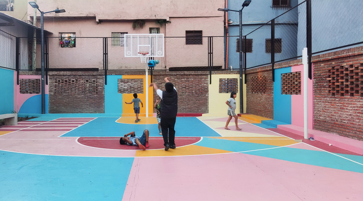
Palpa Court
After
Before

Date
2023-2024
Status
Built
Team
Región Austral
Client
Playón de Chacarita community. Funded by re:arc Institute (Denmark). Support: IVC Buenos Aires
Location
Playon de Chacarita, Buenos Aires, Argentina
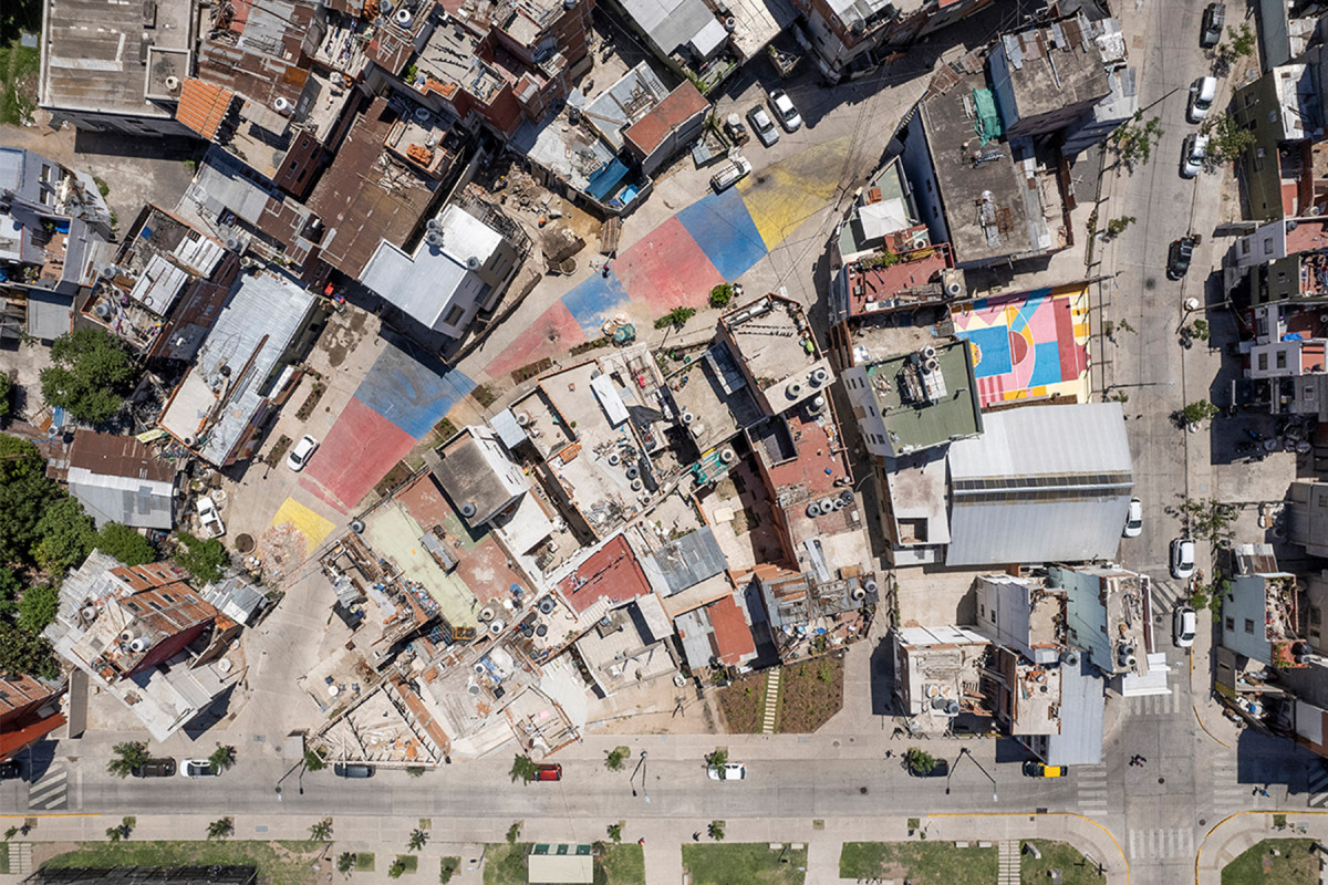
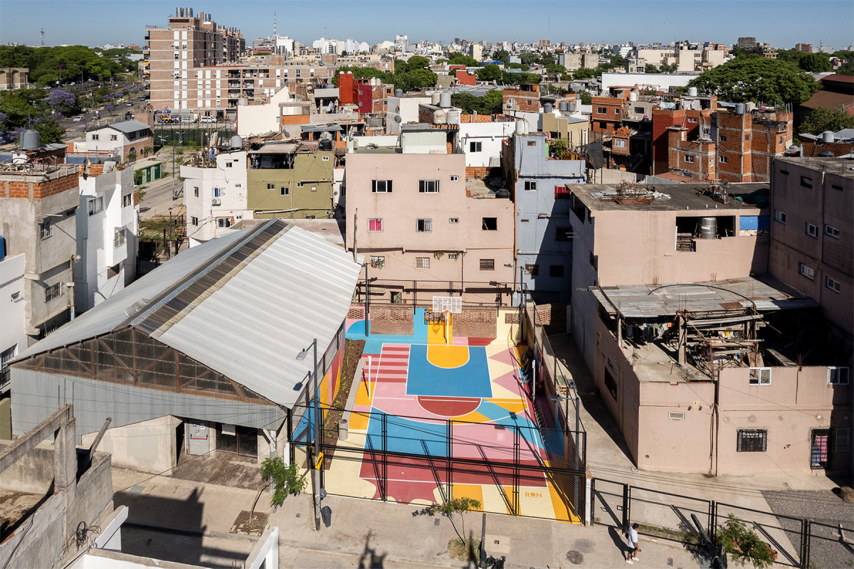
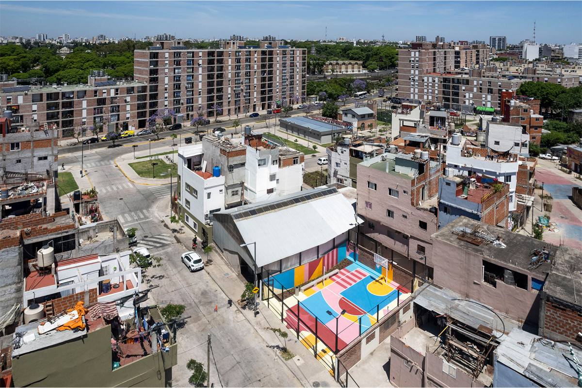
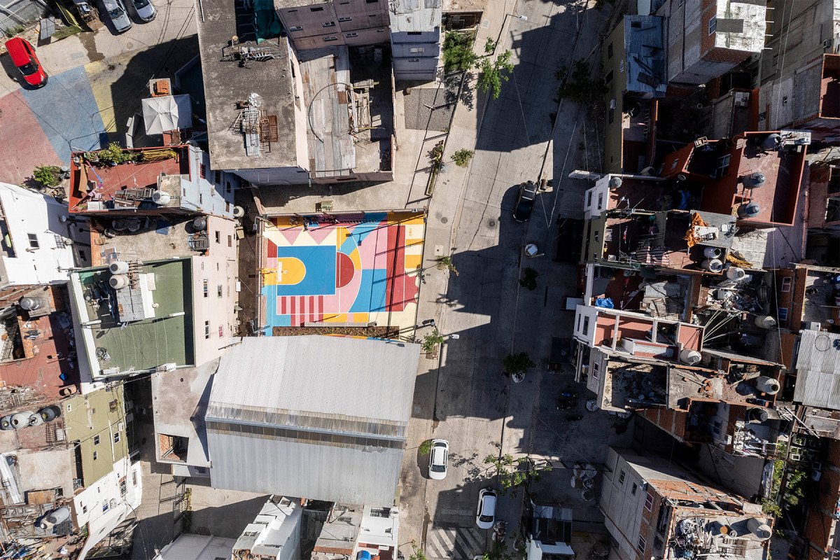
As part of the Playon Network project, the intervention took place in a vacant space that had originally served as the neighborhood’s soccer field. However, with the socio-urban integration process initiated in 2017 by the local government, the area was bisected by the opening of Palpa Street, creating a residual urban void. This space did not allow for new forms of appropriation and posed a security issue for the neighborhood. The proposal aimed to reclaim the site as a place for community integration through sports and play, restoring its original function.
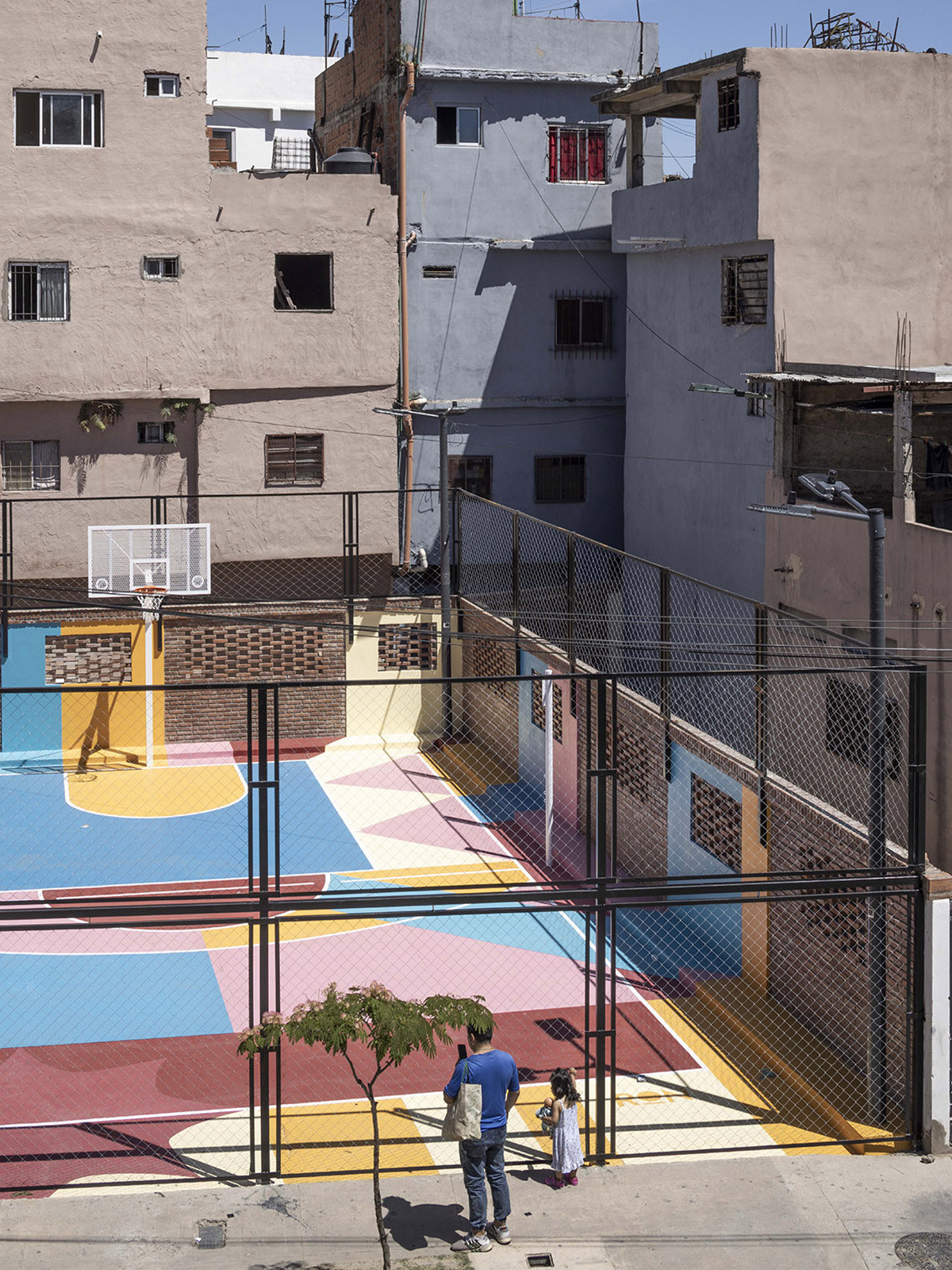
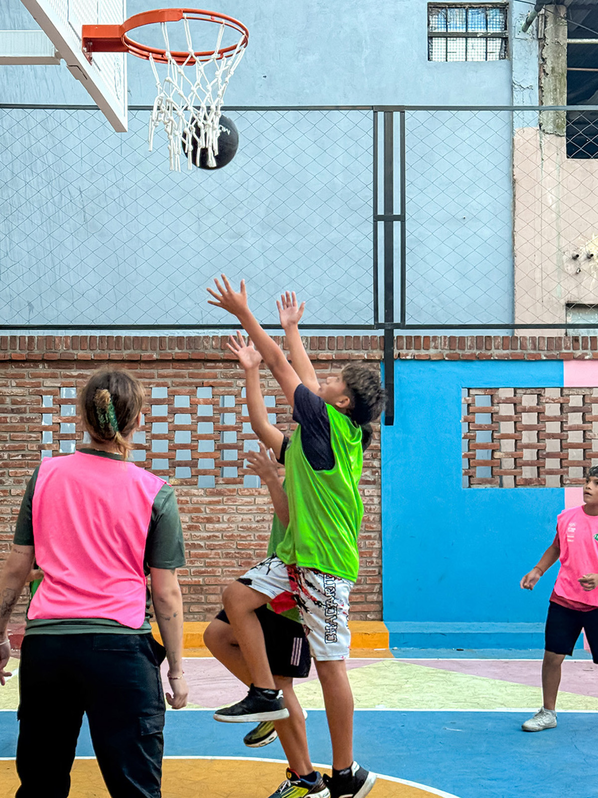
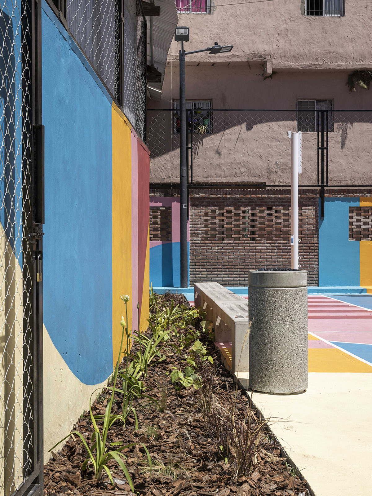
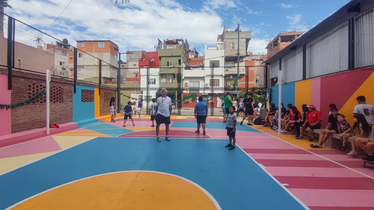
The design introduced meaningful and shared infrastructure, fostering a renewed sense of collective belonging. The space regained its status as an asset for everyone’s use and enjoyment: a place where children can play safely, parents can look after their kids, and the community can come together to engage in sports.
In addition to the playing fields, which accommodate both volleyball and basketball, the project incorporated permeable surfaces with shrub vegetation and urban furniture to support activities. A distinctive feature of the space is a vibrant mural on the ground and walls, created by the renowned artist RON, which adds color and character to the area, transforming it into a true community gathering point.
Related projects
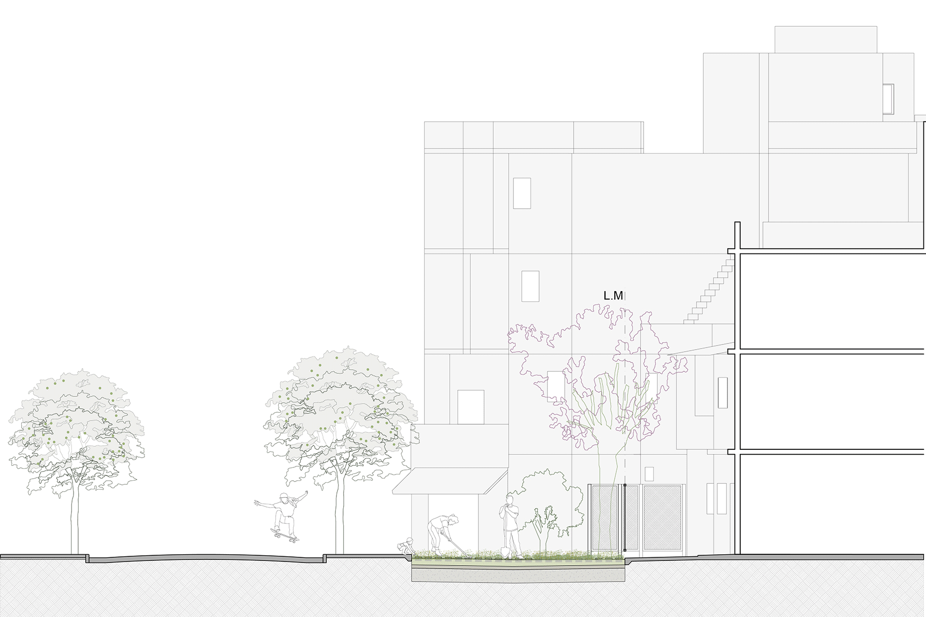
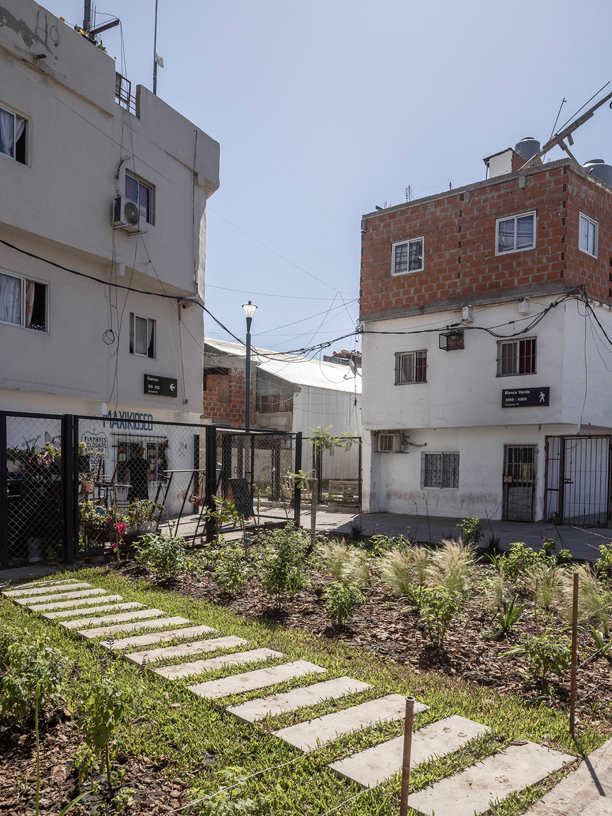
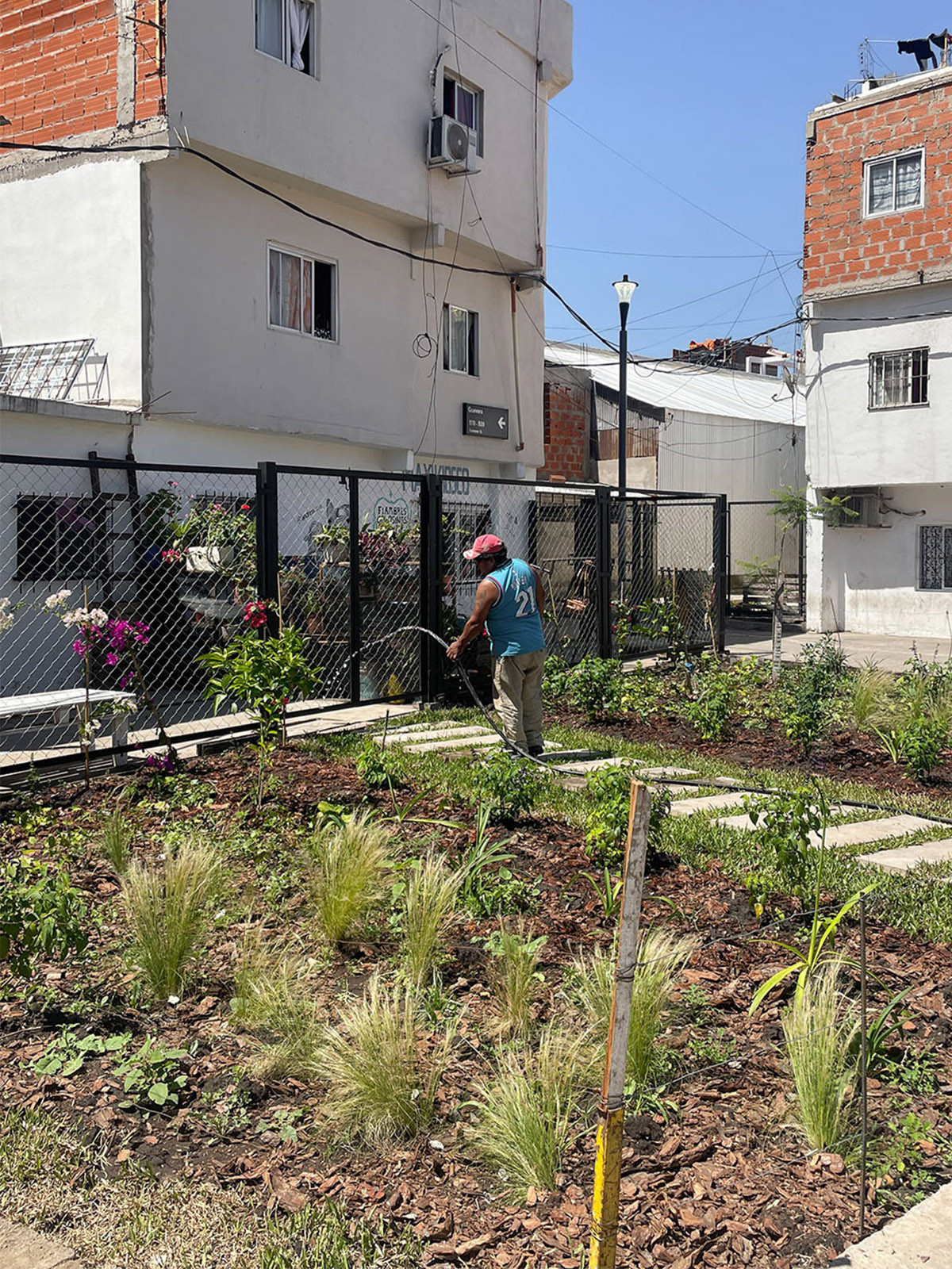
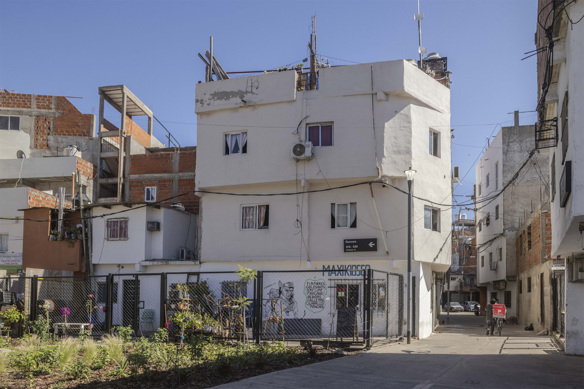
Guevara Rain Garden
After
Before
Date
2023-2024
Status
Built
Team
Región Australdsd
Client
Playón de Chacarita community. Funded by re:arc Institute (Denmark). Support: IVC Buenos Aires
Location
Playon de Chacarita, Buenos Aires, Argentina
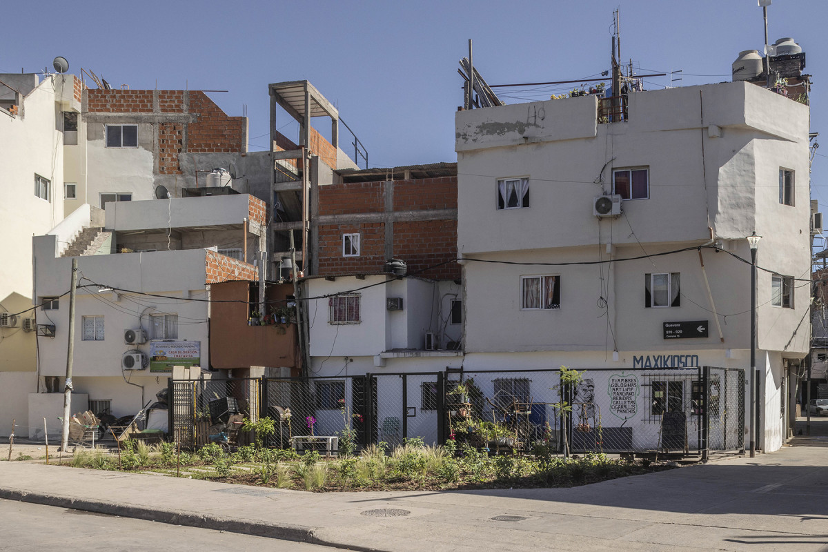
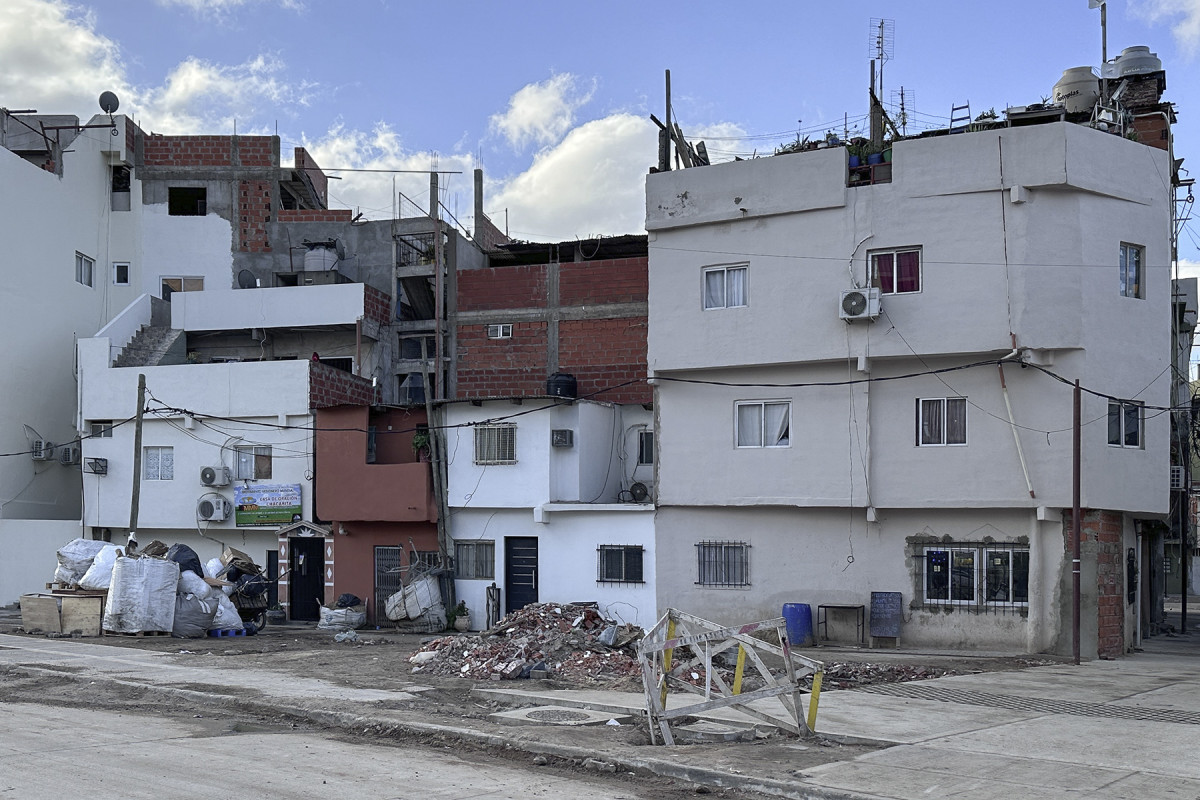
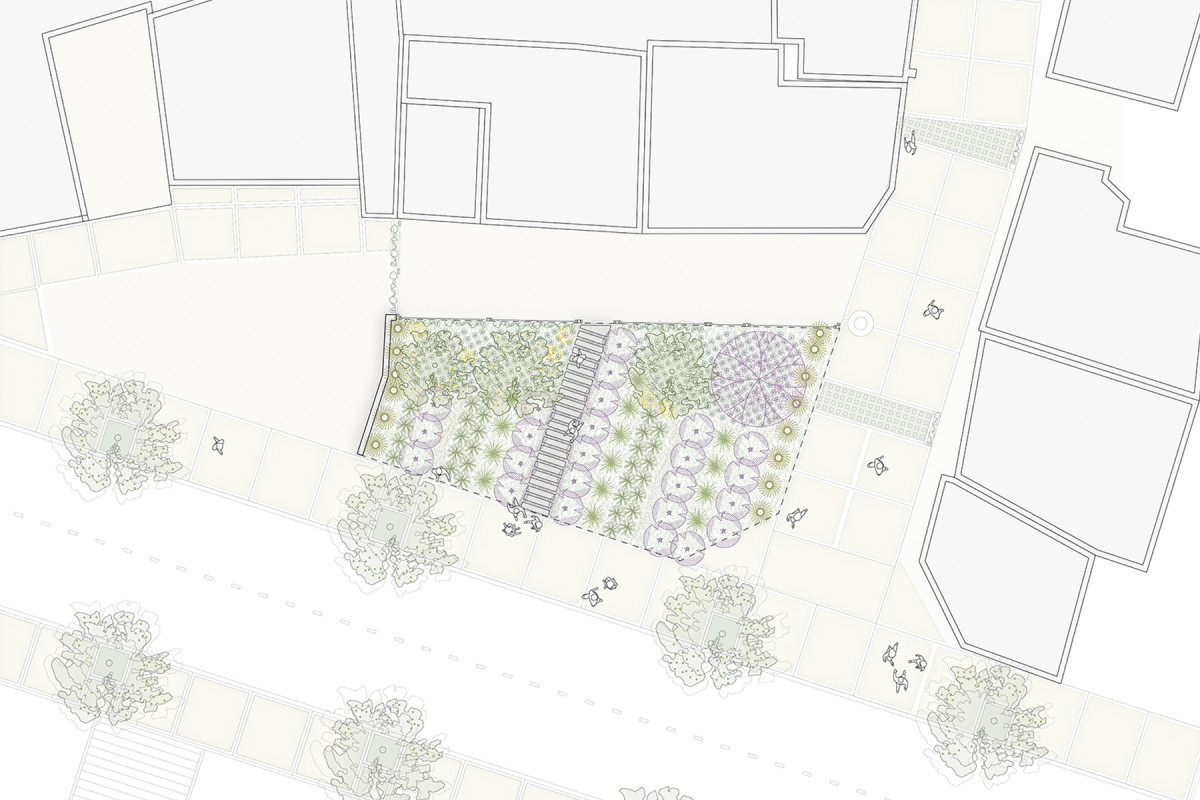
As part of the Playon Network project, the Jardín de Guevara is located on a plot facing the street of the same name, at the corner of one of the passages leading into the block, serving as an entry point for residents of the area. Previously, this space was characterized as a dumping ground for garbage and construction materials and frequently experienced flooding.
The intervention seeks to transform this plot into a rain garden. The landscape design incorporates plant species that enhance rainwater absorption and help mitigate the urban heat island effect, while also improving urban quality. The project prioritized preserving most of the surface as unpaved, interrupted only by a path that ensures accessibility for the residents adjacent to the intervention.
Although the maintenance of this space falls under public management, the creation of the garden has fostered significant community engagement. Residents actively participate in watering, plant care, and the introduction of new plant species.
Related projects
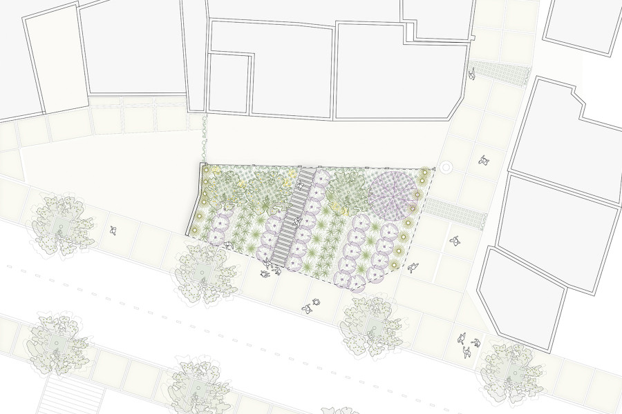
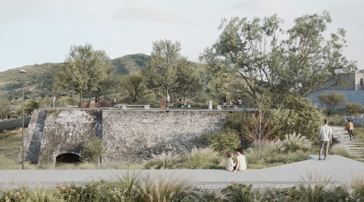
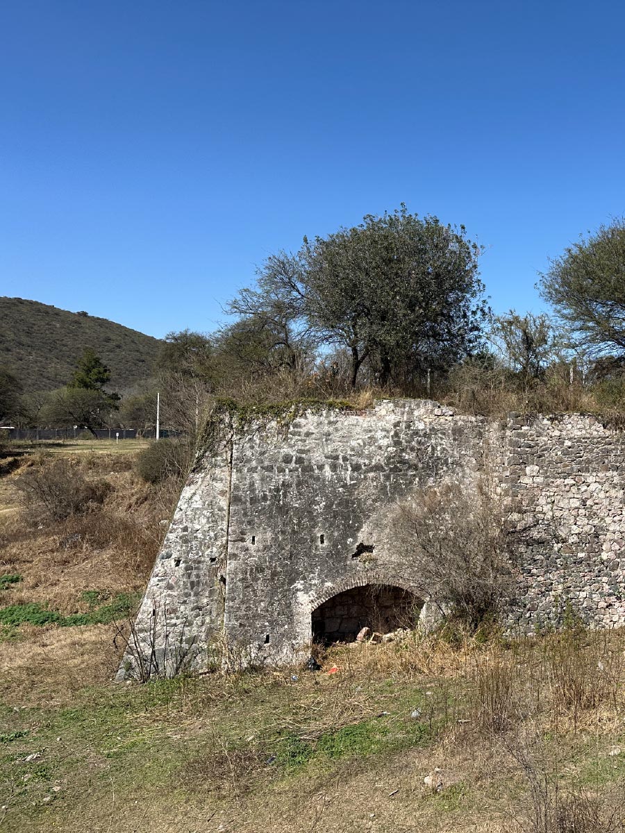
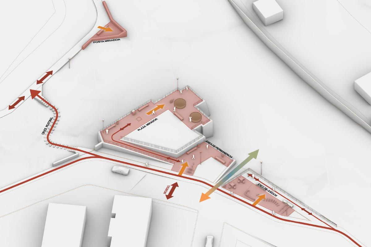
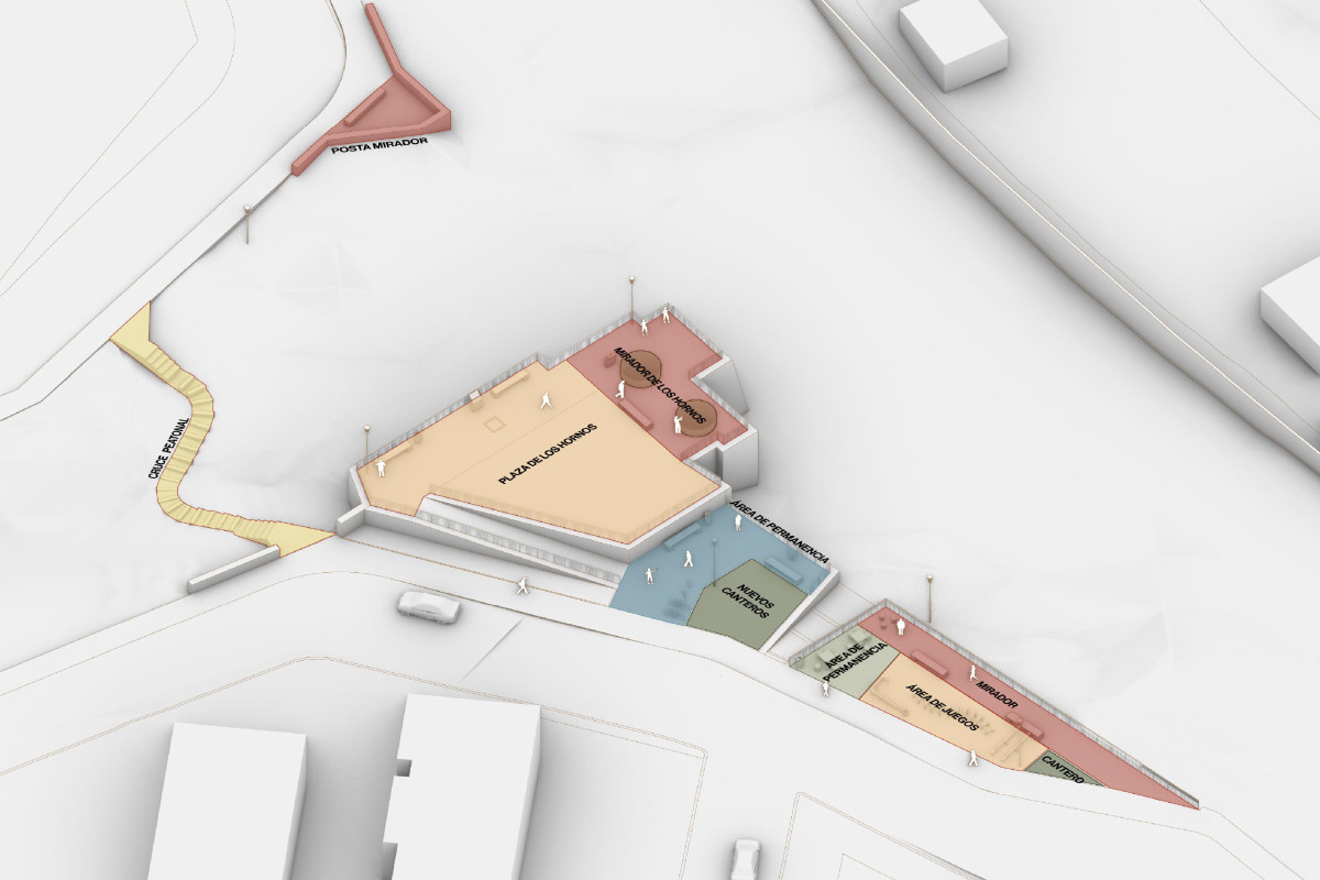
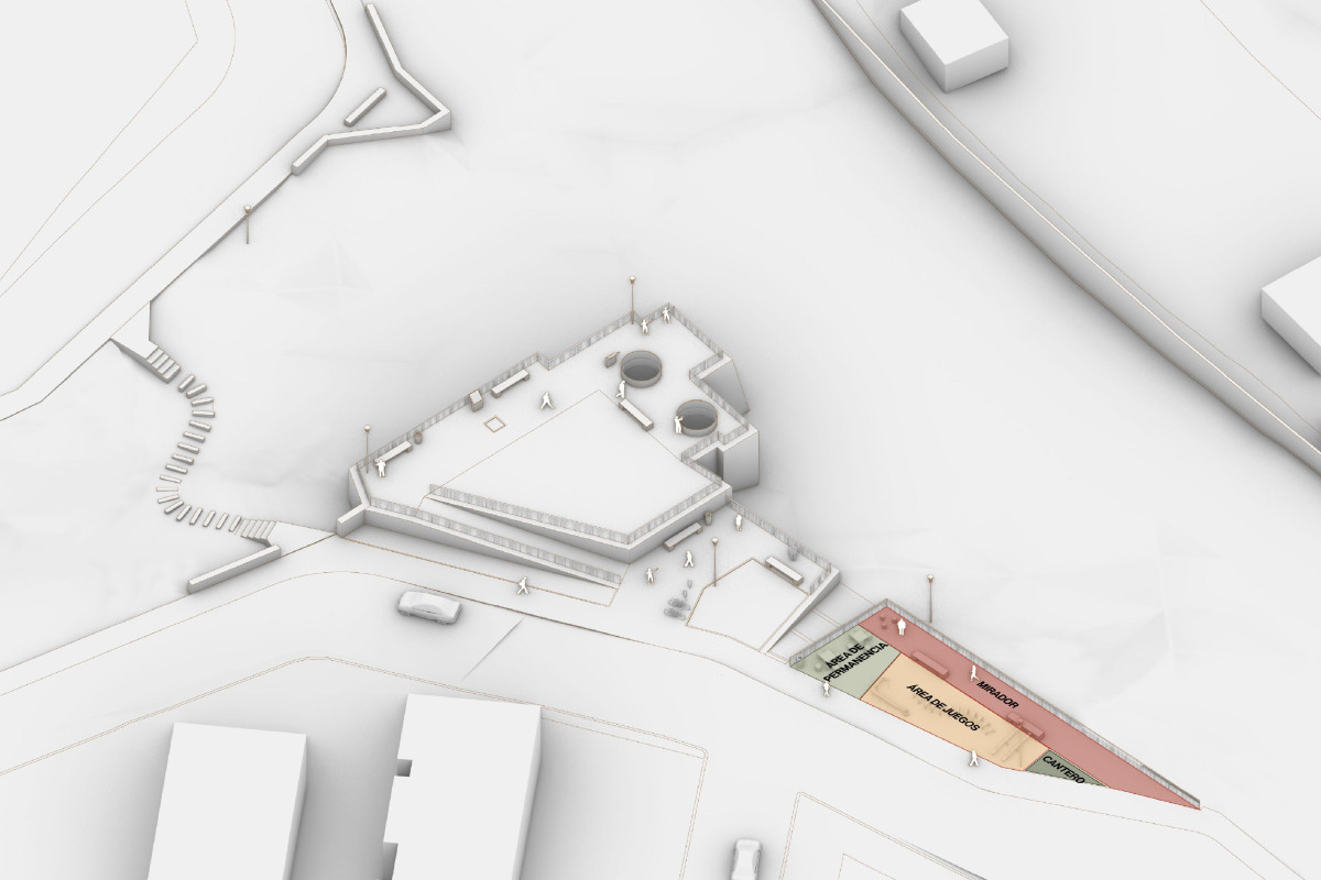
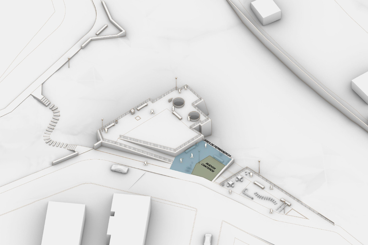
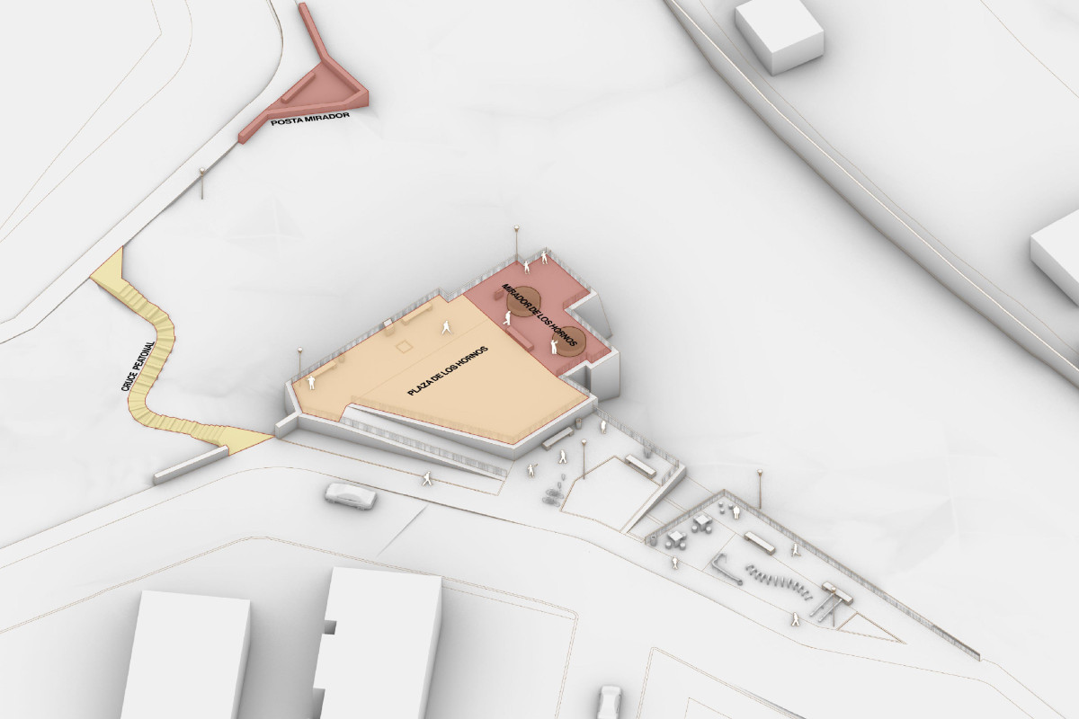
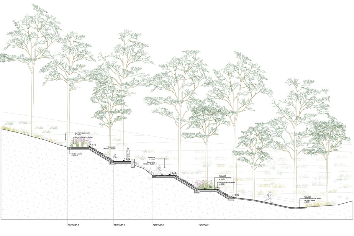
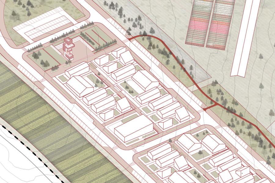
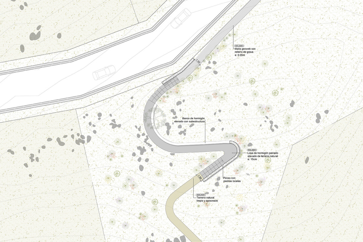
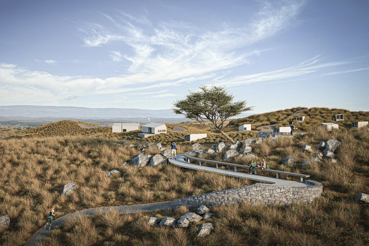
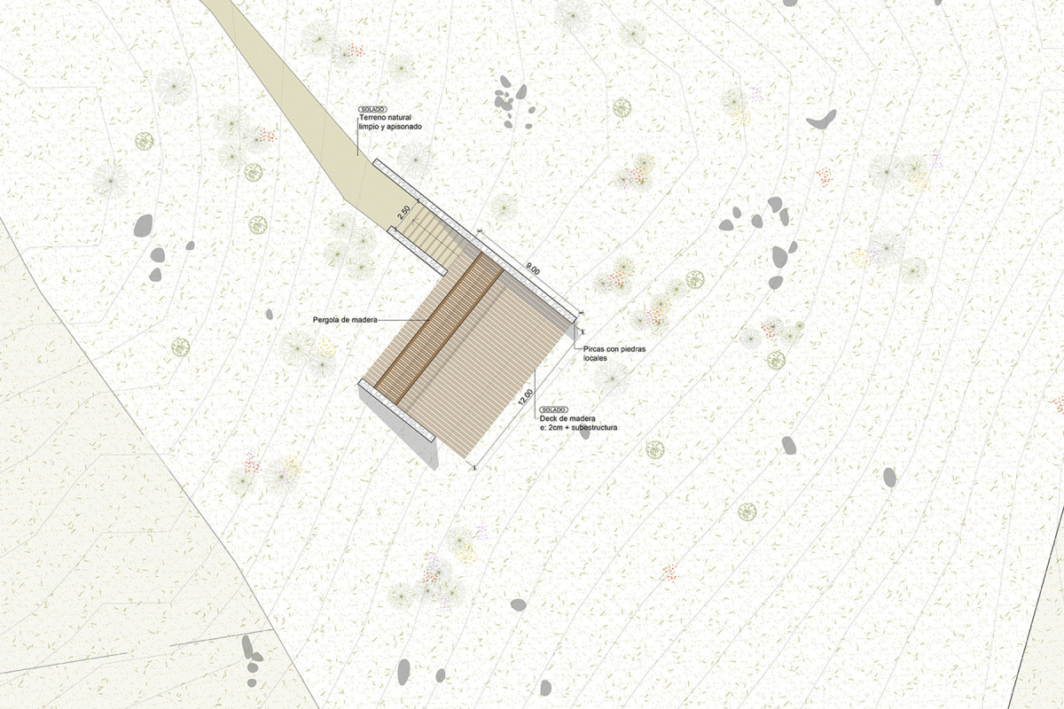
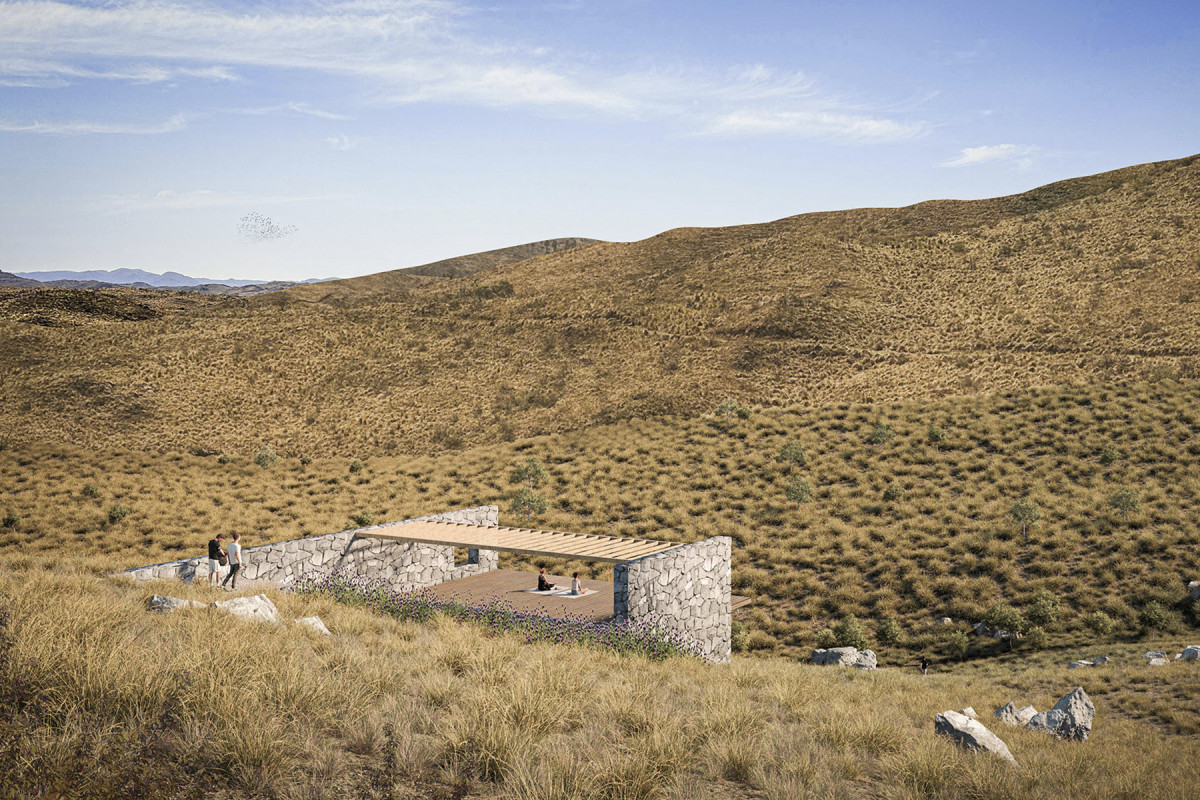
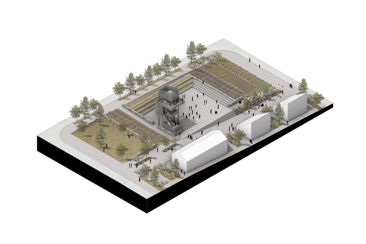
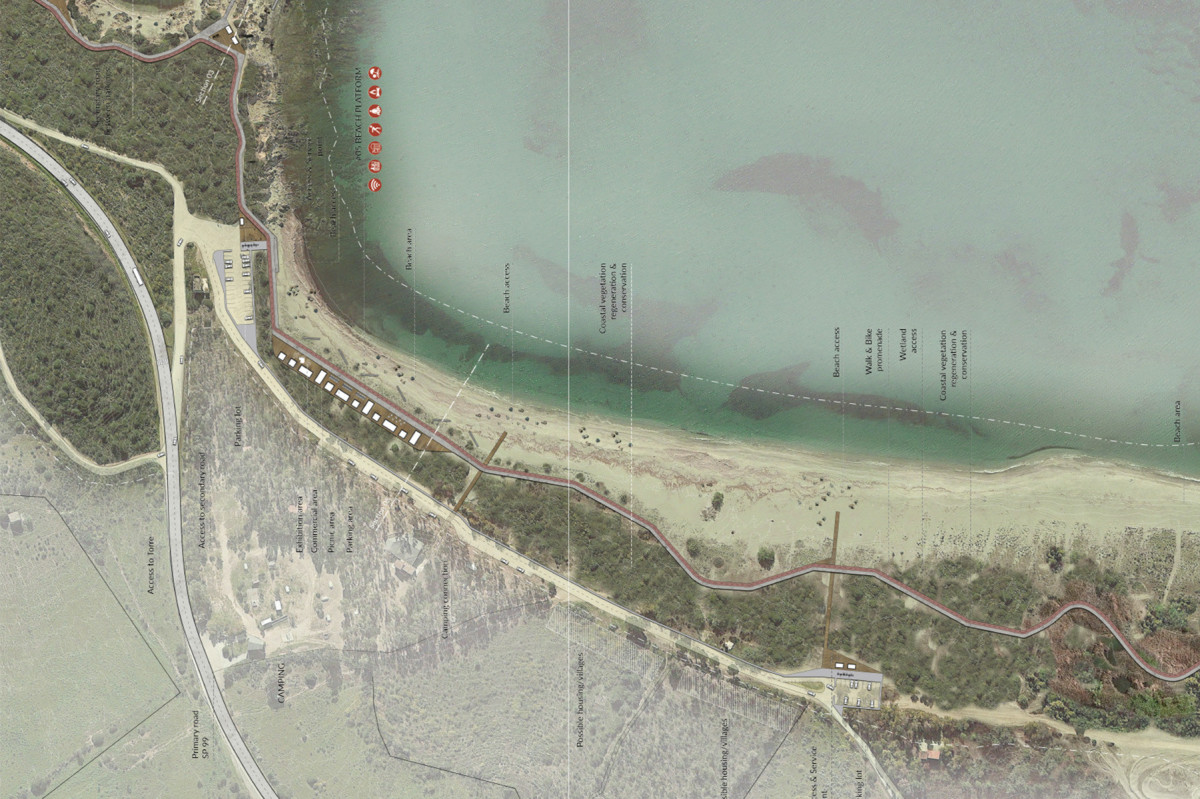
Lime Kiln Plaza
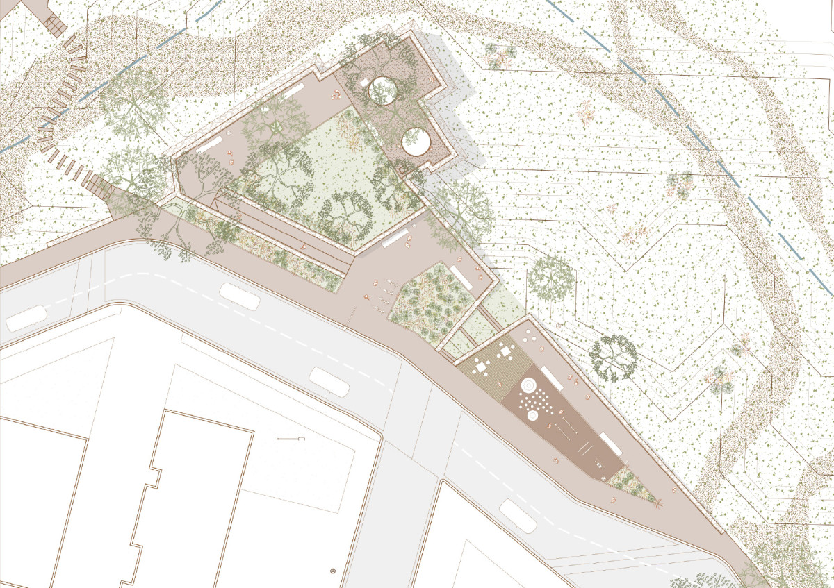
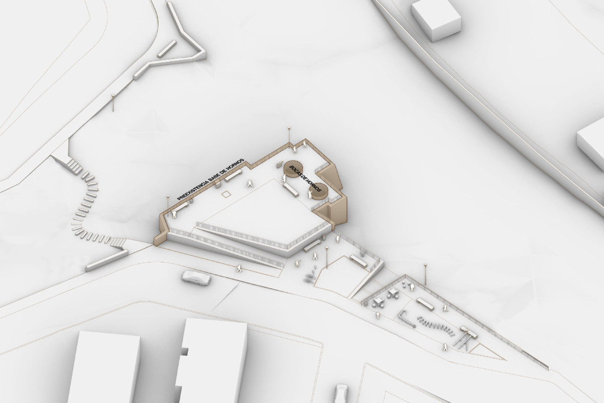
Pre-existing elements
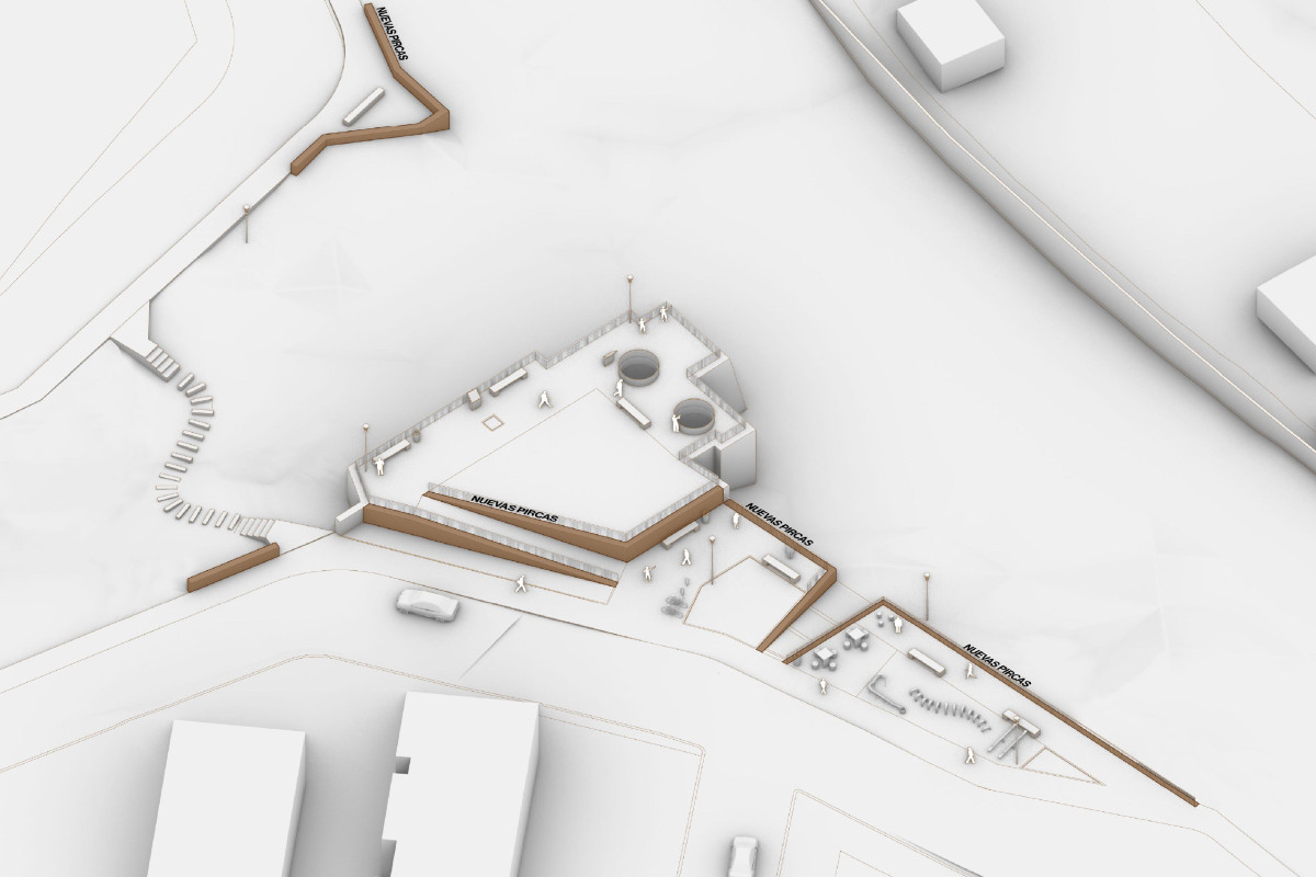
Stone walls
Circulation
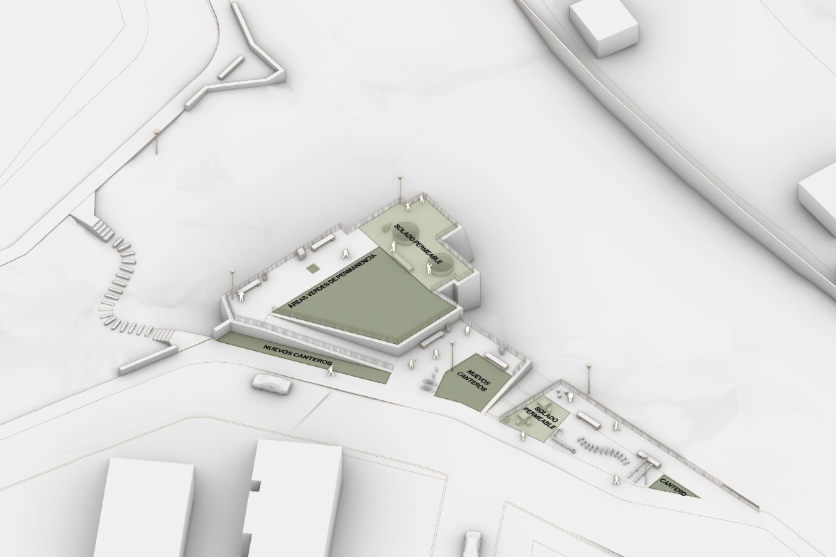
Green and permeable spaces
Program
Playground area
Access platform
Viewing terrace
Date
2025
Service
Urban design
Status
Project
Team
Región Austral
Client
La Calera Municipality
Location
La Calera, Córdoba
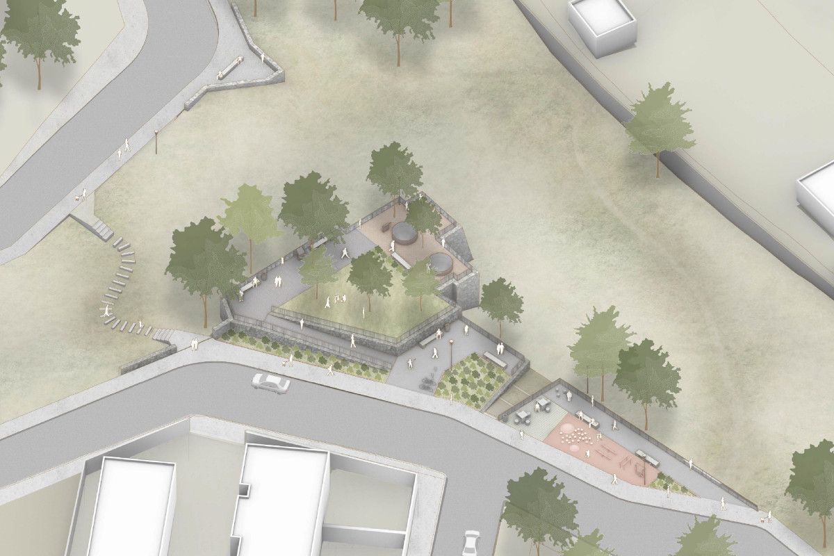
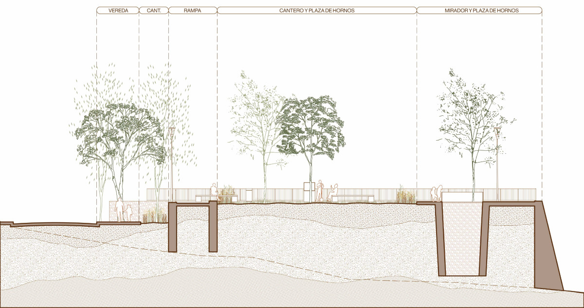
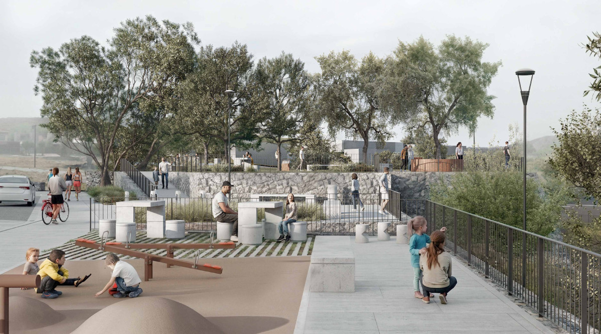
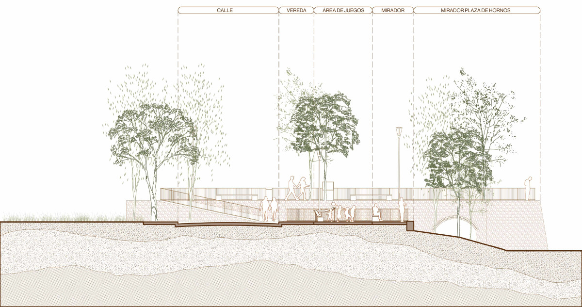
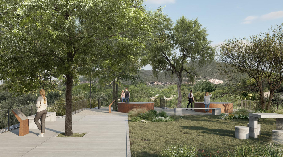
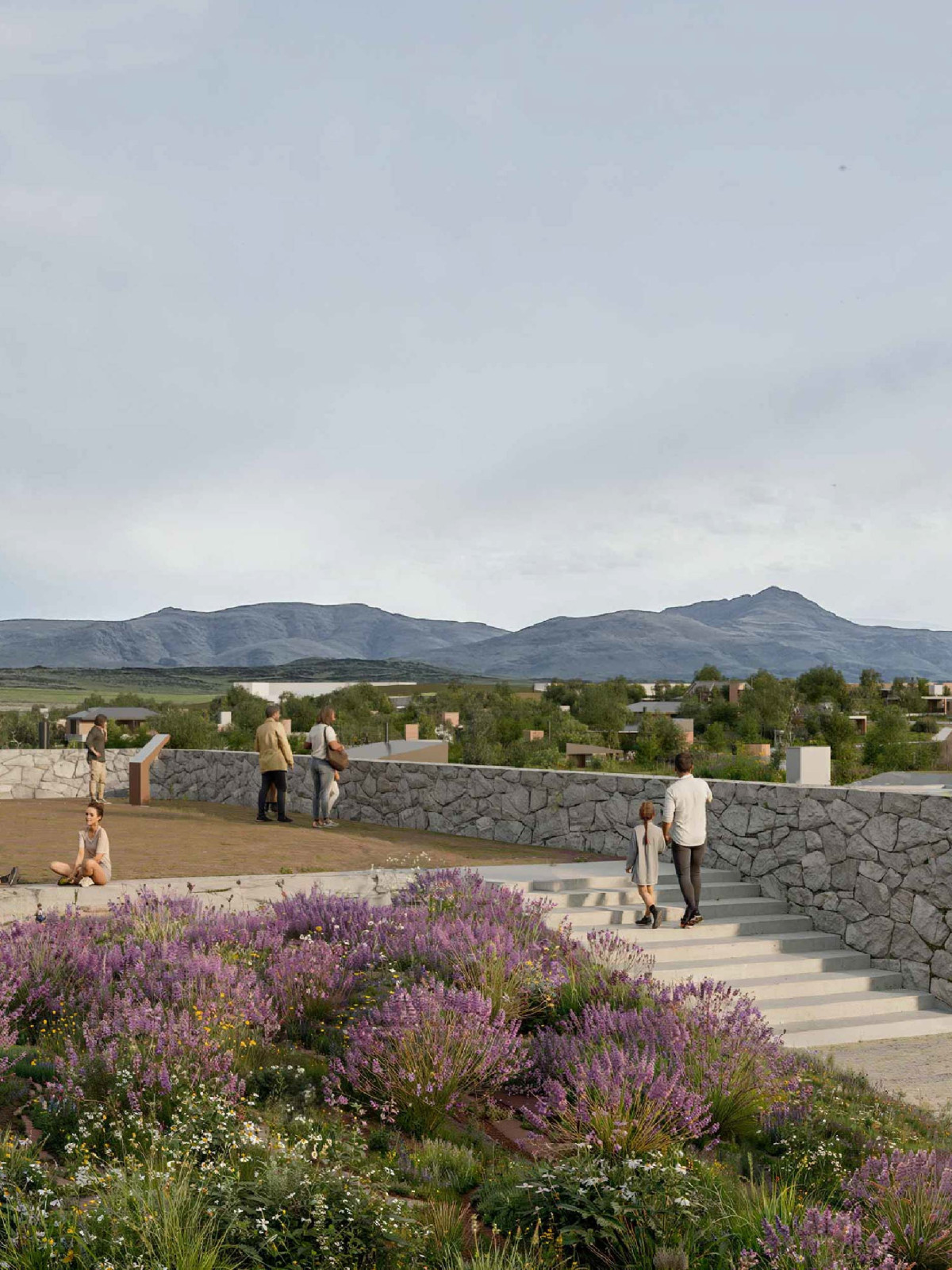
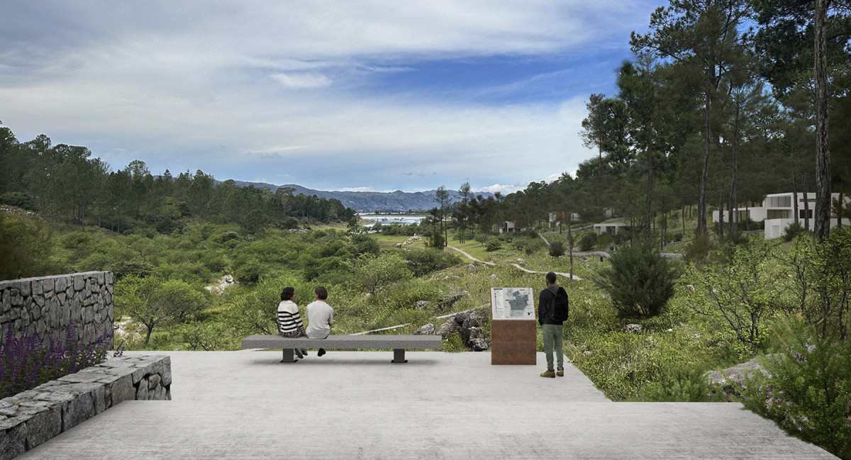
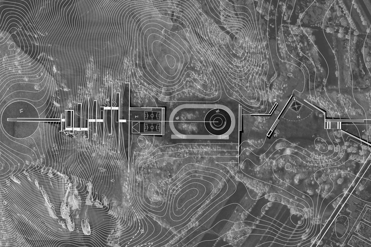
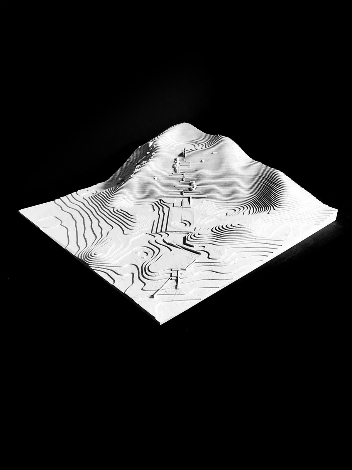
The Lime Kiln Plaza project proposes the creation of a new public space in La Calera through the recovery of former lime kilns, incorporating this industrial heritage as an active component of local identity. The intervention goes beyond simply preserving the existing ruins, integrating them into the everyday circulation of the plaza and transforming them into visible references within an accessible and inclusive system of community-oriented spaces.
The proposal is grounded in a direct relationship with the site’s topography and the landscape of the ravine, understanding the terrain not as a boundary but as an opportunity to frame views, transitions, and areas of stay. Based on this condition, the design organizes a sequence of spaces that alternate between moments of contemplation and activity.
One of the central elements is a viewpoint located above the kiln structures, conceived both as an elevated observation point and as an instance of heritage recognition. From this point, historical signage elements are incorporated, allowing visitors to learn about aspects of the site’s productive past and to integrate its memory into the everyday use of the plaza.
The program is completed with equipped stay areas, children’s play zones, and spaces for light physical activity, creating a balance between recreational and contemplative uses. The landscape intervention prioritizes the preservation of existing trees, taking advantage of their natural shade to create resting areas, while the introduction of planters and green surfaces reinforces the environmental identity of the space.
A system of ramps and access points ensures universal accessibility and continuity between the different ground levels, enabling diverse and simultaneous use of the plaza. In this way, Lime Kiln Plaza is conceived as a place where heritage, landscape, and daily life intersect, consolidating an active space of memory that projects La Calera’s history through a contemporary approach closely tied to everyday experience.
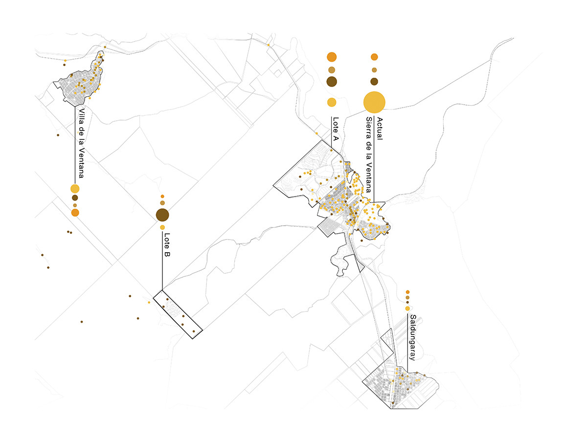
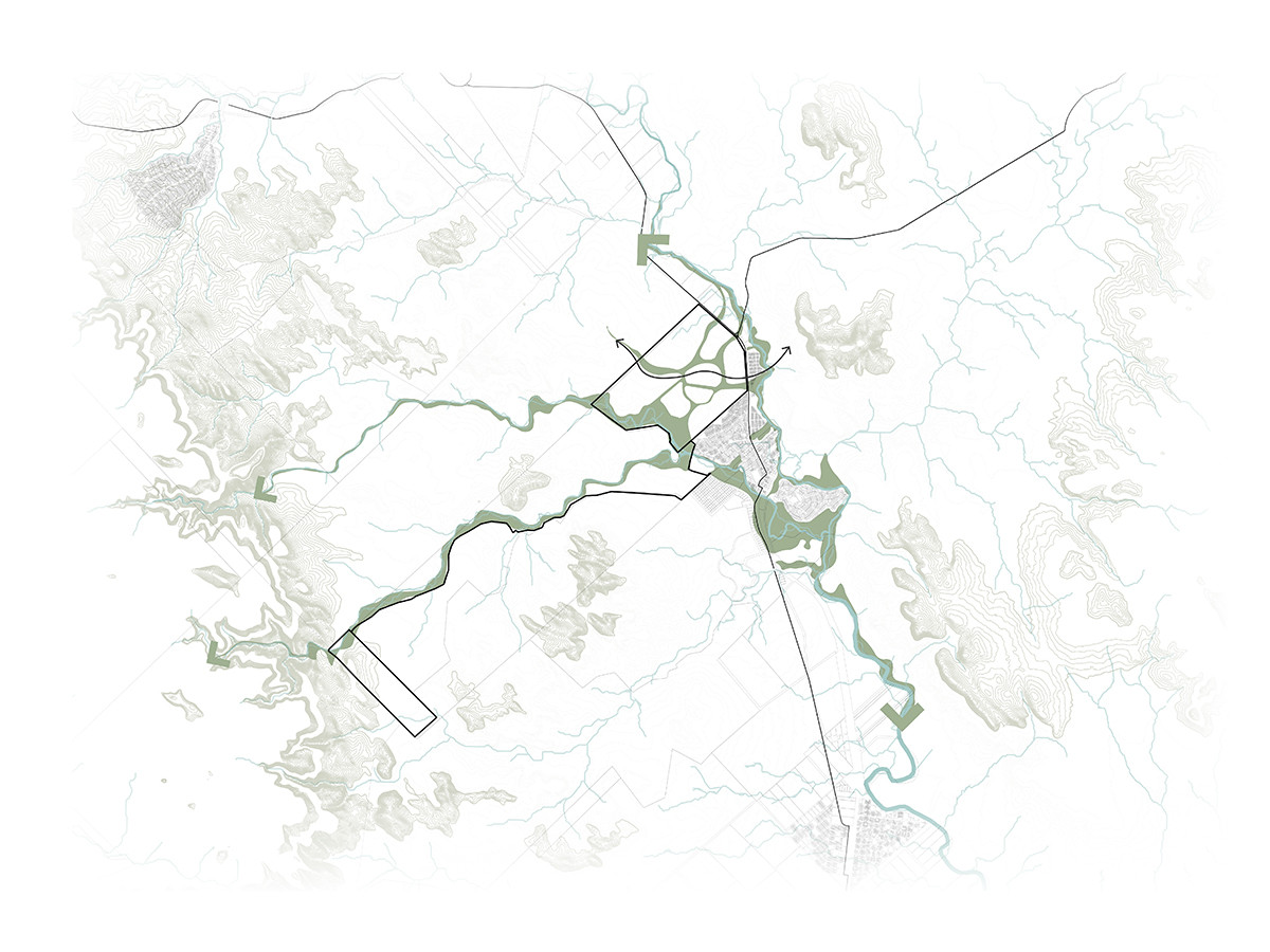
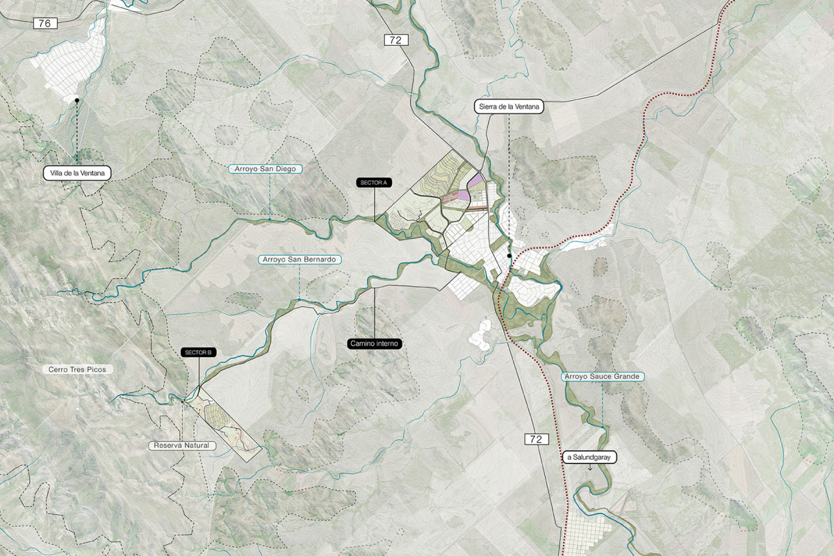
Sierra, Future Destination
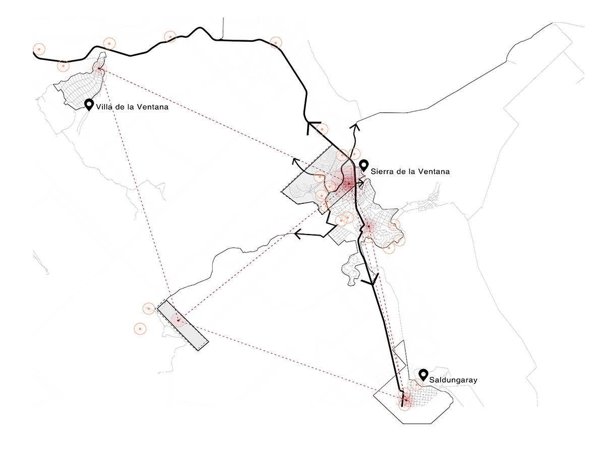
Connected
Atrractive
Sustainable

Diagnosis
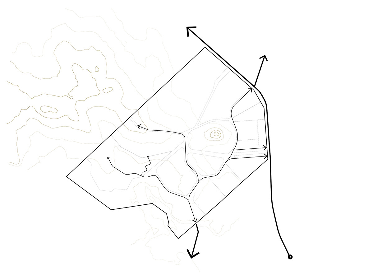
Conection
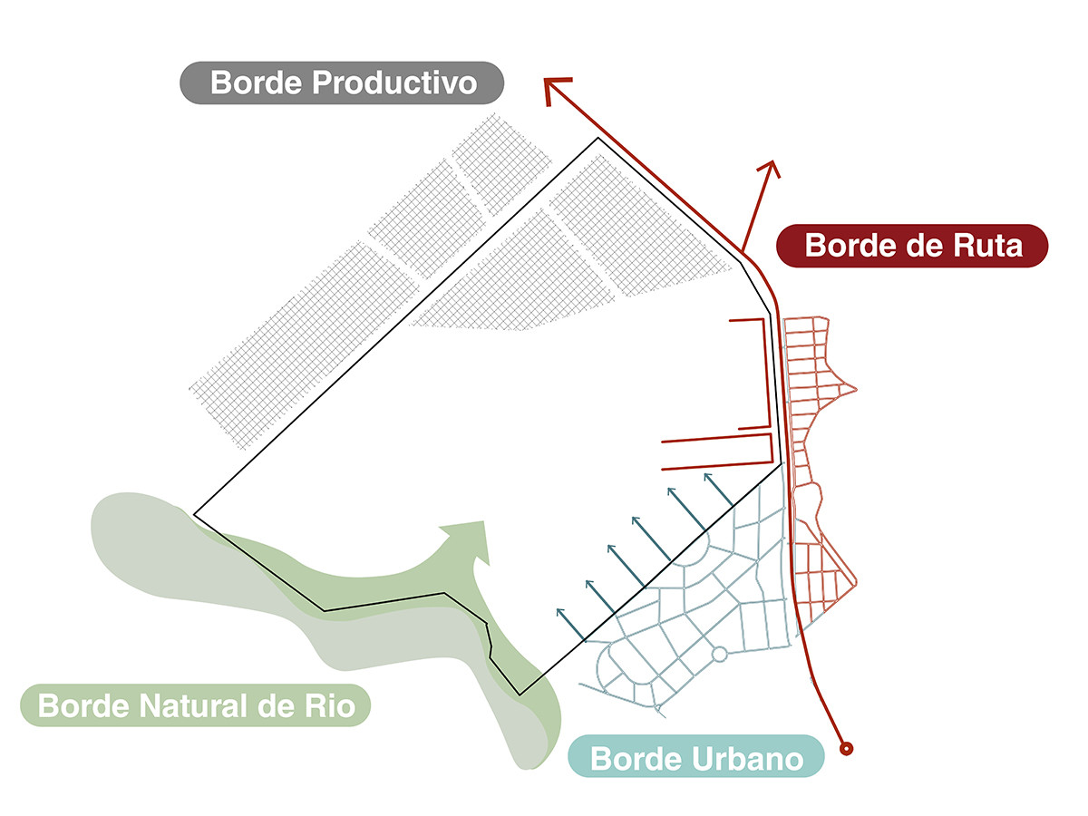
Borders
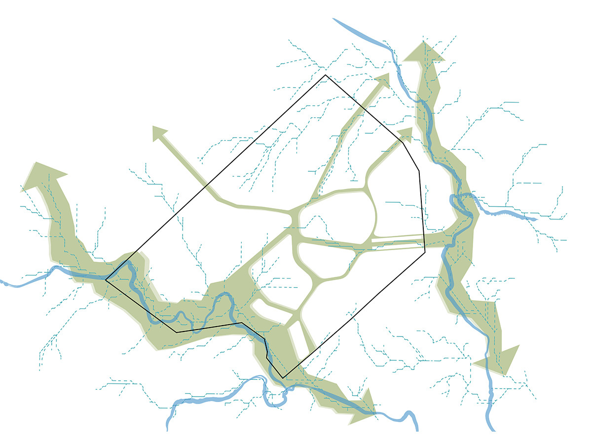
Ecological Corridors
Transition


Date
2024 - 2025
Status
Project
Team
Región Austral
Client
Planet Partners S.A. – Private competition 1st Prize
Location
Sierra de la Ventana, Buenos Aires, Argentina
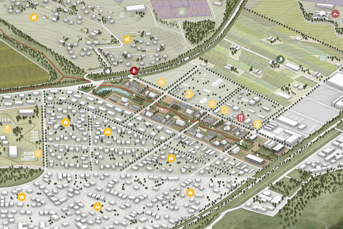
Sierra Destino Futuro is a city model specifically designed for Sierra de la Ventana, based on a deep analysis of its conditions, needs, and opportunities. The proposal was awarded First Prize in the International Competition for the design of the city’s Masterplan. The project promotes the transformation of Sierra through regenerative urbanism—a vision that combines development, innovation, and sustainable infrastructure, adapting to the territory and preparing it for multiple future scenarios.
The proposal envisions a new way of life, grounded in the principles of slow living, encouraging a healthy and conscious lifestyle in close connection with the surrounding mountain landscapes. With a strong territorial identity and renewed sense of community, Sierra Destino Futuro seeks to harness the benefits of living in a small-scale city with complex services. The plan integrates a balanced mix of diverse housing options, community facilities, and spaces for leisure, health, and culture, alongside environmental preservation strategies that reinforce the relationship between city and nature.
The master plan is structured around an integrated vision and strategies aimed at building a resilient, connected, and attractive urban environment. It promotes ecological practices through green and blue infrastructure to safeguard natural resources, and proposes productive landscapes to support the local economy with sustainable agriculture and clean energy generation. In parallel, it focuses on improving mobility and connectivity, encouraging responsible ecotourism, active transportation, and the creation of contemplative trails that highlight the value of the natural environment.
At the same time, the plan promotes an inclusive urban model, offering diverse and affordable housing centered on residents’ well-being, and a network of public spaces for recreation, sports, and cultural activities. Urban renewal is seen as an opportunity to consolidate controlled growth by integrating new developments into the existing urban fabric, improving access to infrastructure and services, and fostering a balanced and sustainable territorial development.
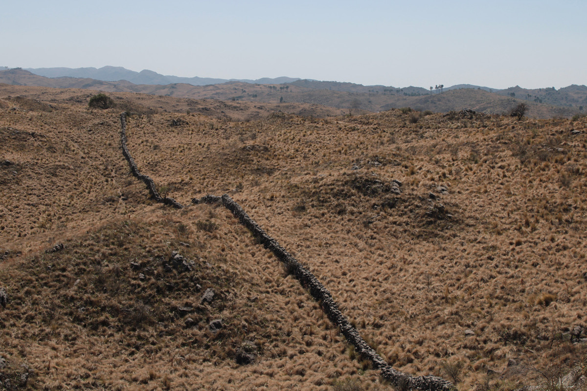
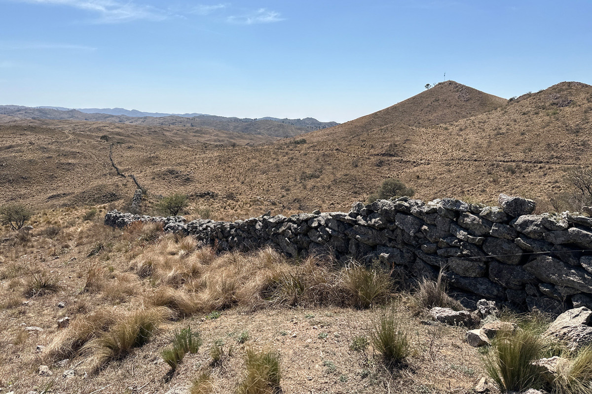
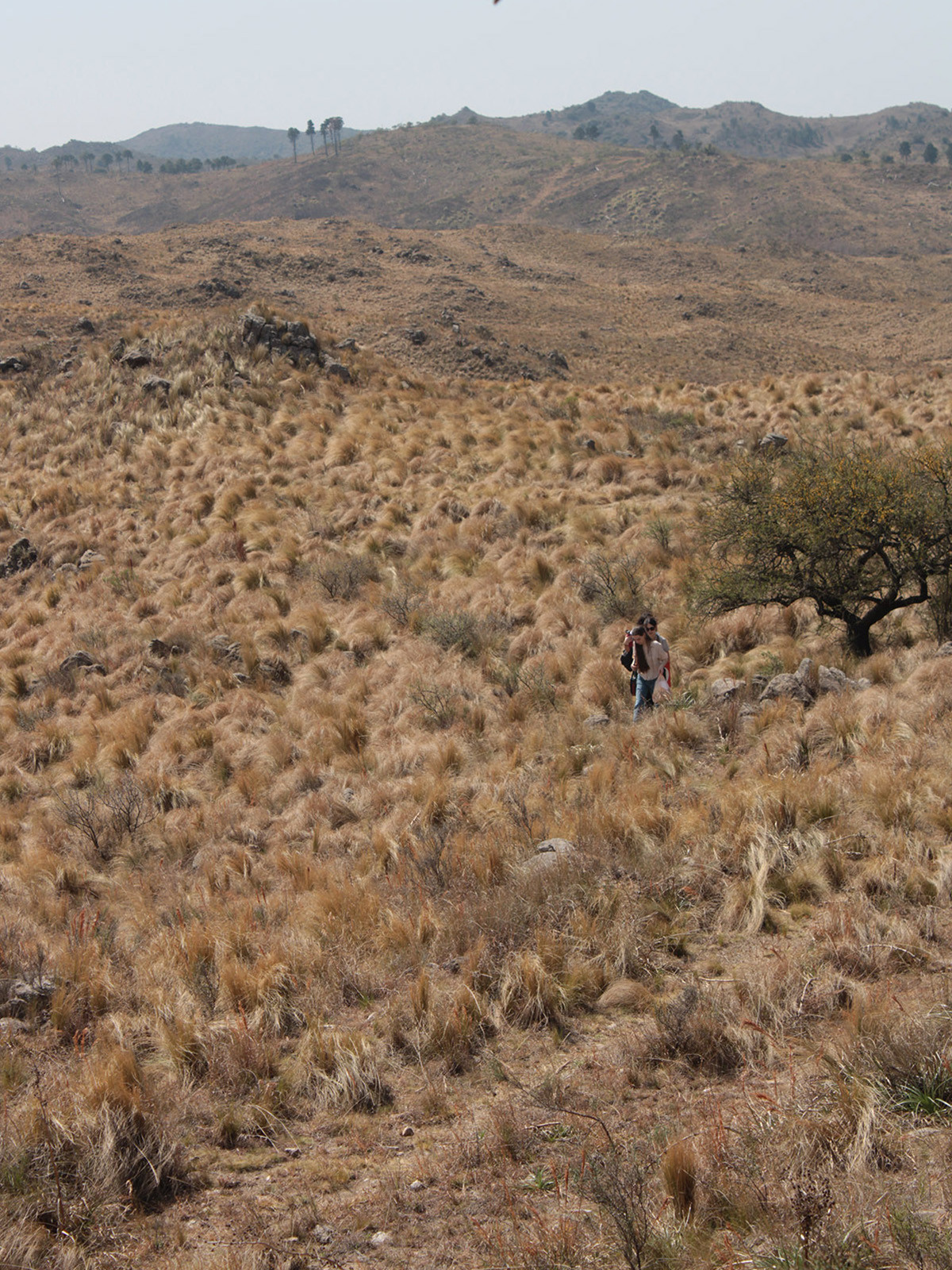
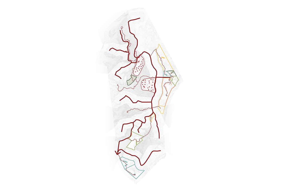
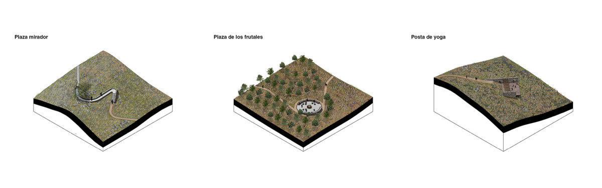
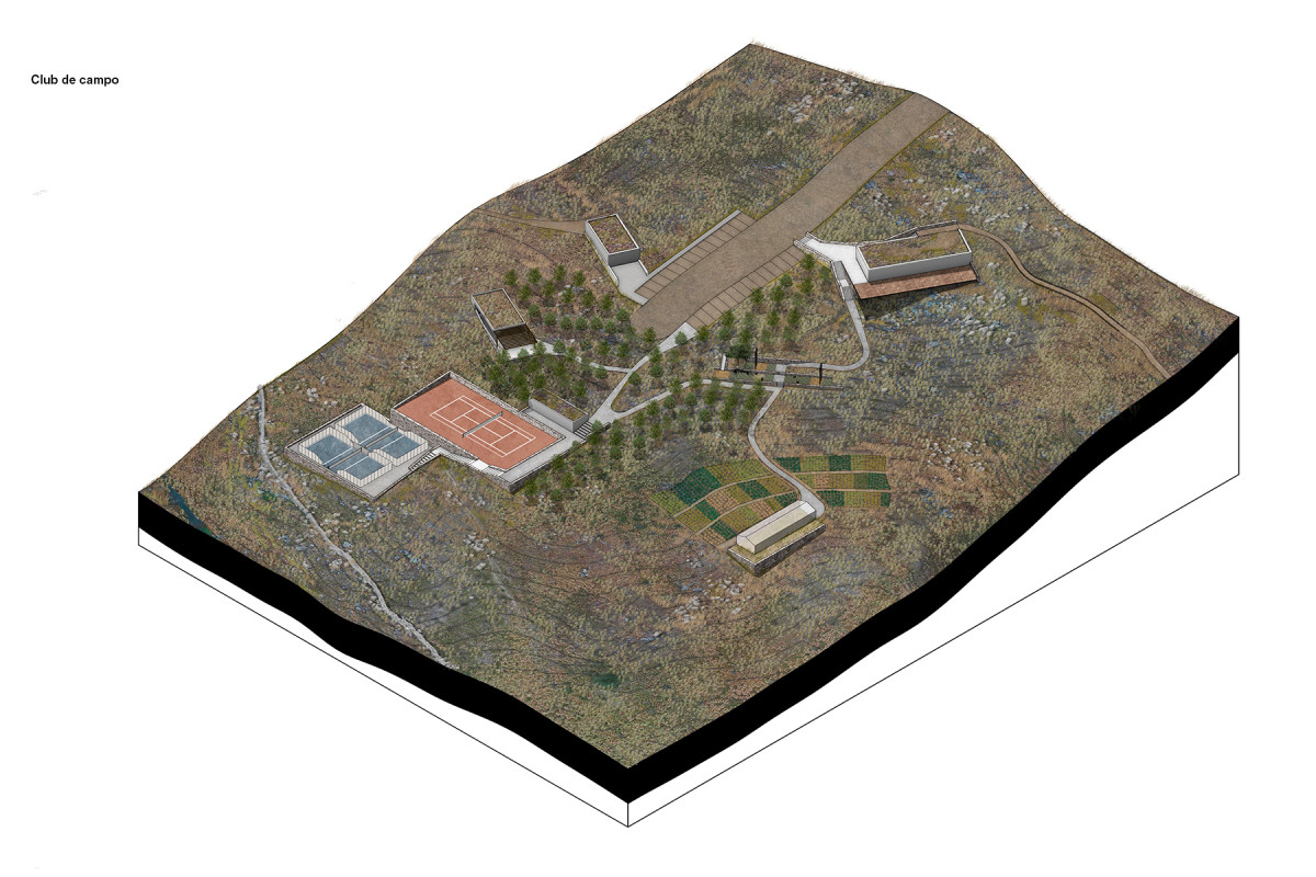
Los Molinos Scenic Route
Network of Trails and Landscape Viewpoints
Date
2024
Service
LandscapeArchitecture
Status
Proyect
Team
Región Austral
Client
Private
Location
Potrero de Garay, Cordoba, Argentina
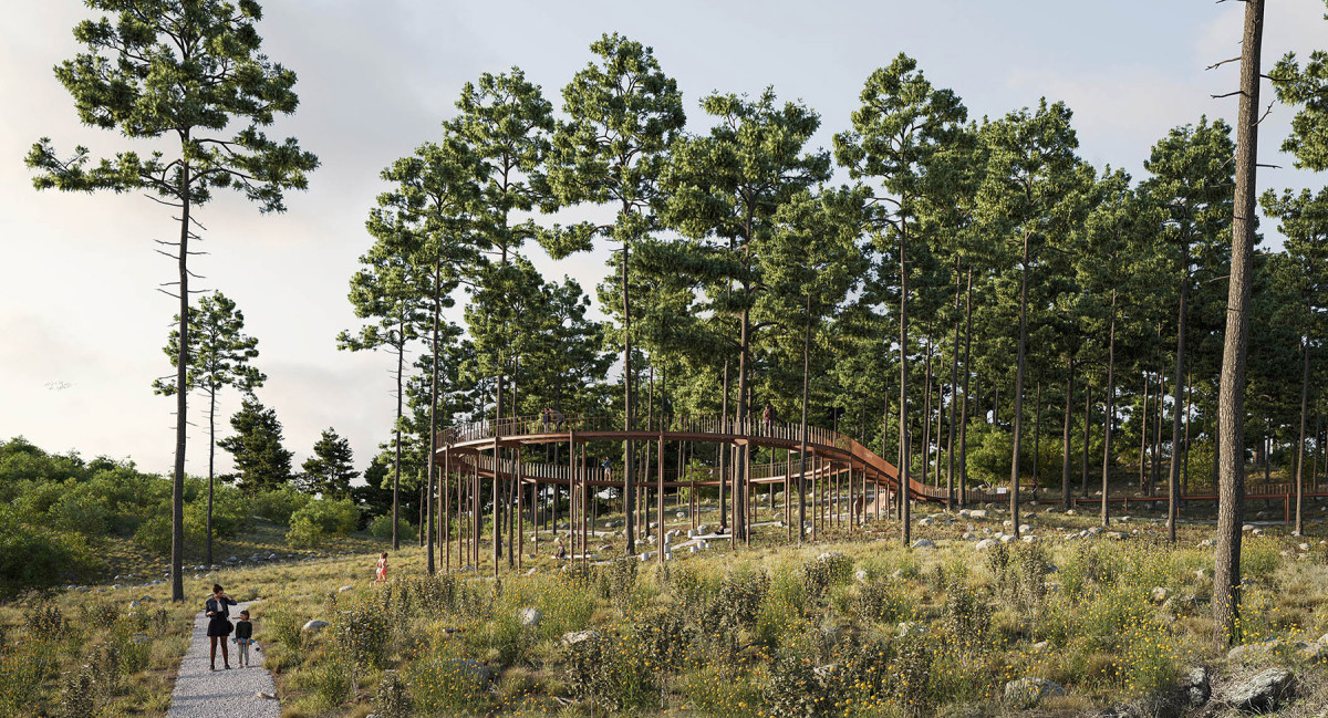
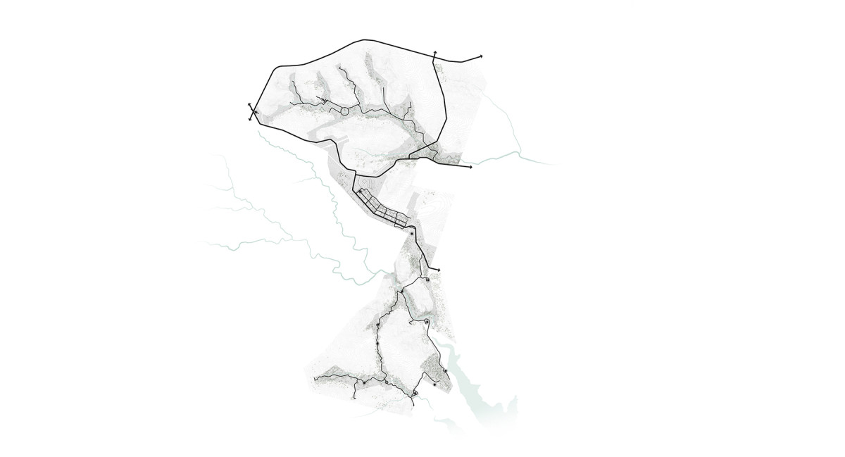
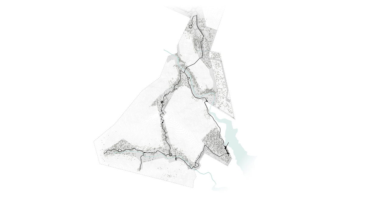
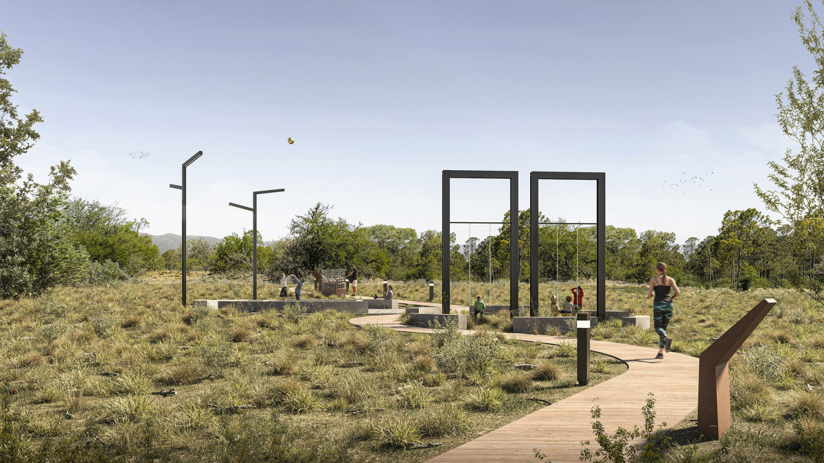
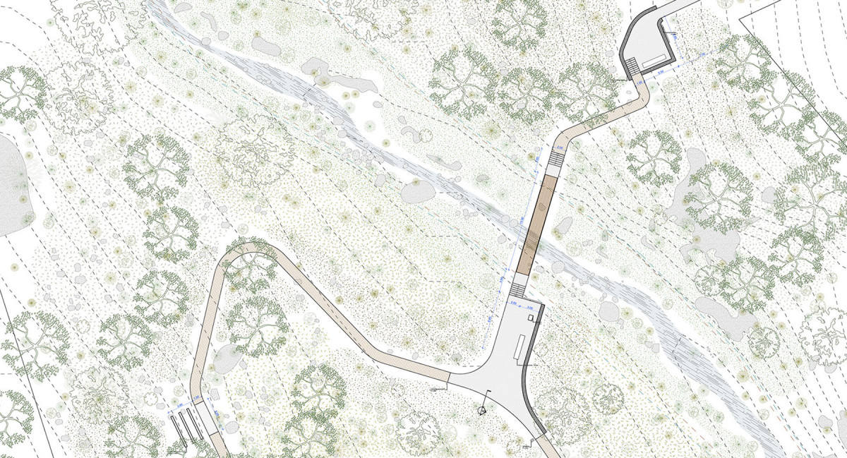
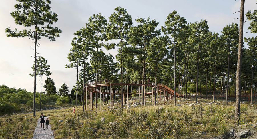
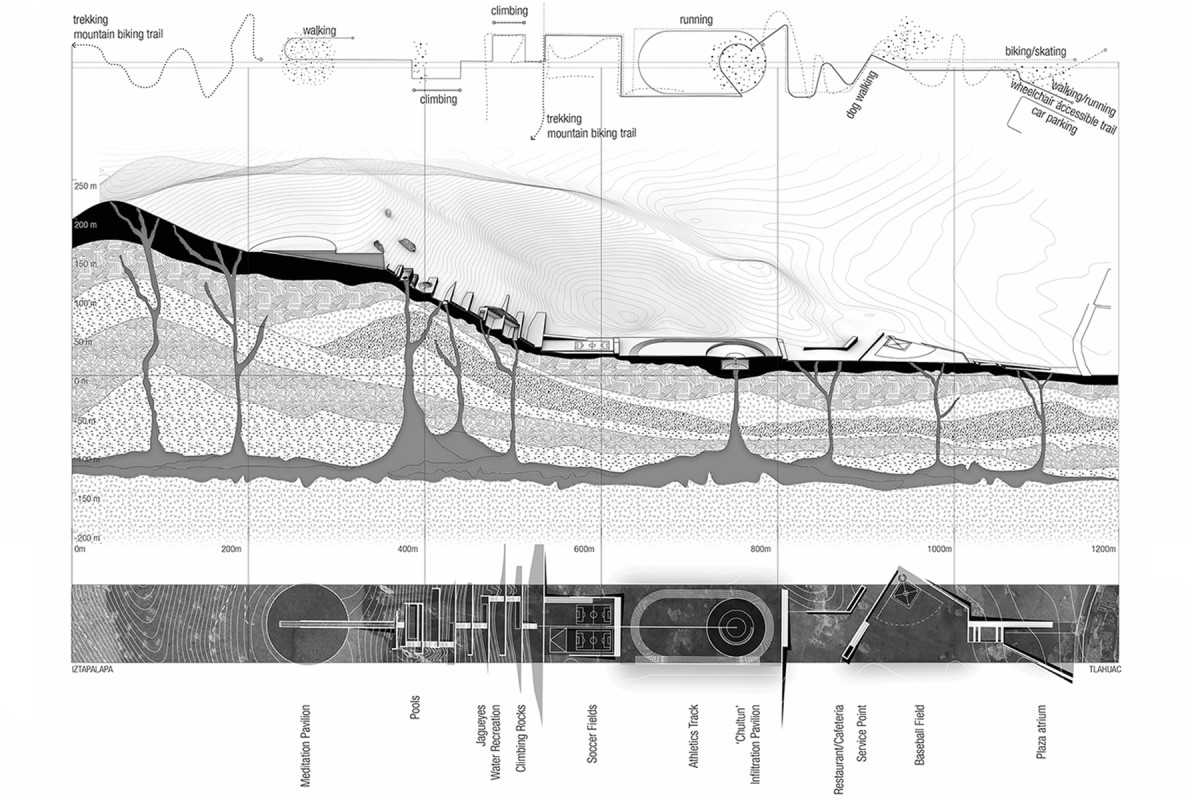
The Sierras of Córdoba are undergoing a transformation driven by sustained urban growth and seasonal tourism, while safeguarding a landscape and environmental heritage of great value. In this context, the project proposes a Scenic Route in Potrero de Garay, a town located 70 km southwest of the city of Córdoba, which is emerging as an increasingly attractive destination.
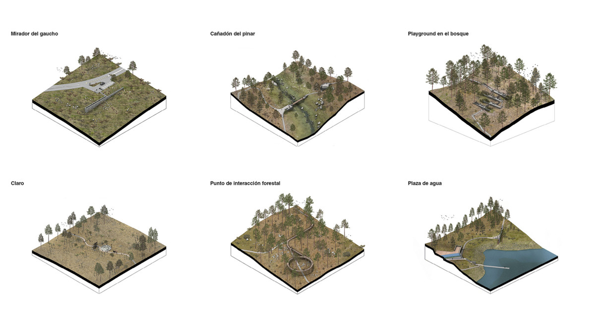
The intervention is structured as a network of trails and landscape viewpoints, approaching landscape design as a tool to restore, connect, and activate the territory. The landscape is conceived as an active element of the project, capable of articulating relationships between nature, culture, and community. A sensitive system that is revealed through experience, integrating diverse scales, uses, and ways of inhabiting the land, among others.
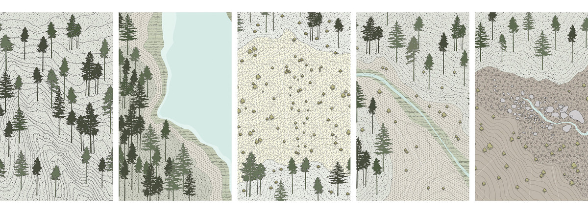
The designed spaces —viewpoints, playgrounds, educational stops, areas for rest, and small shelters— respond to the conditions of their surroundings. They are inserted into the territory with an organic logic, enhancing the natural qualities of each site: a roadside viewpoint with panoramic vistas, a forest clearing with 360° views, a glade among grasslands, a water plaza in direct contact with the lake, and a playground that takes advantage of the land’s natural slope.
Each intervention uses local materials and low-impact solutions, reinforcing a commitment to both ecological and cultural sustainability. Through a territorial narrative that intertwines contemplation, environmental learning, and enjoyment, the project proposes a new way of experiencing and inhabiting the mountain landscape.
Related projects
Haras Dos Ríos
Masterplan + Common Use Spaces Network
Date
2024 - 2025
Service
LandscapeArchitecture
Status
Project
Team
Región Austral
Client
Private
Location
Cordoba Province, Argentina
Haras Dos Ríos is both a conceptual and technical reflection that gives shape to a masterplan and a network of shared spaces designed to foster a way of living in balance with the natural environment of the Córdoba sierras. The project approaches landscape and open space design as a unique opportunity to merge urban development with strategic ecological restoration, generating a positive impact on the ecosystem.
The proposal envisions a sustainable urban development that promotes regenerative tourism and recreation in harmony with its natural surroundings. It seeks to consolidate an ecosystem where built areas coexist in symbiosis with open spaces, blending seamlessly into the surrounding landscape.
In a context where more and more people are choosing to leave behind life in large cities, Haras Dos Ríos presents itself as a model for community living based on shared values—an alternative that encourages healthier and more responsible habits, from housing and food choices to the conscious use of energy and water.
The masterplan proposes an environment designed for community life, where conservation and preservation areas are interwoven with residential zones, public spaces, and shared infrastructure. This coexistence is supported by careful land management, the preservation of native vegetation, and a deep respect for biodiversity.
Through specific design guidelines, the project promotes an architecture that engages in dialogue with the landscape, follows the topography, and protects the natural beauty of the site—consolidating a model of development that is sensitive, regenerative, and deeply connected to its environment.
El Pueblo Commercial Promenade
Date
2024
Service
Urban designLandscape
Status
Project
Team
Región Austral
Client
DENAT
Location
Cordoba Province, Argentina
Located in the mountainous landscape of Potrero de Garay, El Pueblo Commercial Promenade offers a commercial experience fully integrated into its natural surroundings. As part of the Los Molinos Scenic Route project, it is strategically situated in a flat area of low native vegetation, linking the tourist route with a primary street in the town’s urban core, attracting both visitors and local residents.
The design introduces a flexible block typology, conceived to grow organically over time in response to new demands and investment opportunities. Planning regulations, building heights, urban form and materials were carefully defined to consolidate a harmonious, coherent, and context-sensitive identity that respects the natural environment.
Commercial spaces are interwoven with productive units, flower fields and open views, strengthening the relationship between landscape, production and social life. This integration fosters a promenade experience that goes beyond commerce, connecting with a way of living that is open, community-oriented, and deeply linked to the local landscape.
While the project foresees progressive, phased development, the masterplan is rooted in a long-term, comprehensive vision, supported by specific regulations and a design code that guides its evolution. It actively encourages the participation of small and medium-scale producers, with the possibility of forming partnerships for larger-scale enterprises. In this way, each lot may be developed independently while contributing to a diverse, coherent, and sustainable collective identity.
Related projects
A New Vision for the Olympic Neighborhood


Action Plan: Phase 1
Action Plan: Phase 2

Action Plan: Phase 3
Action Plan: Phase 4
After
Before

Date
2023
Service
PlanningUrban design
Status
Project
Team
Region AustralCentro de Estudios Económicos Urbanos (UNSAM)
Client
Corporación Buenos Aires Sur - Gobierno de la Ciudad de Buenos Aires
Location
Barrio Olimpico, Buenos Aires, Argentina
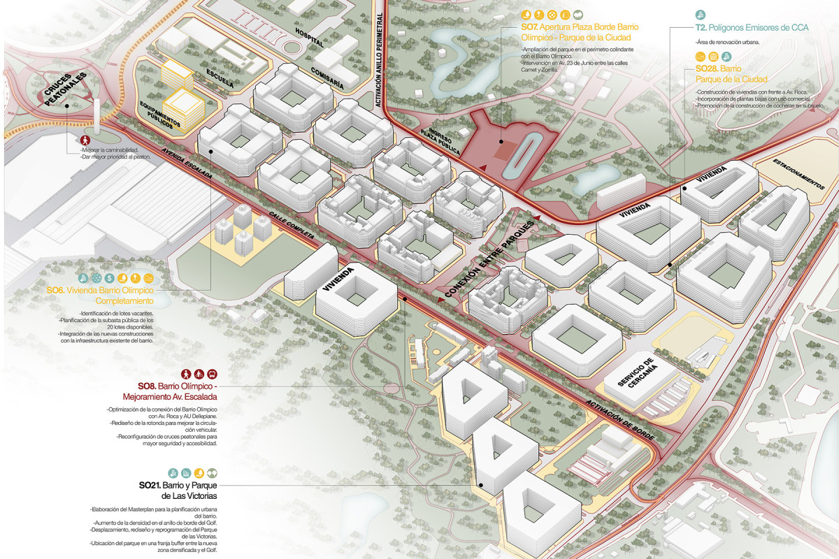
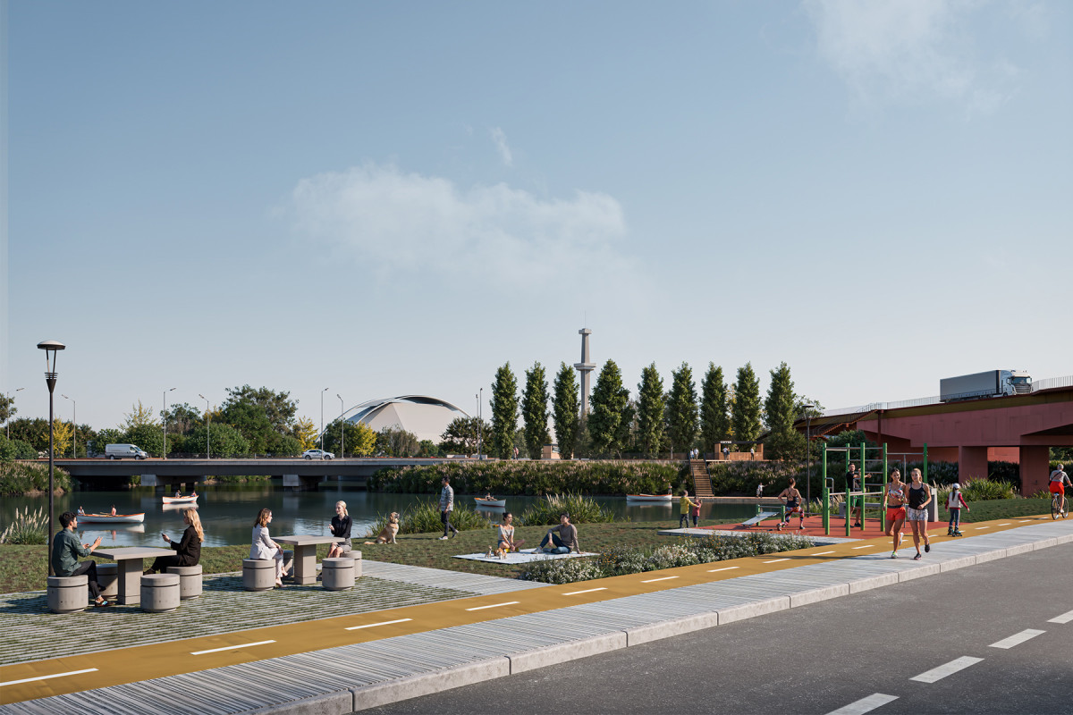
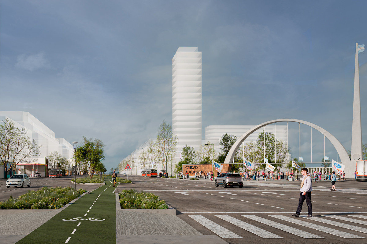
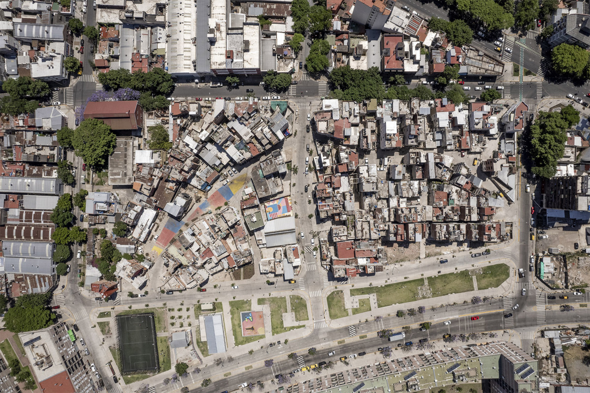
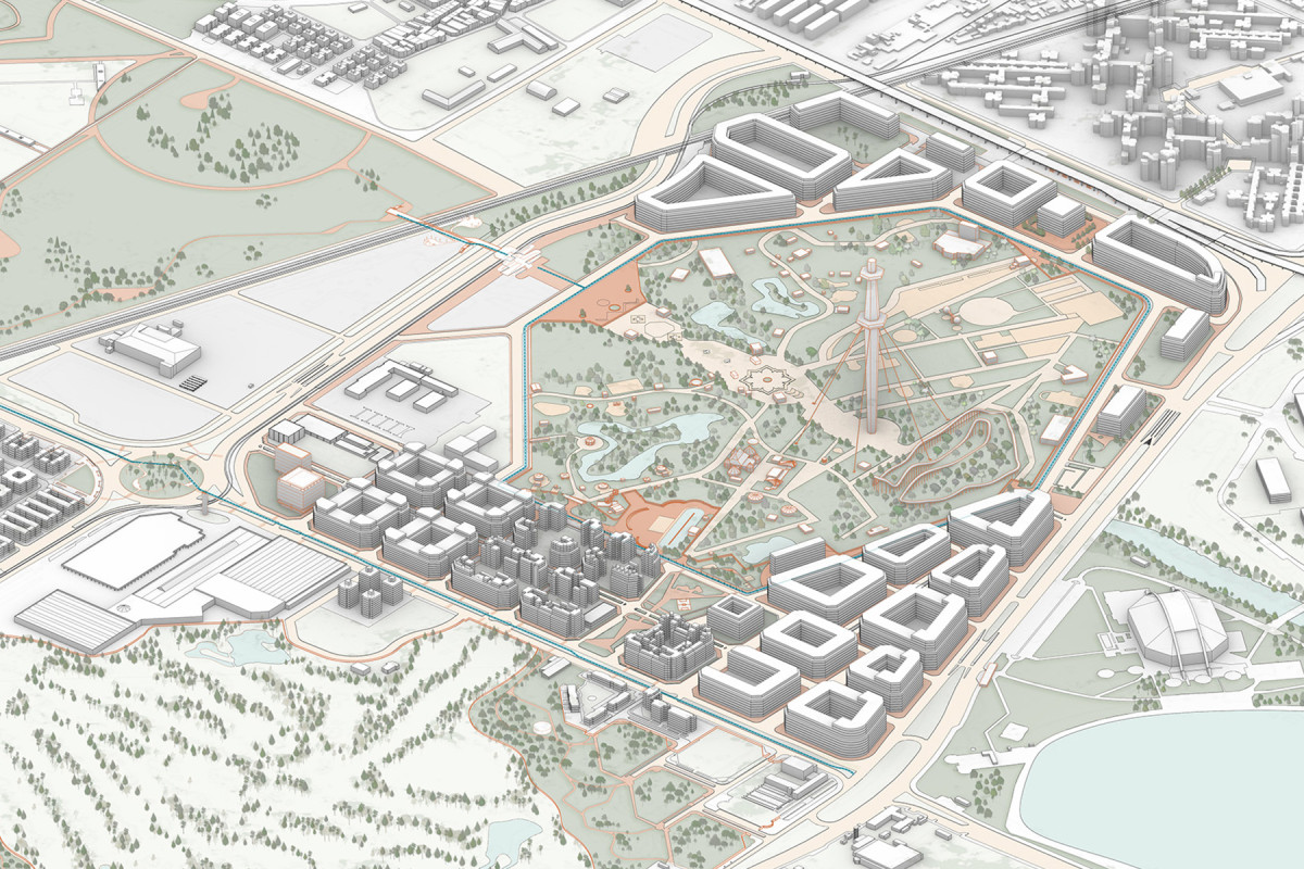
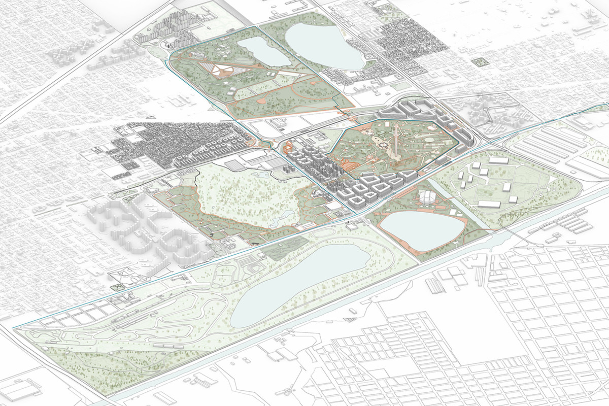
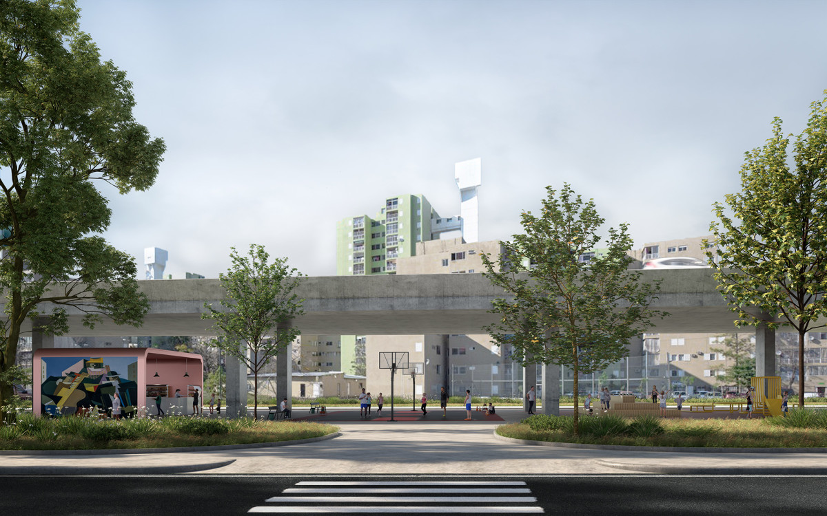
Comuna 8 hosts a vast area of green and open spaces with extraordinary potential to become a vital green lung for the Buenos Aires Metropolitan Region. However, this extensive territory of public land, currently managed by multiple stakeholders, presents significant challenges.
Low-density housing, informal settlements, and a collection of municipal neighborhoods coexist with industrial areas and large logistical complexes that serve heavy freight traffic. This is a historically underprioritized area in the urban agenda, strongly shaped by its origins as a flood-prone waste dumping site. Environmental remediation and improvements only began in the 1940s, with the channelling of the Cildáñez stream. Thirty years later, the creation of the Buenos Aires Metropolitan Area Ecological Belt (CEAMSE) initiated a process of transformation that continues today and was accelerated by the 2018 Youth Olympic Games.
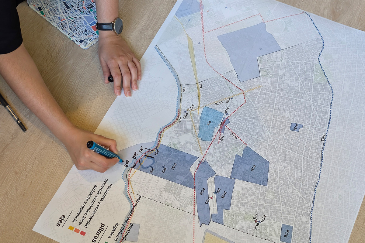
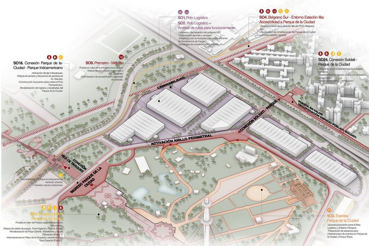
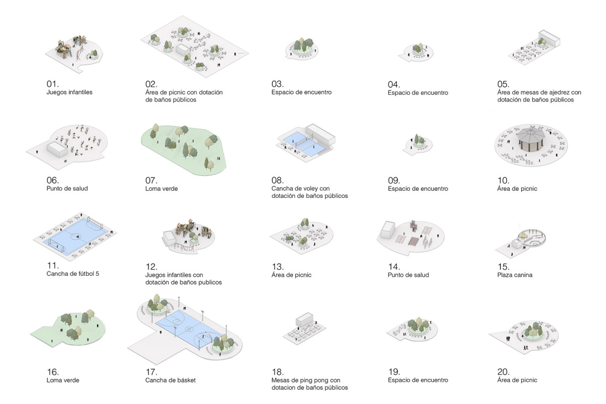
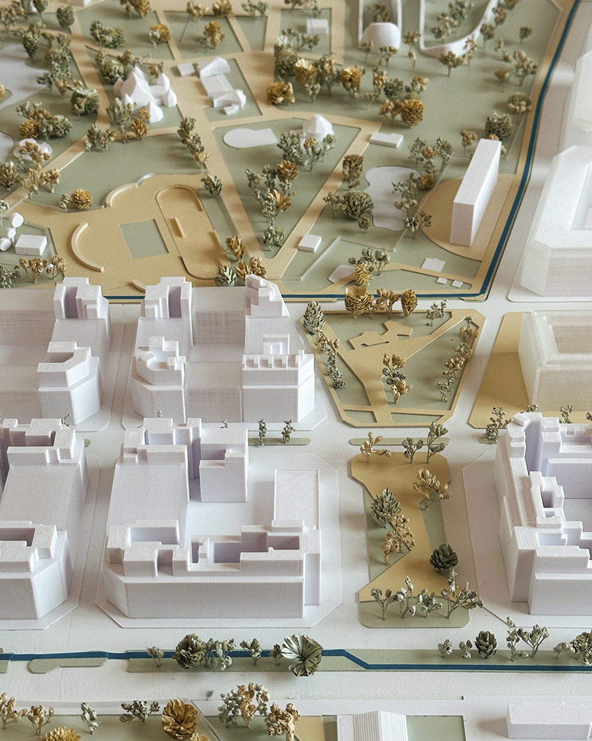
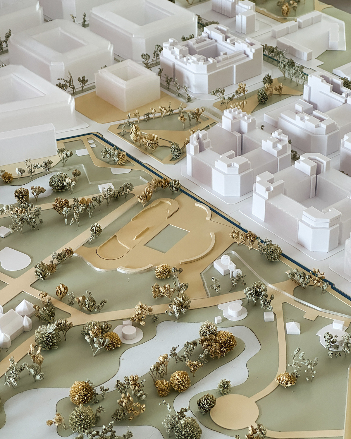
How can we efficiently and safely connect parks and green spaces that remain isolated from one another by urban barriers? How can we maintain 285 hectares of public parks? How can we strengthen the identity of lands historically associated with dumping grounds, informal occupations, and marginalization?
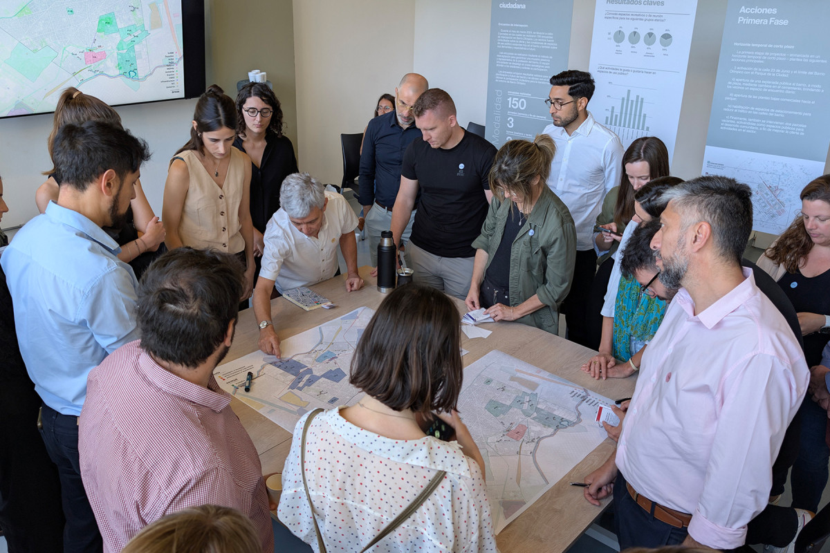
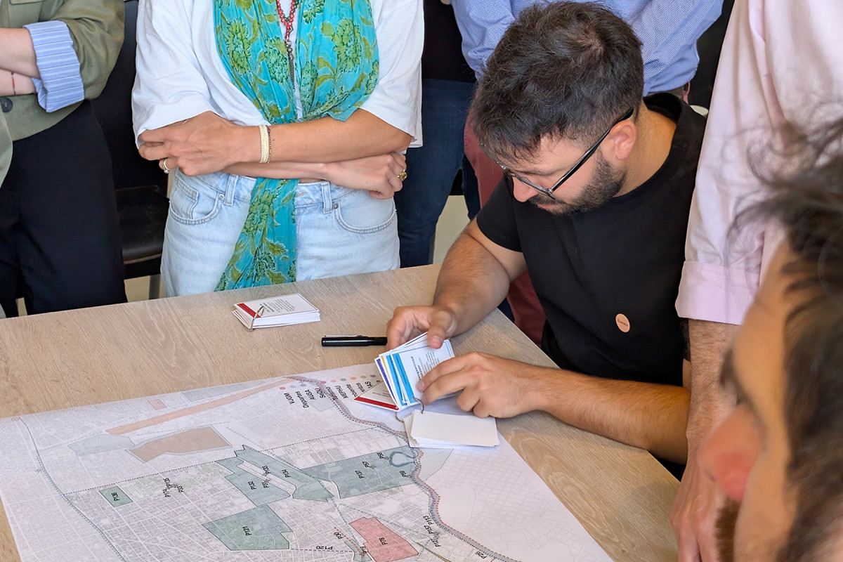
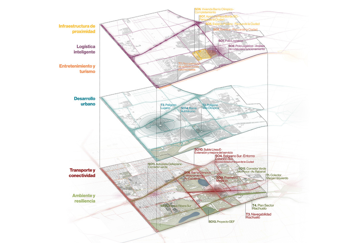
As part of the project A New Vision for the Olympic Neighborhood (CEEU 2022), the intervention was structured around four key themes—Connection, Accessibility, Activation, and Governance—to rethink these areas as a cohesive Park Network, positioning them as the city’s second green lung while enhancing their role as a Sports District.
The project is organized through four overarching strategies to consolidate the network, nine Project Units (PUs), four implementation phases, and a set of specific urban actions tailored to each phase. The proposed framework functions both as an action plan and a guiding roadmap, intended to align the commitment of various stakeholders toward the shared goal of creating a more sustainable, resilient, and inclusive city. By strengthening and adapting connectivity networks, promoting environmental adaptation, improving access and integration, activating public programming, recovering identity, and establishing appropriate governance models, the project aims to create a more cohesive and enriching urban environment for the residents of both the comuna and the city.
Phase One
Of the four proposed phases, Phase One focuses on short-term implementation and prioritizes the following key actions:
1. activating 23 de Junio Street and the edge between the Olympic Neighborhood (BO) and the City Park (PC);
2. opening a public plaza-like esplanade to the neighborhood by modifying the existing fence, providing residents with a new daily meeting space;
3. opening ground floor commercial units toward the park; and
4. enabling parking areas to reduce traffic within the neighborhood.
Finally, two vacant lots are also being transformed into public spaces for community use, expanding the range of activities offered in the area.
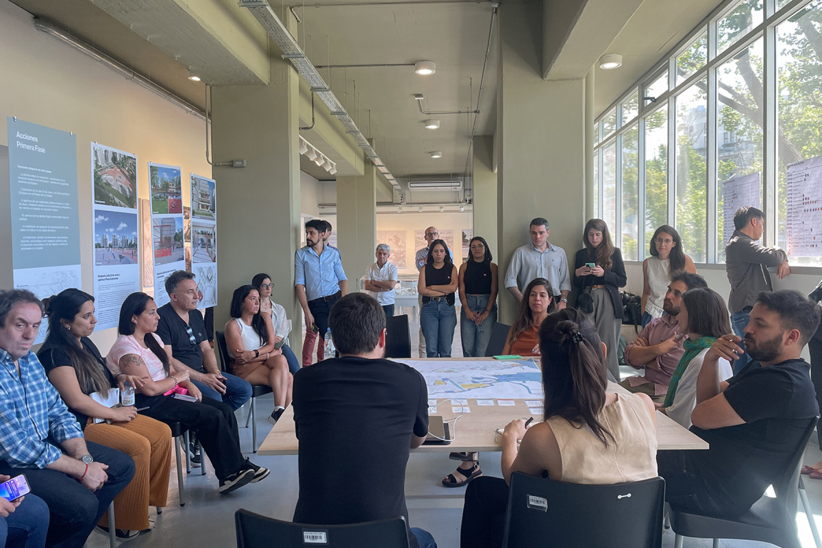
Perception Surveys
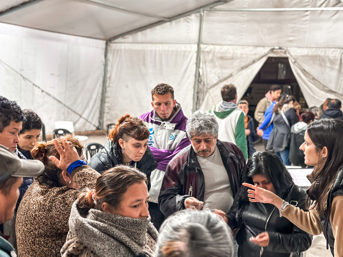
In March 2024, three survey days were held in the Olympic Neighborhood, located in the southern district of Buenos Aires. A total of 150 intercept surveys were conducted with residents, gathering their views on the current availability and condition of public spaces in the neighborhood, as well as their future expectations and needs.
Related projects
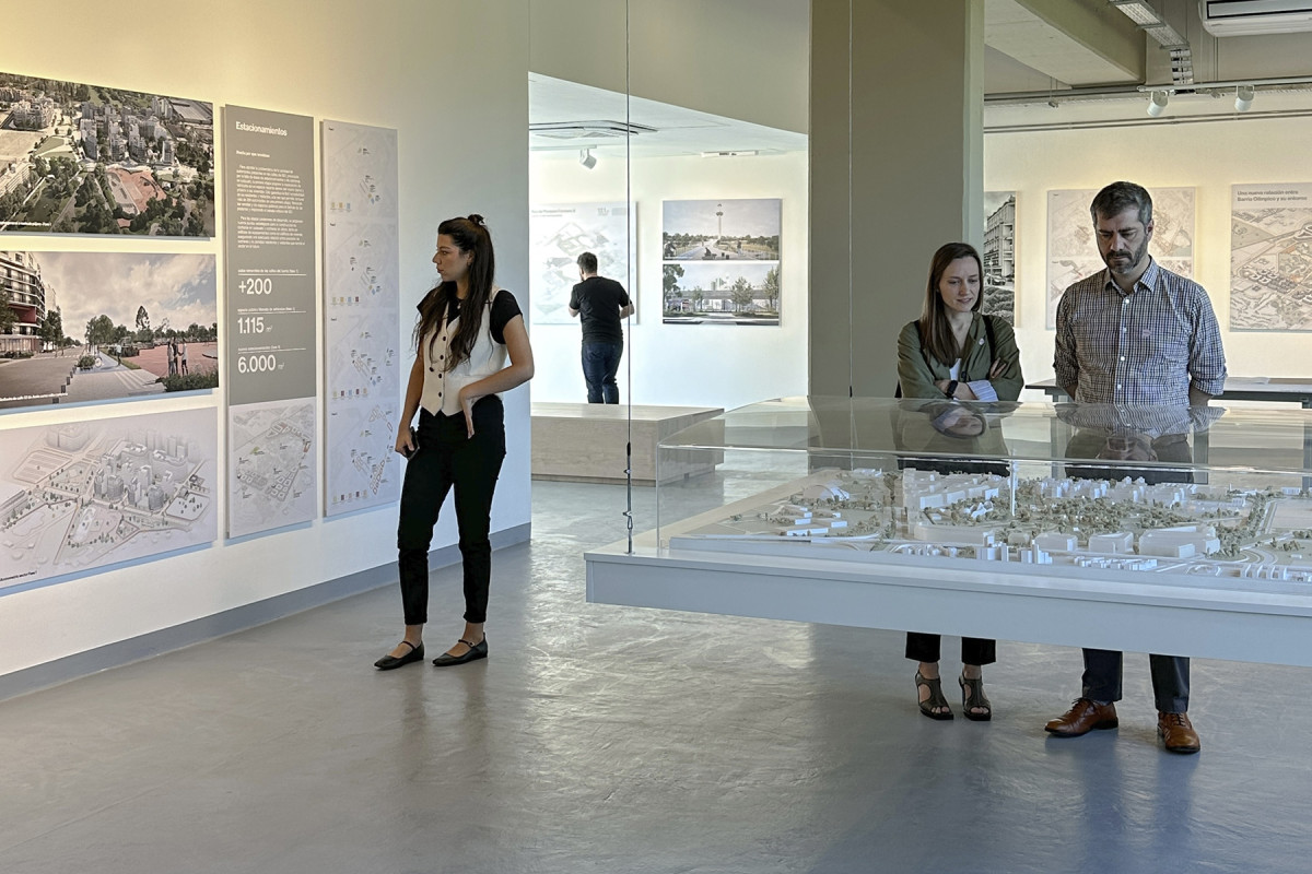
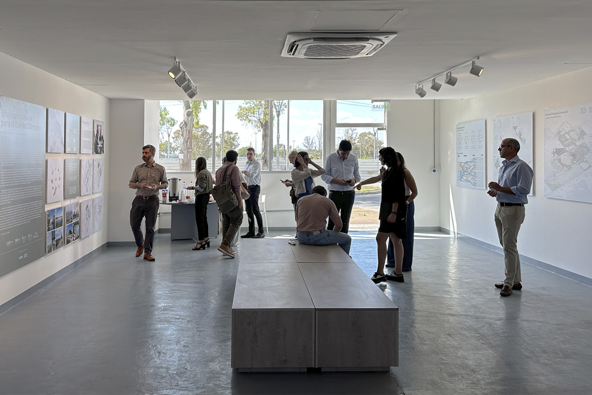
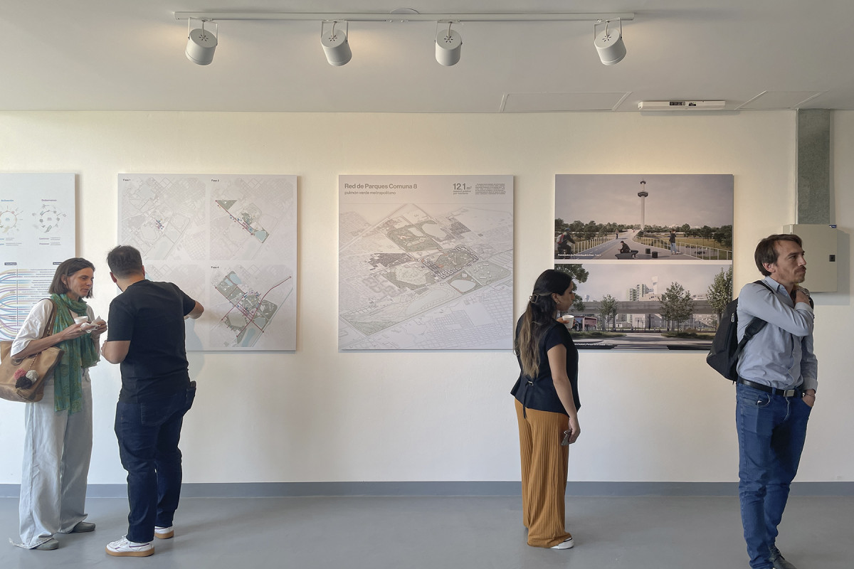
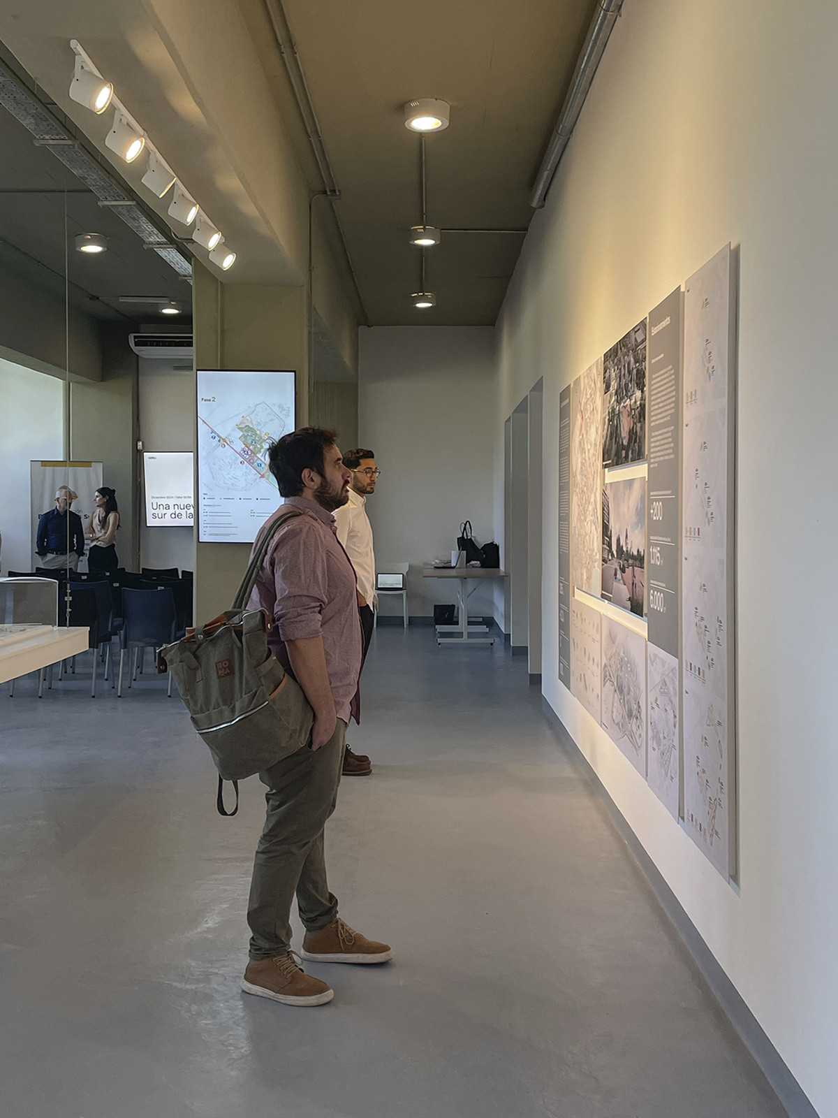
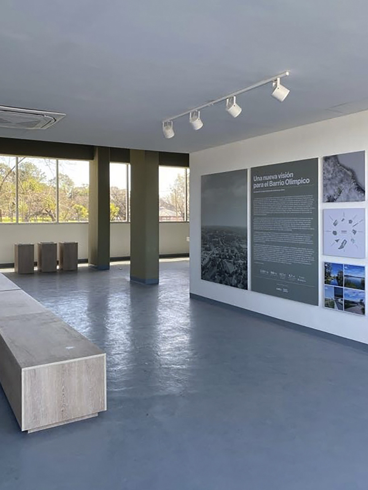
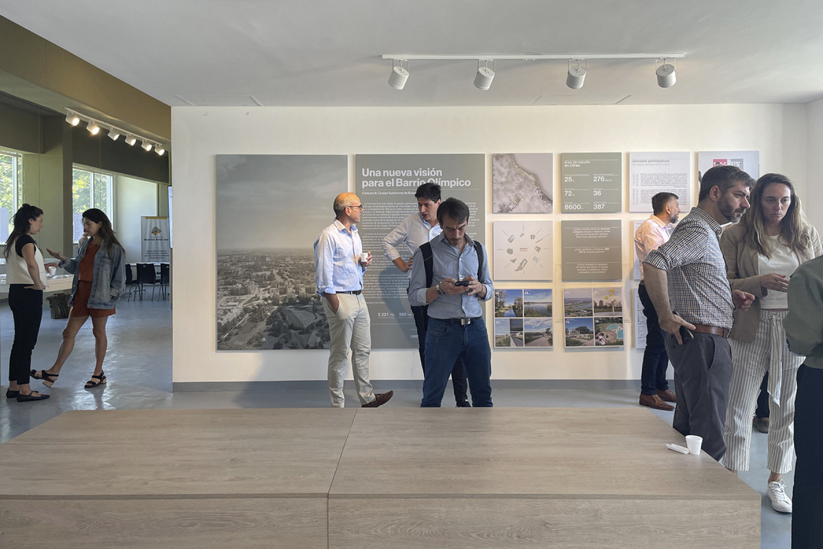
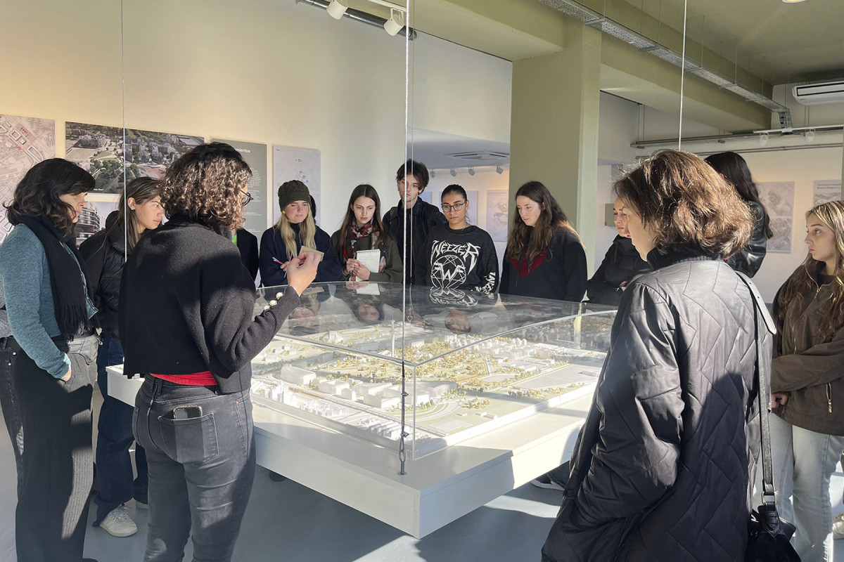
Exhibition A New Vision for the Olympic Neighborhood
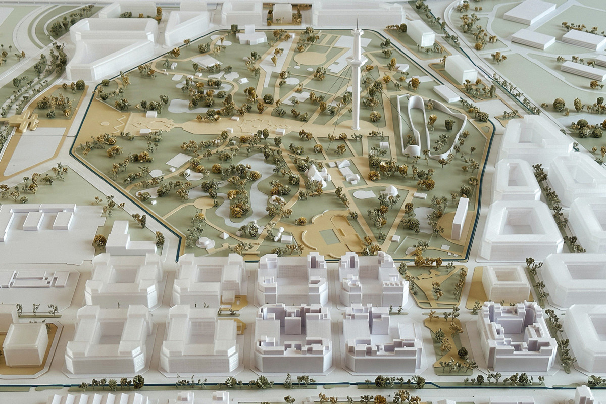
Model


Date
2024
Service
Exhibition
Status
Built
Team
Region Austral Centro de Estudios Económicos Urbanos (UNSAM)
Client
Corporación Buenos Aires Sur - Gobierno de la Ciudad de Buenos Aires
Location
Barrio Olimpico, Buenos Aires, Argentina
The exhibition aims to showcase a series of projects that reimagine the future of the Olympic Neighborhood and Commune 8, located in the southern part of Buenos Aires City. Inaugurated in August 2024, it is housed on the ground floor of a building in the Olympic Neighborhood, in CABA.
Since its opening, it has not only fulfilled its role as a space for dissemination but has also established itself as a platform to foster new dialogues and bring together key stakeholders for the transformation of the sector.
Related projects
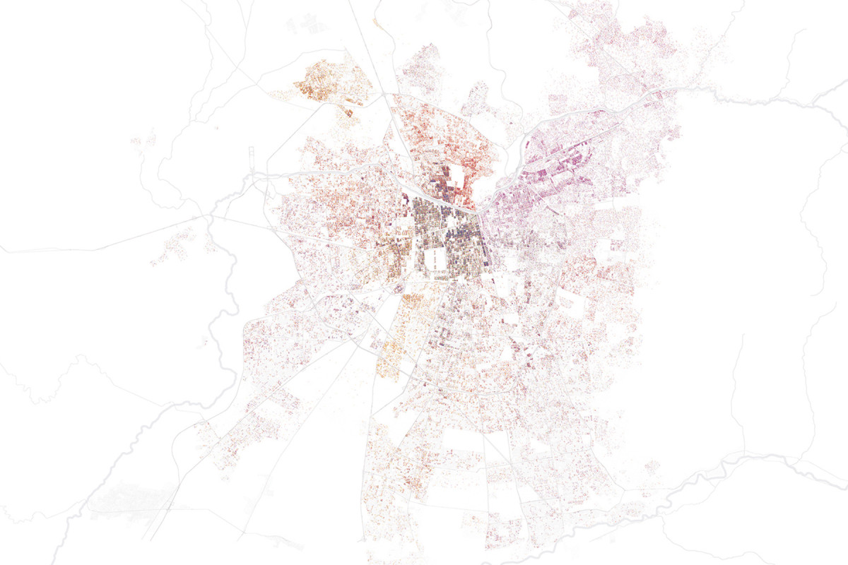
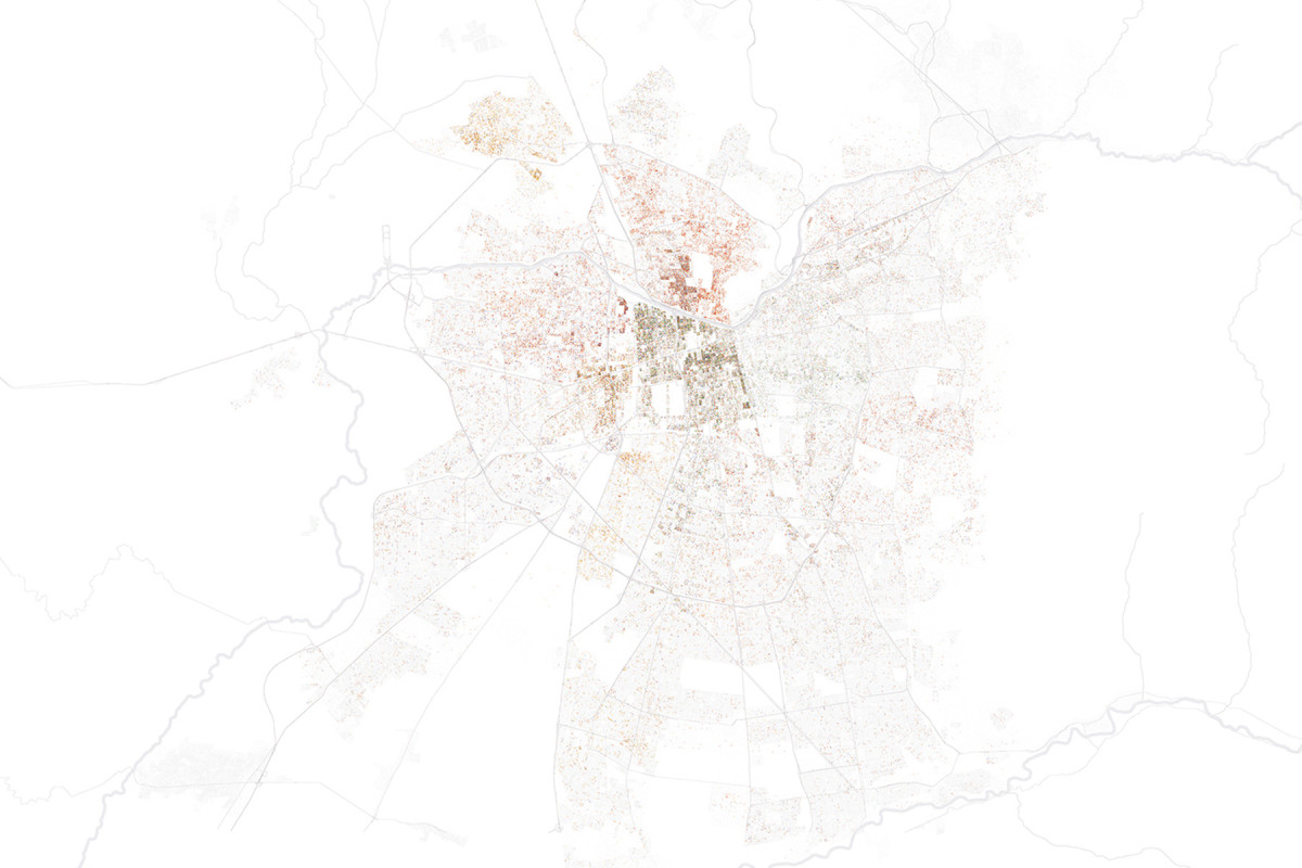
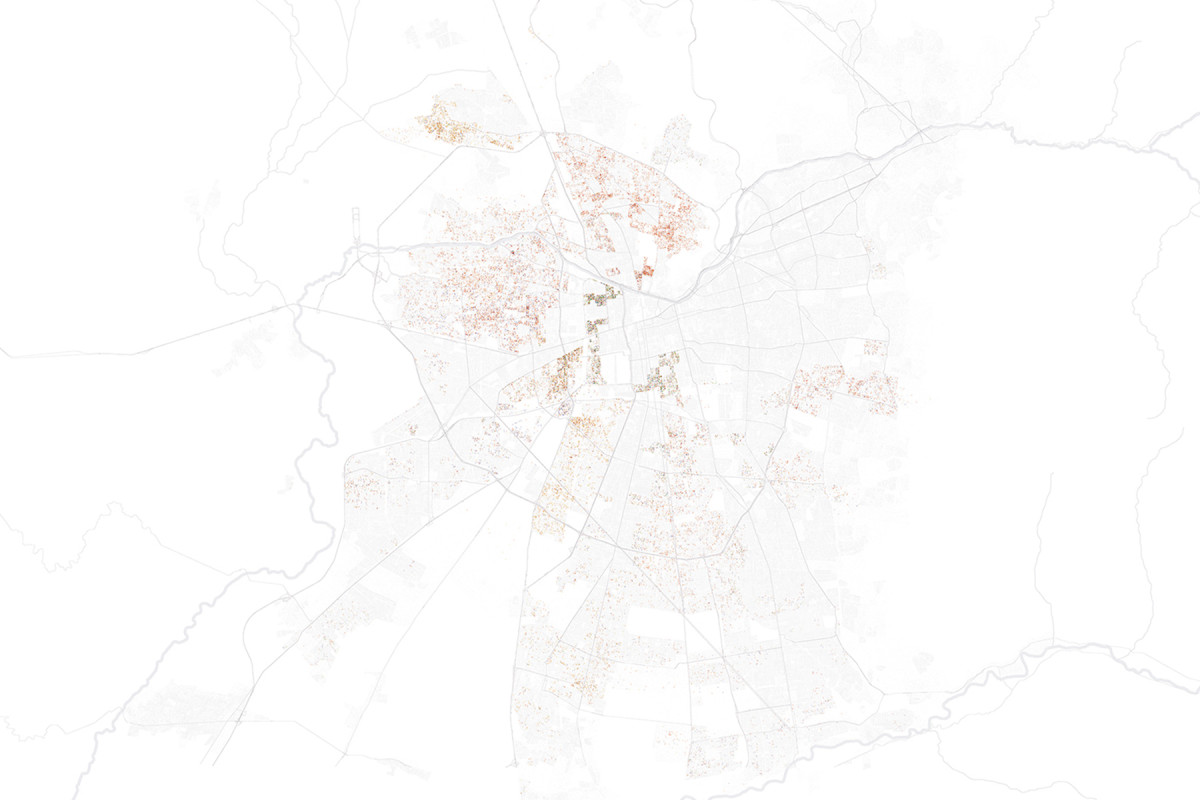
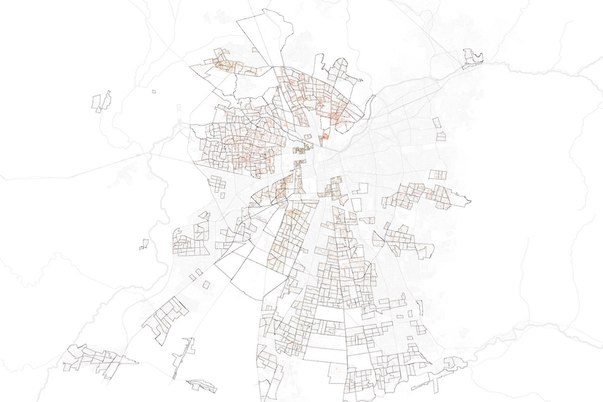
Urban Diagnosis of Sierras Chicas - Mendiolaza Sector
Sierras Chicas Assessment | Electricity and Gas

Sierras Chicas Assessment | Cultural, Sports, and Service Facilities
Sierras Chicas Assessment | Accessibility and Health Facilities
Sierras Chicas Assessment | Urban Land Value

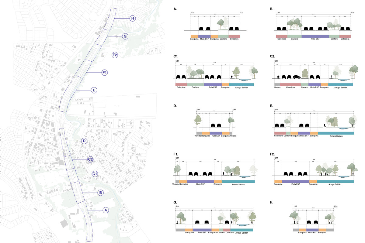
Current section status of Route E57
Date
2023
Service
PlanningUrban design
Status
Project
Team
Región Austral
Client
Private
Location
Mendiolaza, Sierras Chicas de Cordoba, Argentina
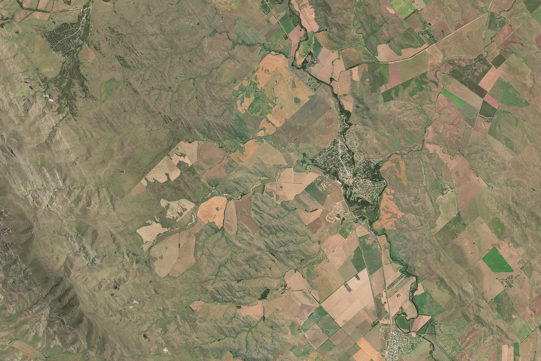
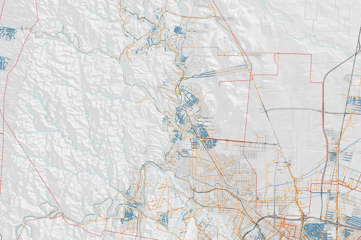
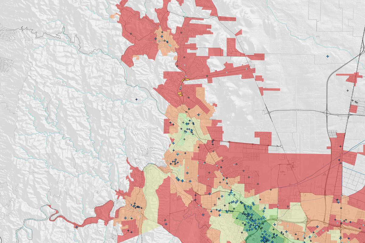
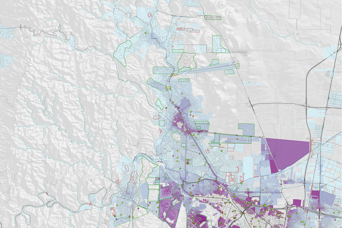
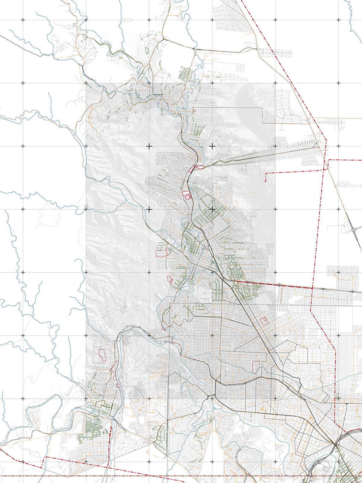
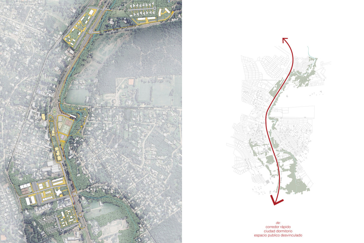
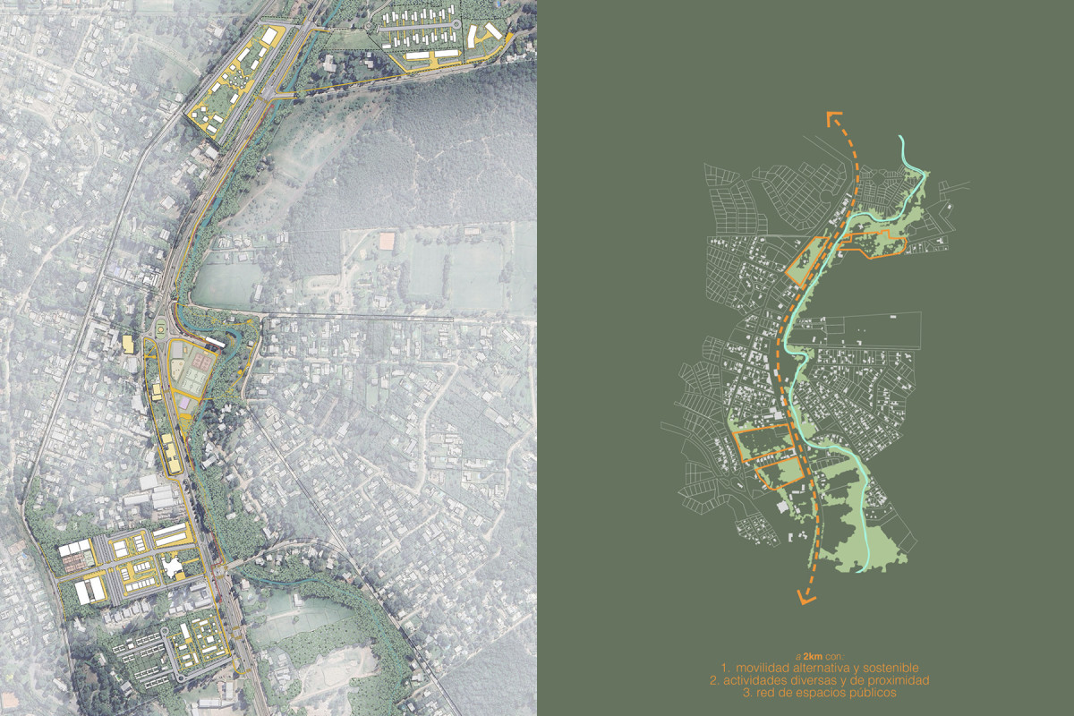
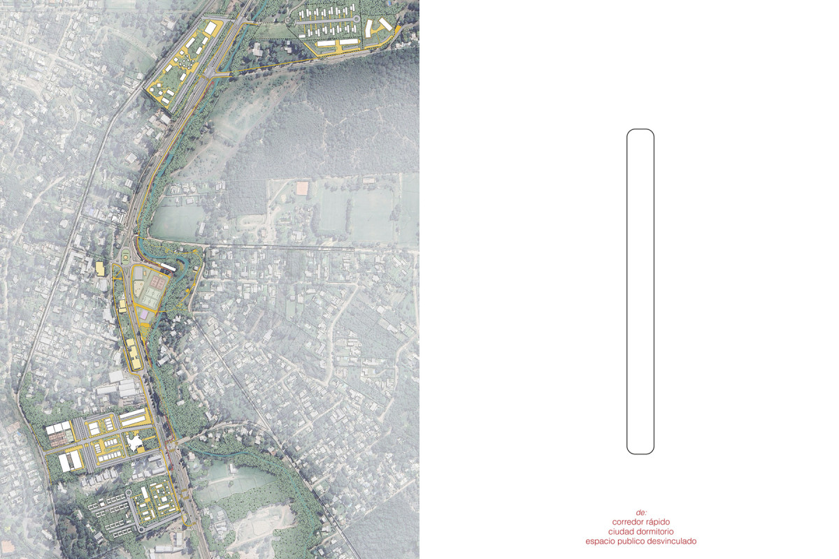
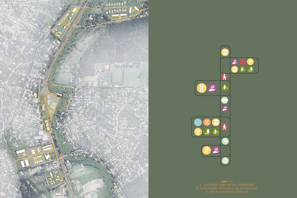
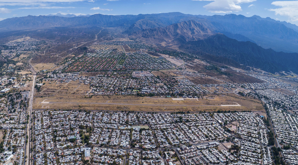
The Sierras Chicas Valley is an urban system whose main expression is the conurbation between the city of Córdoba and the various towns that have developed along the valley, connected by two main road corridors: provincial routes E57 and E53. This work focuses on the urban analysis of the southern portion of the Valley, which spans – from south to north – the northwest urban edge of Córdoba and the urban areas of La Calera, Saldán, Villa Allende, Mendiolaza, Unquillo, and Río Ceballos.
The aim is to gain a comprehensive understanding of the urban situation in the area. In a second scale of study, attention is given to the town of Mendiolaza, to better understand its issues, advantages, opportunities, and challenges, which should be considered for the subsequent programmatic proposal and urban design of the section of provincial route E53 and the adjacent lots that run through the center of the town.
The diagnostic analysis consists of maps, infographics, and data providing information on various topics: demographics, vehicular and pedestrian mobility, transport routes, land value and residential developments, amenities (cultural, educational, sports, health, and services), and accessibility to them; environment (flood risks, fires, types of vegetation, etc.), available infrastructure and services (water, gas, sewage, electricity), land use, current regulations, and existing plans.
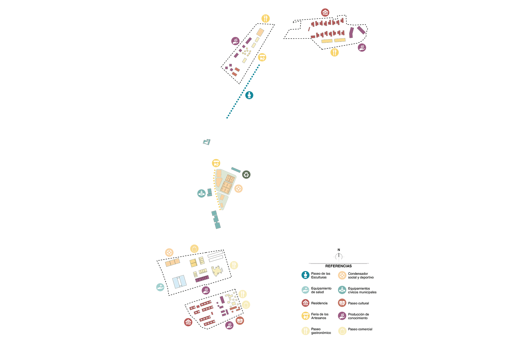
The conclusions, challenges, and opportunities identified in this first diagnostic phase served as input for defining four strategic interventions in the Mendiolaza section. These areas aim to address the challenges of the region and capitalize on the potential of a sector with high urban and environmental value, proposing a set of programs and services deemed appropriate with a projection for positive local impact.
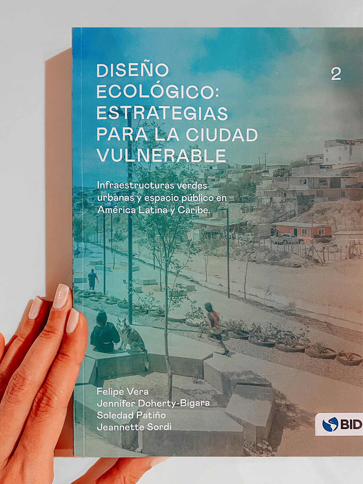
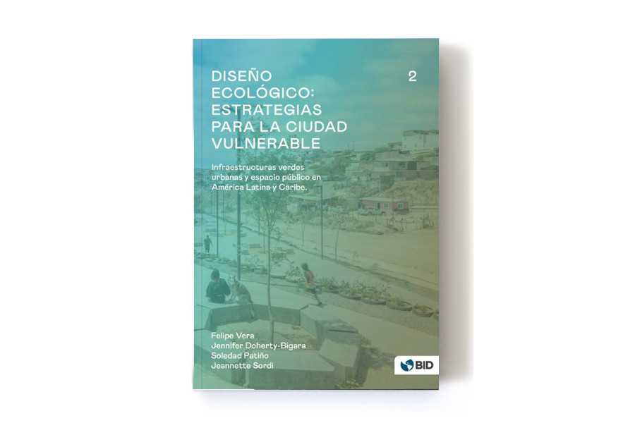
Ecological Design 2: Strategies for the Vulnerable City


Date
2022
Service
Urban designPublicationResearch
Status
Published
Team
Felipe VeraJennifer Doherty-BigaraSoledad PatiñoJeannette Sordi
Client
Inter-American Development Bank
Location
Buenos Aires, Argentina
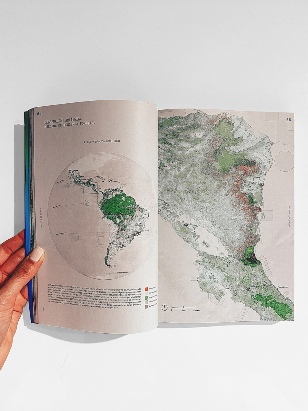
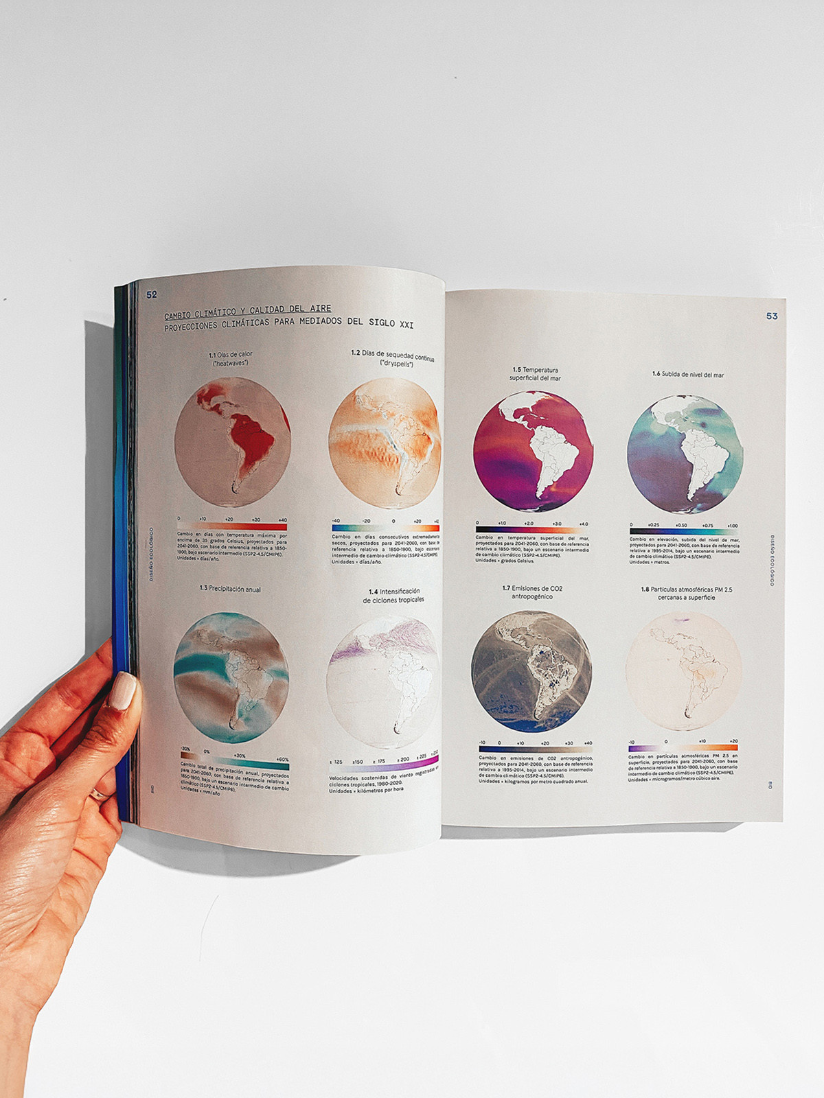
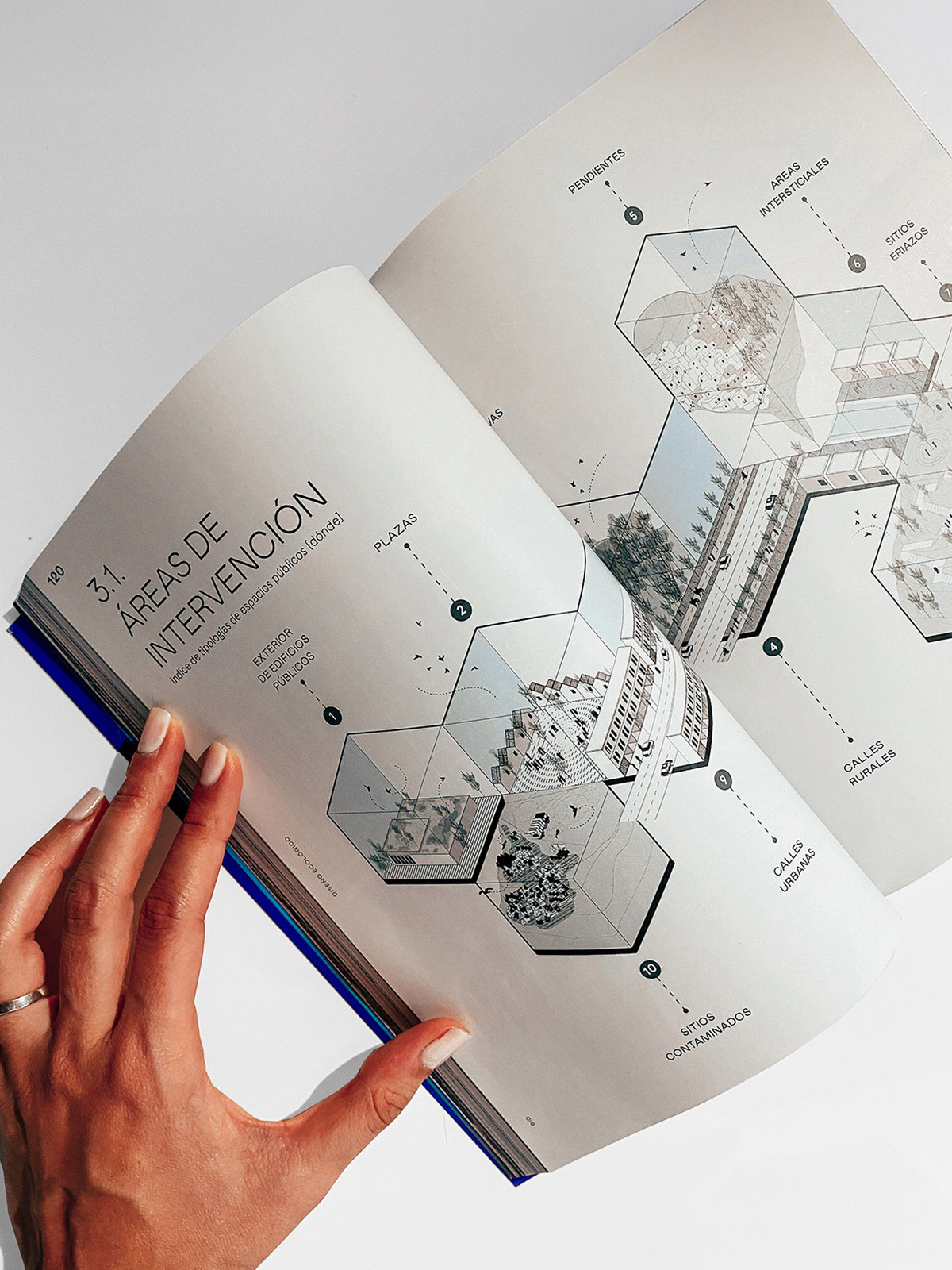
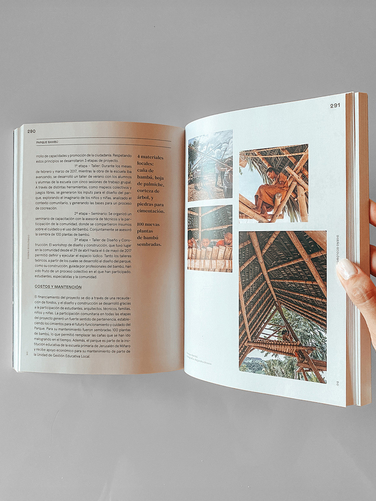
The second volume of the series Ecological Design: Strategies for the Vulnerable, presents a report on urban and national policies, strategies and case studies to enhance public space and territory in the most vulnerable urban areas of Latin America and the Caribbean through green infrastructure and nature-based solutions. These interventions offer multiple advantages to improve the quality of public space and increase the urban resilience of the most vulnerable settlements.
This volume, Urban Green Infrastructure and Public Space in Latin America and the Caribbean, highlights the social, economic and environmental advantages of intervening in public space through nature, outlining a series of criteria and implementation strategies. Thirty public space and green infrastructure projects developed in Latin America and the Caribbean in the last twenty years, distributed in diverse biogeographic regions and inserted in very dissimilar contexts, are presented, analyzing the conditions of these environments, their main risks and background of the projects, the solutions adopted, the construction and implementation processes, the environmental and social benefits provided, and their evolution over time.
Download the full version of the book here.
Related projects

Centre of Innovation in Sustainable Agriculture

Date
2022
Service
LandscapeArchitecture
Status
Under construction
Team
Región AustralAFT Arquitectos
Client
YPF – MINCyT – CONICET
Location
Mercedes, Buenos Aires, Argentina
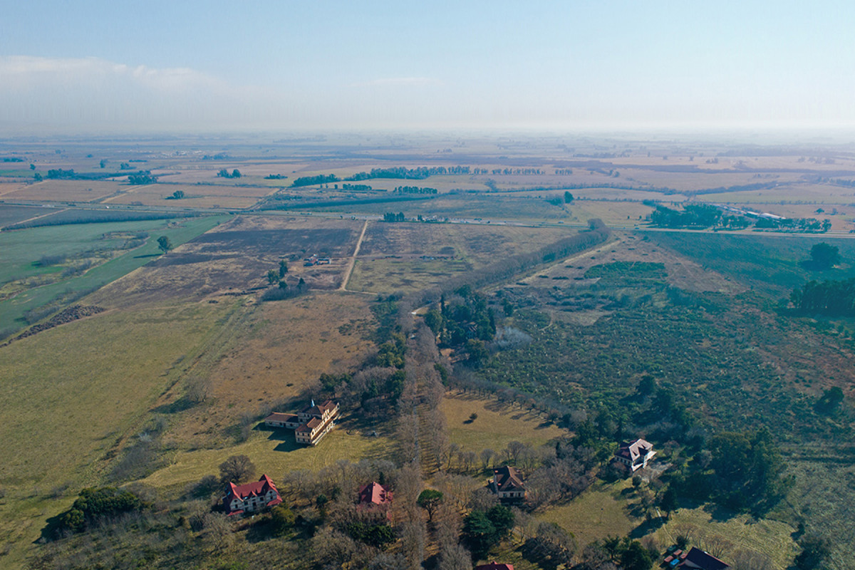
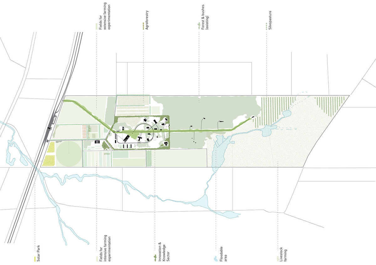
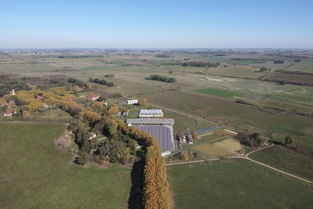
In the face of climate change and global population growth, ensuring access to food by improving productivity and efficiency is of vital importance. The Humid Pampa region—Argentina’s productive core—can rise to this challenge and become a leading territory for envisioning the sustainable development of agriculture in the region.
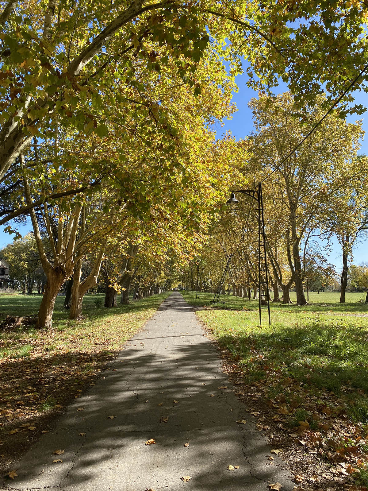
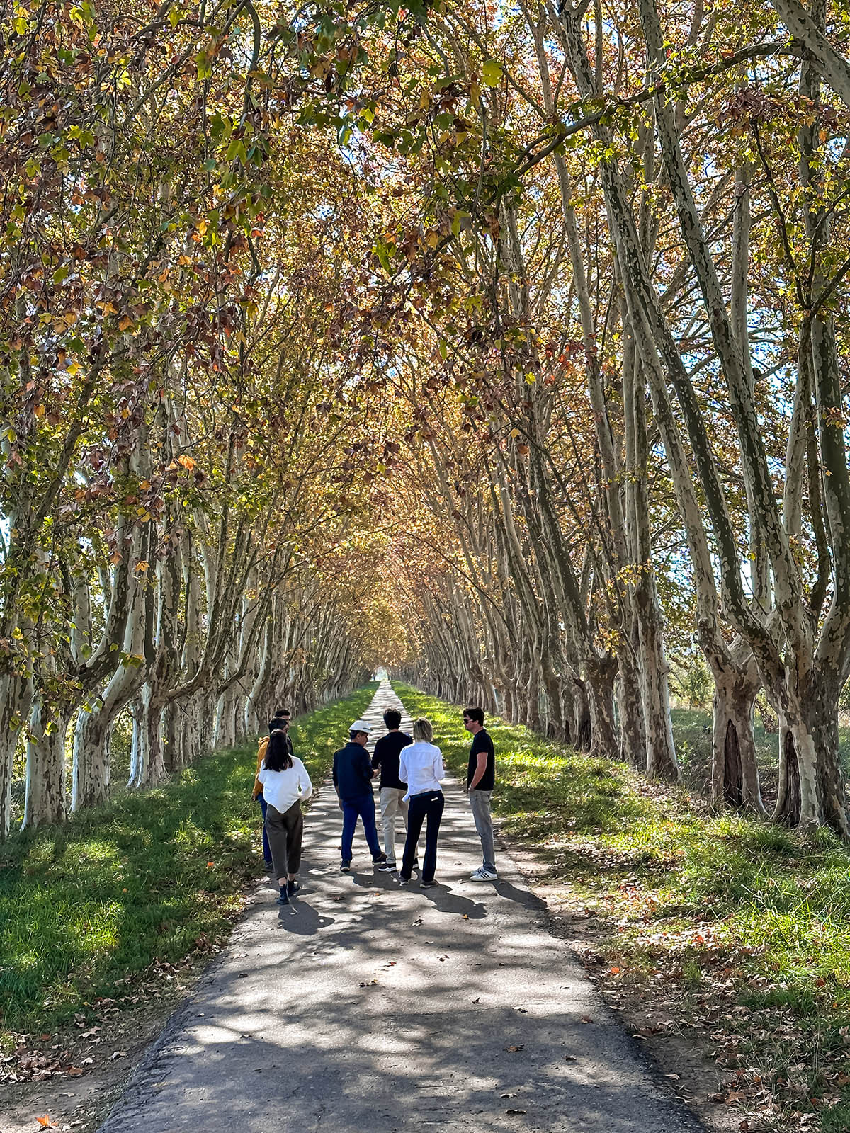
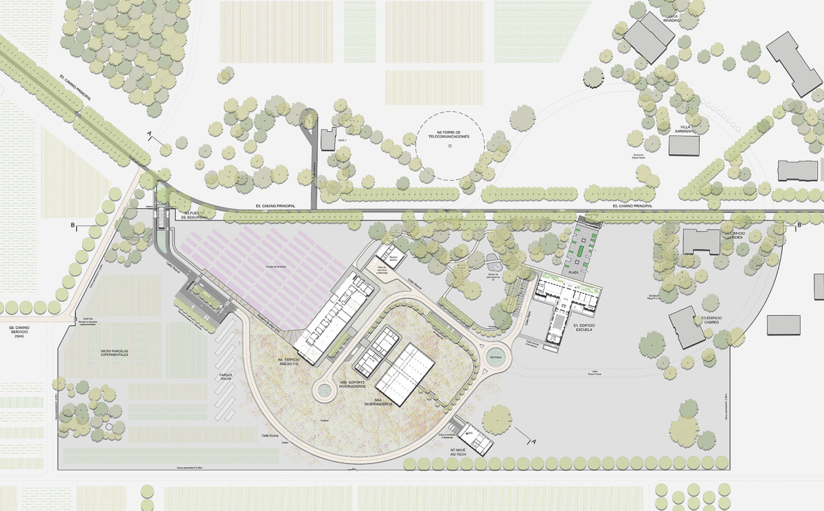
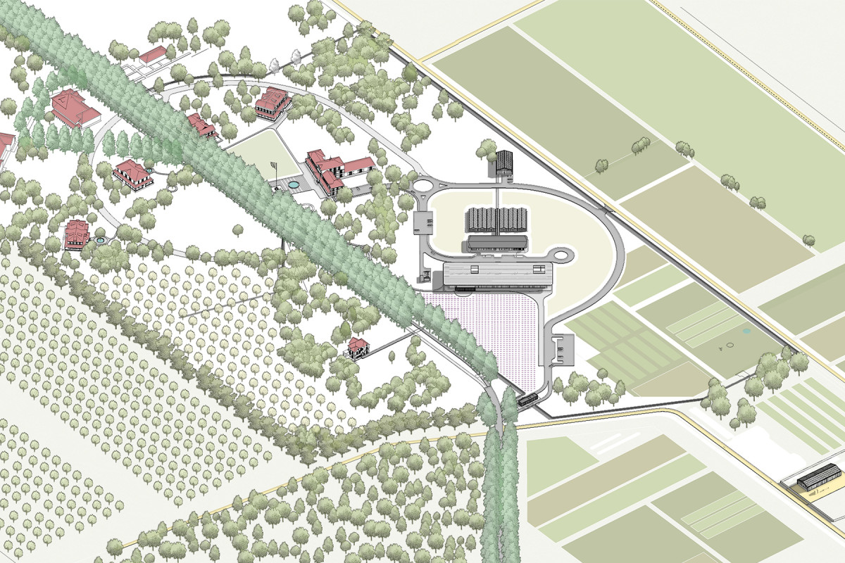
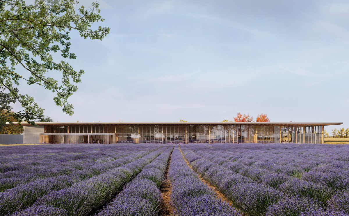
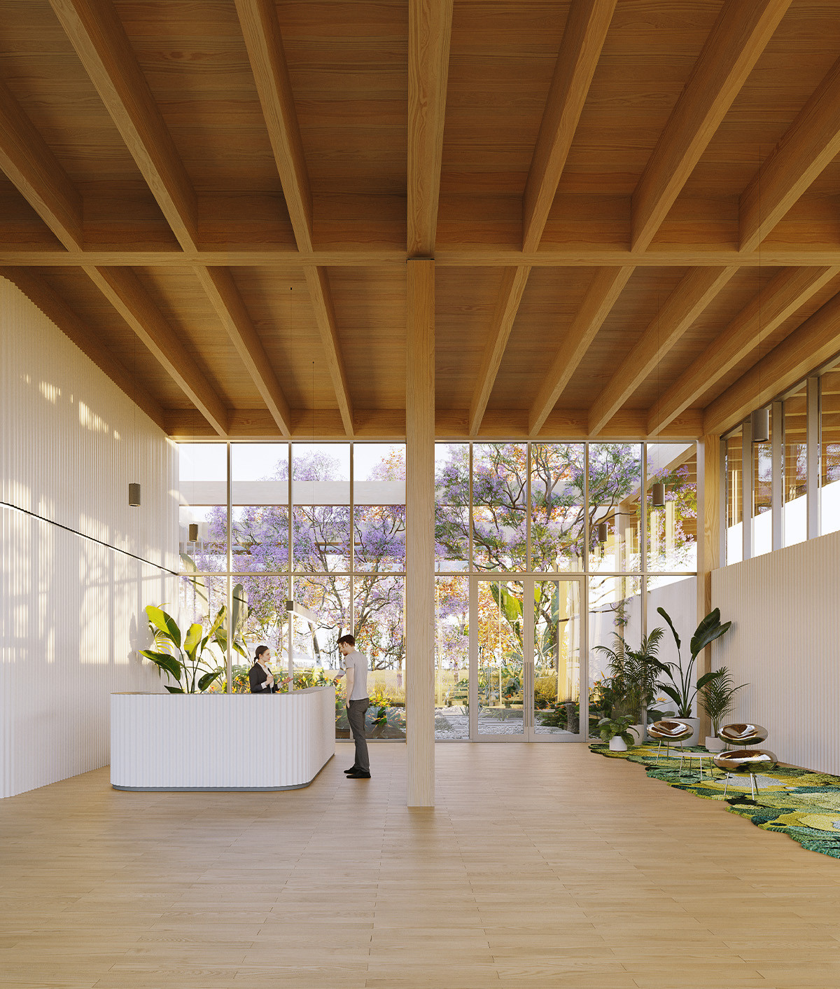
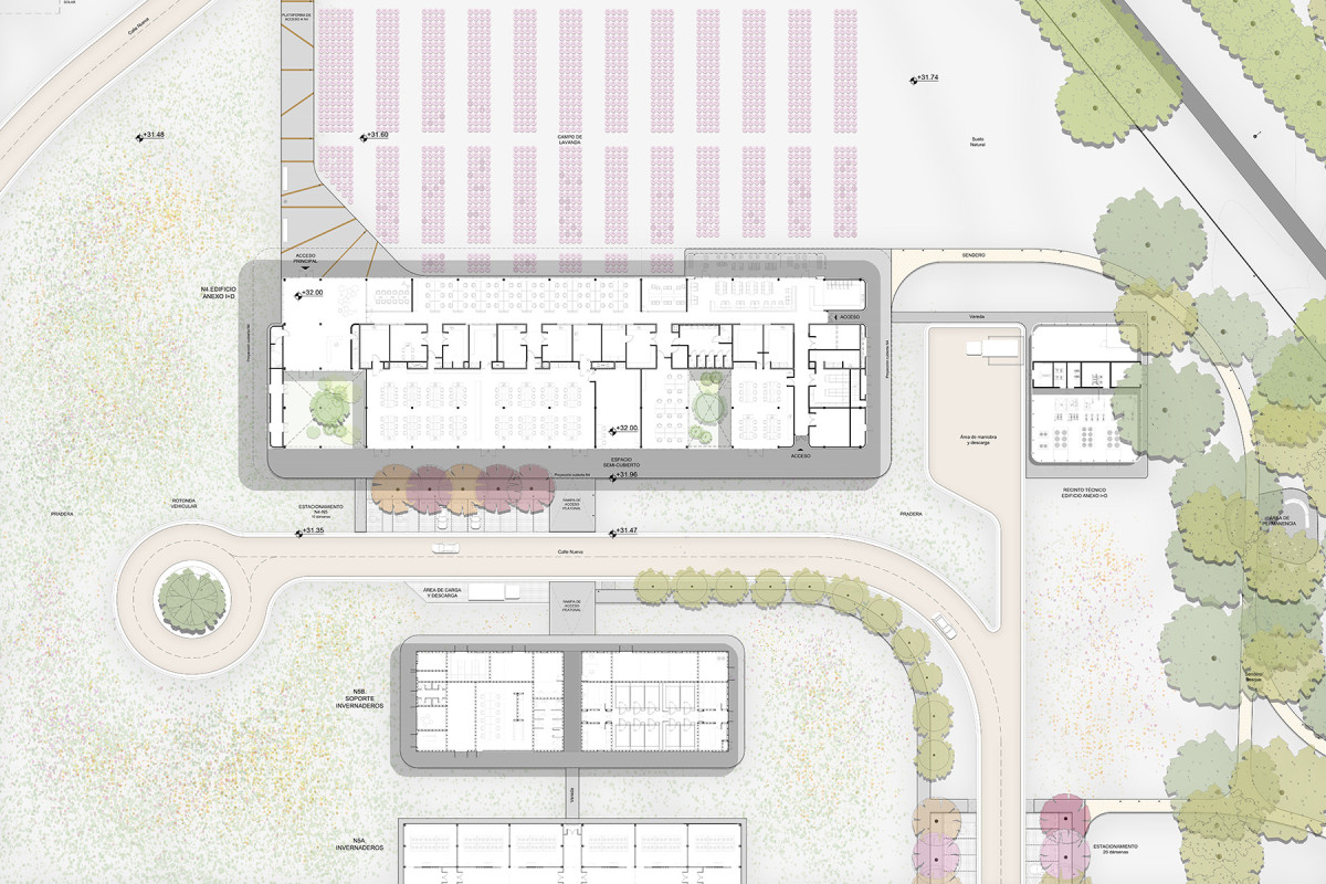
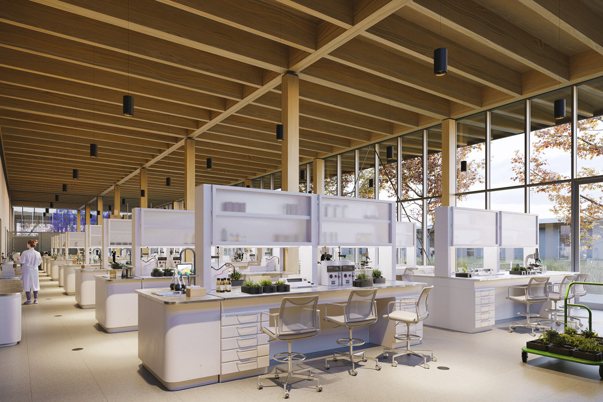
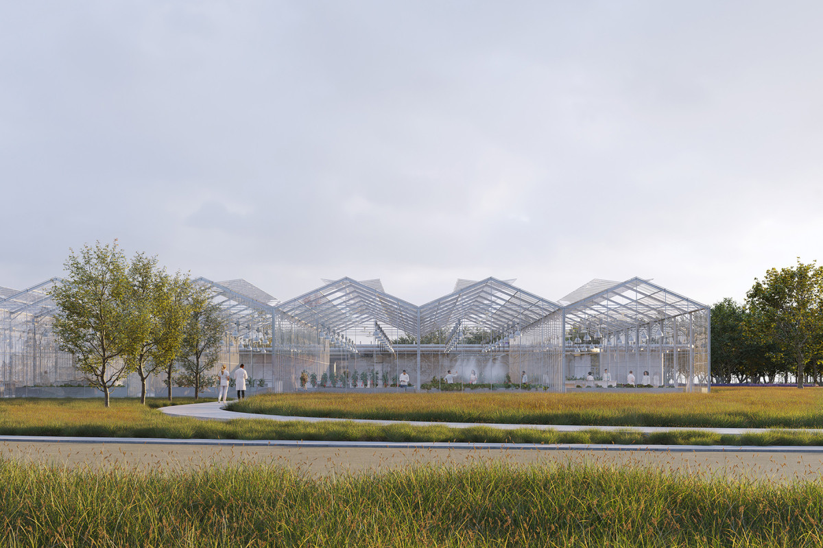
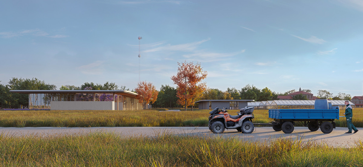
The Centre of Innovation in Sustainable Agriculture (CISA) is located in Mercedes, Buenos Aires Province, within a flat and extremely fertile landscape marked by a clearly defined horizon line. Conceived as a state-promoted technological hub for innovation, CISA acknowledges agriculture as one of the country’s main economic activities and aims to strengthen it through applied research.
The project spans 132 hectares and combines an ecological land-use strategy with cutting-edge technology, experimental fields, and scientific research areas. The Masterplan transforms a previously abandoned heritage property into a campus for technology and innovation, repurposing historical buildings and preserving existing vegetation to safeguard the site’s ecosystem services. Research through experimentation takes place in open fields and in a newly built laboratory constructed entirely using glued laminated timber technology. Additional infrastructure includes greenhouses and support facilities for agriculture.
This regional hub sets a precedent in applied research and agricultural transformation, offering a significant contribution to Argentina’s productive development in response to the challenges of climate change and the urgent need to ensure food security.
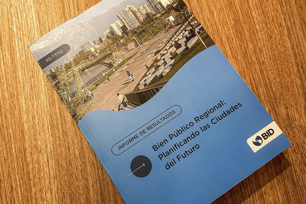
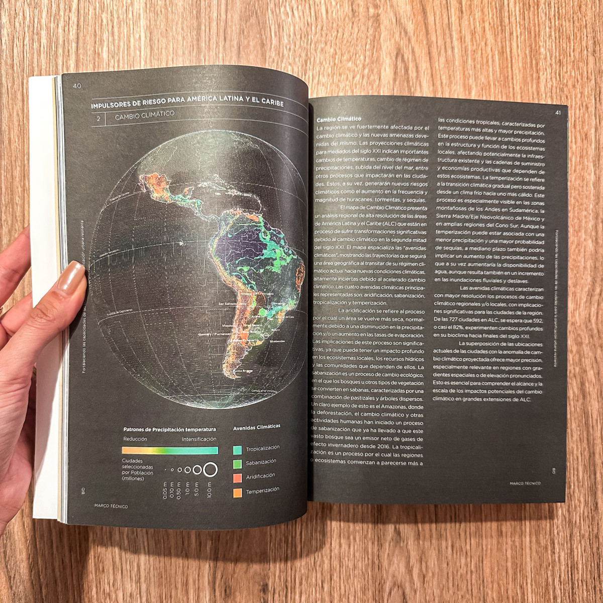
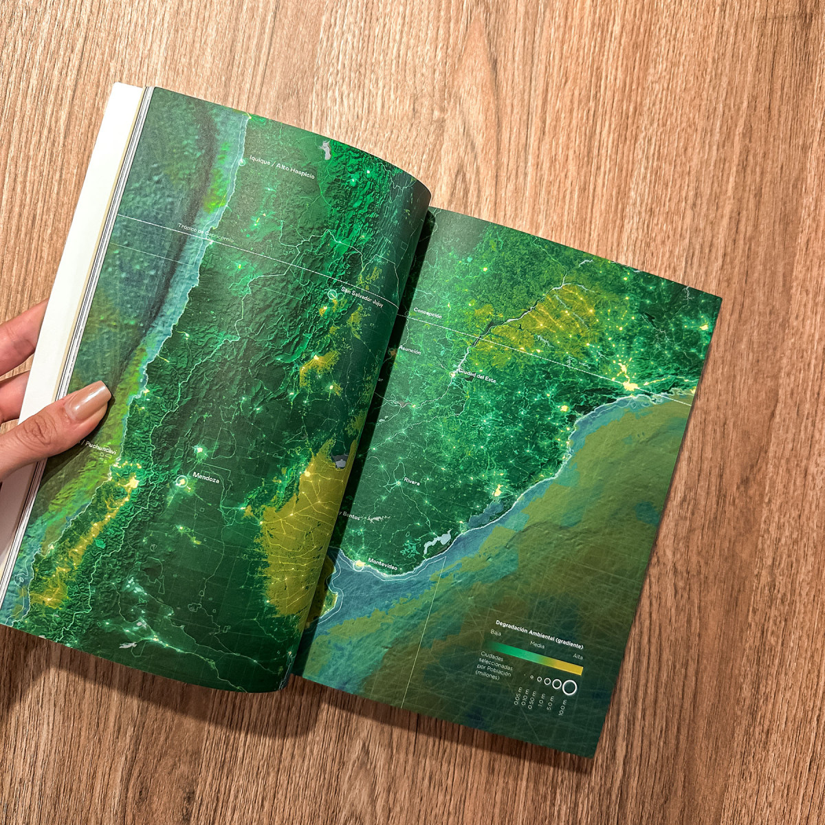
Regional Public Good: Planning the Cities of the Future

Date
2021-2023
Service
PlanningPublication
Status
Published
Team
Felipe VeraFernando ToroPedro HojasJame RobinsonSoledad PatiñoSantiago Aurelio Mota Isabella Martínez
Client
Inter-American Development Bank
Location
-
Strengthening Cities' Capacities for Resilient Urban Planning is a program led by the Inter-American Development Bank (IDB) in Southern Cone cities. Drawing from international agendas, it supports local governments in equipping both decision-makers and communities with the tools needed to enhance resilience in the face of today’s growing climate challenges.
The program included technical training for officials from 16 municipalities in Argentina, Chile, Paraguay, and Uruguay, and fostered the creation of a regional community of practice aimed at reflection, peer learning, and local risk management.
The report Regional Public Good: Planning the Cities of the Future compiles the results and insights gained through months of collaboration with participating municipalities, along with key content on advancing urban resilience in Latin American cities.
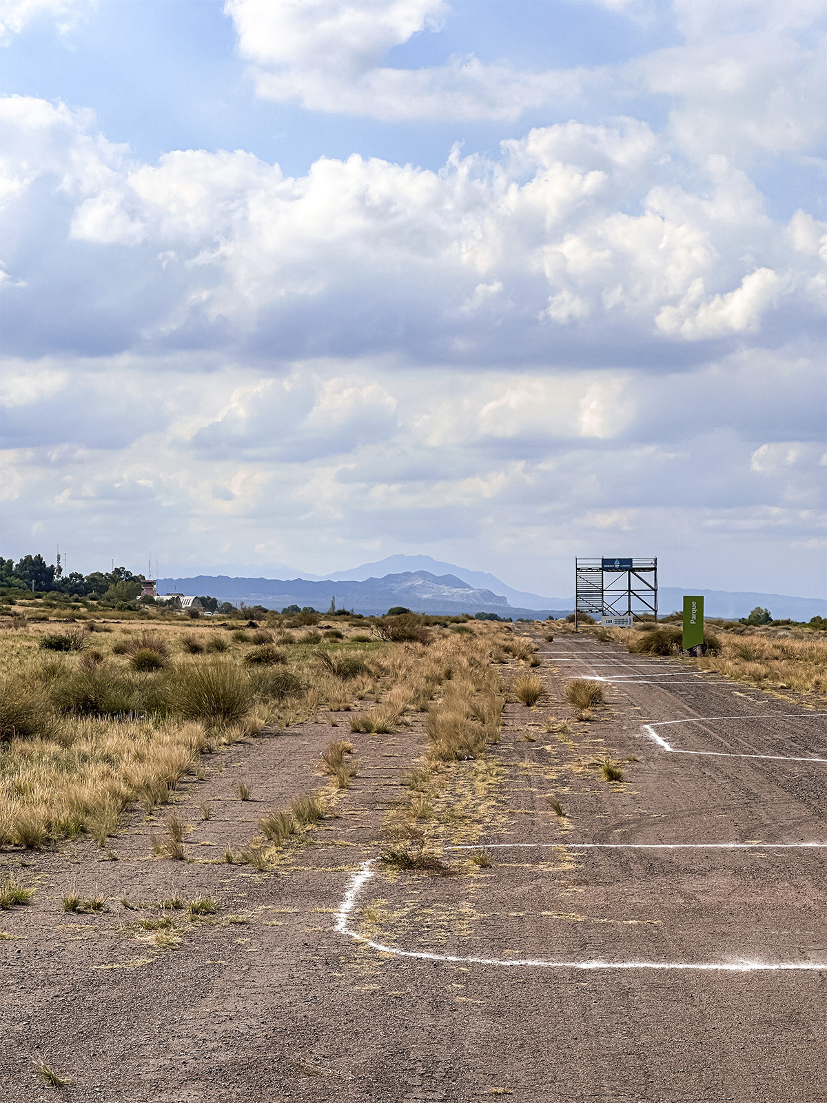
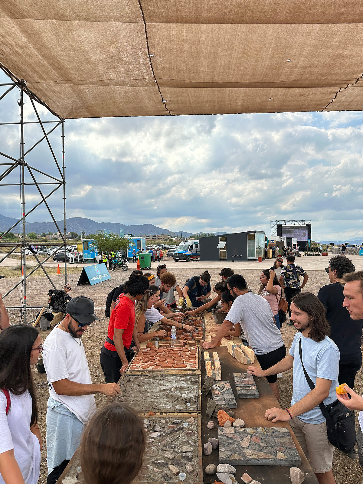
Urban Lab Mendoza 2030
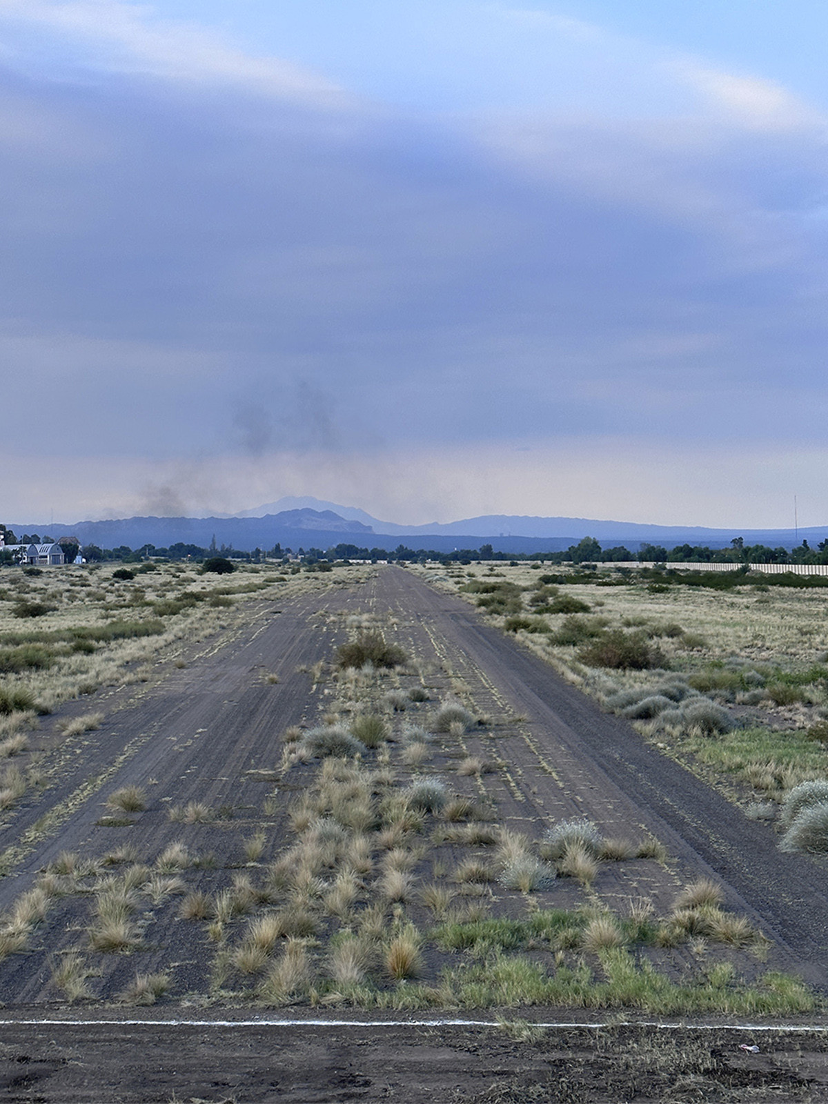
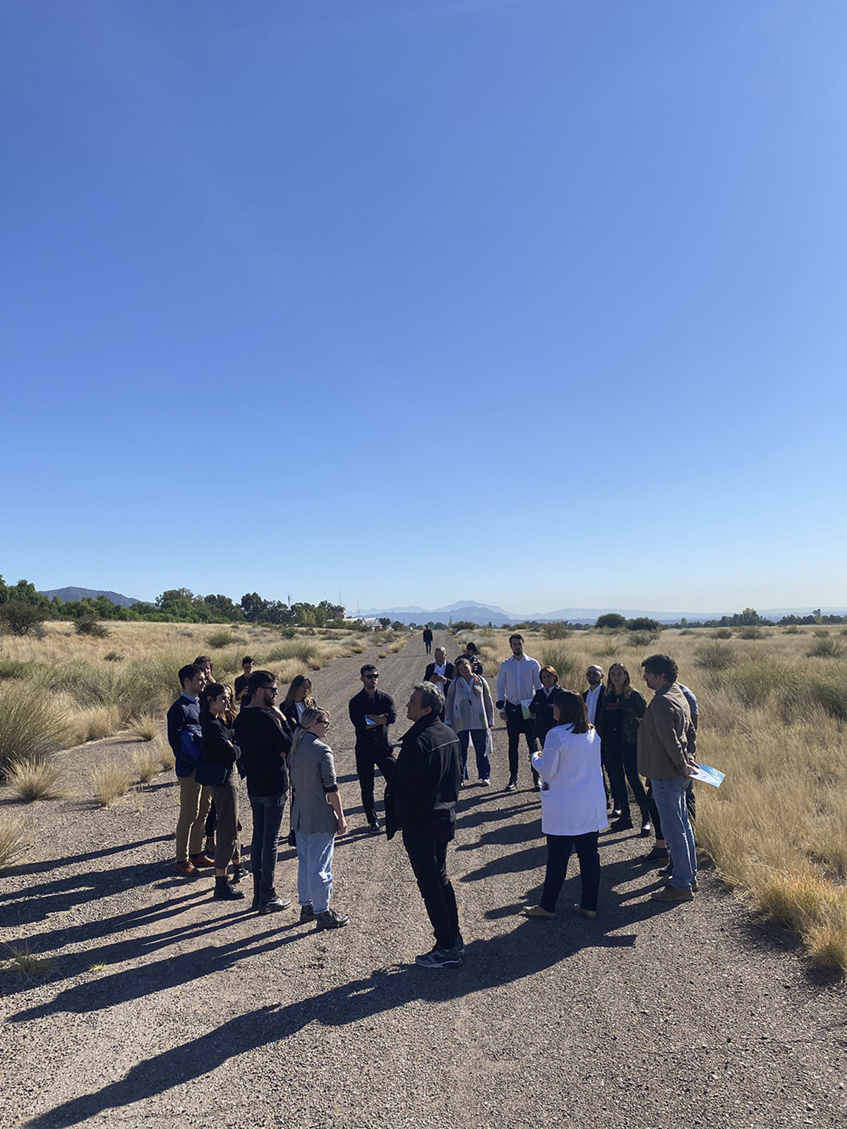
Former Airport Refunctionalization
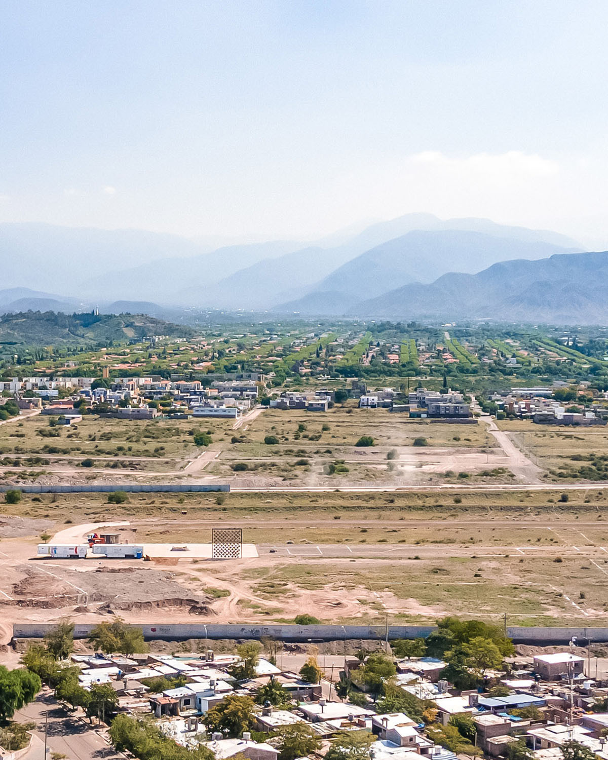
Photo: Luis Abba

Aeropuertos en el mundo hoy
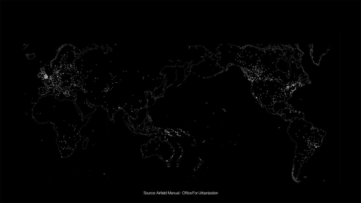
Abandoned / Obsolete Airports

Airports as an Oppportunity

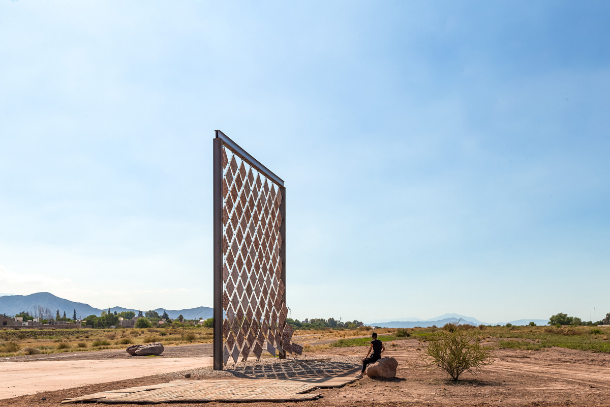
Installation: Solano Benítez / Photo: Luis Abba
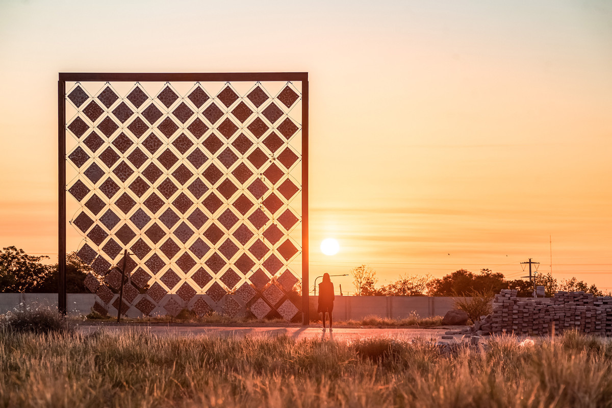
Installation: Solano Benítez / Photo: Luis Abba

Installation: Solano Benítez / Photo: Luis Abba
Date
2022
Service
PlanningUrban designArchitecture
Status
Under construction
Team
Felipe VeraSoledad PatiñoStefano Romagnoli Matías LinceSolano BenitezEquipos consultores
Client
Inter-American Development Bank + Provincial Government of Mendoza
Location
Mendoza, Argentina
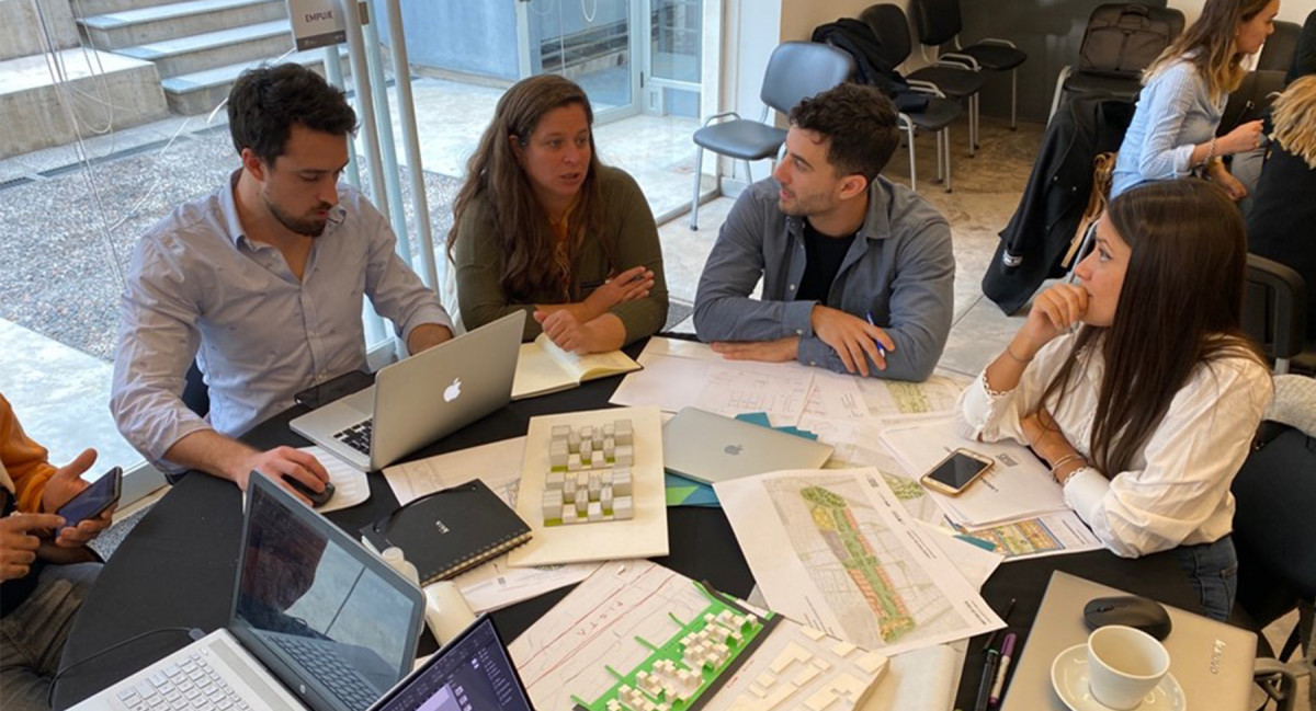
The urban redevelopment project of the former Aeroparque site in Mendoza involves the transformation of an abandoned airport. The initiative stems from the collaboration between the Inter-American Development Bank (IDB) and the Office for Urbanization at Harvard Graduate School of Design, with the participation of provincial and municipal technical teams.
This piece of urban infrastructure represents a valuable opportunity to test ideas, technologies, and innovative construction techniques in response to future challenges. Due to its location within the city's fabric, it has the potential to cease being an urban barrier and instead become a space that promotes integration in an area marked by socioeconomic fragmentation.
Conceived as a 72-hectare urban laboratory, the project explores three key visions for the future of Mendoza: a city that is more open, inclusive, and carbon-neutral.
The master plan proposes integrated strategies focused on environmental sustainability, efficient resource management, sustainable mobility, access to housing, public space, and the strengthening of local social development. The plan includes the creation of urban parks, commercial and gastronomic areas, a technology hub, and innovative models of affordable housing, consolidating a diverse and resilient urban ecosystem.
During the project's official presentation in March 2023, renowned Paraguayan architect Solano Benítez was invited to create an on-site installation in collaboration with community actors. His intervention reflected on the reuse of demolition materials and the importance of applying local techniques and materials in building the cities of the future.
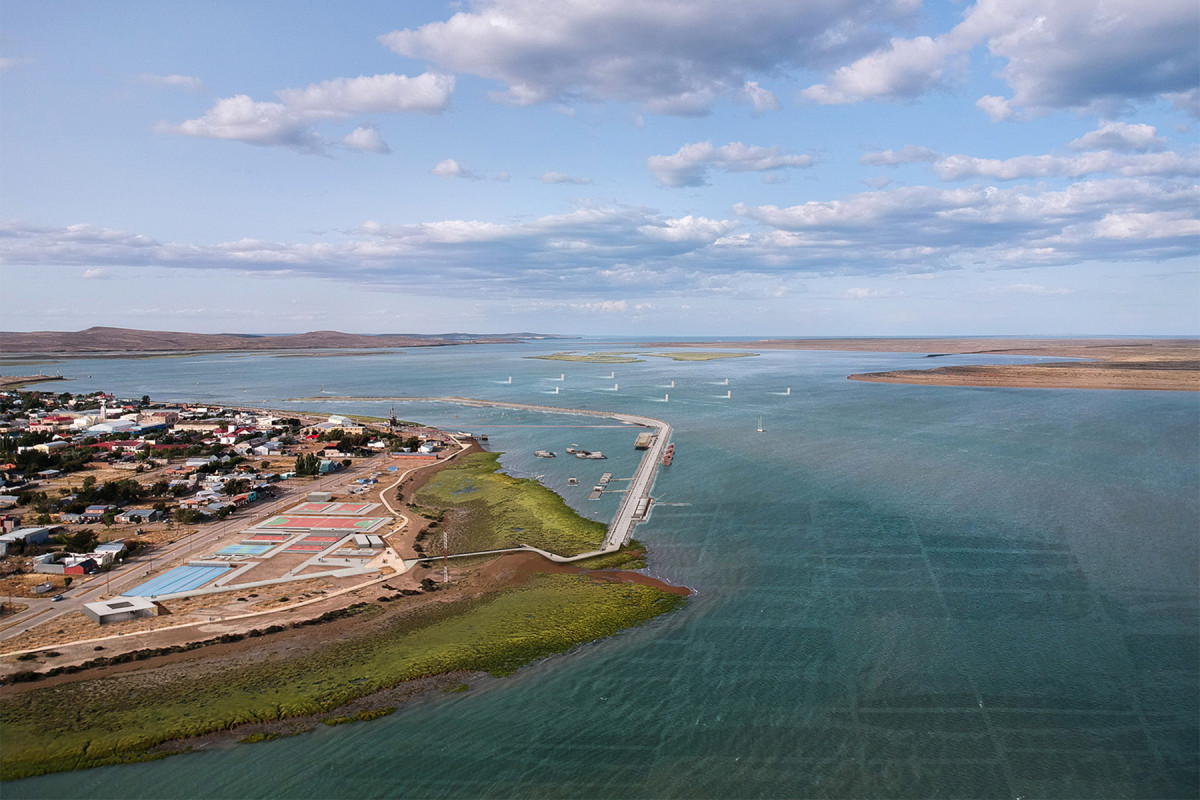
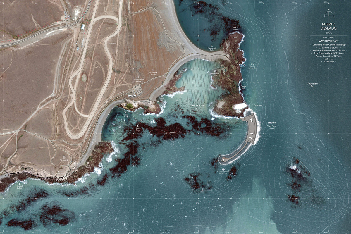
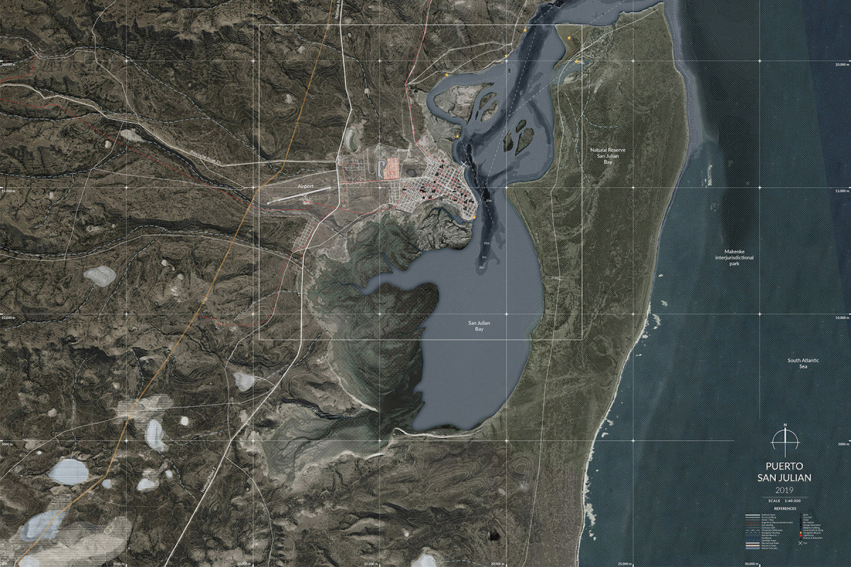
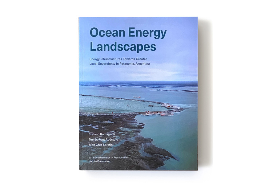
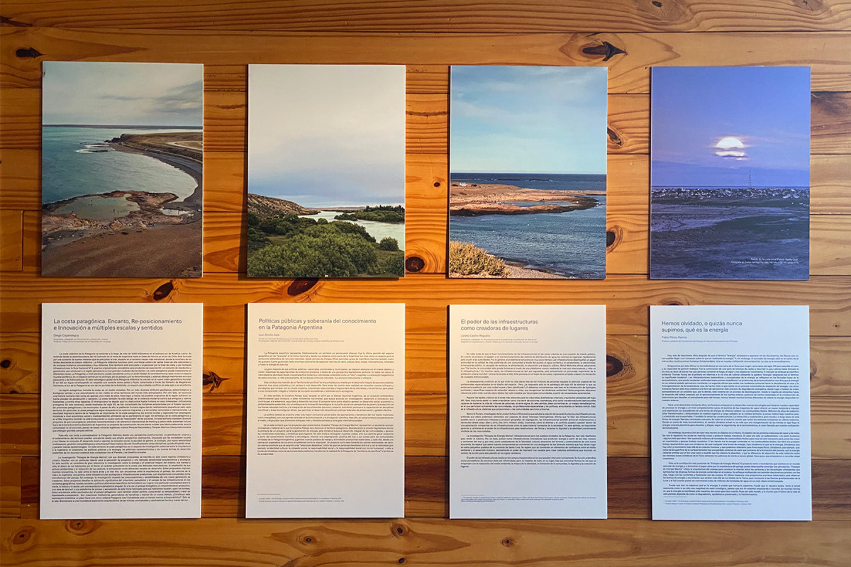
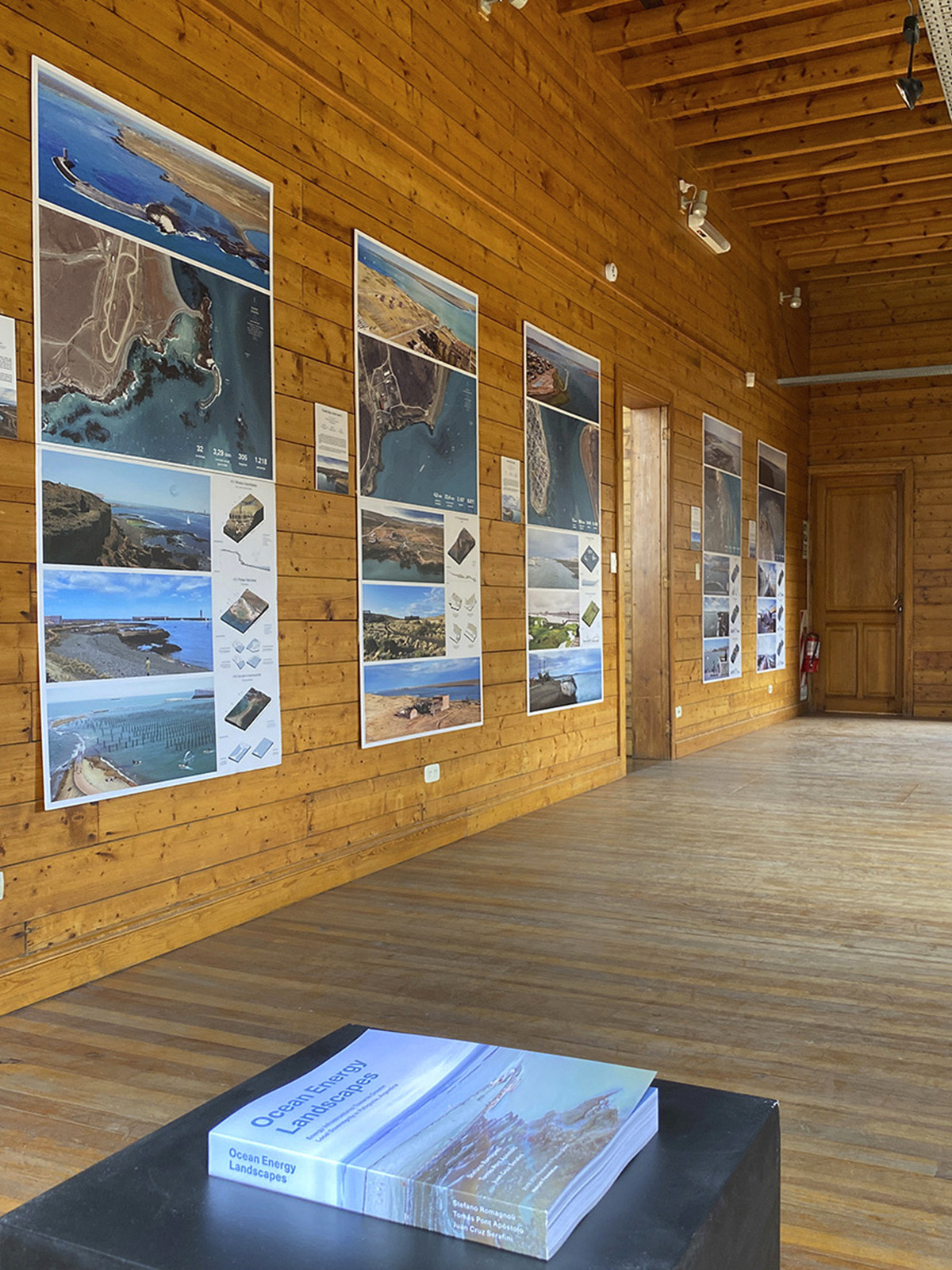
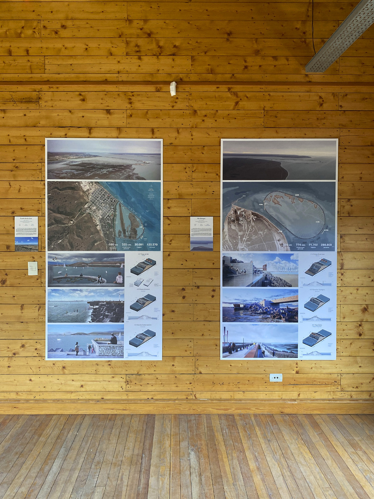
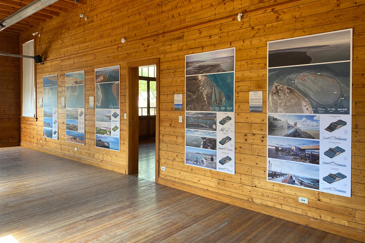
Ocean Energy Landscapes
Energy Infrastructures Towards Greater Local Sovereignty


Date
2021
Service
LandscapeArchitectureResearch
Status
Project
Team
Stefano RomagnoliTomás PontJuan Cruz Serafini
Client
Holcim Foundation
Location
Santa Cruz, Patagonia, Argentina
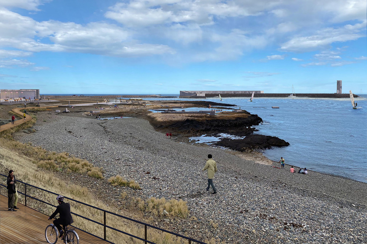
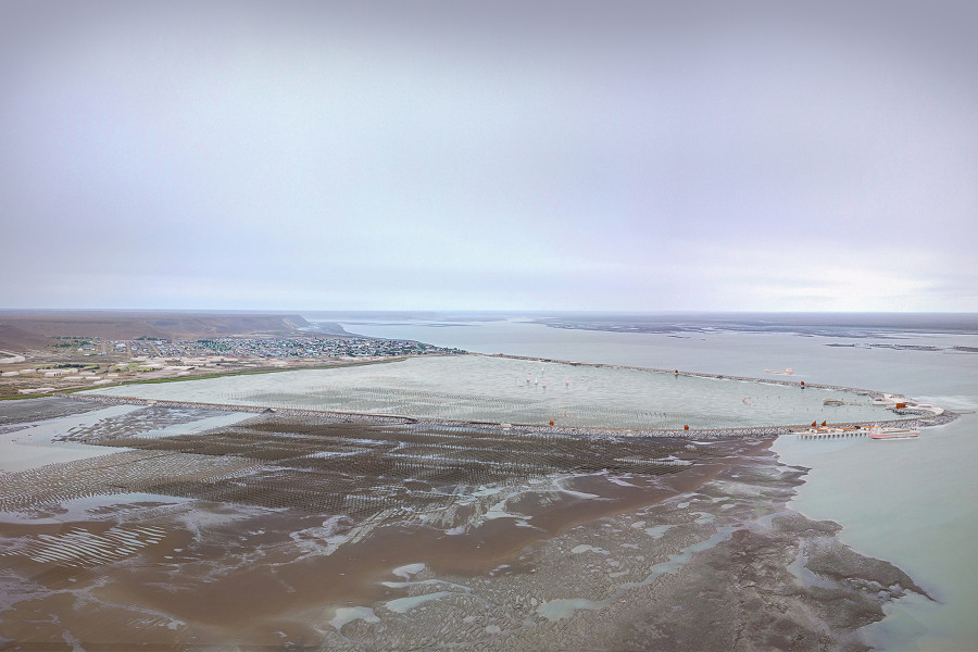
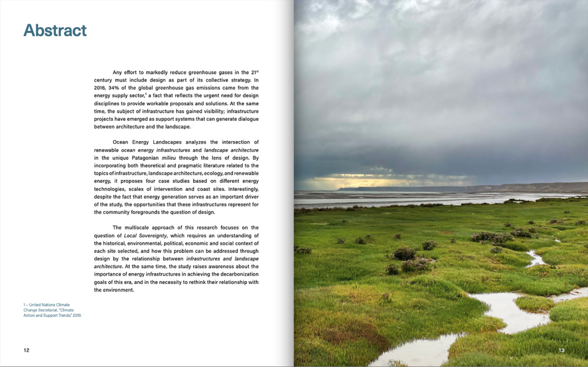
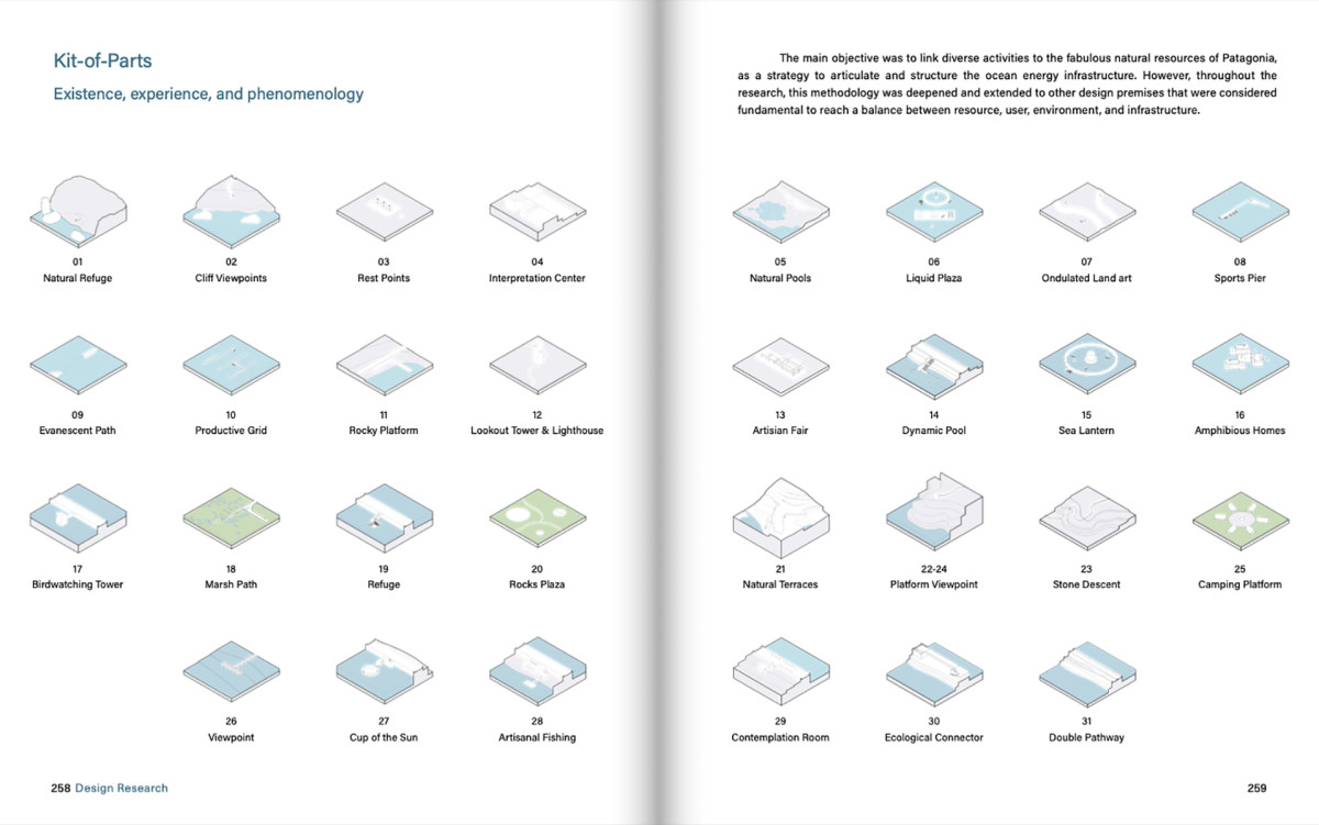
Any effort to markedly reduce greenhouse gases in the 21st century must include design as part of its collective strategy. In 2016, 34% of the global greenhouse gas emissions came from the energy supply sector(1), a fact that reflects the urgent need for design disciplines to provide workable proposals and solutions. At the same time, the subject of infrastructure has gained visibility; infrastructure projects have emerged as support systems that can generate dialogue between architecture and the landscape.
Ocean Energy Landscapes analyzes the intersection of renewable ocean energy infrastructures and landscape architecture in the unique Patagonian milieu through the lens of design. By incorporating both theoretical and pragmatic literature related to the topics of infrastructure, landscape architecture, ecology, and renewable energy, it proposes four case studies based on different energy technologies, scales of intervention and coast sites. Interestingly, despite the fact that energy generation serves as an important driver of the study, the opportunities that these infrastructures represent for the community foregrounds the question of design.
The multiscale approach of this research focuses on the question of Local Sovereignty, which requires an understanding of the historical, environmental, political, economic and social context of each site selected, and how this problem can be addressed through design by the relationship between infrastructures and landscape architecture. At the same time, the study raises awareness about the importance of energy infrastructures in achieving the decarbonization goals of this era, and in the necessity to rethink their relationship with the environment.
(1) United Nations Climate Change Secretariat, “Climate Action and Support Trends,” 2019.
Related projects

Exhibition Ocean Energy Landscapes
Date
2021
Service
Exhibition
Status
Exhibition
Team
Stefano RomagnoliTomás Pont ApóstoloJuan Cruz Serafini
Client
Holcim Foundation
Location
Rio Gallegos, Patagonia, Argentina
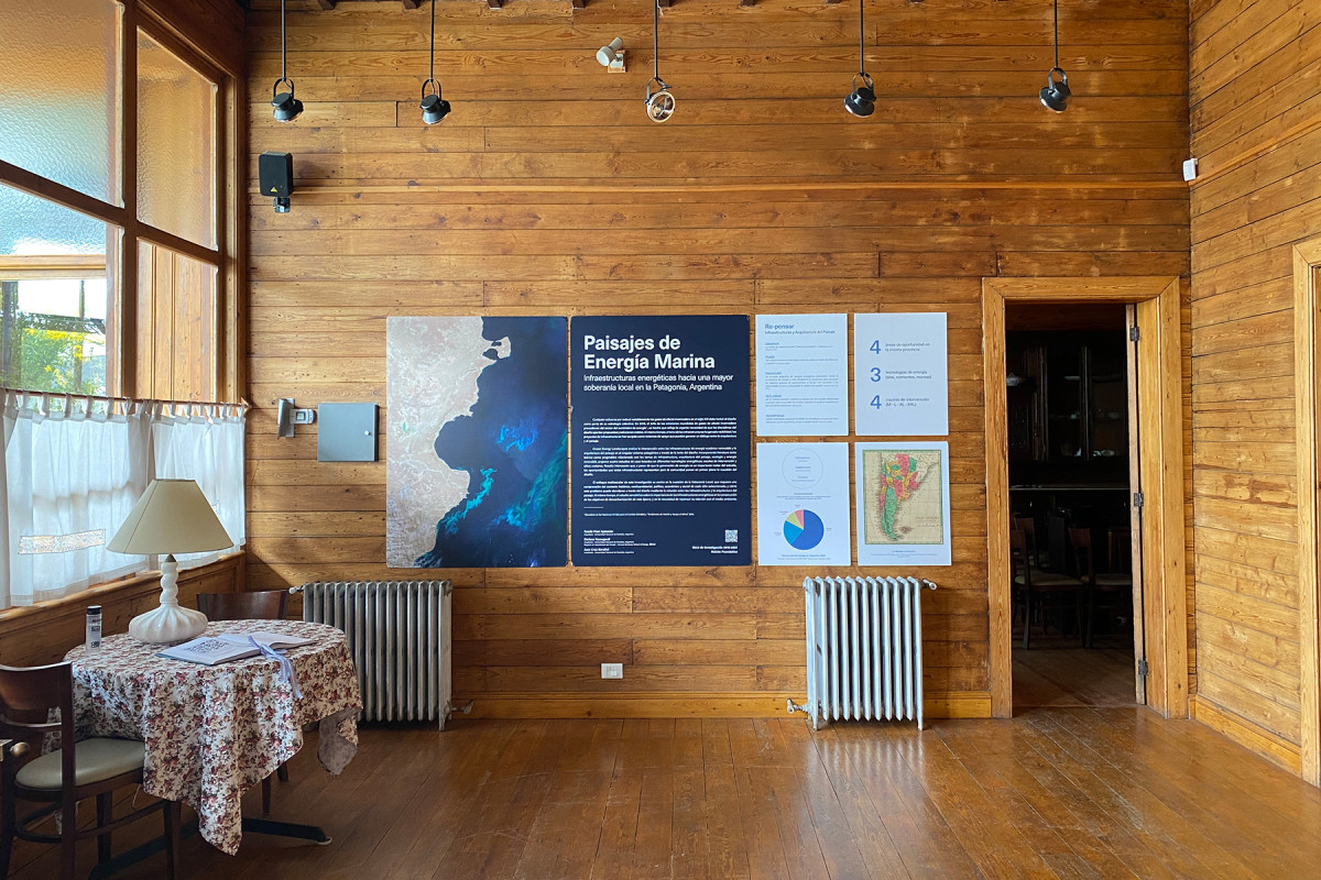
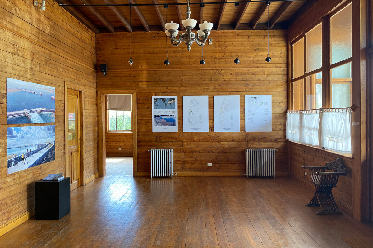
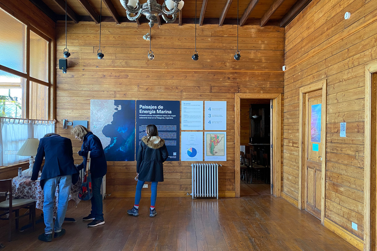
Inaugurated in December 2021 and located at the Casa de la Cultura of the “Fundacruz” Foundation, Landscapes of Marine Energy explores the intersection between renewable marine energy infrastructures and landscape architecture in the unique Patagonian environment, through the lens of design.
The exhibition is part of the research project Landscapes of Marine Energy: Energy Infrastructures Towards Greater Local Sovereignty in Patagonia, Argentina, promoted by Holcim Foundation.
Related projects
Ocean Energy Landscapes

Date
2021
Status
Published
Team
Stefano RomagnoliTomás Pont ApóstoloJuan Cruz Serafini
Client
Holcim Foundation
Location
Patagonia, Argentina
Ocean Energy Landscapes: Energy infrastructures towards greater local sovereignty in Patagonia, Argentina analyzes the intersection of renewable ocean energy infrastructures and landscape architecture in the unique Patagonian milieu through the lens of design. By incorporating both theoretical and pragmatic literature related to the topics of infrastructure, landscape architecture, ecology, and renewable energy, it proposes four case studies based on different energy technologies, scales of intervention and coast sites. Interestingly, even though energy generation serves as an important driver of the study, the opportunities that these infrastructures represent for the community foregrounds the question of design.
The multiscale approach of this research focuses on the question of Local Sovereignty, which requires an understanding of the historical, environmental, political, economic, and social context of each site selected, and how this problem can be addressed through design by the relationship between infrastructures and landscape architecture. At the same time, the study raises awareness about the importance of energy infrastructures in achieving the decarbonization goals of this era, and in the necessity to rethink their relationship with the environment.
Research Advisor: Pablo Pérez Ramos
Contributors: Seizen Uehara, Stefania Casarin, Candela Brizuela
Engineering Consulting: Gastón Segura, Lucas Bindelli, Fabrizio Abbondandolo
General Manager: Edward Schwarz
Academic Committee: Marilyne Andersen, Marc Angélil, Harry Gugger, Dirk Hebel, Guillaume Habert, Phillippe Block, Elli Mosayebi, Luisa Pastore
Thesis Advisors: Javier Giorgis, Alejandro Cohen, Cristian Nanzer
Chair & Editorial Director: Florencia Rodriguez
Chair & Chief Executive Officer: Pablo Gerson
Editor in Chief: Isabella Moretti
Managing Editor: Magdalena Tagliabue
Editor: Santiago Bogani
Art Director: Santiago Passero
Graphic Design: Ignacio Espert
Proofreader: Lisa Ubelaker Andrade
Exhibition C40 World Mayors Summit

Date
2022
Service
Exhibition
Status
Completed
Team
BID (Felipe Vera, Stefano Romagnoli, Soledad Patiño, Jeannette Sordi, Santiago Mota, Matías Lince, Milagros Barchi, Sofía del Castillo)
Client
Inter-American Development Bank
Location
City of Buenos Aires, Argentina
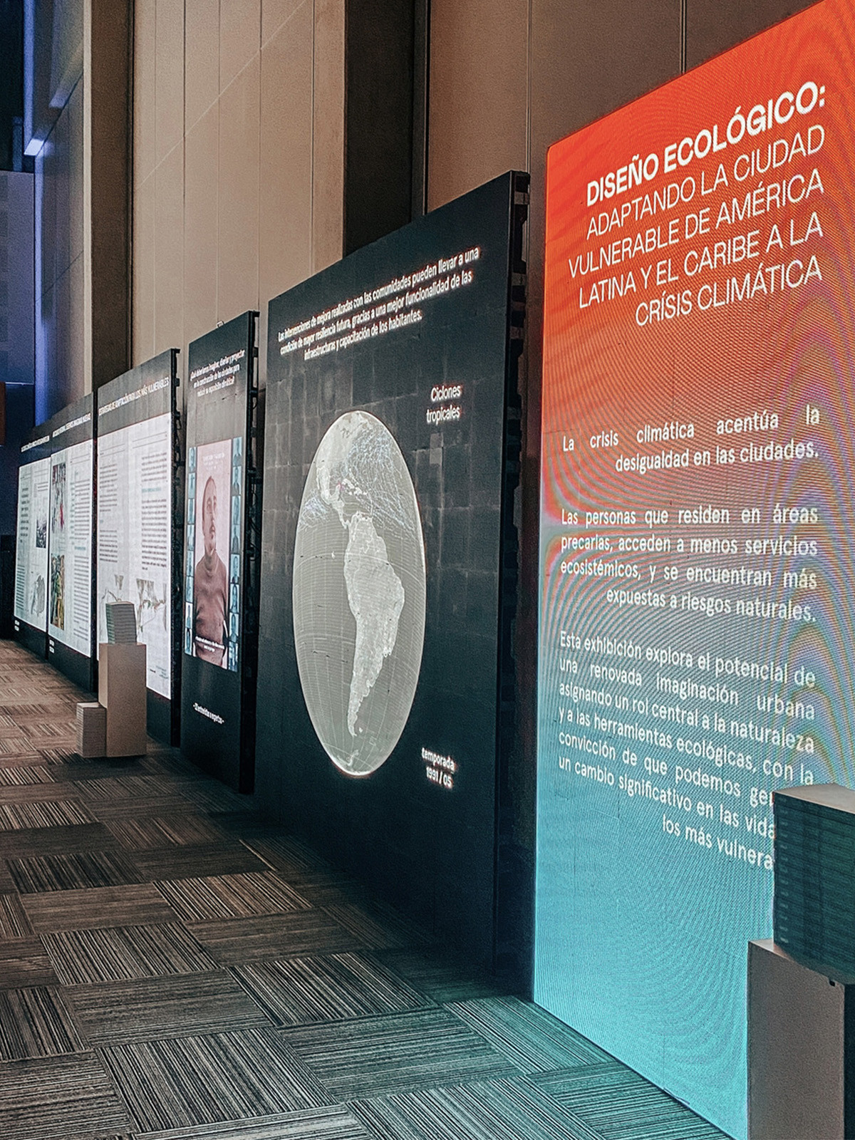
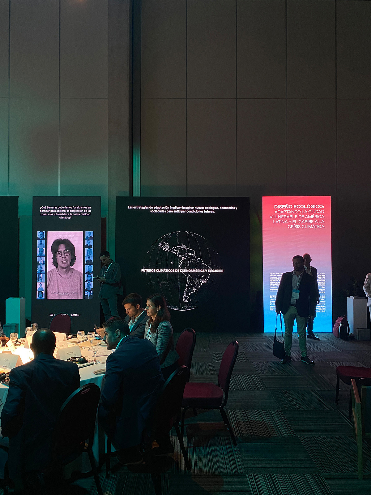
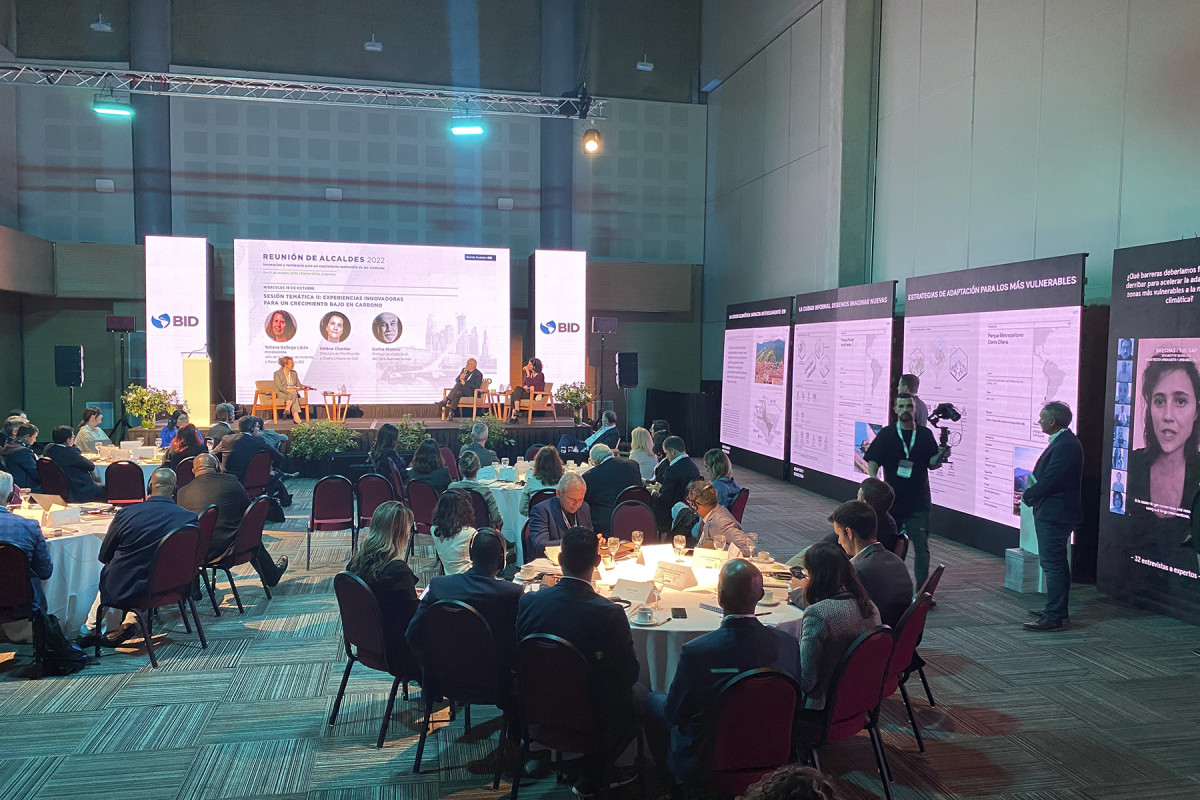
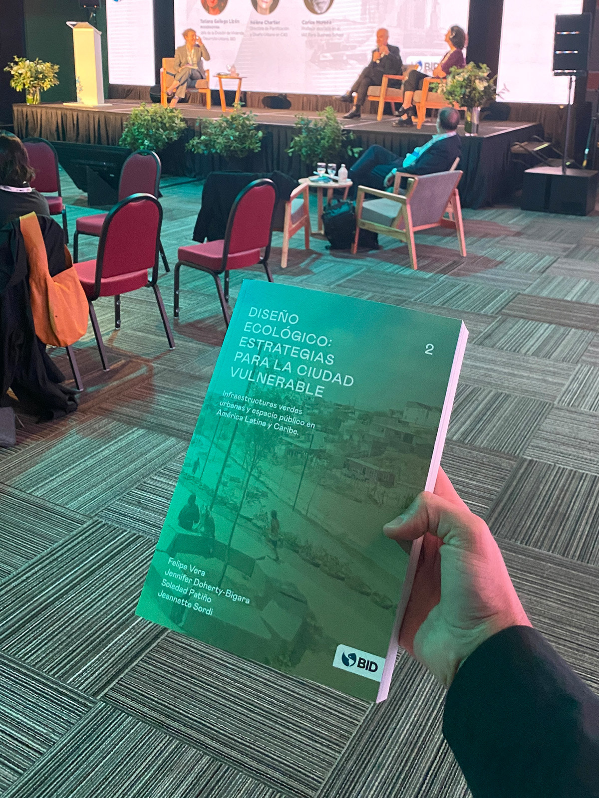
The climate crisis intensifies inequality in cities. People living in vulnerable settlements have less access to ecosystem services and face greater exposure to natural risks. This issue, among others, was discussed at C40, the World Mayors Summit held in Buenos Aires, which brought together mayors from around the world along with business leaders, philanthropists, activists, youth leaders, scientists, and residents. The event took place from October 19 to 21, 2022.
During these days, the Ecological Design 2 book exhibition was presented, aiming to explore the potential of a renewed urban imagination—one that places nature and ecological tools at its core, grounded in the belief that we can create meaningful change in the lives of the most vulnerable.
Related projects
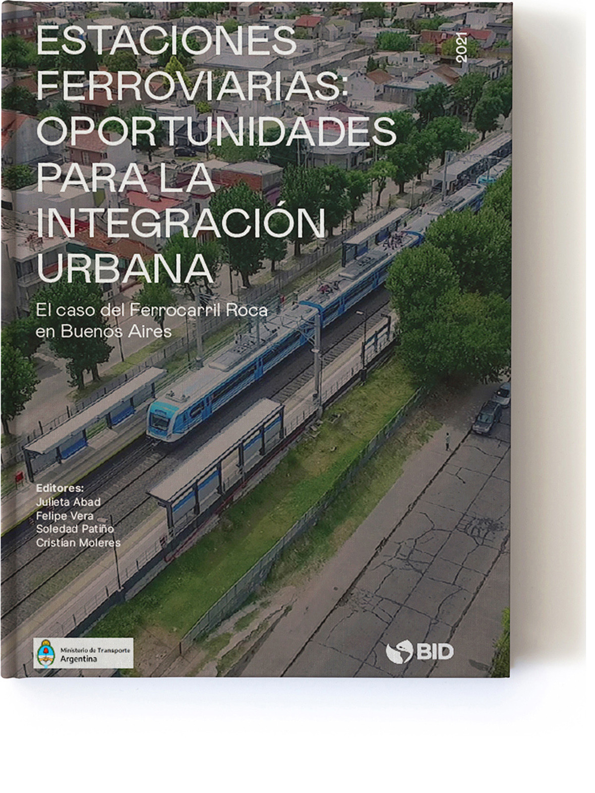
Railway Stations: Opportunities for Urban Integration.
Date
2021
Service
PlanningPublication
Status
Published
Team
Felipe VeraJulieta AbadSoledad PatiñoCristian MoleresGroundlab AA
Client
Inter American Development Bank, Ministry of Transport of Argentina
Location
Buenos Aires, Argentina
The Ministry of Transport and the Inter-American Development Bank collaborated to leveraged the opportunities and urban development potential around the Roca Railway stations in the Buenos Aires Metropolitan Region, with the goal of creating safer, healthier, and more sustainable urban environments.
This document seeks to reflect the results and learnings from a workshop held in March 2021, which aimed to exchange ideas and develop a methodological framework for analyzing and evaluating the station surroundings as input for the proper prioritization of necessary improvement interventions. More specifically, the goal was to validate and iterate a management tool to guide investments in the development of initiatives, thus enhancing the railway stations and their surrounding areas.
Foreign Bodies
Mapping Immigrant Women in Canada and Chile
Ottawa, Canada
Ottawa, Canada
Ottawa, Canada
Ottawa, Canada

Santiago de Chile, Chile
Santiago de Chile, Chile
Santiago de Chile, Chile
Santiago de Chile, Chile
Date
2021
Service
Research
Status
Published
Team
Región Austral
Client
Natalia Escobar Castrillón
Location
Santiago, Chile - Ottawa, Canadá
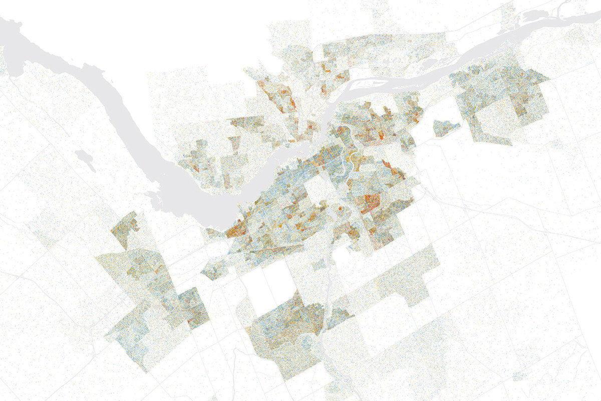
This work is part of a research project exploring how the urban experiences of diasporic communities can contribute to imagining more just and equitable urban futures. Faced with the growing diversity of contemporary cities—and at the same time the persistent structural urban exclusion of certain social groups—the study highlights historically marginalized populations as a fundamental step toward more inclusive urban planning.
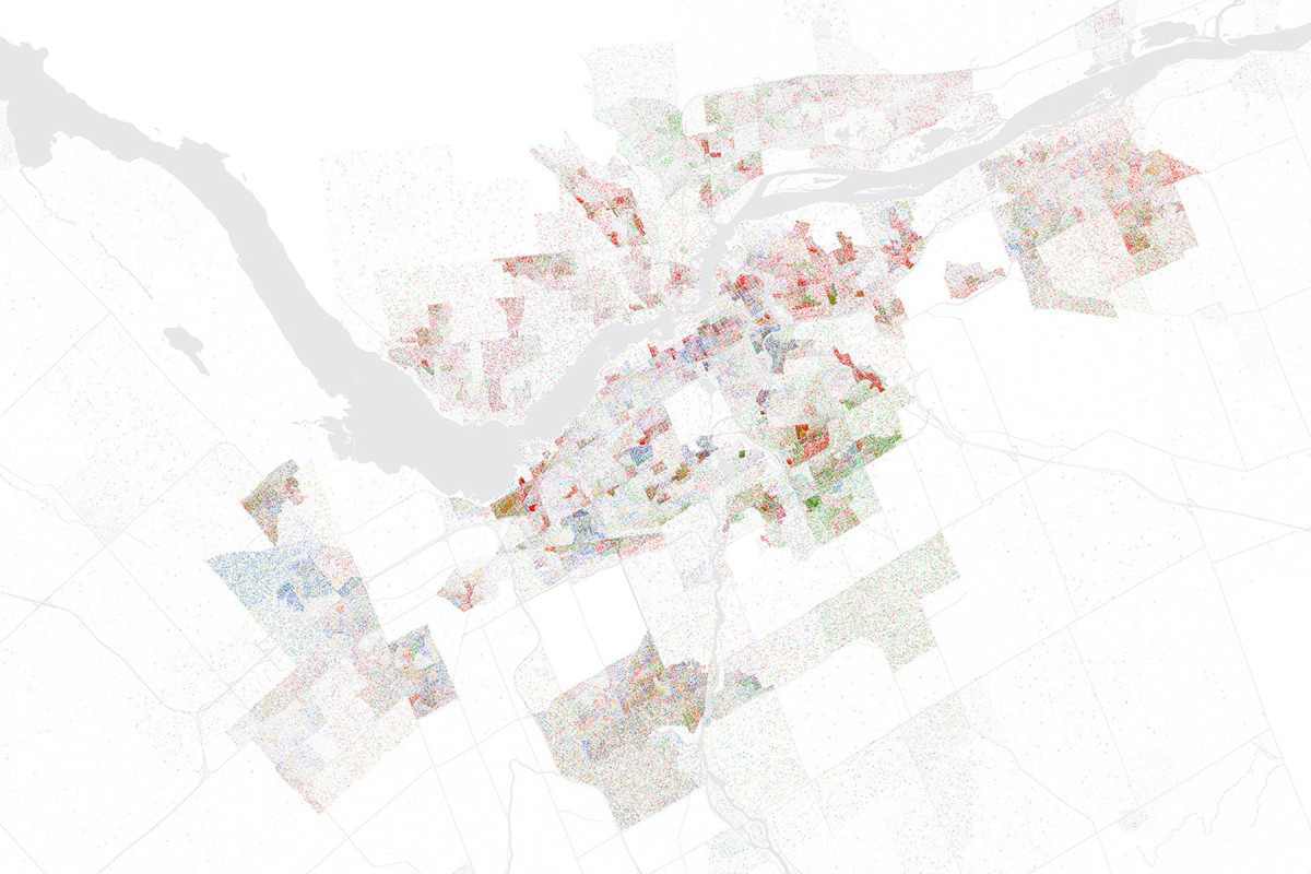
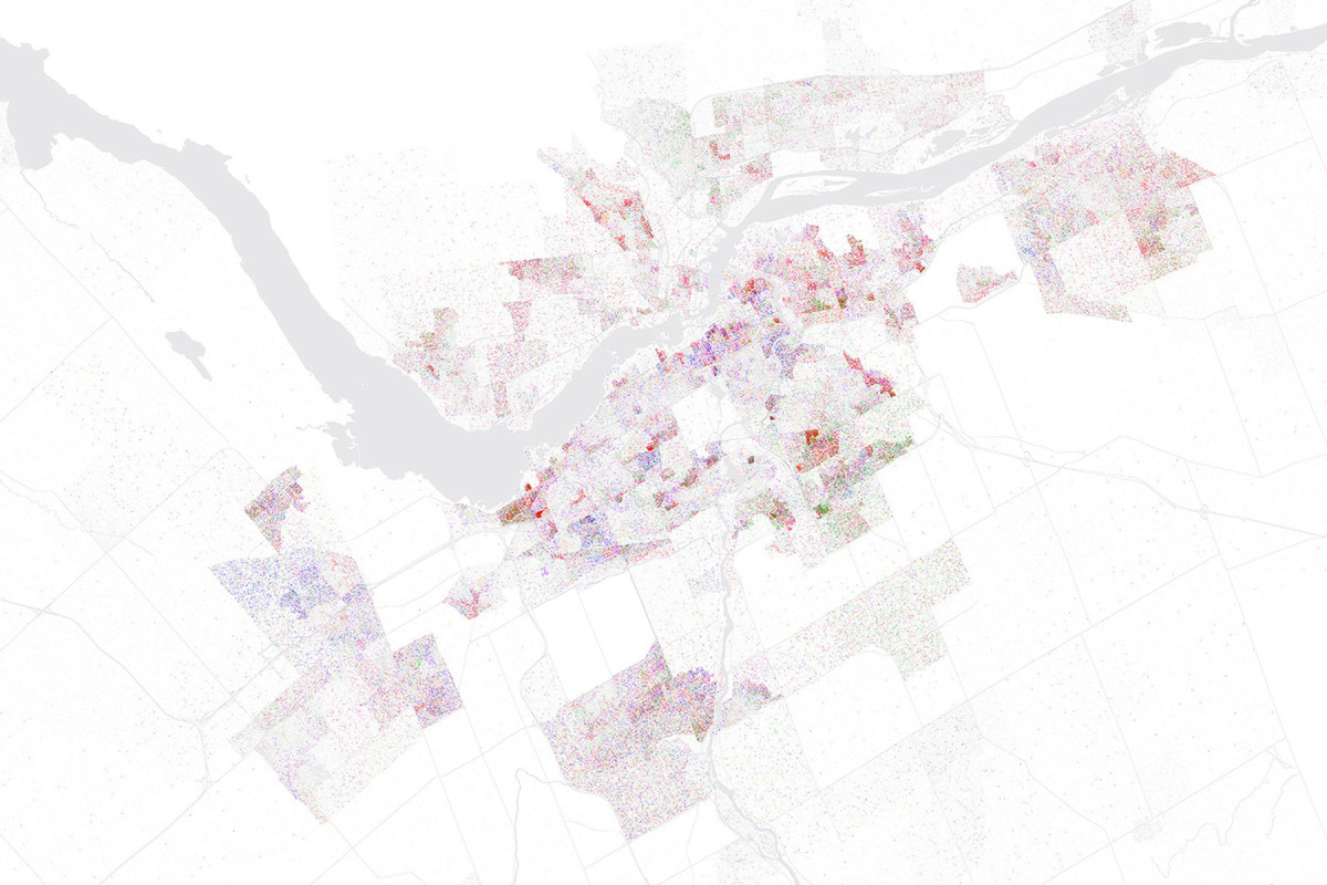
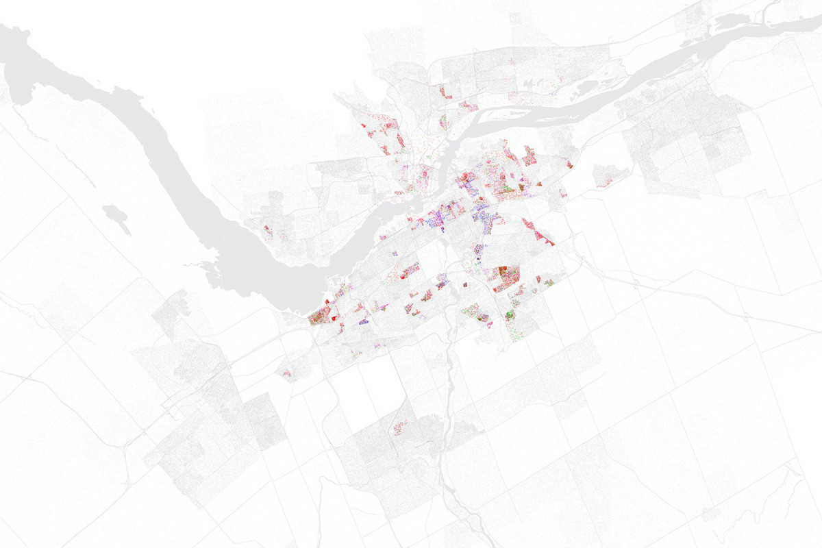
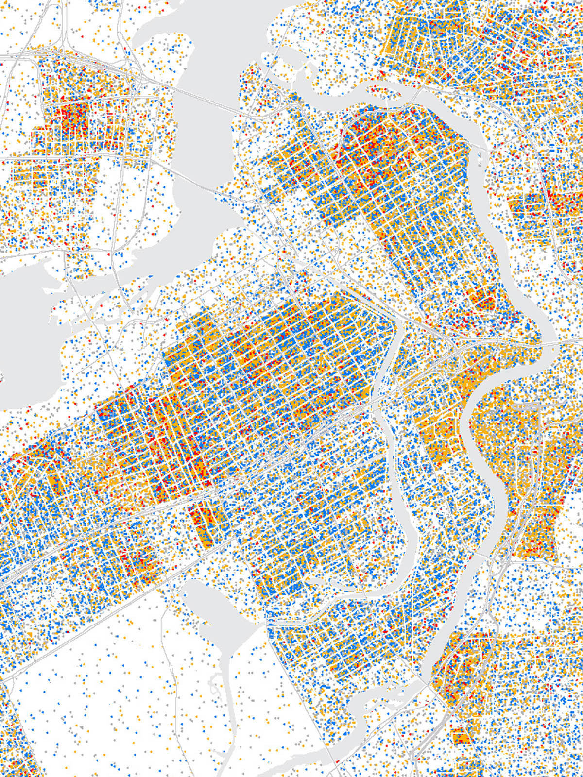
Our contribution to the project consisted of developing a series of maps and cartography based on the use of Geographic Information Systems (GIS) that visualize census data from Ottawa-Gatineau, Canada, and Santiago, Chile. These cartographies were developed to identify urban areas with a higher proportion of people at risk of exclusion, with a special focus on immigrant, refugee, and racialized women in economically vulnerable situations.
Through the georeferencing and visual representation of these data, maps act as an analytical and narrative tool that sheds light on territories and trajectories that often remain invisible in conventional approaches to urban planning. At the same time, they offer an empirical basis to guide subsequent qualitative studies and inform debates around urban equity in contexts marked by migration, racialization, and structural inequality.
Between the layers of Landscape


Date
2020
Service
LandscapeCompetition
Status
Project
Team
Región AustralEl taller de ArquitectosMetha Arquitectos
Client
Municipal Government of Villavicencio
Location
Villavicencio, Colombia
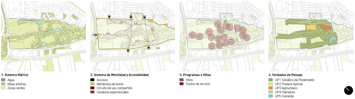
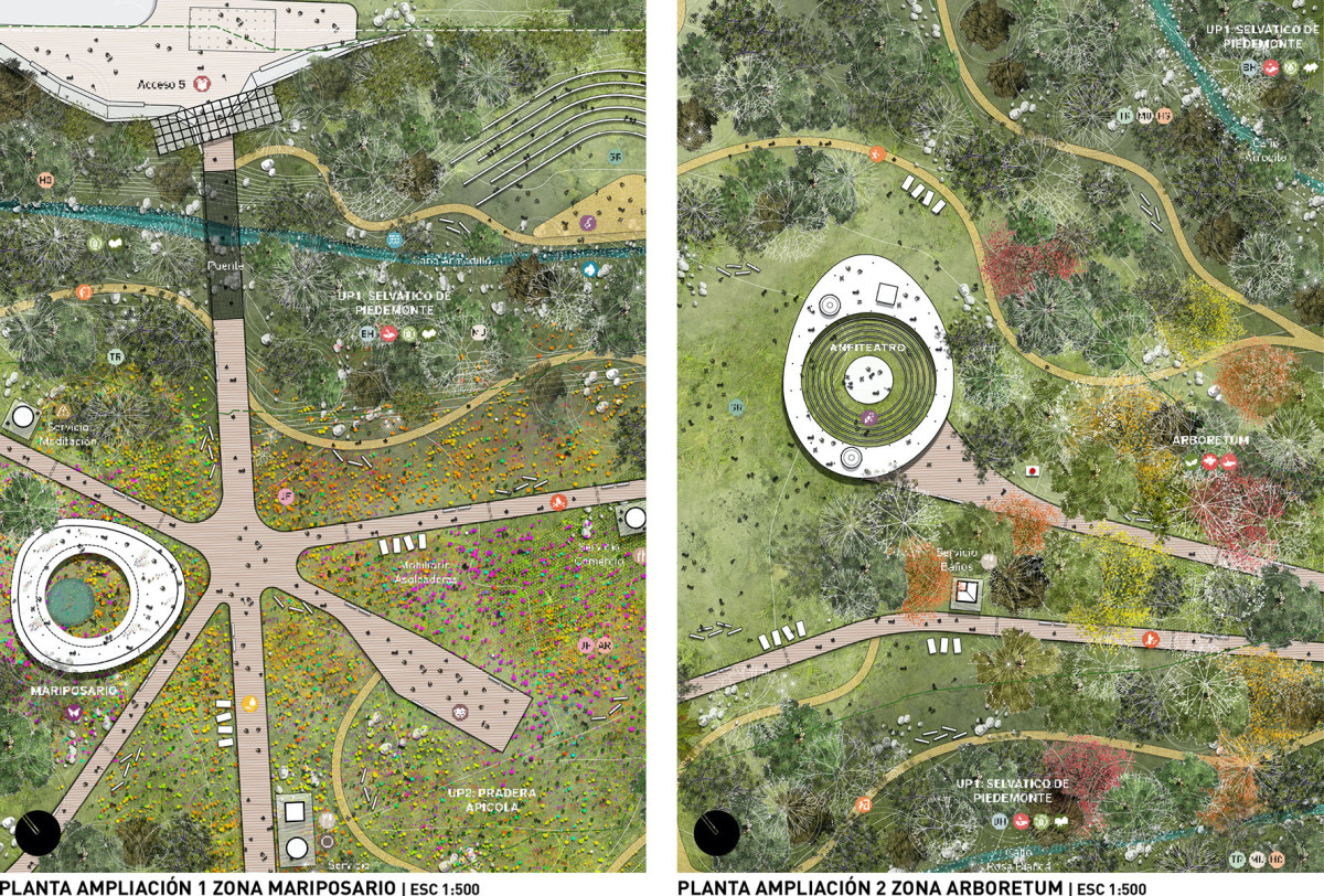
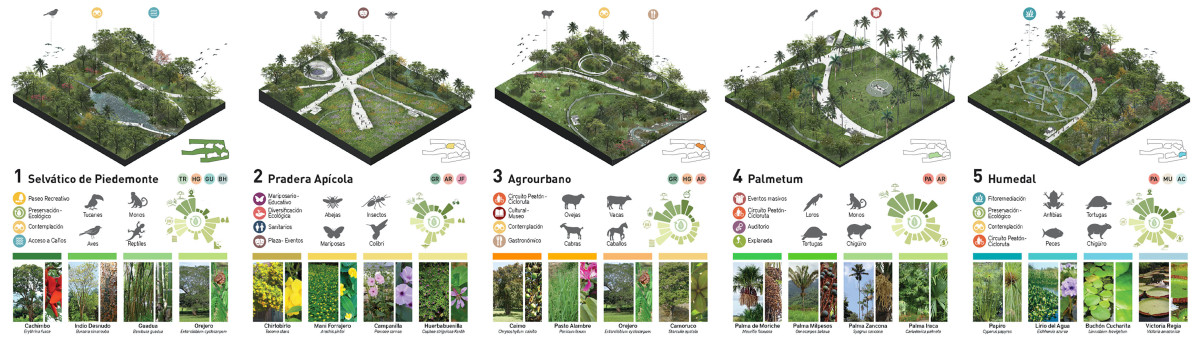
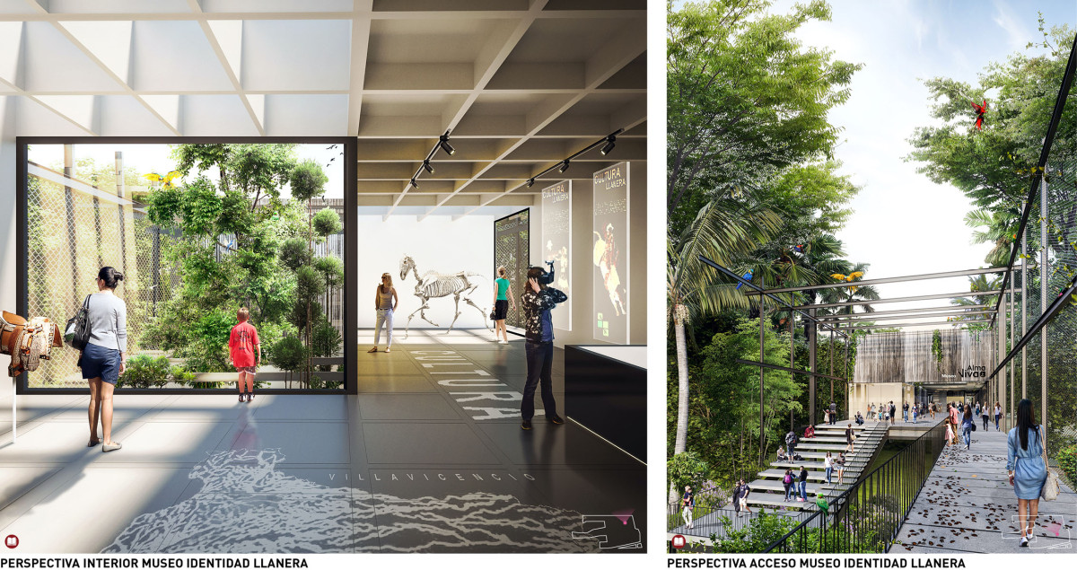
Alma Viva understands the context and history of the territory it inhabits and establishes itself as a new structuring element of the city and a regional park. It highlights the natural and cultural heritage of Villavicencio as the capital of the Llanos piedmont. The Park serves as a key piece in the urban fabric, a public, ecological, and recreational space, and an identity symbol for the city.
The proposal is built upon three strategies:
1.MENDING: The site is understood as a confluence of environmental, social, and aesthetic values, as well as a natural remnant of a landscape altered over time, with fragmented forests. Therefore, the project proposes:
- Environmental actions aimed at connecting and integrating the biotic network of the ecological corridor in which the park is located, consolidating its ecological assets and their associated benefits.
- Connectivity and mobility measures that integrate the proposal into the urban system through a network of paths and routes, ensuring accessibility and fostering community engagement.
2.DIVERSIFYING: The Park seeks to restore and enhance biodiversity through biological strategies, incorporating native species and preserving the richness of existing flora and fauna. Additionally, the proposal expands urban offerings with facilities, activities, and educational and cultural programs. It also creates recreational and public spaces, encouraging a plurality of uses and users, both within the park and its immediate surroundings.
3.ENHANCING: The Park amplifies the environmental, economic, and cultural values of its context through nature-based design strategies and architecture aimed at minimal impact on the territory. It strengthens the park's role as a water source within the regional ecological structure through passive measures aligned with the hydrological system. Furthermore, it enhances the park’s symbolic and social value as a hub for activities, ecotourism, productive areas, and environmental education, promoting the social development of Villavicencio's residents.
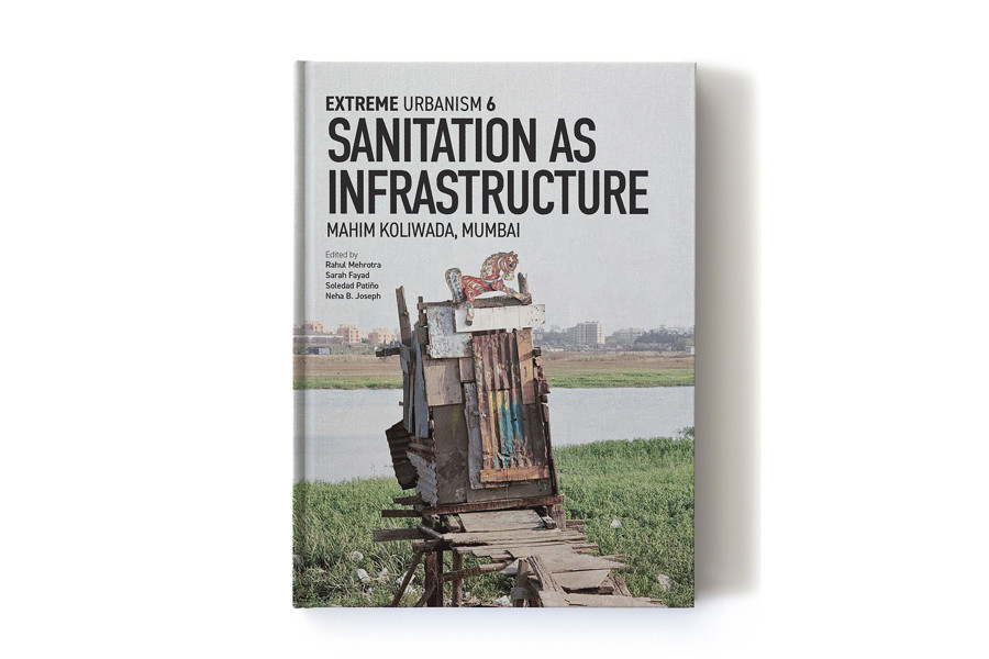
Sanitation as Infrastructure
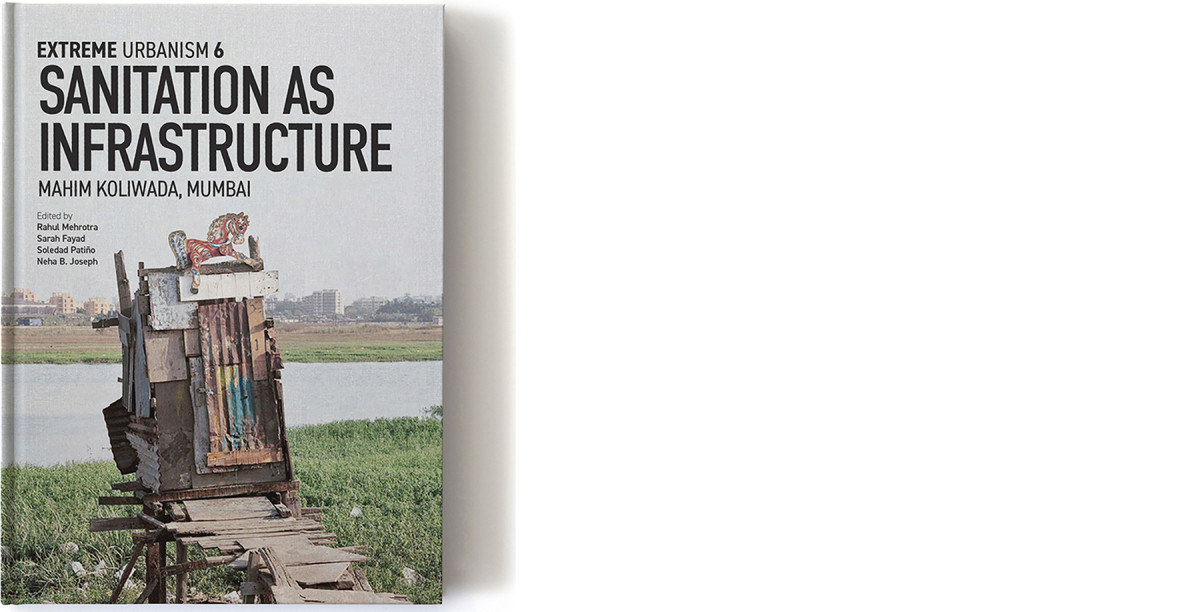
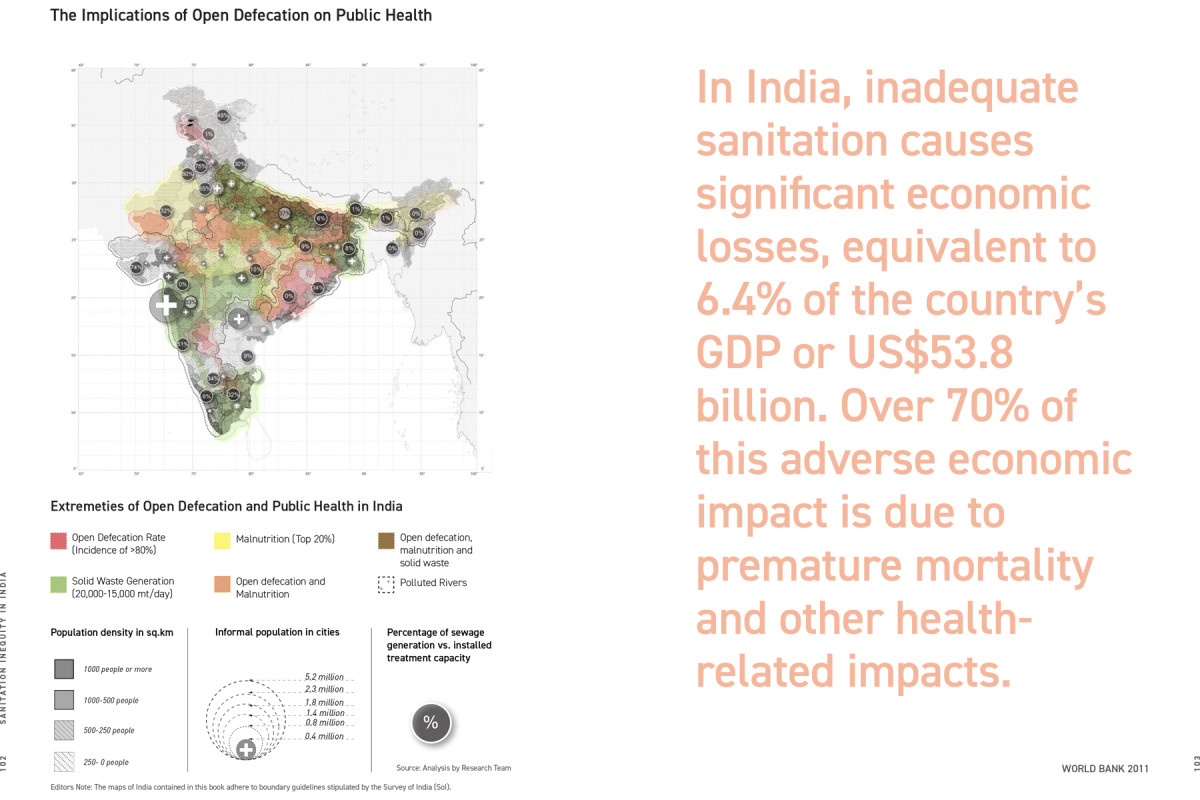


Date
2020
Service
PublicationExhibitionResearch
Status
Published
Team
Rahul MehrotraSarah FayadSoledad PatiñoNeha B. Joseph
Client
Harvard Graduate School of Design (GSD)
Location
Boston & Chicago, United States
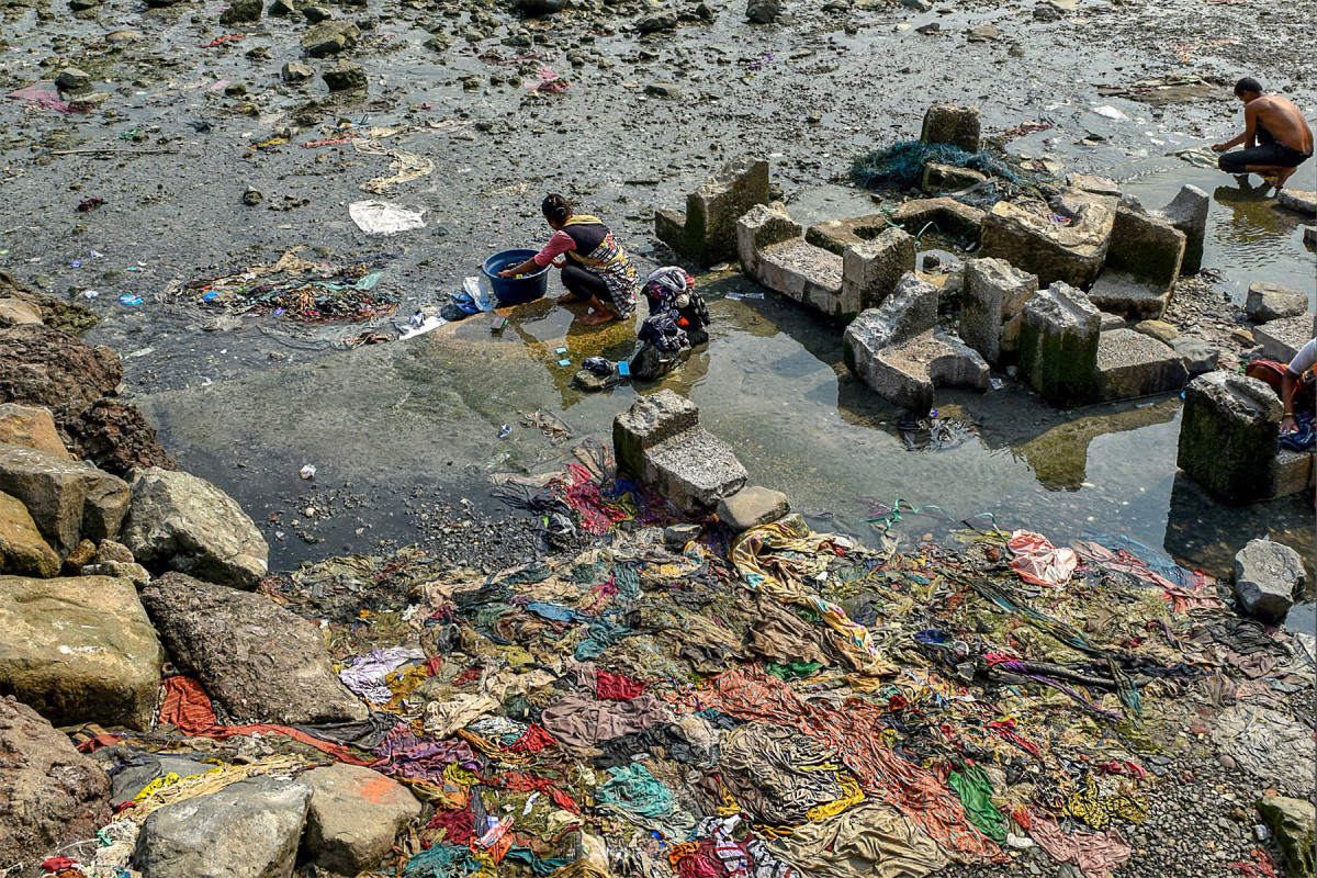
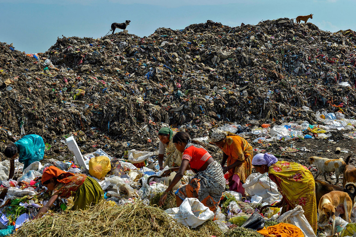
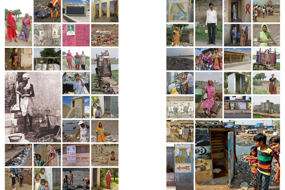
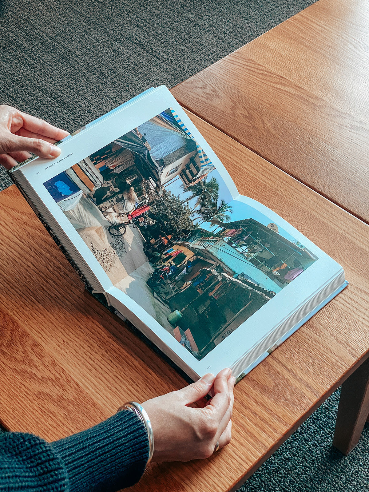
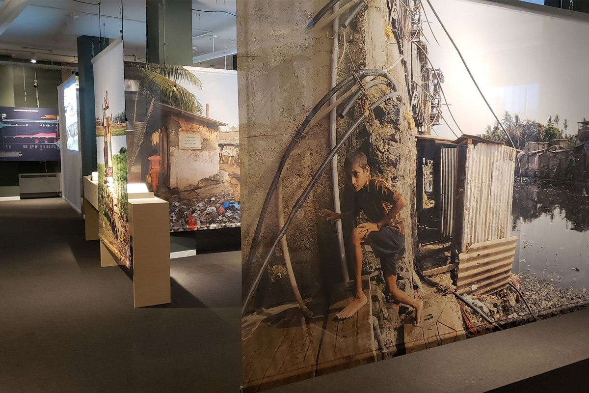
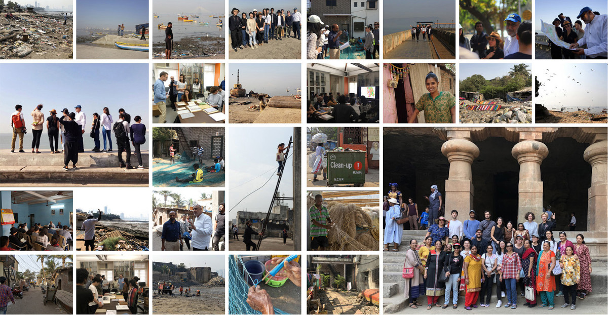
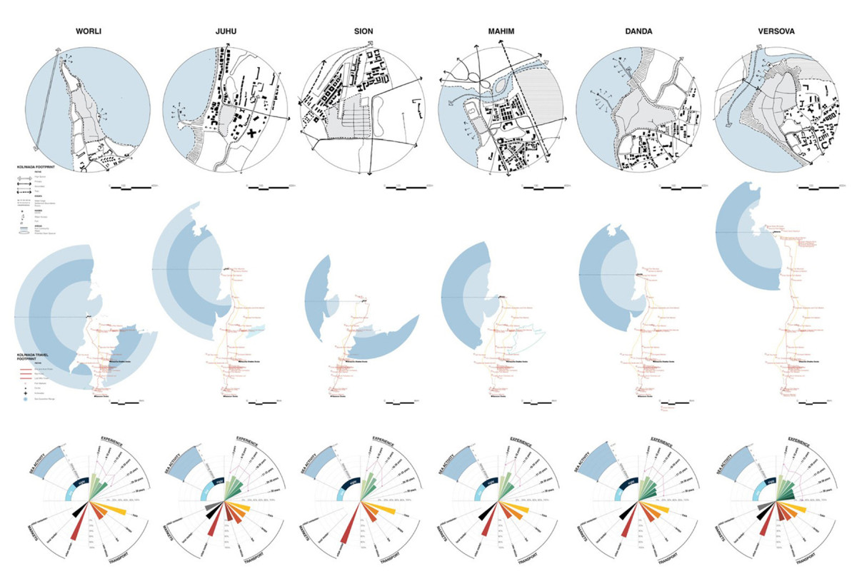
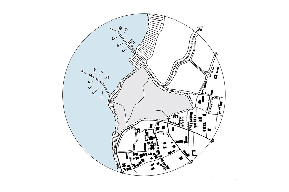
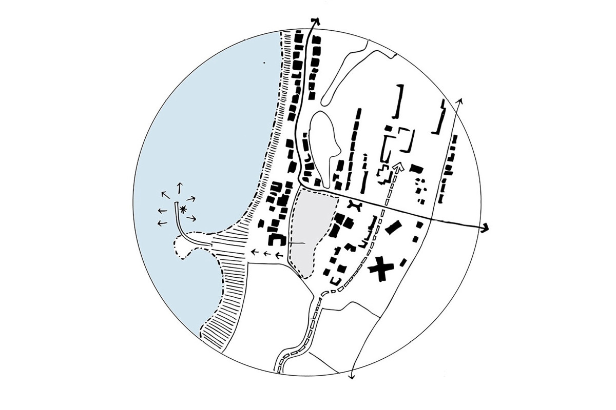
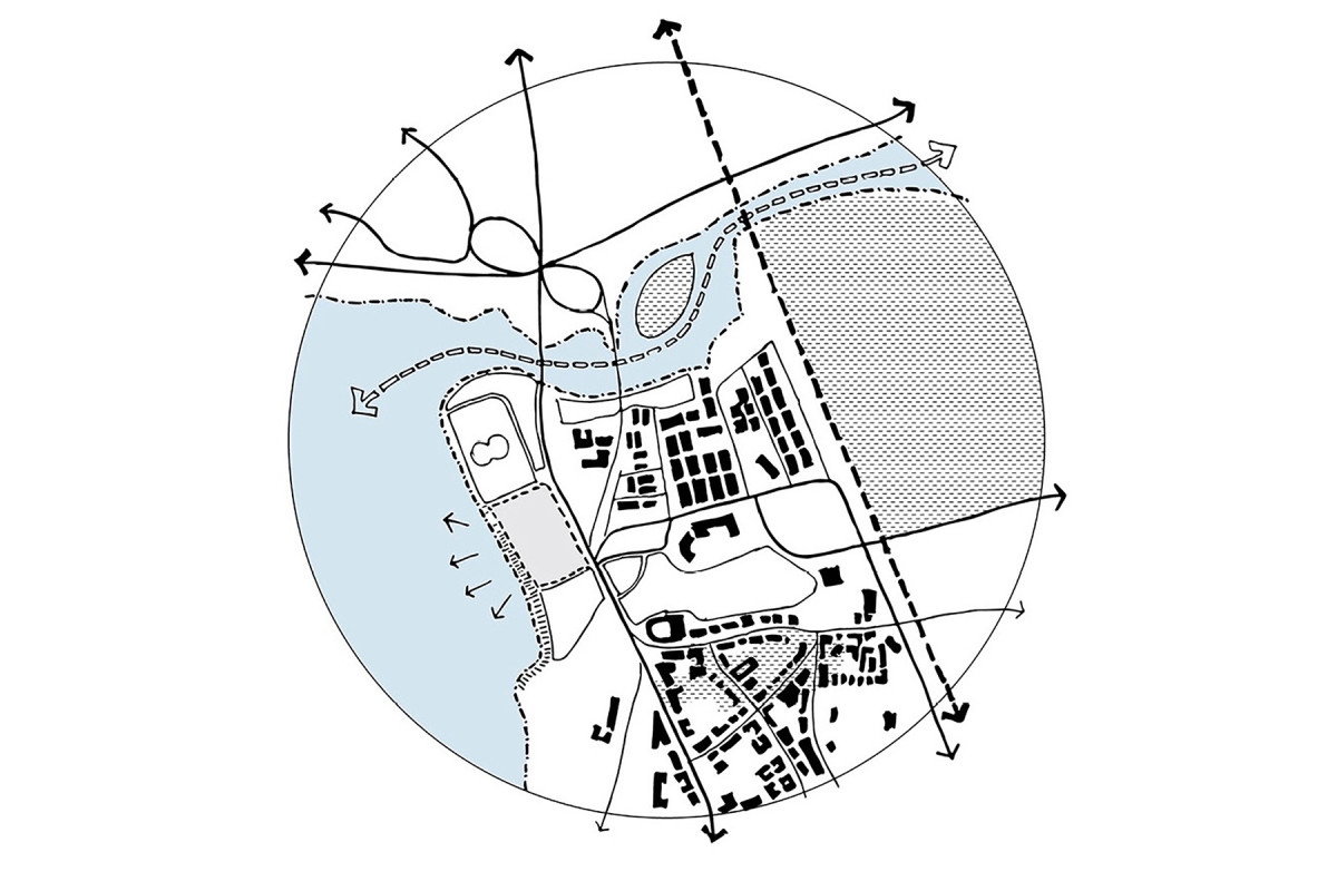
This book is part of the Extreme Urbanism series, which addresses critical issues in contemporary urbanism. Co-edited with Harvard GSD professor Rahul Mehrotra, this volume focuses on Mahim Koliwada, an informal settlement in Mumbai, India. The publication explores how sanitation can be conceived as a fundamental infrastructure in dense and vulnerable urban contexts.
The publication compiles work from Harvard’s Option Studio Sanitation as Infrastructure, where students and scholars collaborated to develop innovative sanitation solutions that extend beyond hygiene to promote social equity and urban resilience in vulnerable communities.
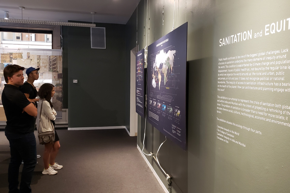
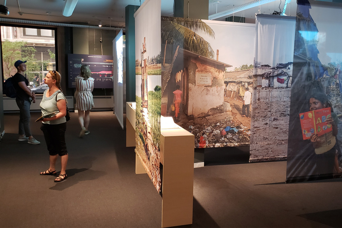
Exhibition: Sanitation and Equity, 2019
The research was showcased at the 2019 Chicago Architecture Biennial in the Sanitation and Equity exhibition. The show highlighted the potential role of architecture and design in improving sanitation systems in large urban centers, emphasizing the critical importance of access to clean water and effective waste management for public health.
It underscored the need for socially and culturally sensitive solutions, particularly in vulnerable contexts, proposing a holistic approach that integrates design, infrastructure, and policy to foster more equitable and resilient cities.
Related projects
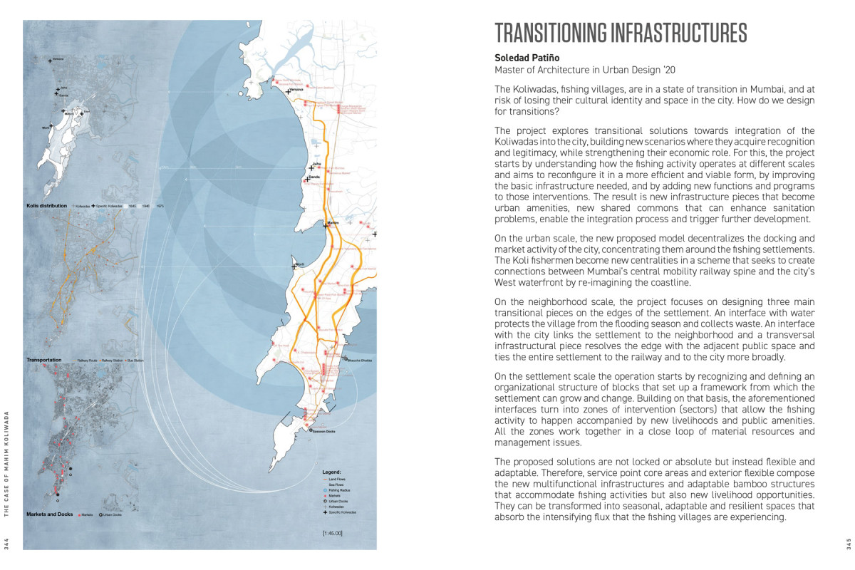
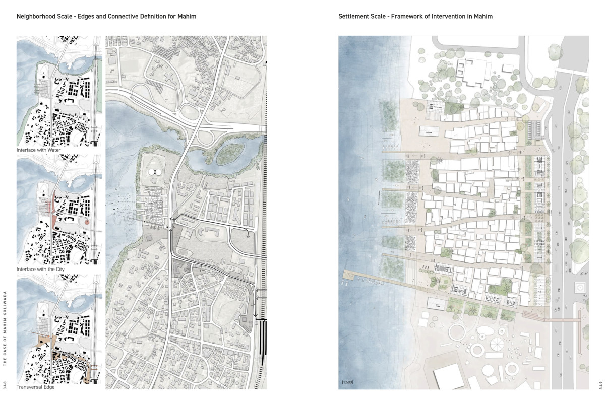
Sanitation and Infrastructure for Equity
Date
2019
Service
Urban designResearch
Status
Project
Team
Soledad Patiño
Client
Koliwada fishing communities. Project within the framework of the Option Studio «Sanitation as Infrastructure» at Harvard GSD
Location
Mumbai, India
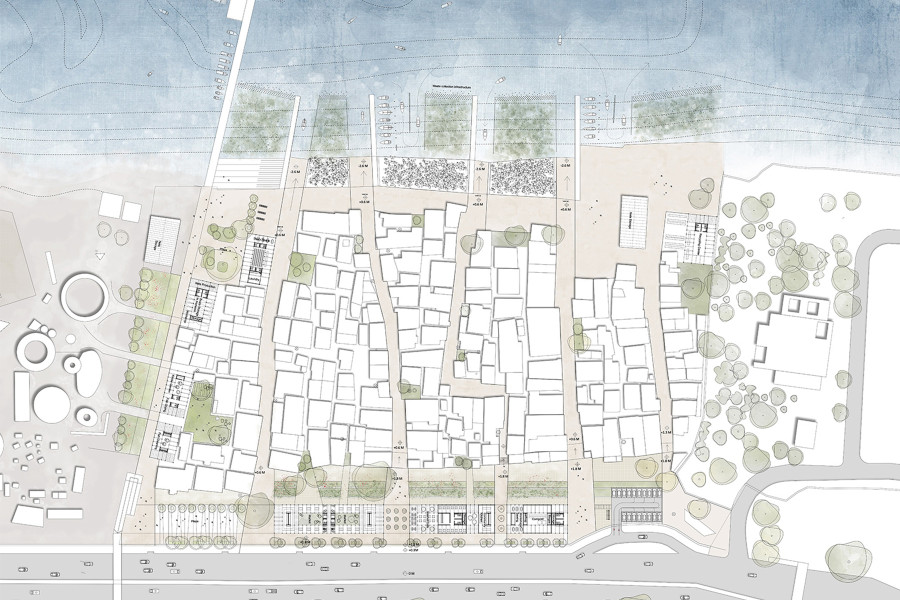
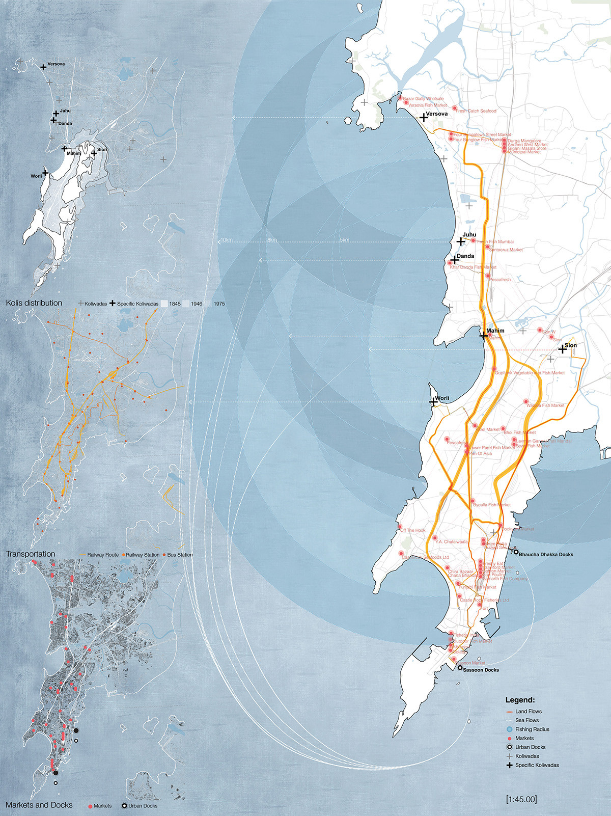
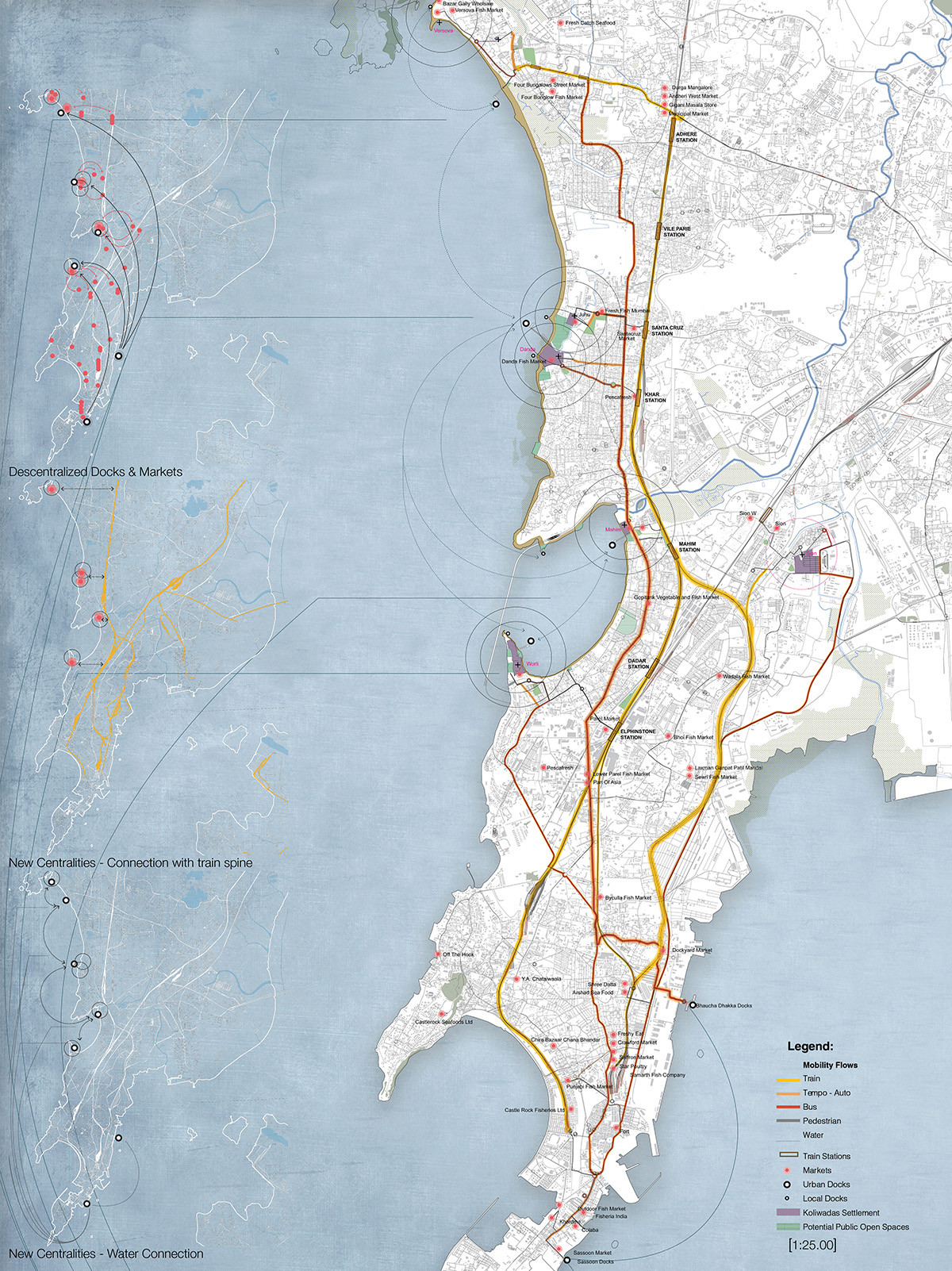
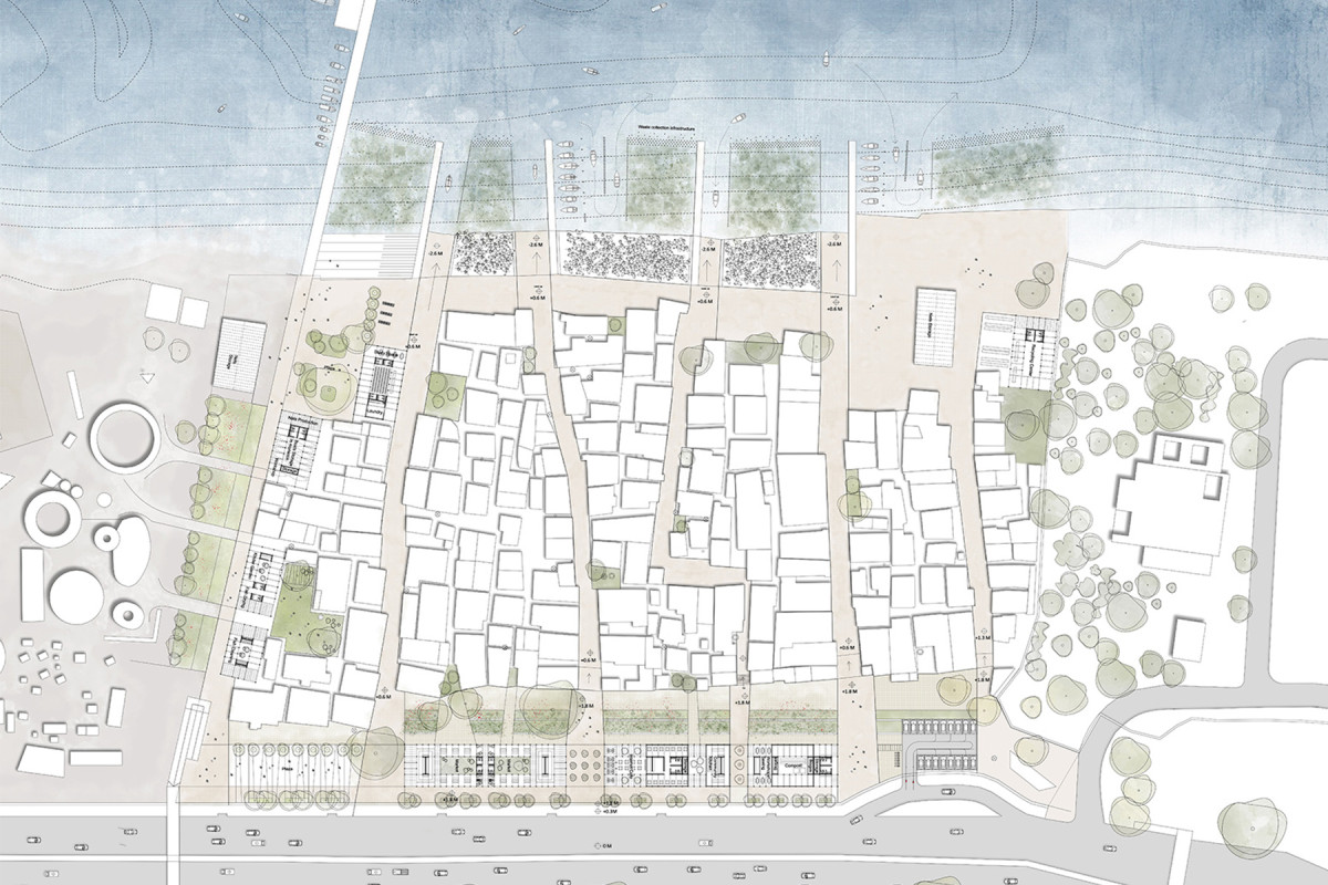
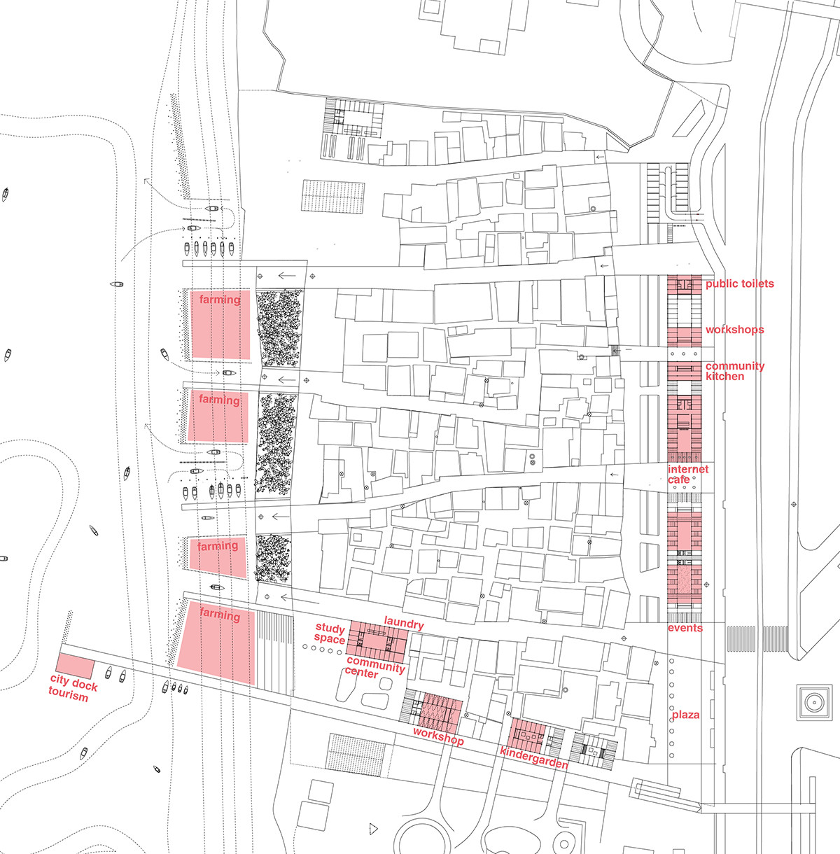
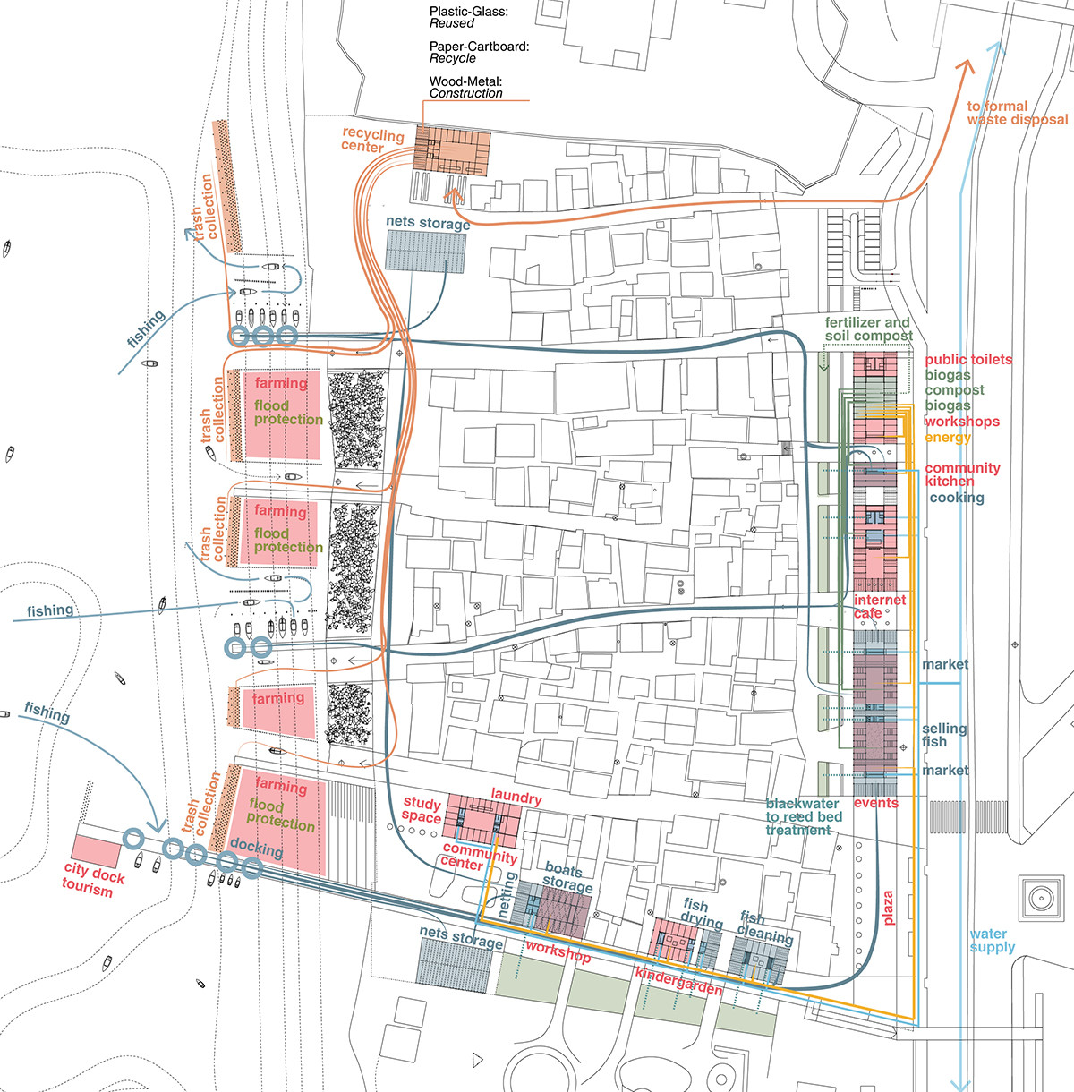
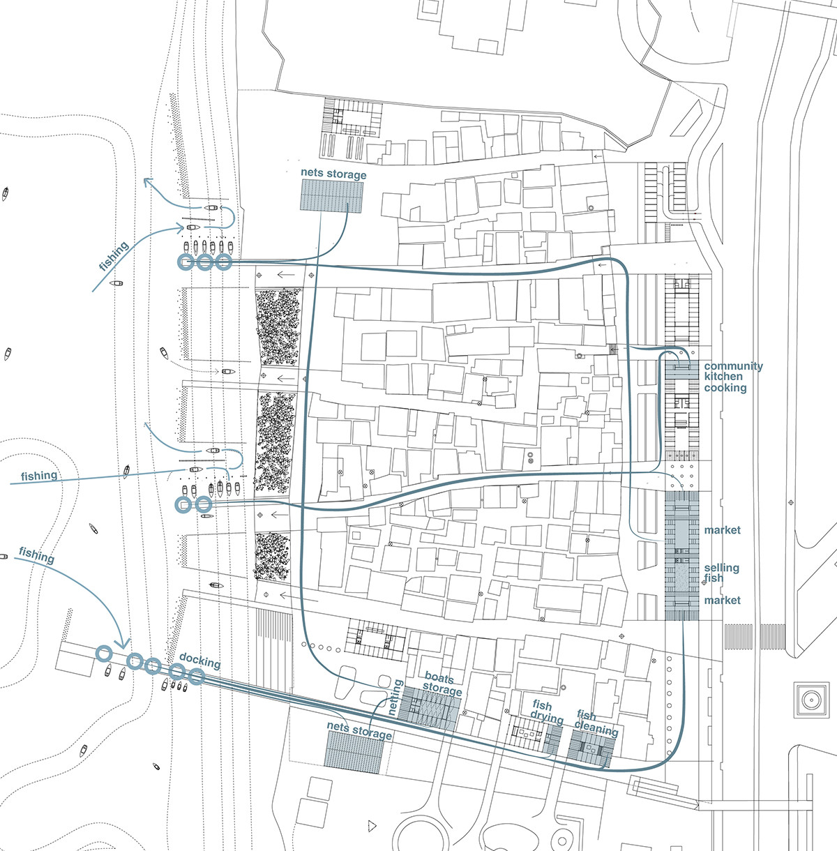
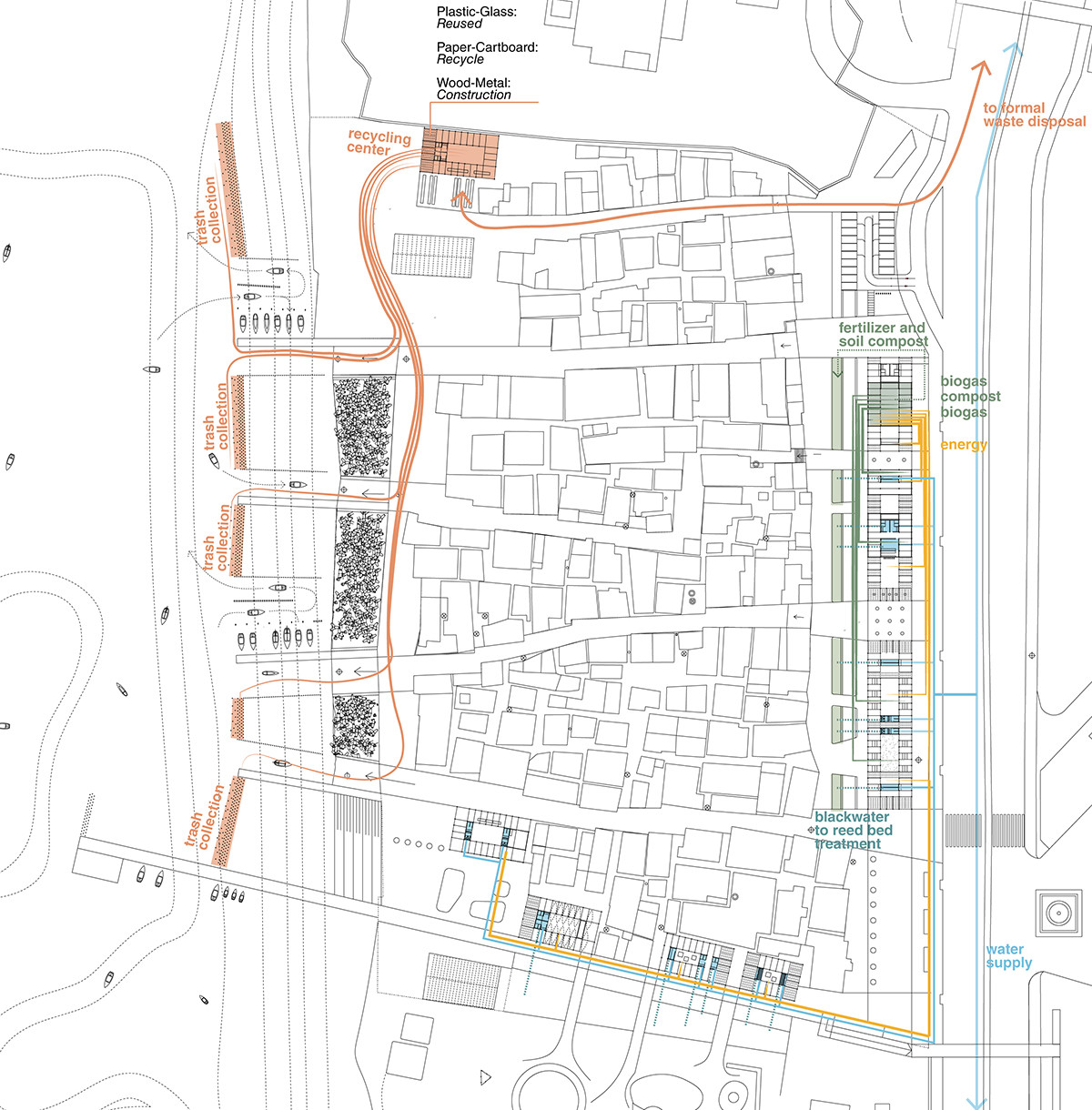
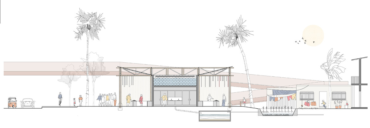
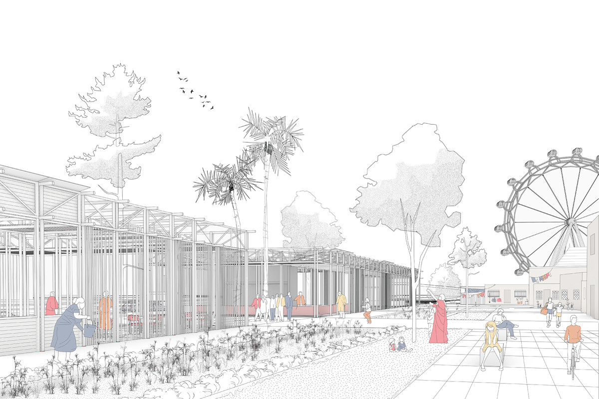
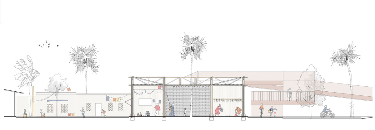
The Koliwada fishing communities are indigenous settlements at risk of losing their cultural identity and their place in the city of Mumbai. The project explores transitional solutions for their integration, building new scenarios for their recognition and the functioning of their economy. It proposes new multifunctional infrastructures that become urban services, community spaces that improve sanitation, and contribute to the integration process. These are composed of service points and bamboo structures, flexible and adaptable for the development of fishing activities and new livelihood opportunities.
The project was published in the book Sanitation as Infrastructure, as part of the Option Studio "Sanitation as Infrastructure" at Harvard GSD, and got the first prize in the Holcim Awards Next Generation 2021, region Asia Pacific.
Related projects
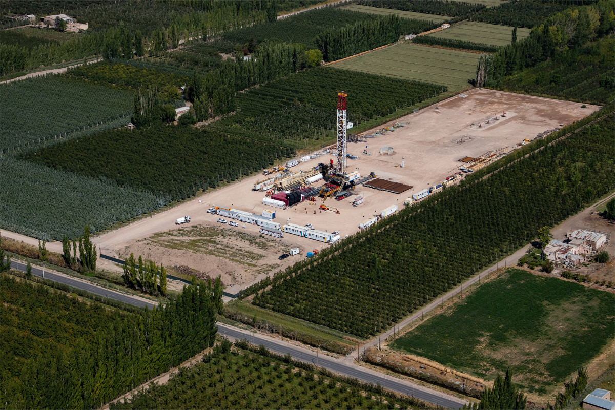
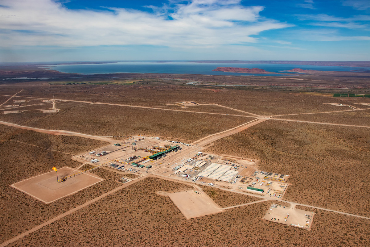
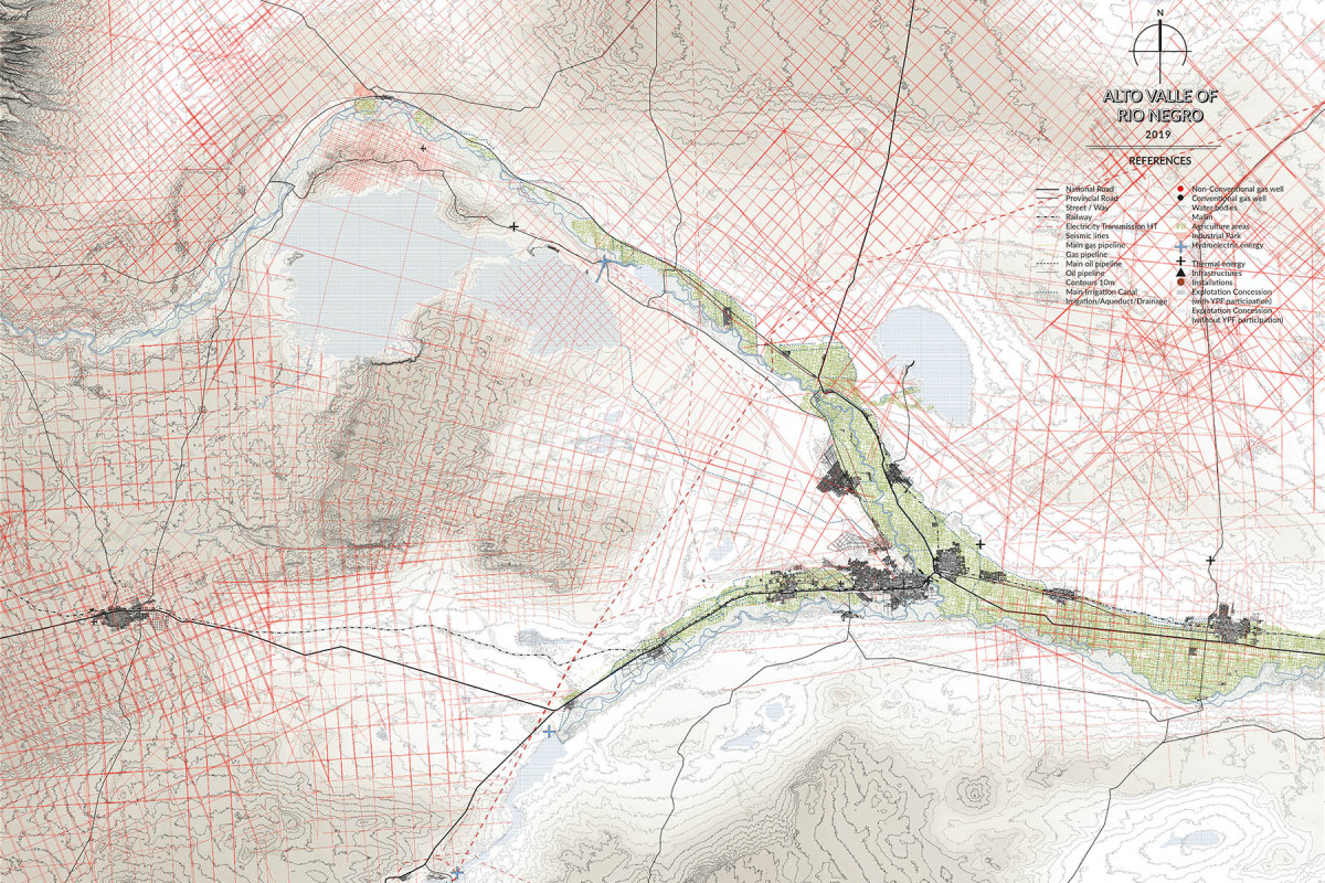
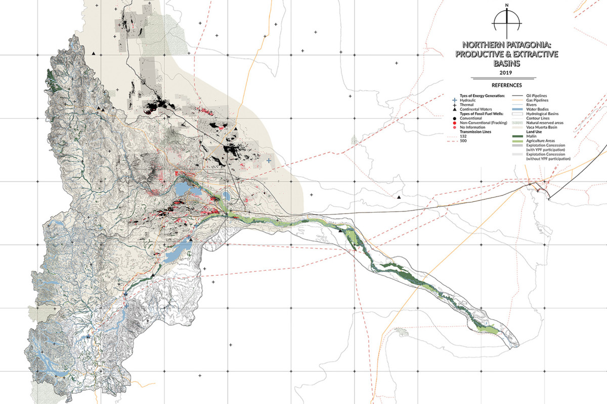
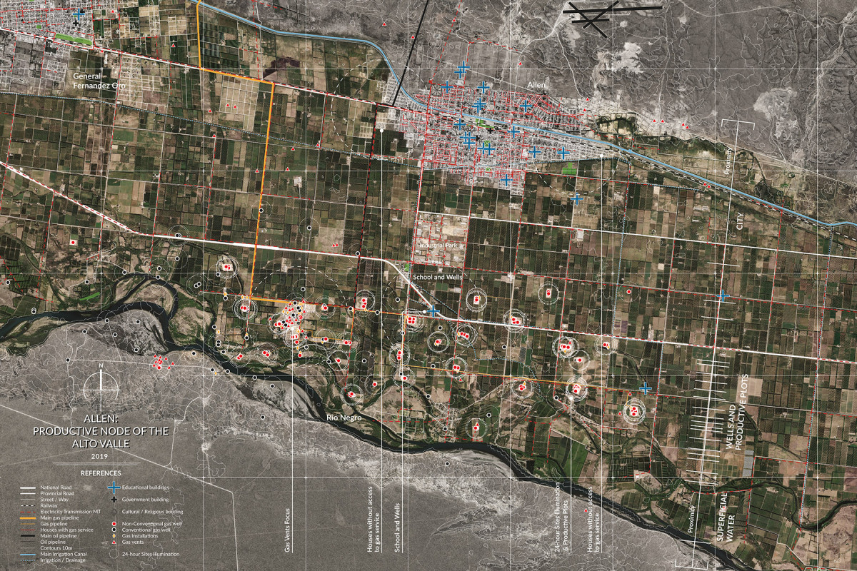
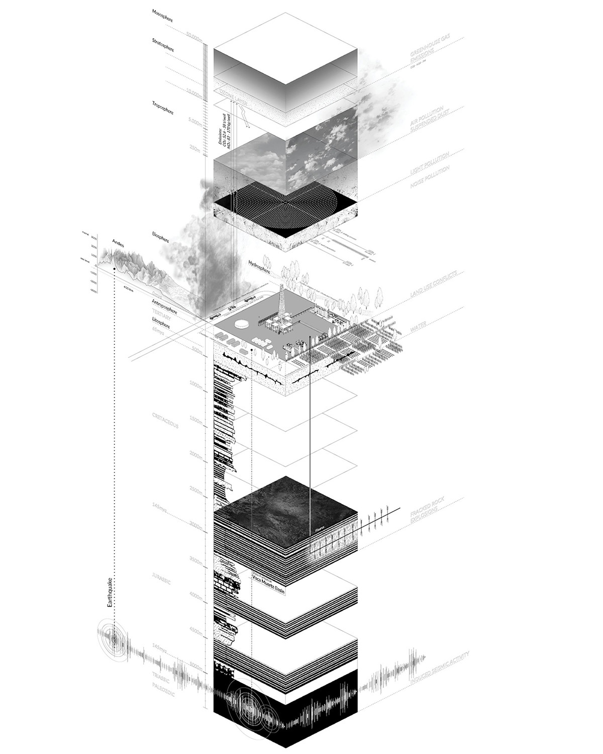
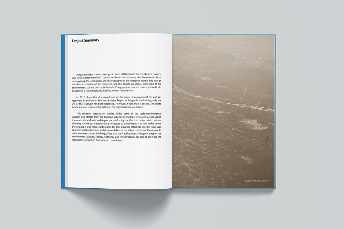
Fracking Landscapes
Mapping socio-environmental conflicts in Vaca Muerta, Argentina


Date
2020
Service
PublicationResearch
Status
Published
Team
Región Austral
Client
Harvard University - Research for the Penny White Research Fellowship
Location
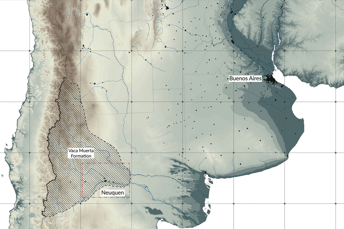
Neuquén, Argentina
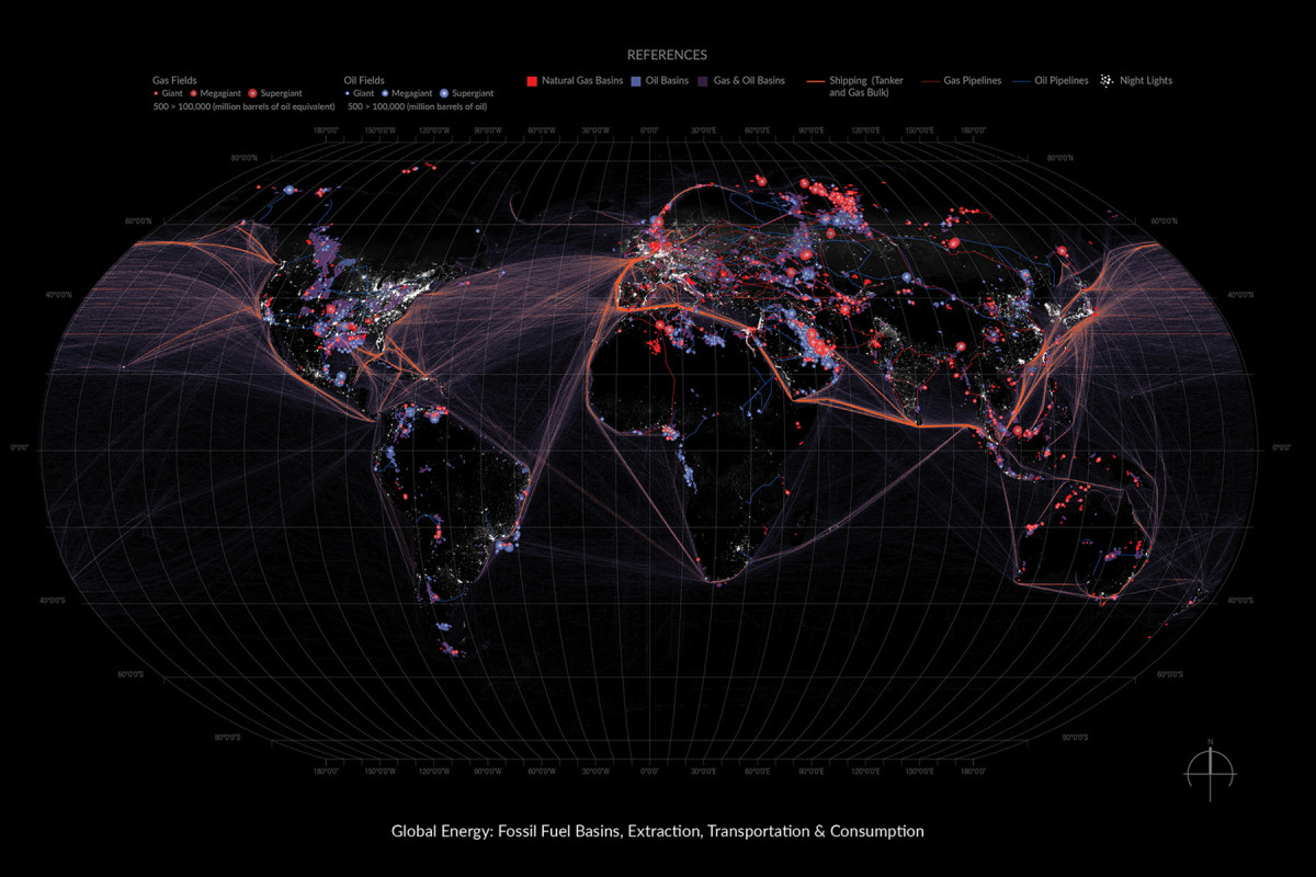
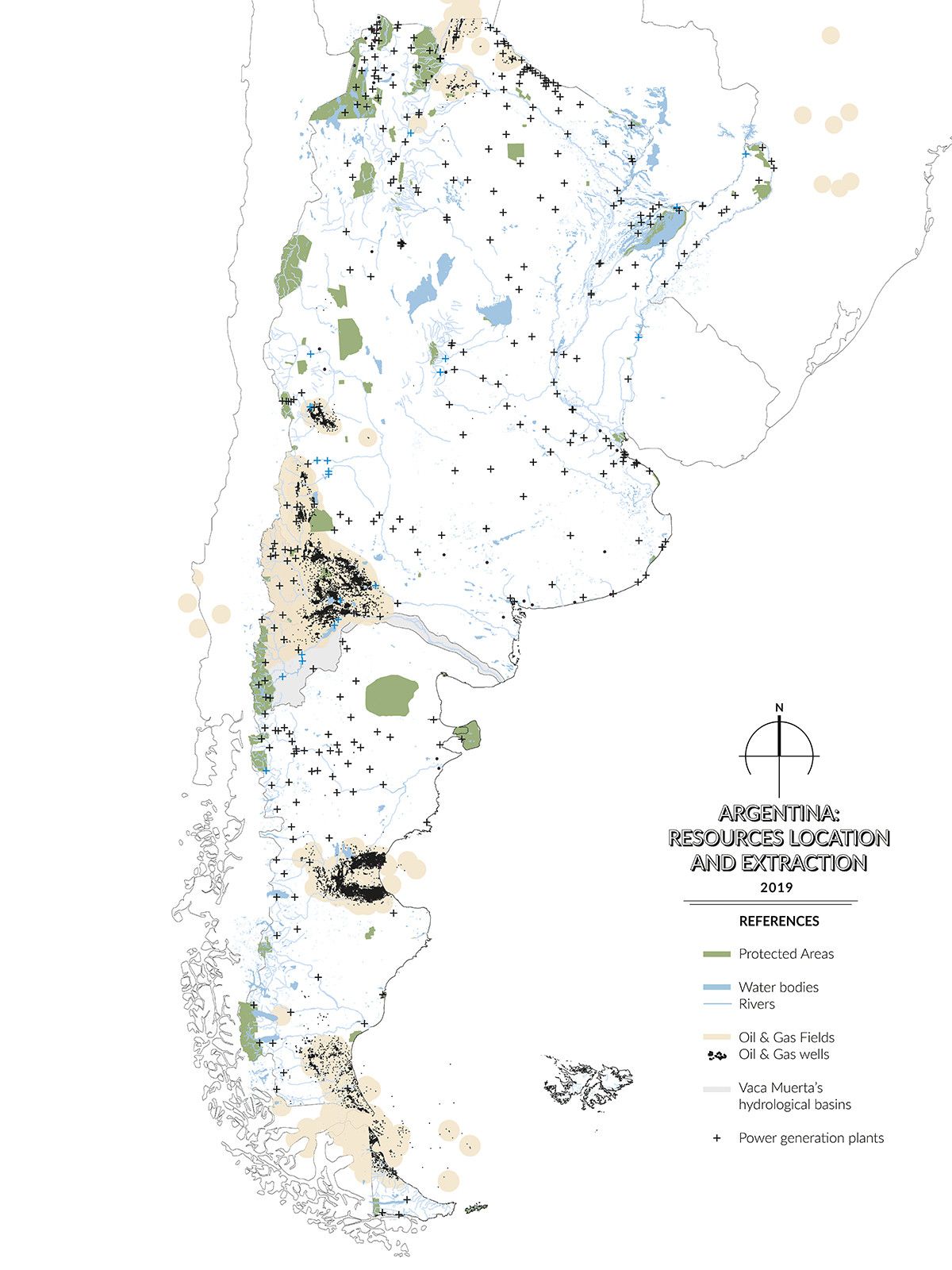
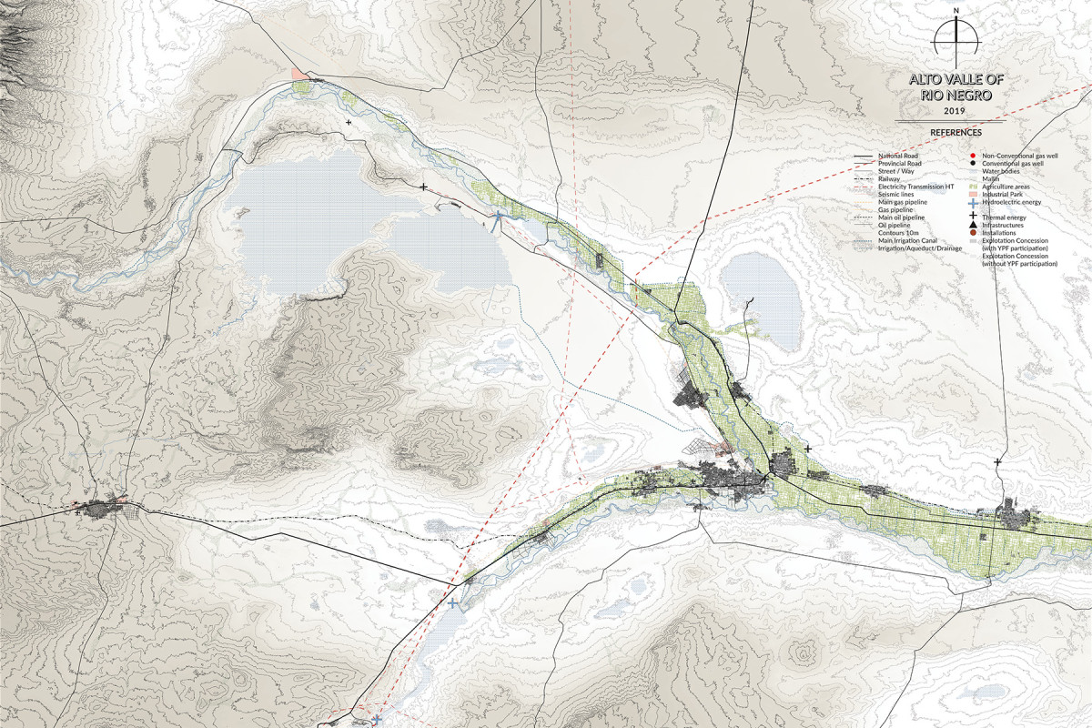
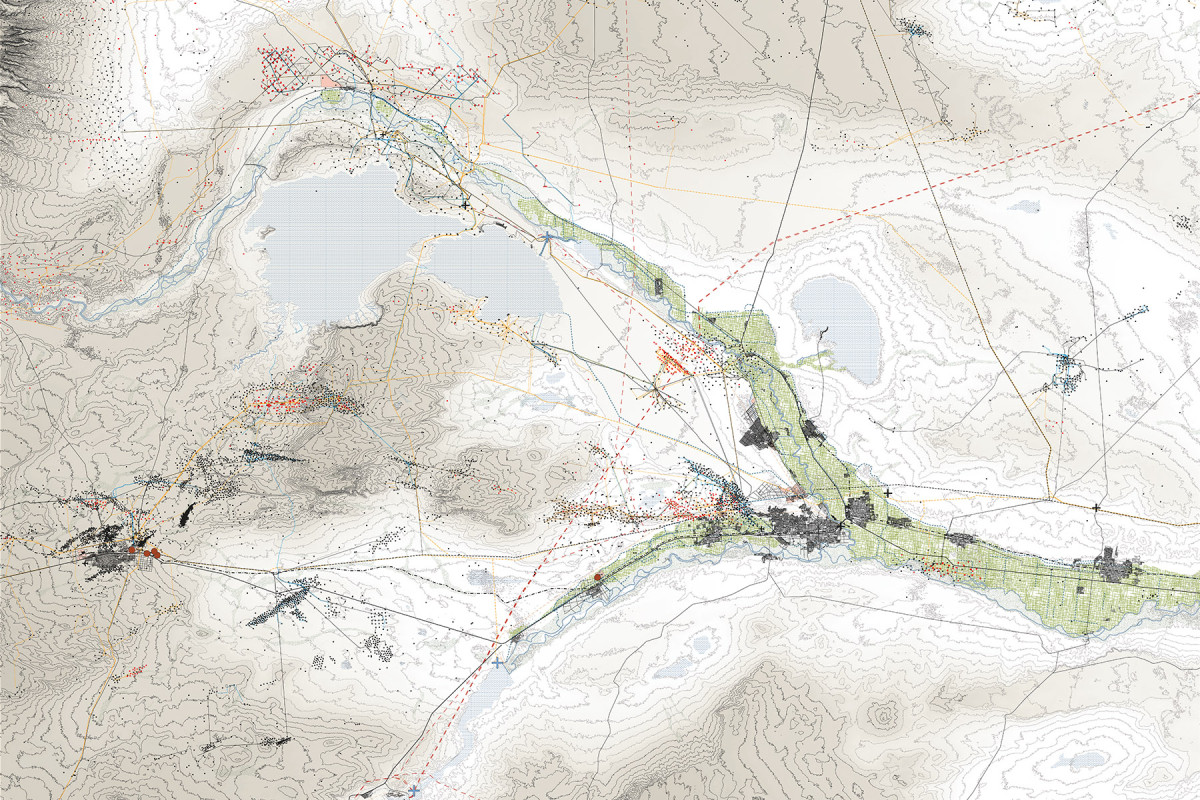
In the 21st century, energy has become a central axis for rethinking territorial organization, environmental justice, and development models. The so-called “energy transition” goes beyond a technical reconfiguration of the energy matrix: it also entails a profound debate on resource access, environmental sustainability, social and cultural impacts, and the need to democratize both the production and consumption of energy.
In this context, the region of Vaca Muerta, in Argentine Patagonia, stands as a paradigmatic case. Discovered in 2010, this deposit quickly became one of the largest unconventional oil and gas reserves in the world. In less than a decade, the fracking industry has radically transformed the region’s landscape and urban fabric, with deep social, economic, and ecological consequences.
This research seeks to make visible the multiple effects of fracking in Vaca Muerta and southern Argentina by mapping territorial conflicts, socio-environmental inequities, and urban challenges arising from the extractive model. Through critical cartographies, it proposes new ways of understanding and representing these processes, with the aim of informing the development of public policies, planning strategies, and design tools geared toward achieving spatial justice.
The work is grounded in a conceptual hypothesis that considers Patagonia as a Global Garden: the counterpart to global cities, defined by its natural wealth, the presence of rural communities, small towns, and intermediate cities, and its growing geopolitical, economic, and symbolic value on a planetary scale. From this perspective, the Patagonian territory should not be seen as an empty space for exploitation, but as a complex, inhabited, and valuable ecosystem that demands sensitive, sustainable, and just approaches for its future development.
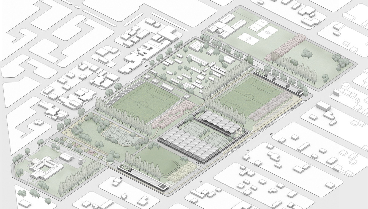
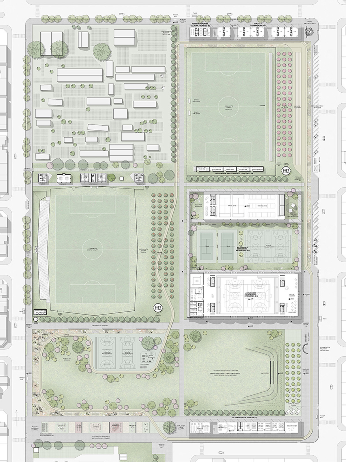
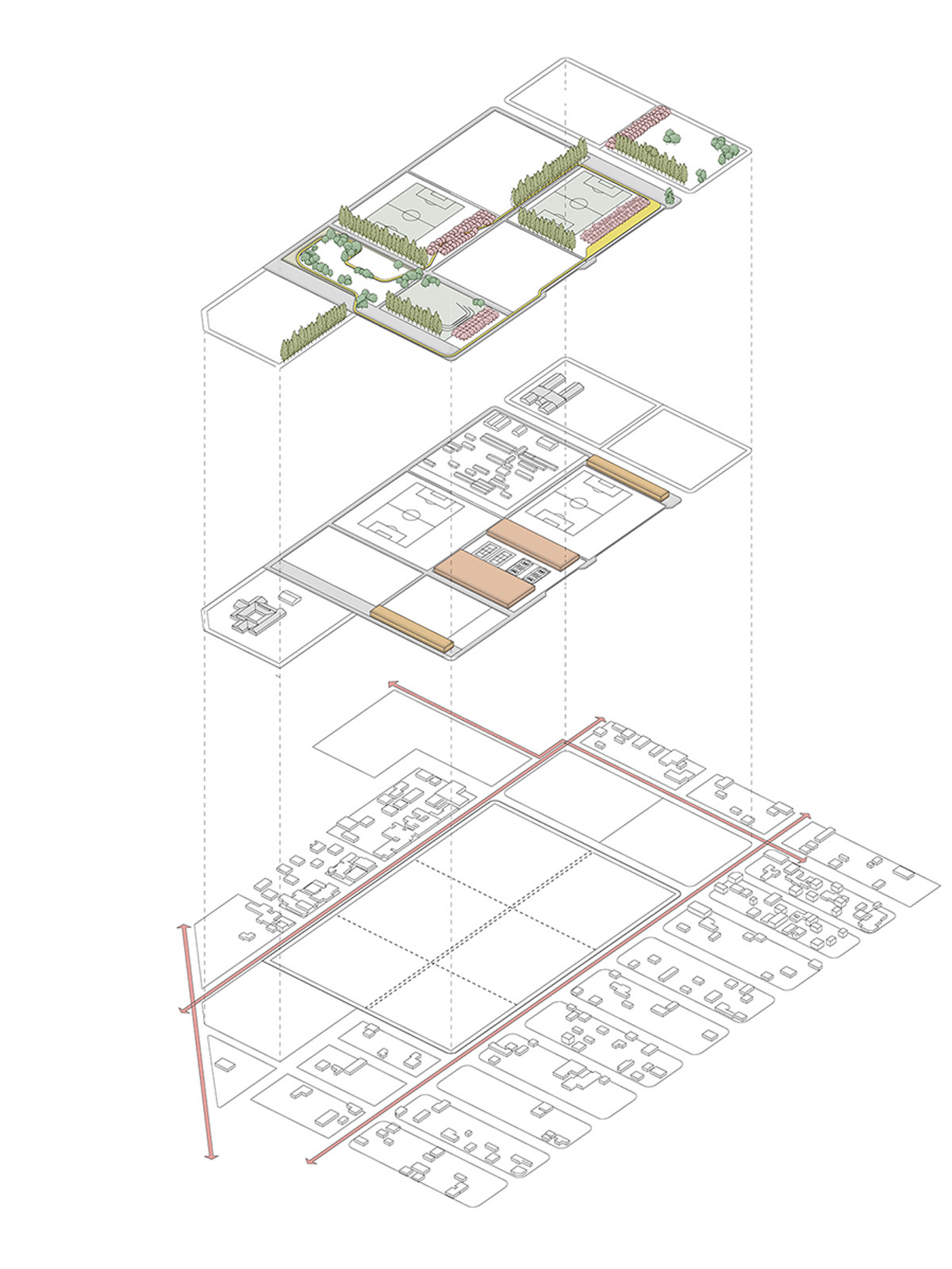
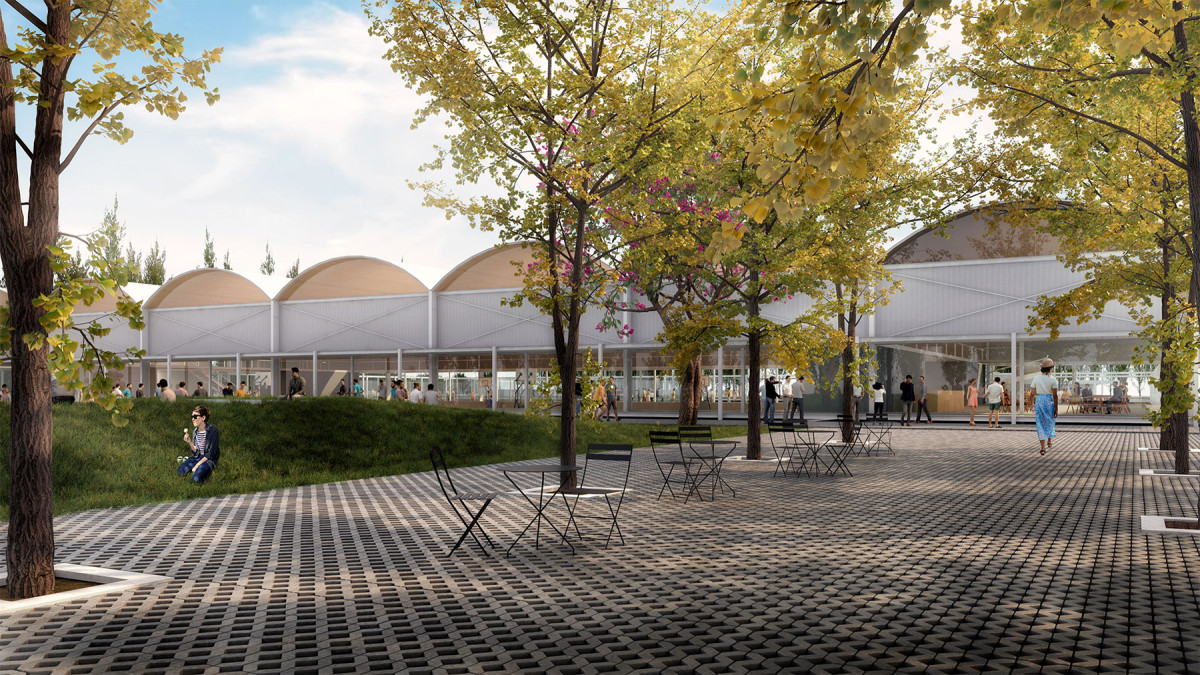
San Patricio del Cañar Sports and Cultural Park
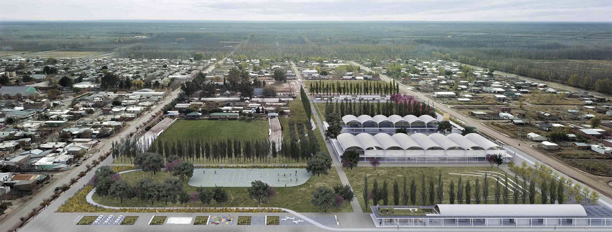
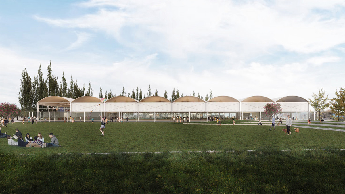
Date
2020
Status
Project
Team
Región Austral Sabattini & Giorgis ArquitectosAgustín Prieto
Client
Municipalidad de San Patricio del Chañar
Location
San Patricio del Chañar, Neuquen, Argentina
The project was developed within the framework of a design competition promoted by the Municipality of San Patricio del Chañar, sponsored by the Argentine Federation of Architects' Associations (FADEA), and organized by Regional 1 of the Architects’ Association of the Province of Neuquén (CAN). The competition aimed to generate proposals for the development of a new urban green space to function as a Sports and Cultural Park for the city.
According to the competition brief:
"San Patricio del Chañar is a town located in the Argentine Patagonia, within the department of Añelo, in the province of Neuquén. The city has a low-density urban profile, with a high degree of parcel consolidation, consisting predominantly of single-family homes not exceeding two stories (6 meters). The surrounding territory is defined by a strong productive matrix, composed of a mosaic of agricultural plots protected by perimeter rows of poplars. Despite this productive richness—and somewhat counterintuitively—the city itself has very little land designated for recreational green spaces. This underscores the strategic value of the 8 hectares designated for the new Park, envisioned as the heart of a future urban green infrastructure system."
Within this context, the proposal conceives the Sports and Cultural Park as a key urban element, with the potential to become part of a broader network of open spaces organized along Roberto Gasparrini Boulevard. This boulevard is envisioned as a potential green public axis that could structure the city along a north-south orientation, linking the new park in the north with the Neuquén River in the south through a series of interventions and public spaces conceived as an integrated urban system.
Giro Porto Corallo
Date
2019
Service
LandscapeCompetition
Status
Project
Team
Región AustralColaboración: Juan Cruz Barrionuevo
Client
Commune of Villaputzu
Location
Villaputzu, Sardinia, Italy
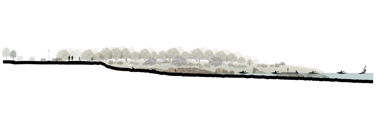
Giro Porto Corallo was the outcome of the Competition “Vivi Porto Corallo: ideas for the revitalization and enhancement of the seafront”, launched by the Municipality of Villaputzu in Sardinia. The project aimed to recover the area’s natural and historical heritage, with the goal of enhancing the identity of Porto Corallo and revitalizing its waterfront.
The proposal focuses on celebrating the site’s extraordinary natural features — the sea, sand, rock formations, coastal vegetation and wildlife, and the wetlands of the Flumendosa River.
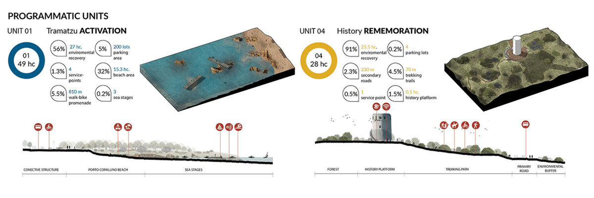
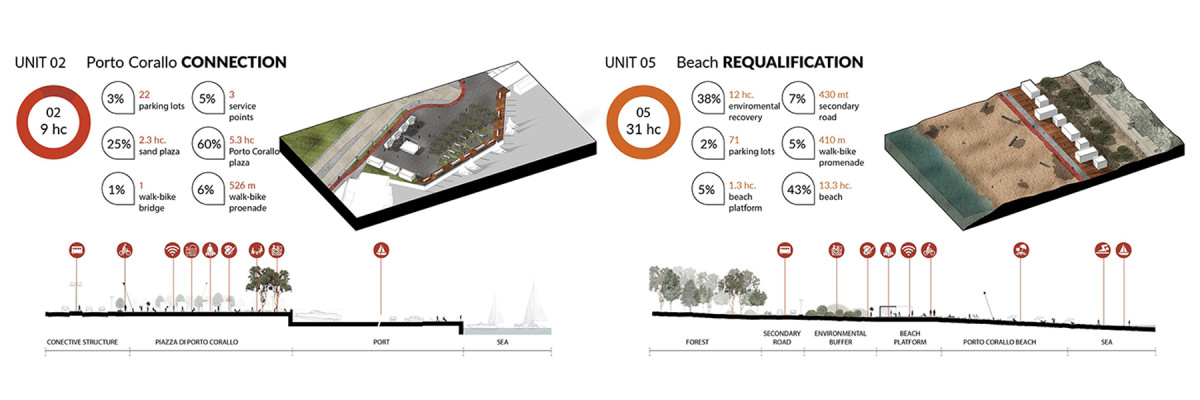
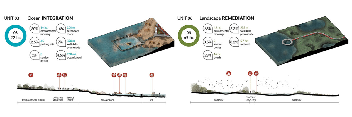
The masterplan is structured around six major landscape units that reinforce the site’s identity through spatial operations: Activation, Connection, Remembrance, Integration, Requalification, and Remediation. These interventions offer a comprehensive interpretation of Porto Corallo’s territory, embracing its geography, geology, history, landscape, and the celebration of water as a central theme.
New Rituals in a Landscape of Volcanoes

Date
2019
Status
Project
Team
Soledad Patiño
Client
Tláhuac Community. Project for the Option Studio «Manifestos for building the utopia» at Harvard GSD
Location
Tlahuac, Mexico City
“Through rituals, we recreate structures that provide an element of predictability and, therefore, safety, around times of insecurity, transition and loss.”
Mexico City is currently the most sedentary city in Mexico. Its urban environment—defined by traffic congestion, a lack of public space, and pervasive violence—has shaped lifestyles that reinforce isolation and physical inactivity. In response, a growing culture of health and sports emerges as a form of resistance: new rituals that require the rehabilitation of open spaces to take place.
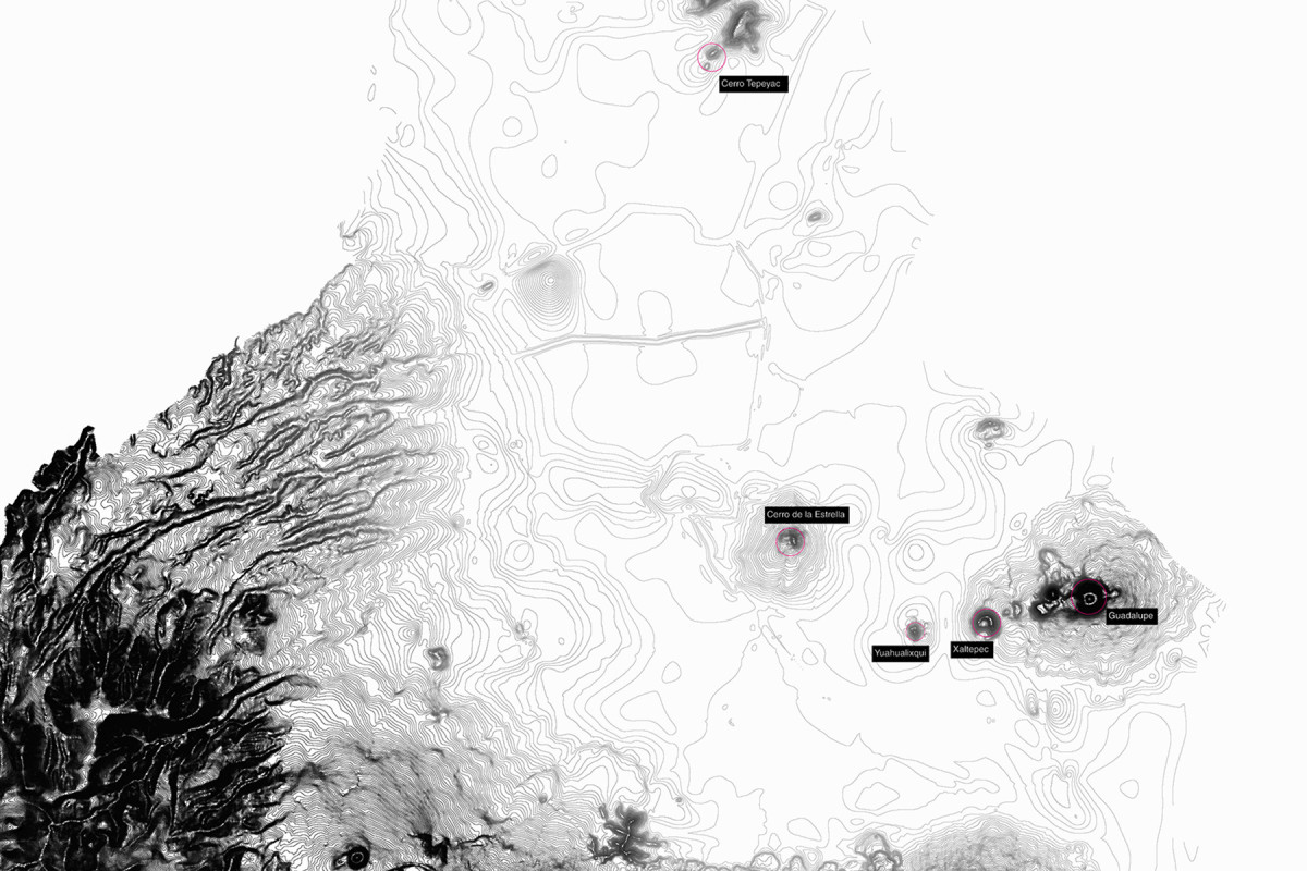
In Mesoamerican cosmovision, volcanoes have long been regarded as hierophanies—manifestations of the sacred embedded in the landscape. Today, the Xaltepec volcano, undergoing environmental devastation due to mining, becomes the ideal site for new contemporary rituals centered on health and collective well-being.
The project transforms Xaltepec into a public space for one of Mexico City’s most socially and spatially segregated areas. Through topographic intervention and ecological restoration, the proposal seeks to halt the volcano’s disappearance and reincorporate it into everyday urban life. In this new ritual landscape—symbolic, inhabited, and revitalized—a fragmented community finds a foundation for rebuilding its collective identity.
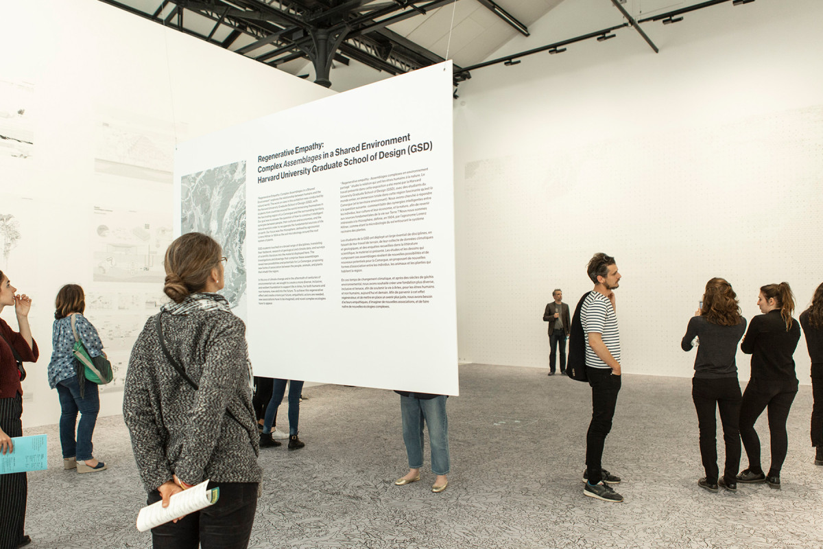
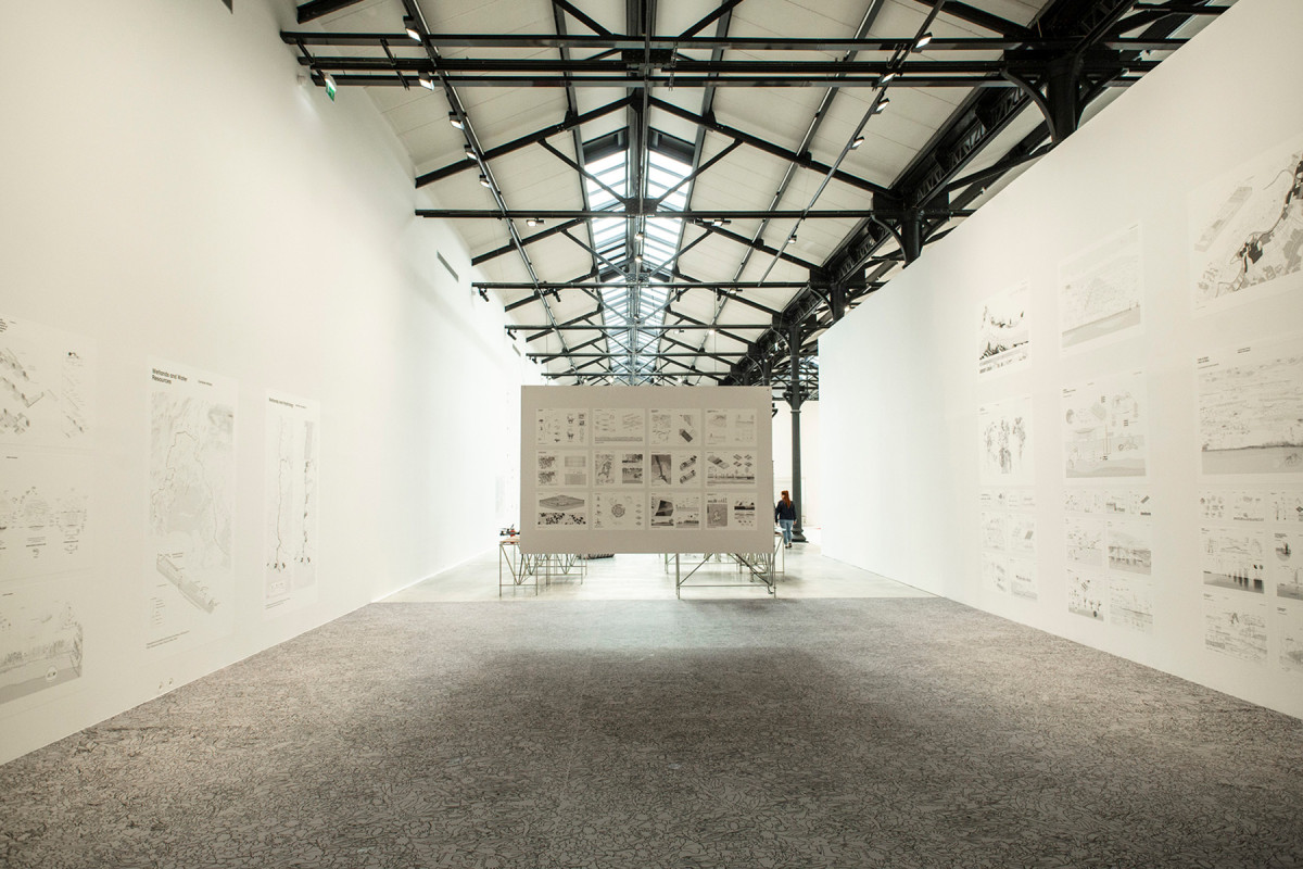
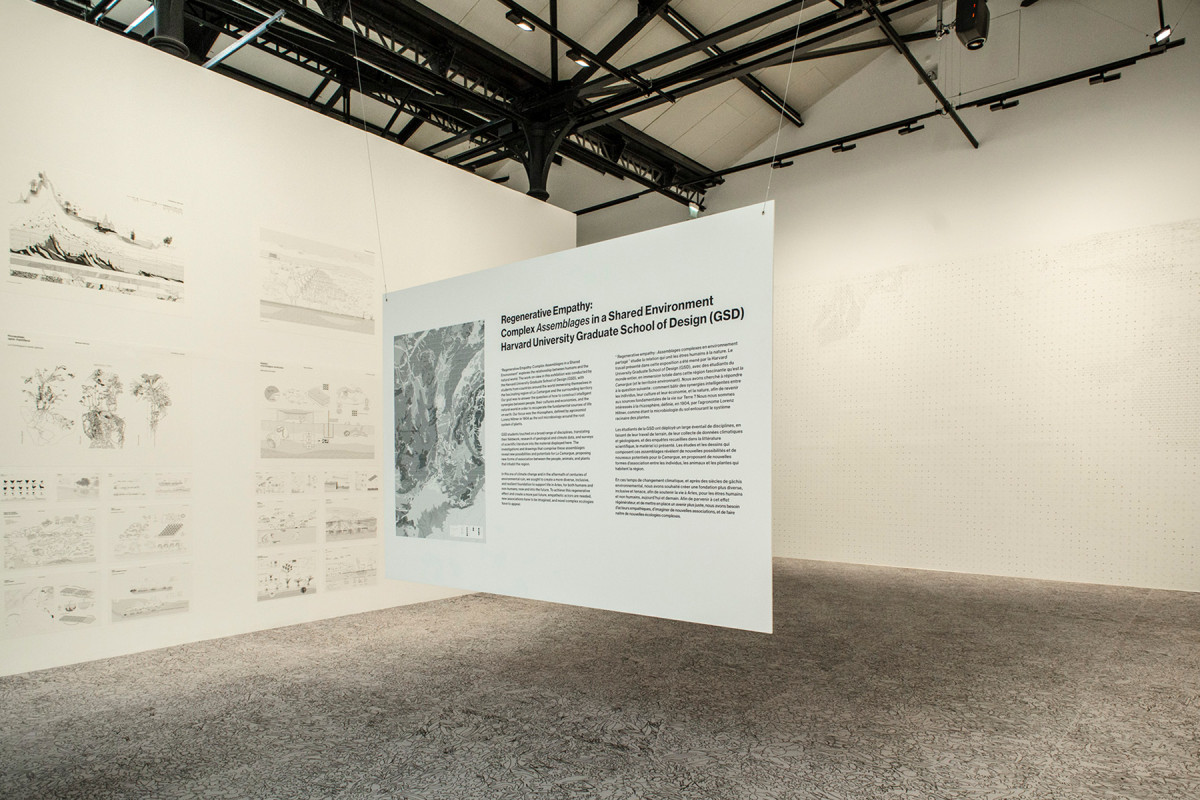
Regenerative Empathy
Agriculture and Rhizosphere
Date
2019
Service
ExhibitionResearch
Status
Exhibited & published
Team
Estudio opcional Rhizosphere. Escuela de Diseño de la Universidad de Harvard
Client
Fundacion LUMA
Location
Arles, France
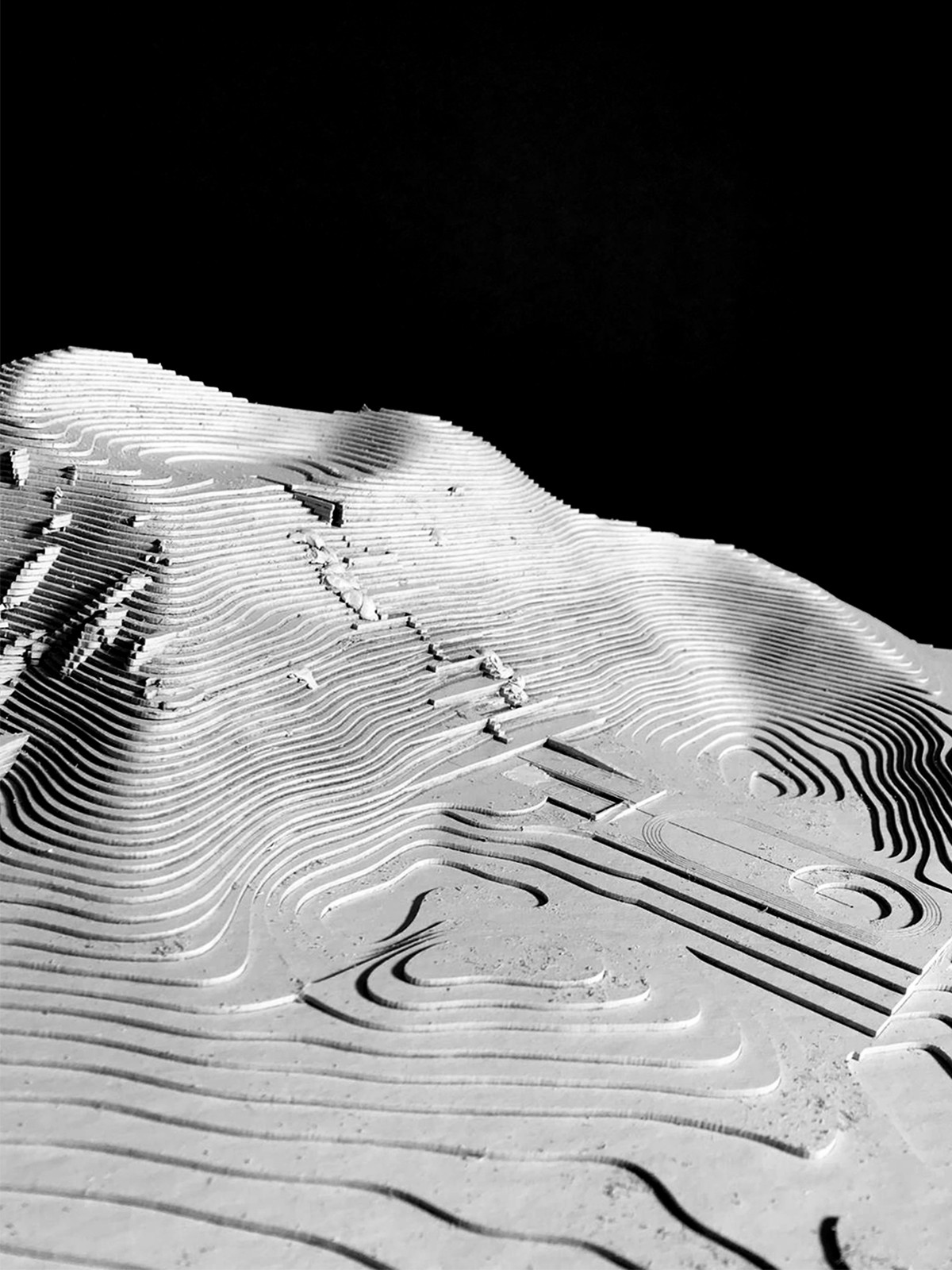
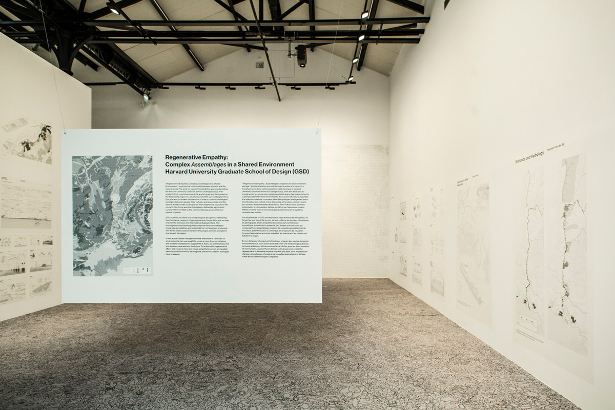
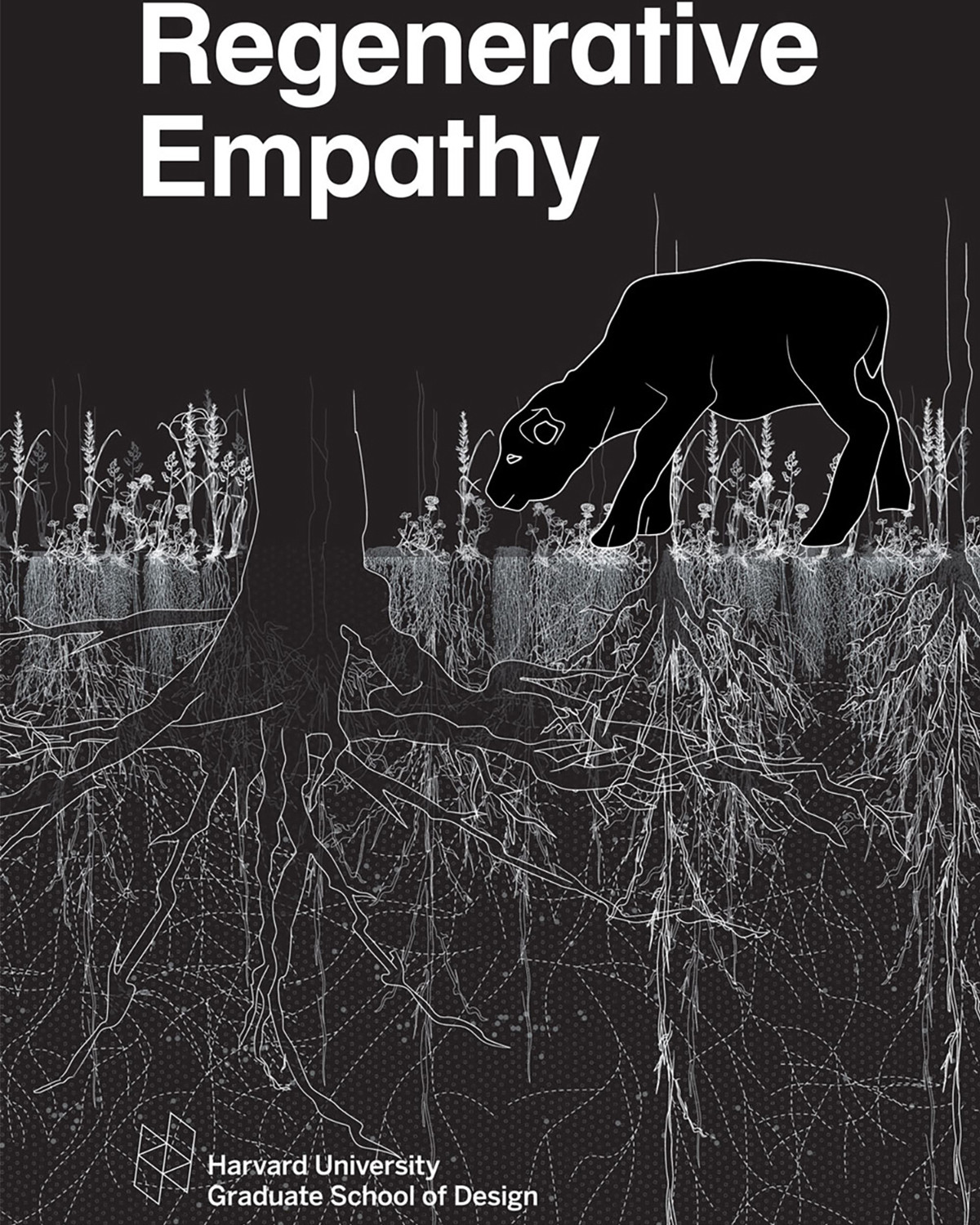
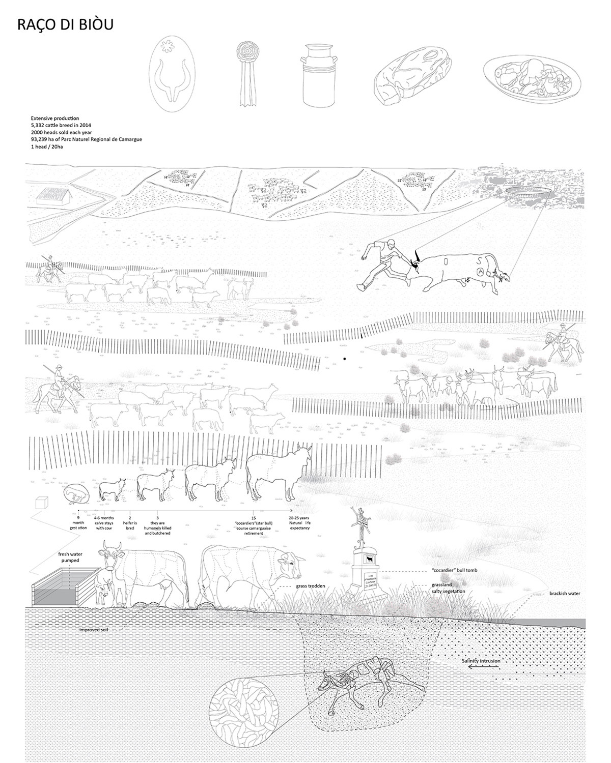
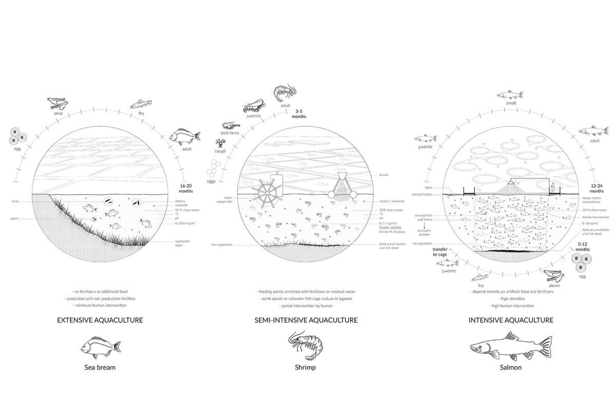
Regenerative Empathy is a research project that explores the relationship between human beings and the natural world, with the aim of building intelligent synergies between people, cultures, economies, and ecosystems. Its purpose is to recover the fundamental sources of life on Earth and propose new connections between social and ecological systems.
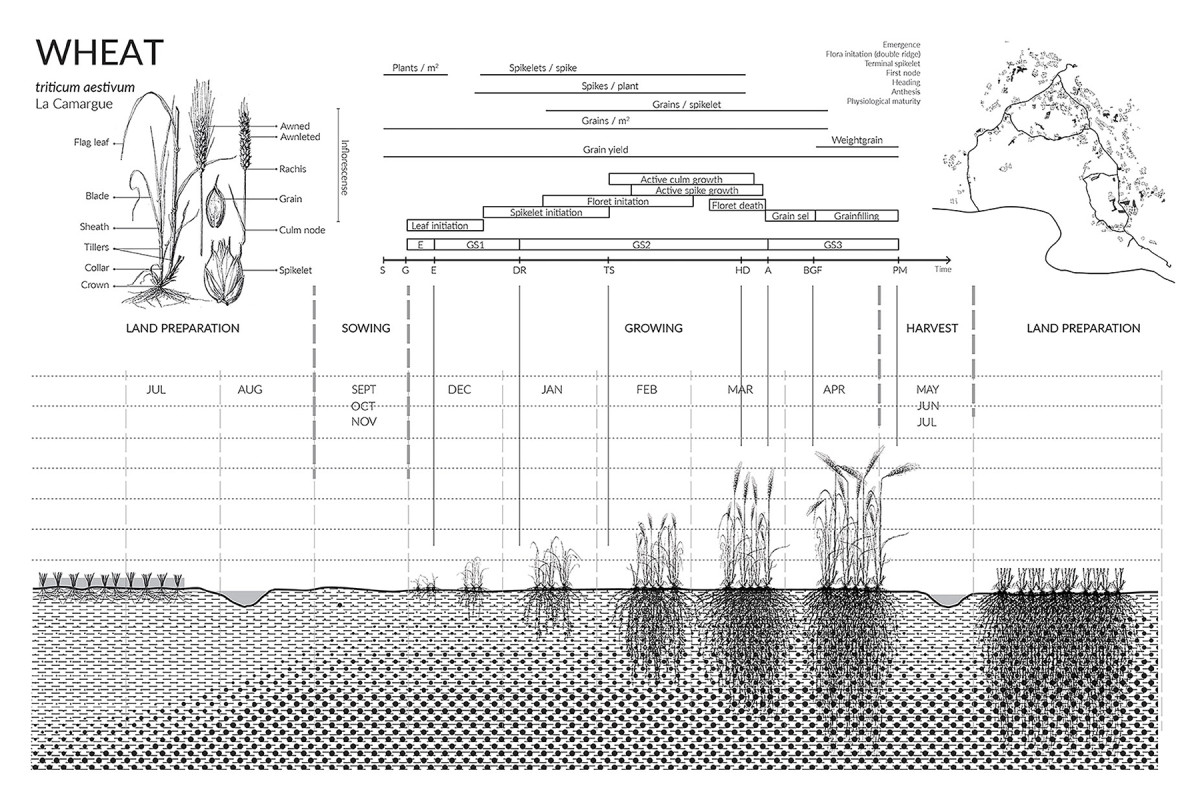
The projects featured in this exhibition and report span multiple disciplines. Based on fieldwork, geological and climate data, food production research, and scientific literature review, students from Harvard University produced a series of drawings centered on the rhizosphere—a concept defined by agronomist Lorenz Hiltner in 1904 to describe the microbiology of the soil surrounding plant root systems. These investigations reveal new possibilities of assemblage for the landscape of La Camargue, in France, proposing innovative forms of association among the people, animals, and plants that inhabit the region.
In a context of global climate crisis and centuries of environmental degradation, the project proposes a diverse, inclusive, and resilient foundation to support life in Arles, both human and non-human, now and into the future. Achieving a truly regenerative effect calls for empathetic actors, new ways of imagining cooperation, and the emergence of complex ecologies that integrate multiple forms of life.
Regenerative Empathy is the outcome of the Fall 2018 studio at the Harvard Graduate School of Design, developed within the “Rhizosphere” option studio led by Teresa Galí-Izard, with the generous support of Maja Hoffmann and the LUMA Foundation.
Córdoba The Liquid City


Date
2016
Service
Urban designResearch
Status
Project
Team
Soledad PatiñoBruno FontanettoSantiago Valente
Client
National University of Córdoba, Argentina
Location
Cordoba, Argentina
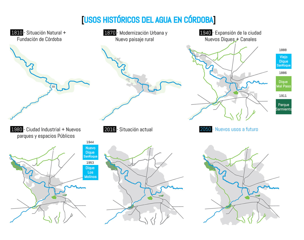
How Can We Restore and Reinvent the City's Water Infrastructure? How do we recover the water infrastructure of cities that are now obsolete or have fallen into disuse? How can we reinvent them in a contemporary key?
The city of Córdoba in Argentina is endowed with significant water resources, both surface and underground, traversed by waterways and canals. However, it is located in an area threatened by water stress and flooding, where access to water is a critical issue shaping territorial dynamics. Today, blue infrastructure has disappeared from the urban landscape, and surface water, when visible, is often reduced to polluted backwaters, littered with waste.
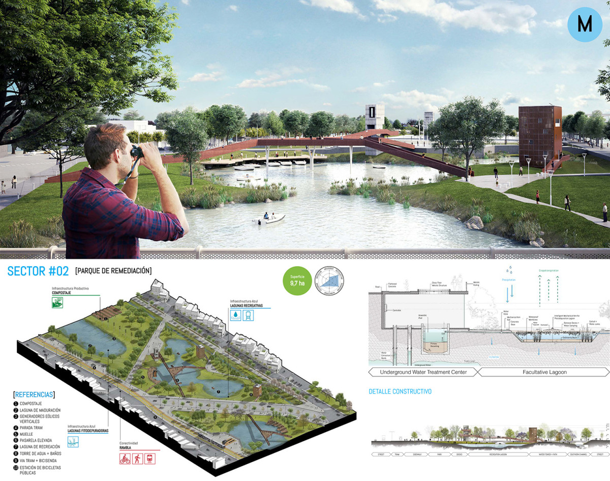
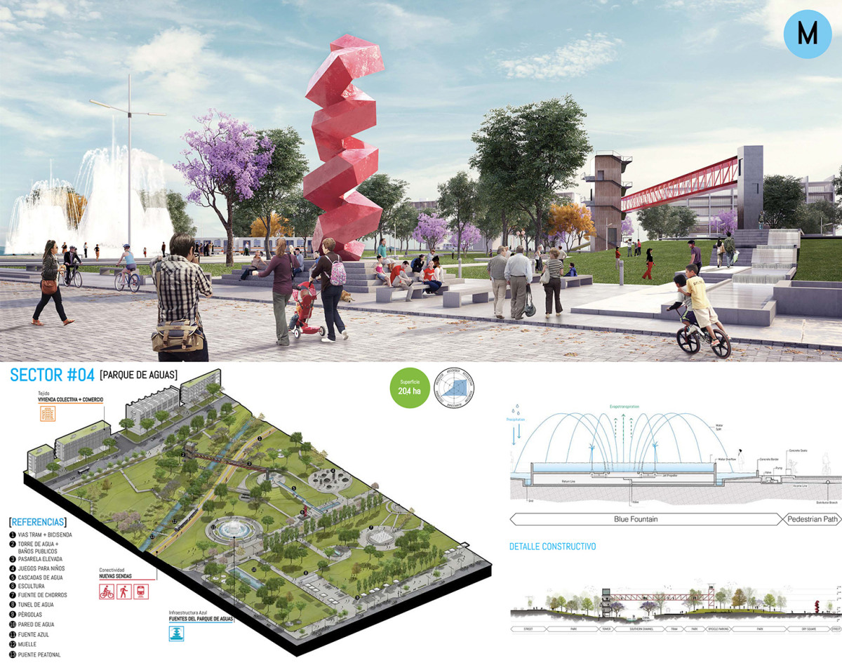
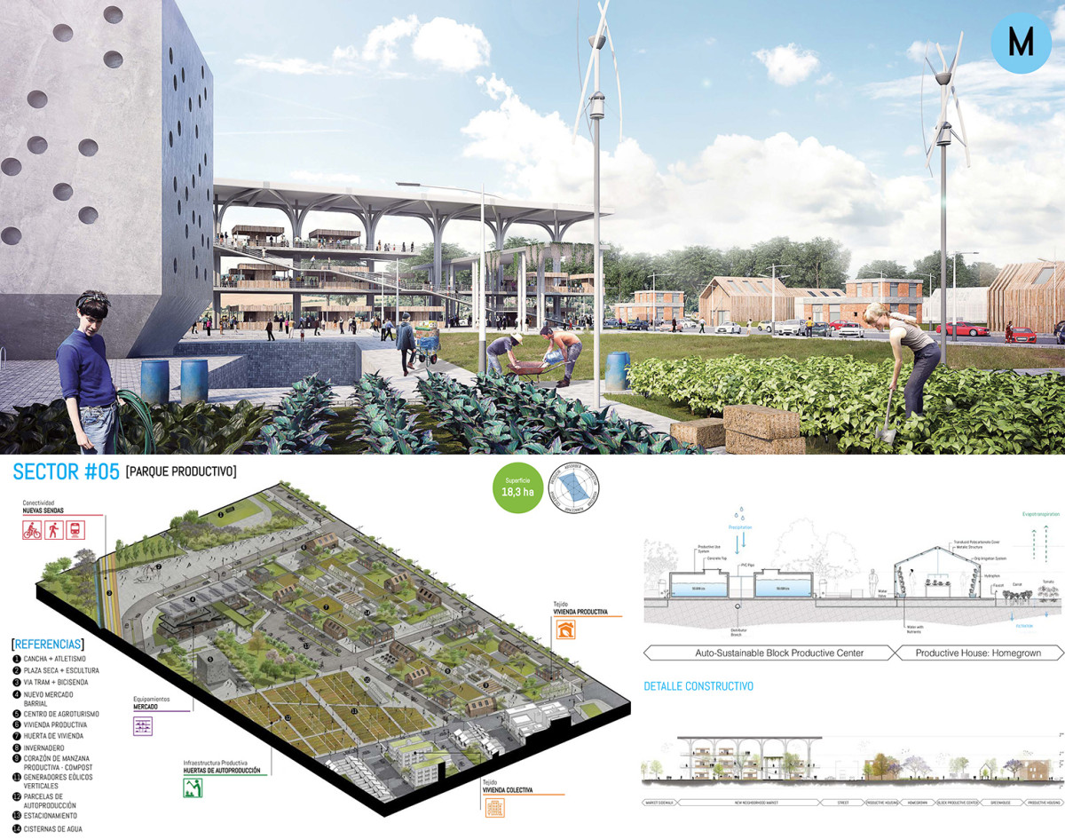
TERRITORIAL SCALE: City of Córdoba
The Territorial Project aims for a more efficient and equitable management of water resources. It identifies green areas where integrating water infrastructure with quality public spaces, urban programs, and new mobility pathways holds great transformative potential. These interventions form new parks—operational water landscapes within the city.
Recovering these corridors as new linear parks ensures two key outcomes:
1. Increased green space per inhabitant in Córdoba.
2. Reconnecting the city with its waterways.
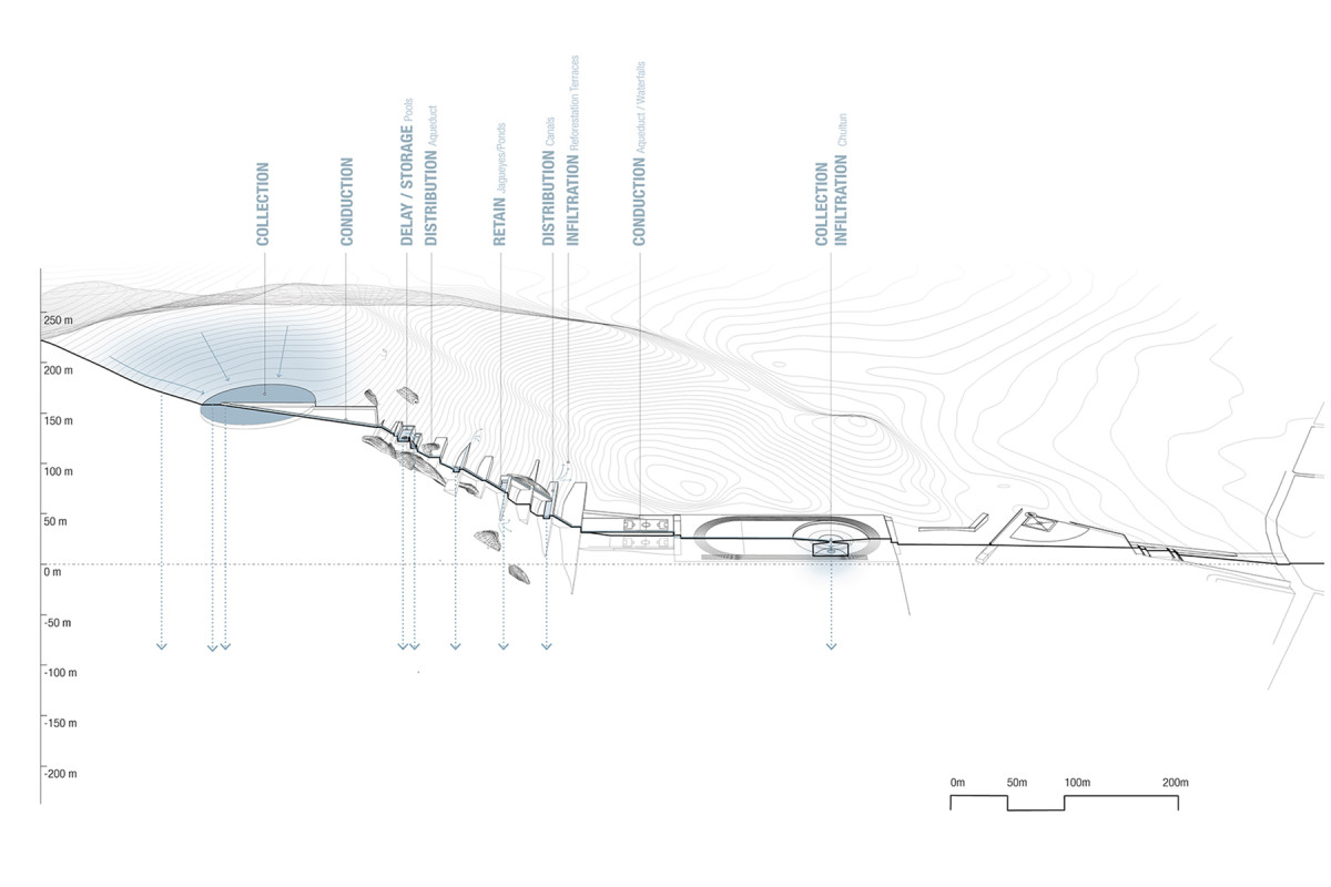
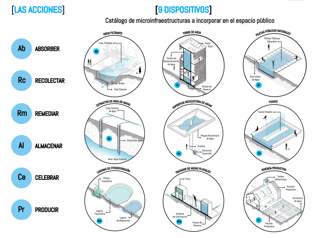
The Water Atlas proposes six actions (Absorb – Collect – Remediate – Store – Celebrate – Produce) and eight devices, serving as a catalog of micro-infrastructure to integrate into these new spaces.
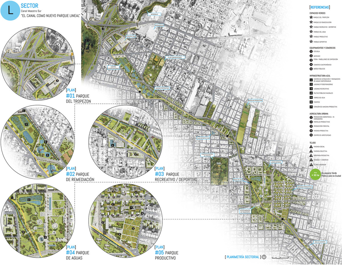
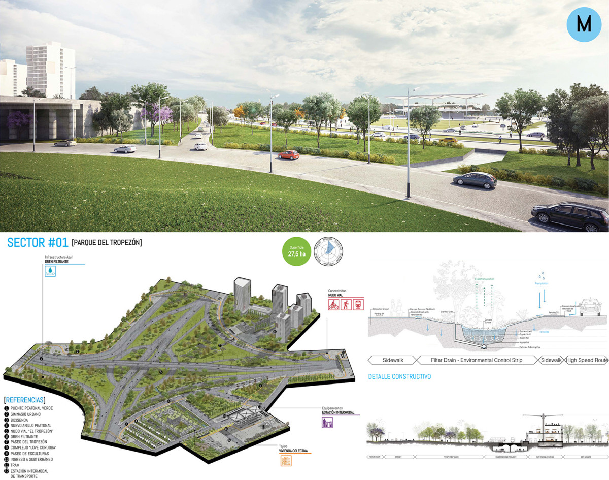
SECTORAL SCALE: Canal Maestro Sur
Over the years, Córdoba's water resources have deteriorated due to urban sprawl, lack of infrastructure maintenance, and decreased irrigation flows caused by growing potable water demand. Built in 1890, the Canal Maestro Sur was originally part of an infrastructure system designed to supply water to the city's Green Belt: the Metropolitan Area Irrigation System. However, since 1995, the canal has been completely abandoned and its condition is critical, now serving as an open sewage drain and representing an urban, environmental, and social fracture.
The Canal Maestro Sur is reimagined as a new Linear Park, divided into five experimental subsectors. Key principles include: Energy – Water - Waste – Food. The project prioritizes social sustainability by proposing new border developments that include social and collective housing and new facilities. These developments add density to the area and activate public spaces. Access and connectivity are ensured through new mass public transportation and bike lanes. Collaboration is central, involving public and private actors, local authorities, non-governmental organizations, and community users, ensuring inclusivity in planning and implementation.